


Snow storm
-
Posts
100 -
Joined
-
Last visited
Content Type
Forums
Blogs
Gallery
Events
Learn About Weather and Meteorology
Community guides
Posts posted by Snow storm
-
-
IMO the charts are a real downer tonight, after a promising 06Z.
Ok so they're not that mild, but high 850's on Weds could seriously start to reduce the strength of the cold pool of air over us. This cold pool is sacred in giving us snowfall anywhere, otherwise it becomes the typical marginal rain/sleet scenario in the south, until cold air becomes established.
The low at +108 hours really P*5sses me off. There is so much cold around over Northern Europe, and one little, pathetic low/trough thing is enough to keep it from the UK, and up the H850's to +5.

-
Massive Flakes here! Better snow event than dec 09/ feb 09 already for me!
-
Oh dear. Rain turning to heavy sleet now.
Guys the front has barely begun to develop, quit with the moaning!
-
Why is no one commenting on the channel low?
http://www.wetterzentrale.de/pics/Rtavn781.png
http://www.wetterzentrale.de/pics/Rtavn782.png
http://www2.wetter3.de/Animation_06_UTC/78_30.gif
Surely it will give the south a pasting?
-
Snow in N Africa?
Lol.
-
Wales could have the heaviest snowfall for years tomorrow-
In actual fact Wales may have continuous snow for the next 30 hours!!!
Not to ramp, but you may have the heaviest snow in 20 years.
Meanwhile, down South, the fun starts Thursday midday when the cold air creeps in, and precip. from the channel flirts with the South-
If the ppn moves North by only 50 miles the South could be in for a surprise.
Next Monday looks phenomenal, but I am completely disregarding it as FI- for the moment.
-
GFS very exiting for next Thursday night/Friday morning in the South
-
xmas eve yesterday and today.
h850 are slightly better.
European h850 looking cooler.
No sign of mild, but no sign of proper cold either. Mind you the LP over scandi. could be one to watch. Just need it to move SW 200 miles.
-
Satellite images attached for yesterday.
...and some images from near me
-
The 00Z is very good for those up North. You may well have a solid week of snow showers, with temperatures very rarely exceeding 0C.
For us down South it is going to be nail biting!
The 528 dam line flirts with the south, on numerous occasions and the day time temps are actually quite low, with maximums between 0-3C inland, but a barmy 5C on the South coast (the contrast in temperatures from 5C to 1C in the movement 20 miles inland is remarkable, and is down the fact that there is an Atlantic low tinkering with NW France, rotating mild air on Monday.
I am not going to get my hopes up for the South, because generally in marginal situations the South rarely gets a good dumping, it normally takes cold continental air or a good northerly plunge to get temps down, otherwise most end up with rain.
One interesting thing about this run is all the PPN in the English Channel, can any one on here identify why this is?
-
snowing W Sussex/Surrey border nr Guildford and settling
-
Surrey/Sussex got a pasting today
More images to follow in photography section.
-
Fantastic. A great dumping outside in West Sussex. Looking foward to 7'0 clock when it starts getting light.
Its been a fantastic few days here on NW, my advice to anyone is- get out there and enjoy the snow!
-
Yes of course, you're right in saying that most places will see frontal edge snow.
Amazingly the 00z wants to move the extent of the snow-all-day fromt the M4 to nearly the M62 - where the snow was forecast to be at its Northern most extent recently
The 0Z GFS is quite bad, the METO aern't listening to it. Which IMO is a good sign.
In actuall fact, the BBC has snow not even turning to rain for the most.
-
The UKMO has the 528 DAM line way further South.
http://www.wetterzentrale.de/pics/brack0a.gif
http://www.wetterzentrale.de/pics/brack1.gif
Very much snowfall until the centre of the low hits south UK, where the air will be slightly milder, although there will be contenential air around it.
-
But hasn't it been said that the 528 DAM line is one of the poorest indicators for snow?
But basically if your not within the 528 DAM line region (unless you live v. high ASL) you stand no chance of any sustained peirod of snow.
-
Judging by the FAX Charts this event will be for the north. The DAM 528 line is way too high for us Southerners.
I guess ive had my dumping so far on the 27th. (1st proper snow in 5 years). 2 dumps in one winter just isn't going to happen.
-
Heres a chart I made.
-
http://www2.wetter3.de/Animation_06_UTC/48_30.gif
HUGE amounts of snow for most on Thursday but very quickly turning to rain unless you live North of the border.
-
Saturday looks good, IMO may result in snow for South (Thursday im not too sure about)
-
BBC has no idea what will happen......
-
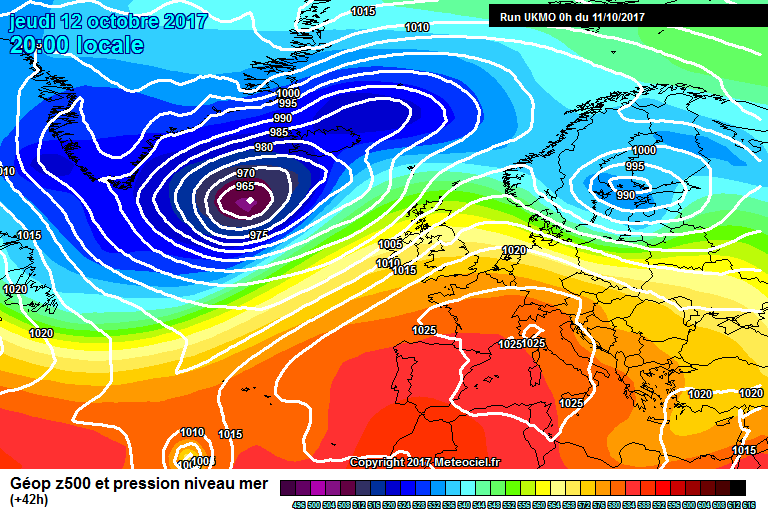
I find it very confusing. The UKMO has picked up a fantastic channel low only 48 hours away, whilst the GFS shows nothing.
Which will be right?
-
-
http://www.meteociel.fr/ukmo/run/UW42-21.GIF
Very hit or miss for the South. Fortunetly there are signs of improvement in the 12Z run. Fingers crossed.


General Model Output Discussion
in Spring Weather Discussion
Posted
The coldish air holds on till thurs in this run. (amazing considering the GFS yesterday wanted to bring it back for tomorrow ) I am surprised no one has commented on this.
The southerly blast only looks set to last 3 days from the 12z
In FI the GFS is keen to bring the easterly blast back- http://www.wetterzentrale.de/pics/Rtavn2161.png
A much improved run IMO.