


crikey
-
Posts
62 -
Joined
-
Last visited
Content Type
Forums
Blogs
Gallery
Events
Learn About Weather and Meteorology
Community guides
Posts posted by crikey
-
-
A warming spot at 10hPa in the SH near Australia curently. Models suggesting a massive cold outbreak in about 8-9 days time
If ACCESS forecast eventuates this event will produce the best cold pool since the pre 70's
http://forum.weatherzone.com.au/ubbthreads.php/topics/1270966/2
-
 2
2
-
-
ACCESS G model has the remnants tracking ALL the way down the Queensland coast to 23s before moving off shore next Tuesday
If that scenario comes off . 4-5 days of big trouble for QLD coasters
-
Been collecting info and picks on this event if interested
and the Australian forum to follow for this is here
current page 52
http://forum.weatherzone.com.au/ubbthreads.php/topics/1255431/62
-
Collected some snaps and info on TC Christine for anyone who is interested
link
http://weathercycles.wordpress.com/2013/12/22/cyclone-threat-for-wa-last-week-of-dec-2013/
Australian forum thread for this event here
-
1
-
-
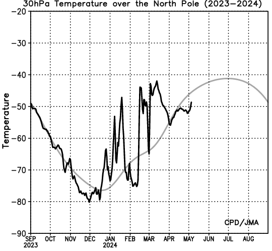
 got this graph from you guys
http://ds.data.jma.go.jp/tcc/tcc/products/clisys/STRAT/gif/pole30_nh.gif
Why is stratosphere so anomonously COLD?>
Usually a severe cold strat' produces an SSW during peak cold in January
This looks very substantial?
http://weathercycles.wordpress.com/2013/09/16/stratospheric-warmings-in-the-northern-hemisphere/
-
If you can watch this convergence now.. AWESOME
http://tropic.ssec.wisc.edu/real-time/indian/movies/m5wv/m5wvjava.html
-
1
-
-
An intense .low forming in mid lat' nth pacific late this week sometimes an instigator of an SSW. MSLP Not strong enough yet l expect
-
2
-
-
Here is a link to our New south wales fires ..
http://www.rfs.nsw.gov.au/dsp_content.cfm?CAT_ID=683
The situation has improved but still some fires idling quietly, awaiting for some bad weather to flare them up again. Unfortunately many are started by humans
.In fact many reports of young minor teenagers starting many fires this spring..
Only a couple of fires started by electric power poles and lightning..
The weather in NSW this spring was dry and hot.. Very early fires..
In Victoria were l come from further south. We have been cool and damp.
In N/west WA some near records for Fitzroy crossing this month.
Some signs of a possible wet season creeping in with some early troughing in the tropics..? Lets see how she goes.
Don't forget Australia is a BIG Island., All types of weather
Tropical storms in Darwin this week and late out of season snow showers forecast for the southern Victorian alps next Sunday
..
..
-
The 10 hpa stratospheric warm anomalies have completely subsided in the SH and the NH is ramping up
------------------------------
ACCESS G ( model) is indicating a severe intense low in the sub polar nth pacific ocean next wed 6th nov 2013
Last year an intense low in the same area accompanied/initiated an SSW in the same area.
Could be a good one to watch..
Select..Play the animation and watch next Wednesday the 6th NOV around 5pm
-
2
-
-
The IPCC report cannot tell us when the current warming hiatus will end
Climate cycle researchers can tell you
..There will be no more global warming before 2030
Global temps' started declining around 2006 . They will not start increasing again before 2030.
May the best man win..
-
Current global land temperatures 4th Oct 2013
source
http://www.ospo.noaa.gov/data/mspps/np_images/amsua_ts_des.gif
-
1
-
-
WINTER STORM ATLAS in the USA dumping LOTS of SNOW<br />http://www.weather.com/news/weather-winter/winter-storm-atlas-forecast-20131001<br />
-
3
-
-
Could see Typhoon FITOW clearly on the Global sat pic' tonight
Thought the west pacific looks quite fertile for cyclogenesis currently
snap
-
Severe weather event for the Nth Island of New Zealand underway
Intense sub-Tropical low transitions on Nth New Zealand and further intensification
Nasty piece!!
I did a bit of a wrap on the event. for tomorrow and Wednesday on my blog
if you want some info'
Max' intensity expected by ACCESS G around midnight tomorrow
-----------------------------------------
Also of interest G Wolf is that Mount Hutt ski resort on the sth Island of NZ had the heaviest snow dump on record in one event in the winter just passed
Meanwhile to the west on the Australian mainland the warm anomalies in many parts continue
http://www.weatherzone.com.au/news/sydney-set-for-toasty-end-to-september/25461
-
1
-
-
-
Satellite picture of USAGI 20th sept 2013
source
http://www.metoffice.gov.uk/satpics/asia_IR.htm
l
Another news report
-
A post from Australian weatherzone forum on this event by KEN KATO showing multi-model forecast tracking
The global sat pic' is looking particularly good for equatorial convection currently across many regions of the earths midriff
Looking on the sat' pic' looks like there is another TS to follow from behind
ACCESS G hinting this next one will head toward Japan in about a week
source
-
A thorough report 'guys'. Great effort
Saw this on the sat'pic today cloud wrapping
source
-
Typhoon Man-yi hits Japan raising fears about Fukushima nuclear plant
http://www.abc.net.au/news/2013-09-16/typhoon-man-yi-hits-japan2c-raising-fukushima-fears/4960034
-
Nice Snap of Man Yi from Met office global sat' pic'
Large diameter of cloud wrapping
http://www.metoffice.gov.uk/weather/satellite/
That video above sounds like storms28?
Do you have a link?
-
The transition into a midlatitude/sub polar low.. looks spectacular..!!!
source
ACCESS Global
-
Surprised no one is talking about this one. Am l in the correct thread..?
ACCESS G has this tropical storm developing into a significant system passing east Japan?
then moving north east and strengthens into a monster!! mid latitude system in the northern latitudes by the 17th sept 2013
ABPW10 (Western/South Pacific Ocean)
http://www.usno.navy.mil/JTWC/
-
Nice graph KeithLucky..Phew! Great news
--------------------------------------------------------
Our new government in Australia ( Liberal party) is not very AGW friendly
"PUBLIC servants are drawing up plans to collapse 33 climate change schemes ...
....
An Abbott government will need to legislate if it seeks to abolish the Climate Change Authority, which is proceeding with work on a draft report about emissions reductions targets that is due to be completed next month. In the wake of Labor and Greens declarations that they would oppose the abolition of carbon pricing, Mr Abbott said he expected the parliament to "respect the mandate that the new government has".
-
3
-
-
Hey.. Great to feel useful.
Well its the end of winter here of course in the SH. Those waves have not had as much impact on the mainland as l thought might happen although the waves have got larger since July. So lets see what the spring pattern here brings
The wave pattern has given new Zealand its warmest winter with positive high pressure anomaly and.. snow to brazil. . The Australian mainland has been anomalously warm with lots of high pressure
The SAM /AAO has been positive all year with just occasional negative dips recently.
There has been some deep lows in the southern ocean but really the affect of these waves seems to have been largely south of the mainland in the sub polar region..
Thanks for your interest and useful link. Cheers. I'll drop by if l find anything of interest...
BTW..... what is GWO?
-
1
-

 got this graph from you guys


Australian Weather
in Weather Around The World
Posted · Edited by crikey
Current snow depth for spencer crek Snowy hydro shows the extent of the last cold/snow episode
http://www.snowyhydro.com.au/water/snow-depths-calculator/
There is another really decent cold pool arriving around the 2nd August with a decent area of 532 thickness over the south east alps and Victoria