


Paul Sherman
-
Posts
8,809 -
Joined
-
Last visited
-
Days Won
26
Content Type
Forums
Blogs
Gallery
Events
Learn About Weather and Meteorology
Community guides
Everything posted by Paul Sherman
-
 Oh dear seeing as our 2 local gritters Brad Grit & Grit Me Baby 1 More time have not been out and treated the roads conditions rapidly getting worse here tracks now on the roads
-
Here have this Ruler ?
-
Yep same in Leigh Snowfall getting heavier again and after clearing the car from overnight snow its the beautiful light fluffy powder type as well.
-
Lots of Snizzle after some Moderate Snow around Midnight. We are still too close to the sinking and fading Darcy but am hopeful the period from Midnight tonight until Midday Tuesday will bring along proper snow showers that at least might go yellow and orange on the radar intensity and not this light and dark blue rubbish. Roads around here were lethal last night, nobody I have spoken to has even seen a Gritter on the roads. Most of the Hills (Yes believe it or not we do have Hills around here) were death traps, Bread and Cheese Hill, Crown Hill, Church Lane all bad, the hill on the A127 from Fairglen into Rayleigh Weir was also closed for a time last night due to accidents. Stay safe out there its the ice thats the talking point at the moment not the snow, but there could be some deeper falls as we go into Tuesday. Then a couple of dry days and drying days to firm up the ground below the snow as its really muddy still underneath the snow cover. 7am Obs Temp is -2c Dewp is -4c
-
Estuary filling up to my east Luverly Orange Skies hope all this heads inland towards everyone else
-
Patio had nothing stick during the day covered now - Good news for those of you further west
-
Yh it's settling on a layer of black ice In the words of James Bond Skyfall
-
Paths Instantly White in 5 minutes
-
Moderate Snow Shower here Why hello Estuary Streamer it's been a while
-
That would be your continental super dry dewpoints working their magic
-
NOOOOOO I feel for you really I do - Pathetic nonsense and the worst type of snow
-
From my Viewpoint out into the Estuary looking east can see some cracking snow showers drifting from North to South, sky keeps going orange behind the lights of Southend and can even see the fall streaks in the darkness of the Snow. So tantalisingly close but an area just between here and Herne is going to get clobbered for a while
-
It happens when Upper Winds are very strong and the snow is actually coming from a Shower Upwind of you, sometimes it can be over 10 mile away - Has happened here before in Convective Easterlies as well
-
4th Ice Day of the Winter here. 4cm at the end of the Day so not the greatest here but just stepped outside and everything is frozen solid, the sky has that proper convective streamer feel about it, my east view of the Estuary is of Showers forming just offshore, might be some Thundersnow for Kent Coasts tonight although Cape and LI not really supportive of that. Well done to the Bigger Spots like Clacton who got 14cm and I saw a report on the North Downs at 16cm, if those places get clobbered by another 15cm then in my opinion the Amber was warranted for them. 30cm of snow does not occur than often in the SE of England. But who would be a forecaster eh like a football referee you cant please everyone
-
Southend Airport then ? -1c since 6am this morning ? Whats causing that as its about 125 miles to Belgium from here
-
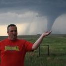
And thats the amazing part of it, for every person who doesn't, there are 100 people who understand just how hard it is. I did a High Risk in Kansas on a Tour once in 2008 , a PDS Tornado Watch was Issued and the dryline bubbled into life, Ma Nature had other ideas and not 1 scrap of Precip fell and the clouds bubbled away to Orphan Anvils, what did we do, well we took it on the chin and said Ma Nature won that little skirmish, we didnt hold it against her and nobody thought any worse after a few beers. These things happen, and then on days when its a Marginal Non Zero Tornado day you luck out on a stunning High Plains Stovepipe, rough with the smooth with the weather and nobody can call it completely correct if they tell you they can they are lying
-
Yh even now on the previous page their is sniping and trolling going on - They think there clever but we see through em quite quickly and know they have not got a clue about Basic Meteorology, they slag the storms coming up in the Summer saying they are heading in a different direction for example just to get a reaction, its so sad really and then hide behind their screens. No point in getting involved with these types of trolls, just laugh at them and do something better with your time I guess. There are some Sad Individuals on the Internet but the majority are really nice people who appreciate it, just spoils it for the rest.
-
Yh Cherry Orchard was busy. Great to see people walking dogs and kids having fun, its what they need. And yes if you dont get slagged for being too technical you get slagged for other things, just not worth the effort and wont be getting on more of mine.
-
Hammering it down again in Leigh On Sea after a 1 hour break of Light Snizzle. Temp has not got above 0c since it dropped below at 545am. Oh and one Facebook Page I give some forecasts for I have told to do one as one guy was complaining that my 6am start of the snow was delayed by 2 hours, this is what you are dealing with these days, Its a shame but I will not do it anymore and probably wont give out any thoughts soon on here as well, not worth the effort if the wind is in the wrong direction for instance. Good Luck with your streamers over the next 48 hours.
-
Yh here as well Temp is -1.3c Dewp is -1.5c You only have to go on XCWeather and see Southend Airport is also showing Minus readings
-
Hi Everyone Dan at WeatherQuest is trying to keep a database of Snow Depths from this cold spell. Would as many people as possible if you have time upload your depth to the following link. You can update it hourly if you want from your Postcode even if you have nothing at all just upload the depth, it gives Dan a better idea of where snow has fallen etc (Much like his Lightning Strike Maps in the Summer) Link Below WQ Snow Depth Reports WEATHERQUEST.CO.UK
-
Enjoy the snow everyone that gets it and for those that havent yet dont give up hope. Am off out for some sledging as its just hit 5cm here and the sledge and kids are ready.
-
Am sure it will get down to Shoreham, temps and dps will become much more favourble from here on in
-
Once that wind switches to ENE it should bring a lot more places further west into the action
-
Just for Steve as he really struggles with this When the Wind is from the NE or NNE you get a Kent Clipper or a Mid Kent Streamer. When its from the ENE you get the Thames Streamer The clue is where the wind comes from


