


Spanish Dani
-
Posts
26 -
Joined
-
Last visited
Content Type
Forums
Blogs
Gallery
Events
Learn About Weather and Meteorology
Community guides
Posts posted by Spanish Dani
-
-
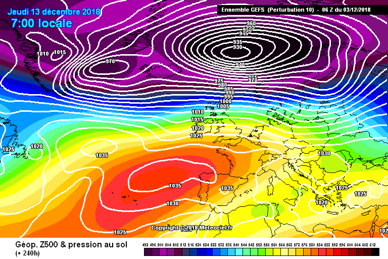
The gfs is better but the easterly is only just making it to UK, angry Low in Atlantic
-
5 minutes ago, Summer Sun said:
UKMO and ICON 12z both developing a low west of Iceland. Running ICON on it brings in slightly milder air

Yes they have the same feature so would be the same bad outcome I guess..
-
Just now, The Eagle said:
UKMO says no
Yes Atlantic going to go over the High there by the day 7 but I don't think we see that till later..
-
6 minutes ago, inghams85 said:
Do you have any idea who he is and what he does? Clearly not
I think he seems to be knowlegable amateur like lot of others
-
 1
1
-
-
30 minutes ago, iceman1991 said:
From gp post earlier they might change soon hopefully
I'm sure they have more data then someone posting on here, with respect to the 'GP' of course ..!
-
12 minutes ago, northwestsnow said:
Who needs a Scandy high??
Long live the Grice - land high!!
Truly remarkable 6Z, perhaps unlikely but certainly an option on the table, protracted period of High pressure to our north in Mid Dec?
Pretty darn cold persisting and probably intensifying ..
But it shows Atlantic back with wind and rain later on ?
-
Well a different position High this time but mainly dry for most.
-
37 minutes ago, northwestsnow said:
It does look like the Azores ridge it going to make it into Scandy, after that, who knows.
EC det is lovely but there must be a helluva lot of members that push the block back before it gets chance to establish judging by the mean later on..
GEFS also look cold mid term but again a signal for the high to get shunted out of the way longerterm..
So, easterly looks fairly certain, but it might be brief..
Yes looking like milder air will come up from the South fairly quickly after an initial easterly, also Europe doesn't look very cold.
-
 1
1
-
-
5 minutes ago, shaky said:
Total and utter garbage from the gfs!!and in all honesty knowing our luck its probably gona be spot on°!!!flat as anything!!
Yes if easterly can go wrong in 4 days then very likely go wrong in 8 days !
-
1
-
2
-
-
GFS is sending Low to Iceland so this is not going to be good later I don't think..
-
2
-
-
5 minutes ago, mountain shadow said:
Let's just say, many any Easterly has gone wrong over the years in fairly short time frames. The hope is with improved computing power and logarithms that we can be more assured of success once we get inside T+144.
Yes and also worry is that Met only see alternate settled/Atlantic weather , then mild for all around the Xmas time
-
9 minutes ago, tomjwlx said:
I also remember all the models were showing a easterly all the way upto 72 hours only for one GFS run to suddenly show all the energy going over the high and sinking it into Europe then all the other models flipped in the same day can’t remember which year but it was one big letdown I’ll never forget
Yes I was in Dublin and Eire Met had even forecasted snow showers for like 3-4 days time but in the end never happened and Atlantic came back quickly.
-
1
-
-
58 minutes ago, ArHu3 said:
I've seen too many modeled cold episodes getting postponed and then downgraded. For a real cold spell we need cross model and almost all the ensembles on board
I want to see something like this
Yes I remember folowing the forum a few years ago in December, there was a huge let down I think it was 2012
-
8 minutes ago, frosty ground said:
Member 10 shows us what happens when we get to much energy to our north!
Ensembles not looking that great with 3 in 4 clappsing the high and the rest only a few showing anything like the operation.Yes that would be a tough situation to change.
-
ECM is outler solution according to ensemble ? I think unless we see MET change forecast then we have to think Atlantic will be too strong over the top.
-
1
-
1
-
-
4 minutes ago, AppleUK 123 said:
Indeed Mucka, I believe the likes of UKWX Info did state on here before that they would expect cold charts to appear, but at the moment average temps are the best thing cold lovers can hope for. There is no sign of blocking bringing wintry weather to the UK and the Atlantic still remains the dominant driver of our weather. Our search continues...
Yes some very mild days for the South too.
-
1
-
1
-
-
26 minutes ago, carinthian said:
The ECM op at 240t would appear to be out of range of the mean but more importantly has the support of the GFS op. This could be a trend to cold that develops rather quickly !
C
But if you see ridge over Iberia like that then Atlantic would return quickly with milder air for UK.
-
27 minutes ago, mulzy said:
A slight change in the NWP with a more southerly tracking jet been shown. Northern areas *could* get some transient wintriness as Atlantic systems brush against any entrenched cold air. However the mild and unsettled theme is still the form horse, especially in the medium term.
Day 10 EPS mean suggests an Atlantic influence in the 10-15 day period and this is confirmed by the extended EPS. A classic winter tale of Atlantic troughing and ridging from southern Iberia into Eastern Europe.
Yes disappointing after reading that there was a lot of hope for December cold.
-
11 minutes ago, Don said:
Is this from the Spanish weather service?
Yes, well very local to where I'm from. They are normal very good, predicted the very dry winters of a few years ago and the very wet one (I think 09/10) ?
-
2
-
-
5 minutes ago, KTtom said:
It also, once again shows either how difficult forecasting is over our neck of the woods....or the Met are useless Only a few days ago the talk was IF the milder westerlies encroach it will be brief...I suspect the next modified text forecast will read IF it turns dryer it will be brief! I'd love to know what went hopelessly wrong if the latest output verifies.
Yes was hoping for drier weather mid December for when friends come over from Spain but just looking wet and windy now.
-
1
-
-
I think MET was saying dry and colder for middle December but now not looking likely from these models.
-
1
-
-
1 minute ago, mountain shadow said:
For us in Britain and Ireland this does not bode well for a cold winter for us and indicates Iberian high pressure so winds from an West to East direction.
However, the Italian weather service appears to indicate low pressure in the Med for Winter. Seems to be a lot of mixed signals around.
Yes I think they are seeing positive NAO.
-
1
-
-
8 minutes ago, mountain shadow said:
That seems to reflect the recent Met Office update for December with Britain & Ireland expected to be around or above average for, where only very recently, below average temperatures were expected.
Still, the top boffins on here remain confident of colder weather taking hold as December progresses into January so it will definitely be interesting to see what actually occurs.
Im from Valladolid, they are expecting dry and warmer than normal throughout
-
1
-
-
Interesting forecast, for Spain they were saying unsettled winter was coming during September October time but now has changed to high pressure settling over Iberia for whole winter period.
-
1
-


The hunt for cold - Model discussion (late November)
in Spring Weather Discussion
Posted
Yes we have to face up to what it is showing..