


exodus
-
Posts
211 -
Joined
-
Last visited
Content Type
Forums
Blogs
Gallery
Events
Learn About Weather and Meteorology
Community guides
Posts posted by exodus
-
-
I'm back to enjoy the lightning party tonight.... Starting to really pep up into the channel!!
-
Hirlam and ICON have the front moving up and slowing over North London up to North Essex and then losing intensity as it moves further North. I'd say the line for good snow prospects can be drawn across from North Essex into Suffolk. South of there will do well, most south of London and M4.
-
 1
1
-
-
A good little covering here in North Essex. Temp 0.5... dropped a degree in last 30 mins or so
-
Have I mentioned it is raining in Essex?
-
Still heavy rain here in Essex
-
-0.5 already here in Essex....
-
Can someone explain to me why certain areas are identified as being more at risk of storms i.e. yellow and amber zones. How is it known that storms would be worse there?
-
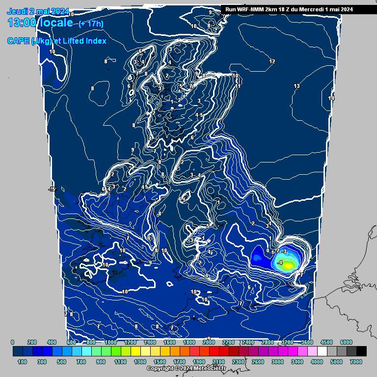
Wow really picking up off the south coast now!
-
5 minutes ago, Surrey said:
Looking at the high RES this morning even later doesn't look that great any more.
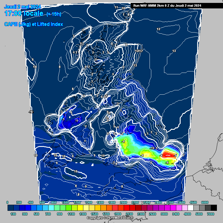
In spectacular fashion every model I posted yesterday with storms further west last night has corrected east
A lot of cloud also starting to bubble up and move north/northeast.
I don't think we will get up to the temperatures we were forcast unfortunately to much high level stuff spilling in... Maybe far reaches of East Kent
Where abouts is looking favourable for storms today do you think?
-
I'm right on the fringe of a big cell moving up across Essex. Had some massive very close strikes but rain just to the east of me. Had a brief bit of heavy rain.
-
Seems to be building as it makes landfall.
-
Lol life poo... Oops.
-
19 minutes ago, Blessed Weather said:
That's quite an area of active storms leaving Holland this evening and heading towards East Anglia. It will be interesting to see how much electrical activity remains after the journey across the cool North Sea. But the heavy rainfall will certainly make the crossing and is already showing up on the Netweather radar.

North sea had sucked the life poo it of it now...
-
NOt gone above 13 degrees here today in North Essex. Rain most of the day too... eurgh... had planned to get out to all my bees but stayed home.
-
How is Essex looking for storms tonight?
-
1 hour ago, Surrey said:
Morning all
As the above alludes to we could get another good shot at some thunder and hail today. There does seem to be some bias towards the midlands but a risk nonetheless
As ever trying to pin point anything is like trying to pin a tail on a real donkey..
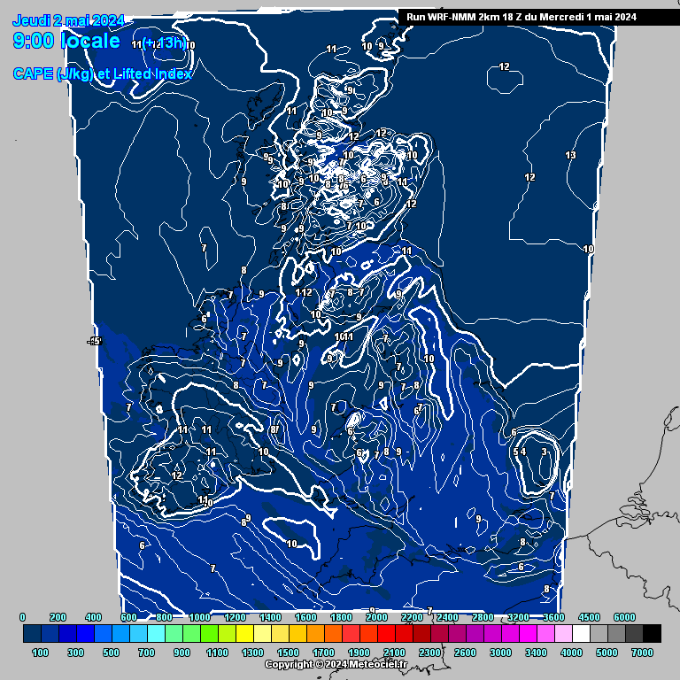
NMM thrown out on PPN charts because of how far off it is this morning.. Although I have used it to highlight where CAPE is present
Current DP of 7 at Heathrow will need this ideally to get around 8-9 to spark anything off
So are higher dp good indicators for thunder?
-
Anyone got a picture of a goat?
-
Seems like pandering to the few at the expense of the majority.
Completely agree with lassie' s comments above. Nothing to add to that, I've enjoyed following the banter as I'm sure the many have.
-
2
-
 1
1
-
-
Temp 5.5
Dp 5
Stansted Essex.
-
18 minutes ago, Stu_London said:
For those with weather stations, how are the dew points looking?
https://www.wunderground.com/personal-weather-station/dashboard?ID=ISTANSTE10
-
I've been sowing my seeds all winter,,,, none grew though.
-
Just now, Sparky68 said:
that could be interesting if we keep the cold
Looks like it will miss us lot
-
Just now, Snowflake Queen said:
Uxbridge was mad today getting to work
That's what winter is all about. Love that! It's a nice way to end winter isn't it?
-
1
-
-
Had a good afternoon of continuous snow here in Stansted A few cm I reckon by everything nice and white again including roads. Nice end to the winter


Southeast and East Anglia weather discussion
in Regional
Posted
Looks like this stuff is going to head across Kent and out into North sea