


Mildcarlisle
-
Posts
44 -
Joined
-
Last visited
Content Type
Forums
Blogs
Gallery
Events
Learn About Weather and Meteorology
Community guides
Posts posted by Mildcarlisle
-
-
2 hours ago, Ali1977 said:
Cold enough for a dusting of snow from the East, long way off but a dryer cold air mass looks very possible - snow forecasting pointless at this stage but you never know

Where did Scotland go?
-
A very benign day here at Port of Ness.Almost wind still,+5c reached...ours is coming by way of wind on Sunday and at points through the coming week and, looking stormy for all around the 27th.
-
 8
8
-
-
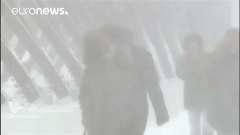
Snow gates at Braemar closing.
-
5
-
-
15 minutes ago, Allseasons-si said:
Absolutely @MATTWOLVES
we can't have cold days everyday of the winter it's fact,even the best winters have there mild moments and sometimes they don't get going until the latter third of January>
i see nothing remotely zonal in the models at present,IE:-west to east full on
look at the gfs and gfs/p tonight in motion...

none of them showing a pv located over Greenland,patience peeps

let's just enjoy this cold spell with a few wintry hazzards along the way this week and see what crops up eh.
BTW @Snowman.,great analysis there and it shows you that you cannot take fl seriously and things can and will change quickly especially with an SSW on our tails.
I agree,nothing remotely zonal but same results...wet and windy,mild with colder interludes.No freeze up,no persistent or recurring cold cycles.Resetting to normal notwithstanding the SSW.I don’t like it either.
-
- Popular Post
- Popular Post
Why has the ‘members online’ facility disappeared?
-
10
-
41 minutes ago, Tim Bland said:
I first posted that the GEFS were starting to show some mild members at the very end a week or so ago and I was shot down in flames and told to pay no attention. Every day over the last week the milder members have increased and are now flattening out. Hopefully the warming up next week is just temporary, but it shows us the value of ensembles to spot trends
Yes you did Tim.9th to 11th January was the target dates.It was dropped but reappeared.Let’s see how things progress.
-
 1
1
-
-
Not liking this at all.Ok,southern England still taking some thing from the east but further north,that’s a southerly source of air with heights moving east.
-
1
-
-
8 minutes ago, Cold Winter Night said:
That is crucial to understand about severe winters. It is never a pattern set in stone for weeks on end, it is waxing and waning constantly.
The raging vortex usually limits (or ends) the number of cycles, but this year our hope is that Weak Vortex+Great pattern+SSW will let these cycles continue...
We'll see!I believe multiple repetitive cycles are a pattern.
-
44 minutes ago, SLEETY said:
Wow that mean at the end is very reminiscent of the Record cold February of 1895,surely not..
Very tasty charts but I’m curious,how are they produced from so far back? Are they speculation based only?
-
2
-
-
This current temperature image would not be out of place in June...
-
1
-
-
17 minutes ago, su rui ke said:
There's a chance of the all-time UK July record being broken today so I don't think it's unreasonable - this time - that the media are focussing on it. It's also been dry and very warm generally across Scotland - your own forecast shows 27C for today, which counts as heatwave conditions!
So in other words,what would qualify as ‘IMBY’ and ‘off topic’ comments are ok if there is a record about to fall? Trust me on this,it’s all about London and the south east.
-
All the talk on the model thread is all about the south east of England’s heatwave and both Sky and BBC are hyping it up large.I’m sick of it and if conditions were reversed (Scotland only heatwave) the priority would still be the English weather,on the model thread and the media outlets.Some say that in a winter set up (where Scotland always scores better than English locations regarding snow fall,lying snow and temperature) then the model thread attention would swing to Scotland...I beg to differ as has happened in the past,” Can we please keep local weather or IMBY isms in the regional threads”
-
1 hour ago, damianslaw said:
Fairly typical April synoptics on offer - i.e. less of atlantic driven conditions, and more of a blocked set up holding sway. In the short term, we have the trough plaguing the UK unfortunately bringing bouts of rain and much cloud, and with an easterly wind, not feeling very pleasant, however, towards the end of the week, the trough is squeezed out and we see a drier SE flow take hold ushering in some nice Spring warmth with temps widely in the teens for all, possibly and some welcome sunshine and dry weather.
Divergence then takes place, with ECM maintaining the dry warmer outlook, GFS showing a colder unsettled evolution eventually with heights retrogressing towards Greenland. My hunch is something more akin to ECM, but with heights further west, which could then either sink, stay in situ or indeed retrogress NW. GFS might therefore be onto the right trend but perhaps too eager to bring it in..
Overall mid April is looking very springlike and will herald the start of a major shift in general feel of things, when we can shrug of the last vagaries of the winter season and move into the warmer half of the year (late April - late October) and indeed generally the sunnier most settled and often driest third of the year (late April-late July).
Aptly put,the country of two seasons.Somehow I like that.
-
Scotland,the land of the 5 month winter.
-
5
-
-
48 minutes ago, Frosty. said:
The Gfs 12z looks unbelievably wintry next week considering it's early april we are talking about..there is snow on most days next week, especially further north..last hurrah?..who knows the way this crazy spring is unfolding!..❄❄❄⛄⛄⛄
I'm hoping for warm settled weather towards mid april though!Hi Frosty, a week ago this forum was buzzing about the potential for a third beast based on the model output then.I'm disillusioned by the current outcome versus prognosis of a week ago.I'm sure the warmer outcome will be the reality this week.
-
I'm sure the media,especially the BBC don't realise that the actual current weather is occurring well in front of the forecasts.Helen Willits mentioned just now (16:30) that the rain will turn to snow on the mountains of Scotland and temperatures tomorrow in Scotland will only reach +4c.Helen,there is sleet falling near Galashiels (180m) right now,with a temperature of +4c.Even the iPhone app is showing this.But of course,Scotland is irrelevant!
-
2
-
-
2 minutes ago, Deep Snow please said:
Yup, our country simply isn't set up to deal with that sort of weather at all. Would be mental.
Scotland is, my friend.
-
2
-
-
Wet sleety snow in Galashiels.
-
Anyone else share my view that since the SSW was forecast,the model thread has become the Fantasy Island thread? I understand the anticipation and excitement of the SSW and the 'potential' ramifications thereafter but almost all output being shown and discussed is all in F1.I hope we do get the protracted cold easterly and dreams sometimes come true but for now they are dreams even at a point of cross model agreement on day 10.
-
6 minutes ago, More Snow said:
some excellent model output at the moment and some really cold weather looking on the cards but for how long? the models seem to want to prolong the cold but the BBC news 24 forecast ended with milder air winning out toward or over next weekend, so do they see something in models we don't get to see?
I think they mean milder air winning out over their London.That aside,fantastic seeing so much overall cold in the charts,especially in the new deliverer,the Northwesterly.
-
And while Carol Kirkwood manages to take 2 out of 3 minutes to describe how the temperature dropped from 10c to 8c in London,the snow is back in Leadhills.
-
1
-
-
And if I may,in Scotland this winter has been slightly milder (by night) but snowfall has been a regular visitor.Even in the Scottish Borders/Cheviots there is still snow lying in drifts(as there should be at this juncture) but the Highlands are as always well endowed with snow,check the relative websites.There is a definite north/south disparity to be observed from this winter and of the last three or four.I suffer the pain of those down south;in years to come this snowless zone may well move north but for now I am happy with the winter gone,I did see snowfall and I recorded -4c in Galashiels as a low likes.
-
- Popular Post
- Popular Post
And maybe the good old days before the internet were best...all they had then was the BBC's 'Weather for Farmers for the week ahead' on a Sunday.Only five days ahead in which model output was converted to synoptic charts.I would suggest less hearts were broken then than now likes.
-
16
-
And the 'Sunday snow for Scotland' possibility is now melting away south as the chart below shows the frontal boundary much further south.


 I'm hoping for warm settled weather towards mid april though!


Model Output Discussion - Autumn arrives
in Forecast Model Discussion
Posted
Business as usual here in Lewis,not been any ‘heatwave’ and no talk of a ‘breakdown’ from said either however,one comforting fact is,that the weather is perfectly normal here and ‘progged’ to continue as such.