


niconpat
-
Posts
10 -
Joined
-
Last visited
Content Type
Forums
Blogs
Gallery
Events
Learn About Weather and Meteorology
Community guides
Posts posted by niconpat
-
-
42 minutes ago, feb1991blizzard said:
So are you saying that the 12z, for instance, has to be initialised at 1530?, surely the WMO have no power over government funded organisations from individual countries?
I think it's because the models have to wait for 12z real world observation data before they can run. The 12z can't instantly get a snapshot of real world data and start running immediately at 12z, the data would have to go through verification and other processing first.
-
For the record, Met Éireann warnings are both threshold and impact based.
"Given that the thrust of the Weather Warnings service is on potential “Impacts” of weather rather than on the numerical values attained by the weather elements themselves, it may on occasion be appropriate to issue warnings at a level higher than that strictly justified by the anticipated weather elements."
https://www.met.ie/nationalwarnings/warnings-explained.asp
-
 1
1
-
-
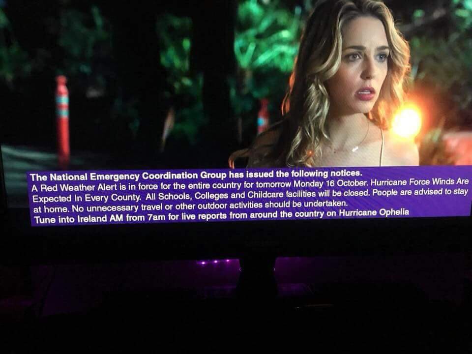
1 minute ago, The Eagle said:

The timing of her reaction is perfect
-
6 minutes ago, Frosty hollows said:
Any web cams we know of in Cork/Dungarvan/ Youghal/ Waterford/ Rosslare?
Here's one in Waterford City
-
1
-
-
1 minute ago, Andy Pepler said:
it would not take much thou..shift of 50 miles to the east could make things very messy ..
i feel for our irish weather fellows ..looks like a low level panic is setting in ..
but i am seeing plenty of good advice and kind words ..
Keep in mind the weather forum on boards.ie is just a small subsection of a hugely popular Irish forum. When a weather thread gets popular it appears on the front page of the whole forum and chaos ensues. In saying that, the mods and regulars in the weather forum do a great job of keeping things somewhat under control
-
1
-
-
6 minutes ago, Ice Day said:
If, and it's a big if, this graphic is accurate, south east Ireland will be getting 130-140mph gusts. Surely overblown, surely?
Shirley would definitely be overblown by Ophelia if she was anywhere near those massive gusts.
The ICON model does look like it's gone off on a mad one, but it can't be dismissed yet. The high res models tomorrow will be interesting.
-
1 minute ago, The Eagle said:
In fairness the storm is not that much a UK event at the moment so it's kind of understandable. If there was an eastward shift it would be packed here!
The Irish boards.ie weather forum is almost up to December 2010 snow event levels of activity right now!-
2
-
-
22 minutes ago, pip22 said:
https://www.ventusky.com/?p=52.97;-6.89;7&l=gust&t=20171016/14
Dublin is gonna hit pretty hard by 100mph winds.
That's the ICON model's take on things, switch to the GFS and it's a lot tamer for the east coast of Ireland. I highly doubt it will verify like the ICON is showing, but it is possible.
-
37 minutes ago, Fiona Robertson said:
Do you have a webcam?? Can you manage to stream live on the Tube of You?
Here's a live youtube stream from neighbouring county Waterford. Pity there aren't more trees, but could be interesting to watch on Monday.
-
2
-


Model Output Discussion - cold spell to end Autumn
in Forecast Model Discussion
Posted
Are the WMO responsible for collecting and sorting the global observation data though? If they only release the 12z data at 1530z then no model can run any earlier. As somebody else mentioned, the model runs are relatively fast and I think we see their output in close to real time.