


topo
-
Posts
187 -
Joined
-
Last visited
Content Type
Forums
Blogs
Gallery
Events
Learn About Weather and Meteorology
Community guides
Posts posted by topo
-
-
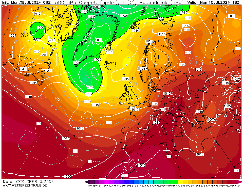
Isn't it extremely interesting that we are having the same weather set up that brought more than 1m of snow in the south of Norway, just one month later?
 This is 1st of January
This is on Sunday
This is 1st of January
This is on Sunday
Is this something driven by global patterns or just pure luck?
-
 4
4
-
-
I don't know why in the UK which is quite north, there are complains about snow in March.
UK has a much greater latitude than New York or Chicago, I don't see a problem with sustained snow cover in March under proper synoptics.
The weather set up is the issue, not March.
Yes, it is not December but still, mid March in Leicester has the same maximum sun angle as early February in Chicago
-
2
-
-
The lack of cold is a result of the synoptics of the previous days/weeks.
Believe me there is cold. It can be unleashed really fast with the proper synoptics.
-
7
-
 1
1
-
-
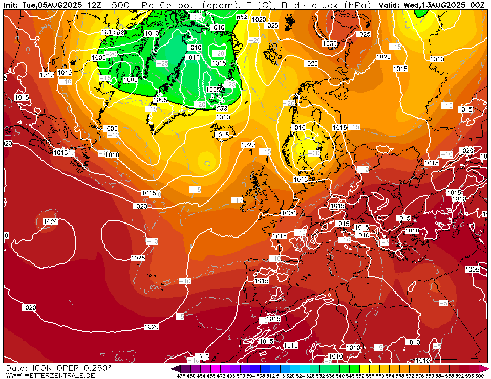
ICON
vs EPS
Looks like the high pressure has just submerged into europe. While the "shape" looks identical in both models it is predicted to be according to ICON in a very unfavourable place.
-
-
Not THAT different from GEM though at 180 hours..
-
1
-
-
New all time record for Norway. Is this a category 3 hurricane??
-
2
-
-
Svolvær havn - Lofoten.com
WWW.LOFOTEN.COM
Webkameraet er satt opp på taket på Thon Hotel Lofoten midt i sentrum i Svolvær. Kameraet er satt opp og driftes av Lofotcamera i samarbeid med Lofoten.comSnow and almost hurricane force winds
Ingunn er på retur i Lofoten: – Høyeste vindstyrke i Nordland er målt i Lofoten
WWW.LOFOTPOSTEN.NO
Torsdag morgen slo ekstremværet Ingunn til og hele Lofoten har fått merket det ekstrem uværet. Torsdag morgen var det lenge helt stille før det plutselig braket løs.-
1
-
 1
1
-
-
I think there are pretty strong background signals for 200hrs onwards..
It can't be a coincidence that all models agree into an Atlantic driven weather with milder conditions in NW Europe and Scandinavia.
-
22 minutes ago, CoventryWeather said:
Quick question, the Swiss 4x4 HD model, heard many say it's a good model at convection - shows widespread shower activity from tomorrow afternoon until late Monday pretty much anywhere southof the mids.. Does anyone have any opinions on this model? It is rated quite highly on Twitter and stuff not really mentioned much on here. Thanks.
I really like it, most of the time it is better than the global models.
There is also the ECMWF version of it and the nowcast version which claims to be the best one for the next 24 hours
-
1
-
1
-
-
- Popular Post
- Popular Post
15 hours ago, Daniel* said:Extreme snowfall in southern Norway. 1m of snow!
Hi all and happy new year!
Indeed, coastal southern Norway is buried after a historic snowstorm that left more than 1-1.5m of snow with some astonishing snowdrifts of 2-3m. Some pictures of my area
By the way December was the 3rd consecutive month with below the average mean temperature and probably January will end up the same.

-
9
-
1
-
GFS ensembles show a completely different picture
GFS operational almost an outlier with few members in the same path, while the vast majority is below the mean..
A bit similar with ECM
So who wins? Ensembles or operational runs? I guess we will found out soon, but interesting that we see similar behaviour in both models
-
8
-
1
-
-
This is a so weird set up for this time of the year..
Usually you expect to see something like this in February.
-
6
-
-
Another insane run by GFS, looks like Scandi will experience the coldest late November - early December period since 2010.
-
3
-
-
2 hours ago, Kentspur said:
My first day in Stockholm on most models and ensemble suites Tuesday is showing a max of -5c and heavy snow I wonder when the last time that happened in November was?
I don't think it is that rare for Stockholm and very late November, but what is rare is the continuous cold and the subzero temperatures for as long as the models predict. That is rare.
By the way, it looks like just north of Stockholm all the Snökanon(lake effect from the Baltic Sea) will take place. A probably remarkable event, GFS predicts more than 50mm for the next week and probably it will be more (usually local models predict better these situations than global ones). So maybe record snow for those areas for that time of the year? It will be interesting to follow up.
-
3
-
2
-
2
-
-
GFS 06z is probably one of the coldest model runs that I have seen for my area and southern Scandinavia.
-
9
-
-
That is awesome
-
1
-
-
The worst floods on record in Greece..
Insane amounts of precipitation with over 1000mm locally and 600mm recorded in cities in the central plains..
This is equivalent to a hurricane..
Villages are covered by 4m of water, people on the roofs.. There are still villages entirely below water that no one has been able to reach them..
-
-
I don't see why March 10 is a problem for the UK regarding the sun angle..
Sure the sun is at a greater altitude than in December or January but UK is still north enough for a March sustained snow cover.
Actually the maximum sun altitude on 10th of March at Birmingham is the same as in New York on 6th of February and the same as in Nagano, Japan on 20th of January...
Original post: https://community.netweather.tv/topic/98450-model-output-discussion-a-cold-start-to-spring/?do=findComment&comment=4815025 -
- Popular Post
I don't see why March 10 is a problem for the UK regarding the sun angle..
Sure the sun is at a greater altitude than in December or January but UK is still north enough for a March sustained snow cover.
Actually the maximum sun altitude on 10th of March at Birmingham is the same as in New York on 6th of February and the same as in Nagano, Japan on 20th of January...
-
16
-
3
-
4
-
-
3 hours ago, JoeShmoe said:
Lovely day here, spring like, can feel the warmth of the sun outside.almost beer garden time !
I see the mad thread is back at 10 day winter wonderland charts, as above not really interested now, let’s just get spring started
thought this was interesting in terms of patterns of recent snowfall. Not pretty reading if you like snow and live in the NW!
I'm really curious about the methodology they used.
-
Seems an outlier according to the ensembles at 192hrs... Most go towards ECM ensemble path
 This is 1st of January
 This is on Sunday


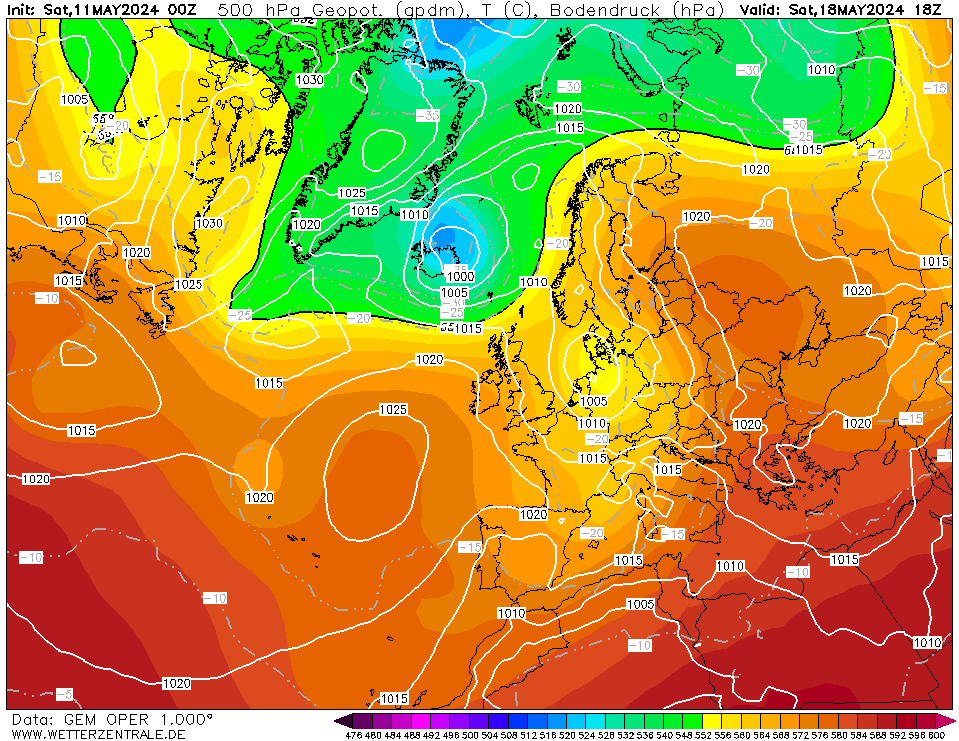
 vs EPS


.jpg.595f07bab7550edc1a9fa5ba8b9e6bee.jpg)


Model banter and emotions
in Forecast Model Discussion
Posted
raz.org.rain I know all these, I am just referring to the power of the sunlight. My point is that sun in March is not the core problem. Of course it is not January, but UK is north enough, to not have that issue.