


Chris Knight
-
Posts
889 -
Joined
-
Last visited
-
Days Won
1
Content Type
Forums
Blogs
Gallery
Events
Learn About Weather and Meteorology
Community guides
Posts posted by Chris Knight
-
-
btw when it comes to the veracity of data from UK weather stations, why did the MetO stop accepting data from Barbourne, even though the station appears to be perfectly situated?

Clearly some stations (out of thousnads) in the USA are very poorly placed and if in the UK wouldn't even be counted by the likes of us let alone the MetO. I really cannot say why data from such stations gets accepted in the USA. But in this country a station has to be whiter than white to be accepted. Else we set the likes of Philip Eden and Stephen Burt on it
Of course, in terms of comparative analysis, the location of a station is irrelevant - just so long as it has not significanty altered during the duration of the analysis period. ALthough even then, any change in environment should show up as an obvious step up/down. Except of course in cases where asphalt is laid around the station - but only 1 square foot per year over 40 years .....
No. I think rather than entering the data into the computer they just wait to the end of the month and make up a figure.
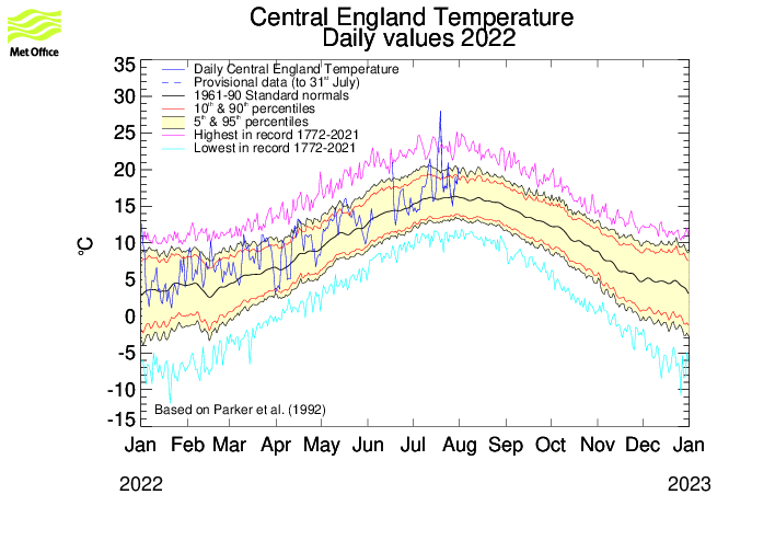
btw where's that chart you posted from and what is it meant to show? Deviation from the 61-90 average or 71-00 average?
(and is the Pershore graph meant to be deviation from the Malvern average?)
The link to the figure is http://hadobs.metoffice.com/hadcet/graphs/stations2mean_2009.gif
I arrived there via the hadobs hadCET diagnostics page.
All three stations are currently showing flatlines, and why the 'data' is presented online I do not know.
As to the deviations, the Metoffice are the people to ask, as Dev points out.
This is what they would like us to believe is the current situation, link first, then image:
http://hadobs.metoffice.com/hadcet/graphs/HadCET_act_graphEX.gif
Frankly I think it is Cr*p, but who can say?
-
Oh no
we're not going to see another 'debate' blathering on about tarmac AGAIN are we? These climate debates, if it's not McIntyre it's Watts and if it's not Watts it tarmac and if it's not tarmac it's Hansen or bloomin hockey sticks. Stroll on, I guess it will be 'air cons' next
or even (LOL) aircraft exhausts. Go on, surprise me Remember Whitewash versus Dulux Brilliant White, Dev. And the commercial Stevenson Screens you can buy that are made of White coated steel (that somehow gave record high temperatures during summer heatwaves in 2003).
-
omigod!!!! Dev's flatlined too!
Well the data for Pershore is coming from Pershore
http://www.metoffice.gov.uk/weather/uk/wm/pershore_latest_weather.html
Good, but is it feeding into the CET?, or are we just coasting along on the mean?
-
Ask them. Seriously, ask them. Don't imply there is something amiss when a question politely deliver to the right people would give you your answer.
I've asked questions of The Hadley Centre - and got very helpful replies. Go on ask them.
And if you don't (or wont) I will in the next day or two, time to compose a letter permitting!
Thanks Dev, I am sure you will get to the bottom of it!
I have answered your previous question satisfactorily I believe.
I don't trust them on the basis that they continue to release sloppy information, as far as I am concerned.
OK?
-
C'mon....
You cast doubt, so put up some reason for that, don't just play silly b's.
OK, here's the link to the three main stations that are supposed to supply the Hadley CET data in real time.
None of them appear to be working at the moment, so where is the data coming from?
Dev? Are you there?
-
Why would NASA/GISS not trust the Hadley figure? Care to show me one figure from the Hadley CET you think wrong - just one.
Not a single one Dev, the trust is universal, and who can argue with that belief?
-
We may need to do something similar in this country. Does anyone have a list of locations - In the first instance I'd be willing to search Google maps/street view.
NASA/GISS just takes the figure from the Hadley CET to represent the whole of the UK doesn't it? Such trust.
-
The cruwlda2 data only goes to - at most - 1999 so presumably the file McIntyre has also covers the last decade.
Is the data in a form that we could all use?
It also could be used in order to cross-reference the validity of the file McIntyre has.
This is what the hoo-hah is all about - raw historical station data that has then been corrected and adjusted by various algorithms to produce the Datasets that Professor Jones has used to produce papers that show there has been historical global warming. Steve McIntyre wants to see if he can reproduce those results, or if there are problems with the methodology.
I think that recent data all falls under FOI legislation, and can be obtained from source if required.
The data is a large text file, with station names and data laid out as in the first post.
Here's a bit of the data, which will get all un formatted when posted
1904 3 -7 13 66 106 148 170 160 124 83 42 21 77
1905 -7 9 27 40 120 171 177 156 124 50 32 17 76
1906 7 7 15 68 132 170 172 165 135 94 69 -11 85
1907 -11 -9 20 55 106 135 158 144 124 118 37 6 74
26180 557 -132 73LUND SWEDEN 17531773 101753
1753 -18 -13 37 76 115 146 167 159 134 99 32 -30 75
1754 -10 -14 -12 56 129 152 151 155 119 101 47 19 74
1755 -38 -53 8 79 120 178 182 154 121 84 37 20 74
1756 19 23 25 42 99 176 194 156 141 92 18 -1 82
1757 -28 7 14 82 107 182 214 176 136 52 60 13 85
1758 -39 -20 7 33 139 167 160 168 118 67 45 10 71
1759 24 23 34 62 102 174 201 181 131 91 21 -20 85
1760 -40 -10 7 61 118 192 182 171 153 85 40 25 82
1761 6 12 50 68 129 180 173 183 152 63 51 -6 88
1762 11 -7 -18 81 115 170 174 142 124 48 41 5 74
1763 -39 5 5 46 112 149 178 169 115 77 28 30 73
1764 -1 30 14 56 125 136 205 163 118 76 24 1 79
1765 -3 -23 29 69 102 153 159 169 119 90 45 -2 76
1766 -18 -27 21 81 119 173 188 172 138 87 58 -9 82
1767 -61 -6 21 27 98 139 164 173 150 89 64 4 72
1768 -55 -31 -24 51 107 163 179 171 125 82 49 21 70
1769 6 -5 23 57 113 156 176 159 136 52 26 32 78
1770 -23 0 -29 45 115 151 181 181 154 105 25 15 77
1771 -38 -38 -39 22 124 180 172 151 125 101 28 25 68
1772 -16 -21 -11 47 100 162 178 171 136 110 72 29 80
1773 10 -9 16 73 141 159 181 180 145 112 50 26 90
28070 686 -274 -999IVALO FINLAND 19611970 101961
1961 -107 -110 -65 -43 34 131 148 119 66 52 -35 -150 3
1962 -158 -111 -145 -5 32 89 109 92 56 2 -23 -153 -18
1963 -146 -158 -131 -11 110 84 123 118 86 16 -71 -114 -8
1964 -64 -146 -68 -30 49 100 142 106 50 29 -77 -104 -1
1965 -134 -110 -107 -15 12 100 108 101 65 -5 -99 -149 -19
1966 -189 -231 -163 -43 34 120 145 101 34 -32 -35 -104 -30
1967 -181 -88 -38 -7 46 105 137 132 82 -4 -7 -174 0
It's the same data, but presented without decimal points, i.e. as tenths of a degree.
McIntyre has this file, no doubt the will be doing a comparison.
-
Did they release this today following the leak?
I doubt it, the file name cruwlda2 was mentioned by Doug Hoyt, he said it was zipped at about 3.6Mb here, so I went fishing with my friend Google, found the gegereka site with the link then did a little FTPing and a reverse IP lookup to find out it is a CRU site, with some research data available by anonymous FTP. I'd bet it has been around for ages, but interesting how long it will remain available now. Of course I have a copy, should it disappear...
-
The data is apparently available online from CRU at the Tiempo Climate Cyberlibrary
ftp://www.tiempocyberclimate.org/projects/advance10k/cruwlda2.zip
-
Hmm... feedbacks are tricky little blighters to pin down.
-
I think it's both hence why its a positive feedback mechanism
Then 'something' must stop the process from running away - since it doesn't get hotter and hotter, each time there is less cloud and a warmer ocean, what is it that stops the positive feedback?
-
It is still chicken or egg.
Warm oceans -> less cloud, or less cloud -> warm oceans?
Correlation is not cause and effect.
-
There are plenty of facts that we fully understand. There are other facts that we are starting to understand....
The main fact is, we don't fully understand the systems at play and therefore we don't know what the hell is going to happen..
.................... We can guess tho and that is a fact........
You're fact, I'm fact, in fact, we're all fact! and that's a fact!
-
Dry here but thunderstorms are rumbling around...
Just mopped my kitchen dry from the last downpour. The lightning has just ceased being continuous. 3mm more to be wet for a week! How the uplanders moan!
-
My understanding is that coral atolls are always witin a few metres of sea level by nature. Ancient, extinct ocean volcanoes erode, and shallow water coral species colonise the submerged fringes of the island. Eventually the volcano erodes away completely, leaving a shallow lagoon surrounded by coral islands.
Living, atoll-building coral is only present in the top few metres of tropical seas, requiring sunlight, but not too much UV, and just cool enough water temperatures to ensure that the coral polyps are the dominant organism. The living coral is neither submerged too deep, nor exposed by tidal action.
Diminishing sea levels, or rising sea beds expose the reefs, the exposed corals die, and erosion takes place, creating sand and a habitat for water-, air-, and animal-borne plant seeds and spores to germinate. Sand binds together with roots of vegetation and rain produces freshwater water tables. Wind and tides build up more sand, birds and rafted animals occupy the various ecological niches. Coral eaters, such as parrot fish, produce even more sand, and occasional storms and tsunamis both strip away and deposit more debris on the islands.
Eventually man discovers the island, and settles there. If the island provides enough for a large population to develop such as in Tuvalu, the balance between people and nature becomes even more precarious. Freshwater aquifers are overdrawn, and become brackish or saline. Sand is used to produce concrete for roads, sea defences, and buildings, and the physical structure of the islands becomes more prone to erosion. Pollution and overfishing kills the local corals, and rapidly the source of the replenishing coral sand disappears, and in time the islands die, and disappear into the ocean.
-
Frog found this and we wondered what it is, any ideas?
Looks like the new invasive ladybird species, the Harlequin Ladybird, which may be instrumental in forcing out several native British species.
-
About the greatest number of storms in one day in the last six years for Worthing. Three this afternoon, however none was spectacular. Storms from the south rarely seem to strike here, usually passing to the east. Todays north-westerly approach worked well though!
-
Splendid! Well done John and Paul
-
How's about 'El-Nino Modoki'?
http://www.time.com/time/health/article/0,...=rss-topstories
whilst I search for the "late09/early10' El-Nino forecast (I'm hoping I pinned it on the right guy!!!)
Maybe the old PDO-ve could become the new PDO Modoki?
Sounds like a small Japanese scooter
-
Sorry to labour a point but I think this will make interesting watching over the next week or two.
This is the north greenland pack less than a week ago compared to yesterday.
Quite a difference, I think it might be good to compare again in a weeks time to see if Greenland becomes detached from the Arctic ice.
It appears that the cloud in the earlier image obscured most of the features of interest in the later one. I agree that the leads are extensive though, in the area where the ice pack is the oldest, and potentially thickest.
If you look through the gaps in the clouds of the earlier image, the leads were already there:
-
I really like that explanation. I believe that is what I was trying to say but in a much much better way.
If you consider that all journeys begin at "home", and end back at "home" at some point in the future, then the baseline is always "home". No matter what form the journey took, how long or far. Is that an equilibrium, or a position of rest?
-
Previously the smallest lambs would have perished in the cold conditions of early spring. But shorter, milder winters and warmer springtimes mean that more small lambs survive and pass their "small" genes on to their offspring, according to the study, which is published today in the journal Science.
The Journal "Science" seems to have given up Darwinism in favour of Lamarckism, if this is the case. Whatever next: Creationism?
-
Cracking display this morning from about 0315 from Portsmouth, until the sky got too bright.
Handheld photo taken about 0335:


Meto Update: Scientist Acquires Raw Station Data
in Space, Science & nature
Posted
Or everybody there has "flu", and since the kids are off school until September, we will now take a BBQ break