


Snowaddict
-
Posts
225 -
Joined
-
Last visited
Content Type
Forums
Blogs
Gallery
Events
Learn About Weather and Meteorology
Community guides
Posts posted by Snowaddict
-
-
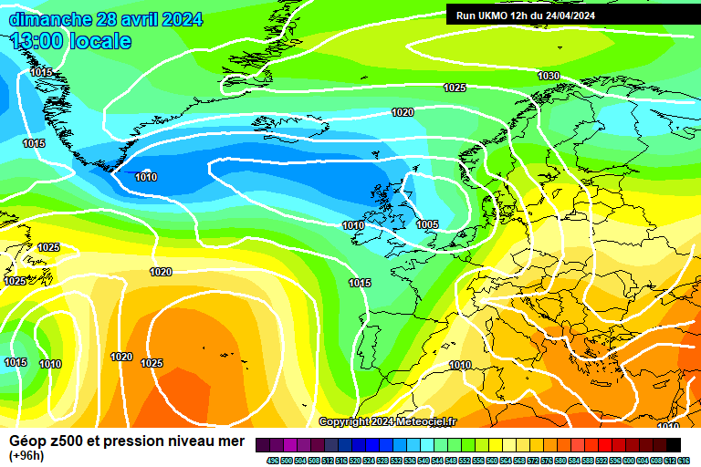
A very difficult time for those within professional forecasting. For example, the Irish Met's outlook at 18.50 this evening is entirely erroneous IF the latest ECMWF guidance is proven to be correct.
Despite the obvious cross model agreement at T+96 - I would advise exceptional caution. We have been here before and given that we are SO close this time, I can't imagine the carnage on here if everything goes wrong.
SA
-
Exciting times from a cold perspective! :-)
First 12Z NWP Guidance rolling out in the form of GME/DWD.
http://www.meteociel.fr/modeles/gmee_cartes.php?&ech=72&mode=0&map=0&archive=0
We have at least confirmation of pressure of 1020MB centred mid-way between Iceland and Scandinavia @ T+72.
-
Not just ireland, scotland probably has more chance than ireland in reality. Cold and wintry next week whether the gfs or ukmo verifies, probably neither will but the north is definately favoured as per the meto update today.
 did ireland get mentioned on the meto update?
Scotland, being further North certainly has the advantage, however Ireland is very favoured indeed on the latest UKMO T+144 Chart. Winds are actually from the South across the UK on that T+144 chart, so areas across the south in particular would not be heavily favoured for snowfall, especially to low levels.
Ireland is never mentioned on the UKMO Update Frosty.
SA
-
Ireland would not get snow out of the ECM, heights are too high and the flow is slack.
Actually it would, 850mb temperatures at T+96 - T+120 are -7 widely across the country. In addition, towards T+168, there would be renewed chance. T+168 is very similar to the the pressure readings in January which delivered snow showers at 1025 - 1030mb - giving 5cm in several places in the East of Ireland.
Granted it's not as good as UKMO/GFS, but it certainly would deliver snow showers into the East, albeit light in nature, on some occasions between T+72 and T+168.
-
Basically the small problem with the ECM is that little shortwave that forms east of Greenland at T96hrs, a less developed feature
and a more extensive easterly across the region.
Whilst the ECMWF 12Z Operational Evolution is not as fantastic for Eastern Ireland as the 12Z UKMO/GFS Operationals, I still think it's quite good indeed. There would be a risk of snow showers between T+90 - T+120/125. Severe cold once again possible, even likely at night with penetrating frosts & a renewed risk of light snow showers towards T+168. I think it would be fine still for the Southeast.
Worth noting though that ECMWF brings in the cold air quicker than any other source of NWP Guidance tonight so it might just be a little too progressive.
Very solid out to T+168 & it would require only minor tweaks to become much better.
-
Exactly my thoughts!
Some south westerly muck to have to endure and then perhaps more light at the end of a not too long tunnel
Yamkin - yes, GFS has belatedly picked up a signal and has now gone gung ho with the atlantic lows.
On that point I see lots of people are slavishly taking the model at face value. From epic snow burying snowstorms, now to windstorms
Hi Tamara
Just read your post after posting & indeed it doesn't look terrible... As you say, SW rubbish & muck to endure at first, but longer term quite possibly promising..
The atmosphere, generally, remains & should remain predisposed towards supporting a cold outbreak of at least some description during February. We have seen a major setback in the last 48 Hours, but all may not be lost yet.
SA
-
Looking at the North Hem view of the latest UKMO 12Z Operational @ T+144, it might appear ghastly at first, but I don't think it's that bad..
We could conceivably get an Easterly evolution down the line from that setup..
Mild at first, with a displaced ridge perhaps moving Northwards over time & eventual WAA to High Latitudes, resulting from deep cyclonic activity in the Mid Atlantic..
Something to watch I think.. Potential Easterly flow towards the 10th of February?
Certainly becoming very unsettled during the coming week.
SA
-
Major upgrade on the 12Z GEFS Ensemble suite..
In fact, there are a few members that support the GME/DWD 12Z Evolution, which is something akin to the ECMWF evolution of last night..
Mean 850mb Temperatures of -8 in London @ T+150..
Large & very positive turnaround when compared with the 06Z Ensembles..
-
Yes indeed. The very latest guidance would indicate possibly significant potential towards the latter part of the weekend from what I am seeing..
SA
-
Picked up several inches of snowfall here today!
Fantastic conditions. Many roads now blocked however which is very dangerous, thick covering of snow everywhere with a hard freeze underway.
Truly fantastic weather though! A throwback to the top classic winters of old.
SA
-
The 18Z GEFS Mean is now much closer to today's ECMWF/UKMO 12Z Evolutions than that of the previous 12Z/06Z/00Z etc..
GFS seems to be struggling with the positioning of the HP cell later in the week, but it's pleasing to see the ensemble mean move in the right direction now in terms of positioning.
FAX Charts, even at T+96 obviously indicate strong confidence in the 12Z GME/GEM/UKMO/ECMWF evolutions, with troughs embedded in an Easterly flow.
Stunning 850mb temperatures out to T+120 on the 12Z ECMWF also.
Again, deep cold moving over warmer water - quite possibly leading to localised heavy snowfalls in a rather potent Easterly flow later in the week.
SA
-
GEM 12Z Evolution also follows that of the 12Z UKMO to a large extent, with a renewed Easterly/Northeasterly flow. Pressure built well to the north out to T+144.
Excellent run again.
SA
-
Thankfully the GFS control run seems to be going along with the UKMO rather then the op run upto 120hrs.
Also just worth noting how much snow could fall in central Europe this week, I think a foot of snow could fall it quite widely, this can only help to freeze Europe up and make our SE/ESE winds even colder again...
Indeed Kold W,
Also note that the Ensemble Mean at T+120 is much better than the 06Z Mean & is far closer to the Euro guidance that we have so far today.
SA
-
This is what many of the experienced members were saying...get the cold in place, and then Mother Nature will do her bit. Sensational model output again today, and all I would say is expect the unexpected over the coming days.
UKMO 12Z coming out, and at T+96 its not too dis-similar to the 12z GFS:
http://www.meteociel...96-21.GIF?04-17
By T+120 it is a stunning set-up:
Indeed Paul,
It looks increasingly likely that there will be a fairly potent Easterly flow later in the week, into the weekend. GFS 12Z has already backtracked bigtime towards this idea compared with the two previous runs. GME/DWD 12Z also models a potent Easterly flow.
SA
-
GFS 12Z Operational is steadily backtracking to support the Easterly at the weekend, monumental changes up to T+108 even and almost there with the Easterly.
Meanwhile, GME/DWD 12Z holds firm with a strong Easterly flow developing as early as T+108:
http://www.meteociel.fr/modeles/gmee_cartes.php?&ech=132&mode=0
SA
-
18Z GFS Operational was a 850mb Temp outlier almost from the very start for Eastern Ireland:
http://www.meteociel.fr/cartes_obs/gens_display.php?ext=1&x=119&y=26
SA
-
Looking at all of the output this evening January Snowstorm, Eastern & Southeastern Ireland could potentially do very well next week, with rather heavy snow showers developing off the Irish Sea. This is indicated on 12Z UKMO, GFS & ECMWF Guidance..
Medium Term also looks bitterly cold with a renewed Easterly flow.. I have just one question however, for perhaps John Holmes, Nick F, S Murr, Nick S et al..
ECWMF seems to be a bit out on it's own tonight, with a slower phased evolution to a more potent Easterly flow between T+120 and T+144.. The vast array of other guidance, GME, GFS, UKMO etc seems to suggest a more rapid transition.
Indeed, UKMO has been very consistent on the past two runs regarding this change to a more due Easterly flow later in the week. I know that ECMWF is, by and large, the superior global model. In light of this, which is likely to be nearer the mark? Or are we likely to see a middle ground final evolution?
UKMO seems to be performing very well to Day 5 at the moment:
http://www.emc.ncep..../html/acz5.html
Regards,
SA
-
GME/DWD 12Z has certainly upgraded compared to the overnight run..
Now going with the ECMWF evolution with a full blown due easterly and a Scandi High at T+132..
SA
-
GFS 18Z Control Run follows the ECMWF 12Z Operational Guidance very nicely indeed...
In fact, it's an absolute stunner!
http://www.meteociel.fr/modeles/gefs_cartes.php?ech=0&code=0&mode=1&runpara=0
SA
-
I'm still very keen on this period being the zenith of our cold pattern Geoff as it will probably coincide with the MJO and GWO both entering a favourable phase for blocking to our immediate north allowing the jet to pass directly underneath.
The posts above pretty much capture this discussion about where we go from now to the end of the month and beyond. Of particular interest in the medium term is the depth of the surface cold given upper air values / thicknesses well, well below average for a sustained 6-12 day period and still, anticyclonic / col type conditions. The only variable missing is snow cover but the coming night time minima are going to be the real news story. Places such as Benson, Pershore, Great Malvern and Shawbury are worth keeping an eye on in this respect.
As per Ian and Darren's posts - some potentially very warm phases of weather into February as the whole pattern becomes very unstable with blocking collapsing with wedges of cold air being shifted around the mid latitudes bumping into sub-tropical airmasses.
Thanks again GP for the fantastic updates and to JH above also.
So basically, if I'm understanding it correctly, you are expecting an overall winter pattern being the reverse of what we would usually expect in light of El Nino conditions. That is a cold December and January with a mild, even warm February..
Do you expect any potential for renewed blocking and cold in February or for a fairly consistent mild or very mild pattern?
SA
-
Anyone notice the similarity to this evenings ECM run!
Block much stronger by T+168..
Also of interest is the depth of the cold projected into the medium term, this is really a fantasticly cold outlook, with several opportunities for snowfall.
SA
-
ECMWF is absolutely stunning!!!!
A Stunner to T+168!
SA
-
I would say evolution looks about spot on- but the track could still vary a little bit ( it will be further south than todays low) but I think its starting to firm up that the south will be looking East then south west for snow at the end of the week-
UKMO is similar but not quite as far north at 12z- very favourbale thicknesses though-
Steve
Cheers for that Steve..
Certainly looking very interesting...
M
-
Very much liking the UKMO 12Z evolution...
Also has a similar low at T+120..
T+144 doesn't look bad at all to me either..
SA
 did ireland get mentioned on the meto update?


Winter Model Discussion - 12/01/13 06z Onwards
in Spring Weather Discussion
Posted
Regarding the latest 12Z UKMO and GEM Guidance: Several of the GEFS 12Z Members indicate an undercutting sequence in the T+96 - T+120 timeframe.
It may not verify - but certainly something to watch - a trend that is not without support this afternoon.
http://www.meteociel.fr/modeles/gefs_cartes.php?code=10&ech=114&mode=0&carte=0
SA