Tim A
-
Posts
199 -
Joined
-
Last visited
Content Type
Forums
Blogs
Gallery
Events
Learn About Weather and Meteorology
Community guides
Posts posted by Tim A
-
-
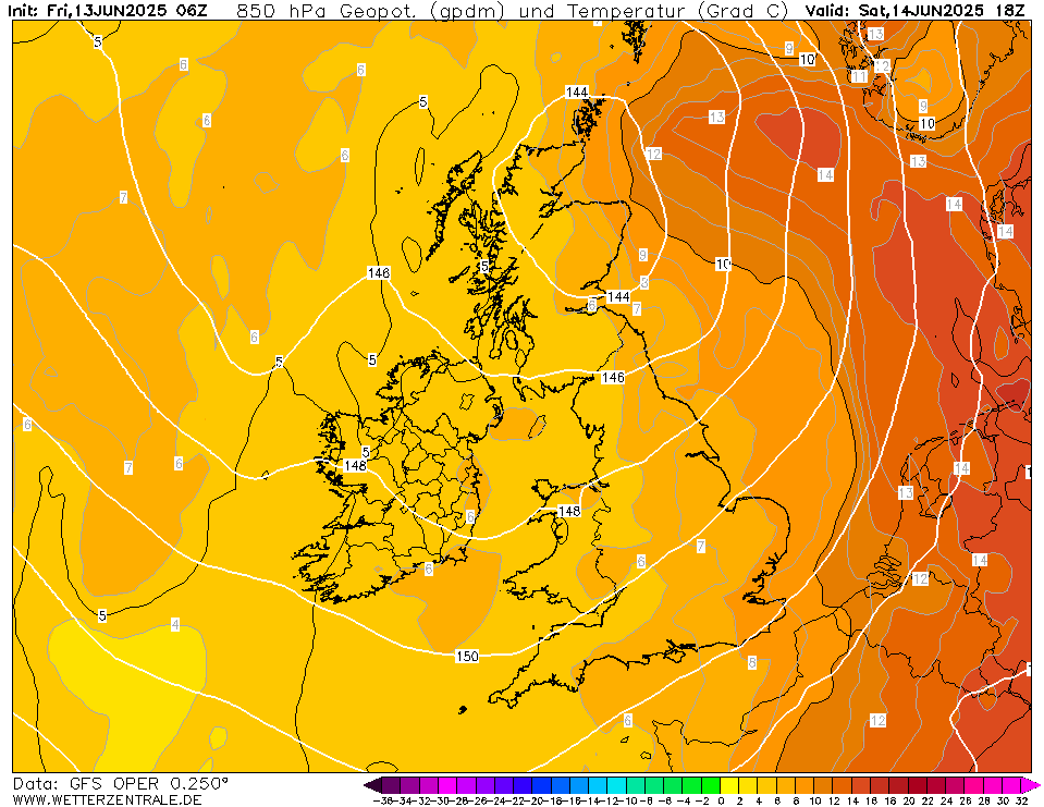
Freezing rain maybe , but no chance of snow after 12, as the 850 temps will be positive, so impossible. So Met Office App is just faulty.
-
6 minutes ago, Cheese Rice said:
Unless the Met Office app has been upgraded in the last few years it shows freezing rain as snow. Dec 18 we had a warning for freezing rain, heavy snow symbols on the app and we got freezing rain.
Other problem , yet to see any of the short range models showing anything more than really fragmented and weak precipitation tomorrow .
-
Tomorrow looks like there is a chance of some patchy snow first thing but the problem is it will even turn to rain or sleet tomorrow with temps of 3-4c by the afternoon associate with warmer air from the west so not likely to be decent snowfall.
-
Yeah Sunday is looking more dodgy now. I was confident before but now many models show it fragmenting. UKV 15z has no snow cover downgraded from 5 -10cm this morning.
-
27 minutes ago, Empire Of Snow said:
Yes, must have been this one. I'll check if I have any photos on my phone also.
The 28th November snowfall didn't melt quickly, was sub-zero throughout ,then a clear, cold night with snow still in trees, a cold Monday morning followed, before turning milder in the afternoon/evening and thawing.
There were transient snowfalls of 6-10cm on Boxing Day (Sunday) 2021 and Feb 19th (Saturday) where snow turned to rain and melted quickly.
-
6 hours ago, Adam lufc said:
-6.5c here.
Sunday-met "a few hours of disruptive snow"? I bet not.
200m plus as per.
M62 as alix deacon put it, very poor conditions. But thats 350m asl.
Why not lower down being so cold!! abc.
It's almost a dead cert it will snow for a few hours on Sunday morning. You can never be 100% certain with snowfall but would say it's very likely for 2-3hours before it turns to rain. Go out and make the most of it.
Might actually get some light rain or sleet showers on Saturday strangely, but then it should start as snow on Sunday.
-
25 minutes ago, cheese said:
When 40cm of snow fell in one evening in Leeds, I remember it pretty well even though I was only 7. A few of my friends from school got stranded that evening. It was caused by an area of low pressure moving into cold air (which is where many of our best falls have come from).
Maybe one day we’ll get a repeat of that.
One of my best memories too. Most of it fell in about 3 hours during rush hour. I was 11 and remember sticking my 30cm school ruler into the snow and it completely disappearing. Our school was still open the next day but most people didn't turn up. Some of our best snow events don't come from amazing synoptics or long cold spells but random events. Fortunately in 95 the next day was cloudy and 0c so no melt followed by another cold day before snow turning to rain arrived in the evening so enough time to enjoy the snow before the Atlantic returned.
This spell would have been great if we had locked in some deep snow early on , but wasn't to be. Great to see the East doing well for once, I think we have been lucky since about Dec17 here , couldn't go on forever.
-
Sadly those showers are dying a death. We have had very light snow for the past hour but nothing significant.
This morning we had a dusting from light snow but to be honest it wasn't much different to a heavy frost.
-
Is has been modelled for some time that a warmer sector was associated with the disturbance running down eastern parts now. It has been mentioned in here a few times. The dew points have been forecast to be above freezing and 2m temps of 1c at 200m and 2-3c towards sea level.
If we had any more precipitation here it would be wet snow but marginal and that is at nearly 200m.
Should get colder again later.
-
Very light snow here at 1.3c
-
That big blog of precipitation approaching Newcastle and heading South looks good, but unfortunately most models break it up completely, none of the 16 MOGREPS show any snow for our region. Arome/Arpege show a little but unclear whether would settle, the other thing is temps will be marginal. Saturday might be better for the west of the region.
Still there is a chance and will be radar watching that is for sure.
-
Small disturbance tomorrow evening could bring some showers inland, best for NE parts.
But unfortunately there is a warm air sector, so would think sleet or wet non-settling snow below 200m.

-
11 minutes ago, summer blizzard said:
This is unlucky. I was in BD11 at the time and I definitely had snow for two days around the 16th/17th in 2010 and cover on the ground for 25 days from Nov 24th. Likewise although I was in school, im fairly sure we caught snow in Jan 04 as that was when I was starting to view the BBC forum.
Nov 10 and Start of Dec 10 was awesome but most of that melted in the very brief mild spell.
The second spell was mostly cold and dry. You are right there was some snow before Christmas, it affected the NW mostly one evening and got as far NE as around Horsforth . I was in Idle and there was 3cm but nothing in Cookridge or North Leeds or places East of there ( as per photo) .
-
1 hour ago, Empire Of Snow said:
I've spent a lot of hours looking at current charts, runs, potential fronts/troughs etc and I have a terrible headache. This country is a meteo nightmare when it comes to snow precipitation.
As it stands I've decided to expect just a dry very cold spell until Sunday. If any ppn comes in it will be a bonus surprise for me.
It is always a worry that we will see very little in the middle of the country in such a set-up with a low over us.
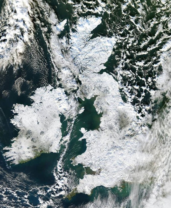
Dec 2010 (second half) - Spot the green area:

January 2004 - Thundersnow event completely missed here , it broke up and reformed. Can't find the satellite image anymore but it is almost comical being one of the only areas of green. I mention that event, as it was a front from the North, there is also a possible front from the North on Thursday. They often break up . But not always, Nov 28th last year was a stunner.
Will be lots of Nowcasting.
-
Nice snow shower now, another covering overnight but this time much thinner. Less than 1cm.
See York has some rare snow, looking at the railway webcam.
-
17 minutes ago, Empire Of Snow said:
I think METO underestimated the intensity of this streamer of showers that hit North Yorkshire. We've reached nearly 10cm now and it's still snowing.
I didn't see a single model that showed any significant depth of snow, i know showers are hard to predict but it's not ideal when there is no useful tool to predict them. Had double the snow we had in the easterly last year in just a couple of hours. 6cm total depth here.
Flights at LBA were supposed to start at 06.00 but by 8.30 none of the 10 due had departed , so it has caused some disruption.
-
 2
2
-
-
Great event as others have said.
Still coming down, measured 6cm on the patio set now.
-
 1
1
-
-
-
-
Snow has covered grass, roofs and trees here too, but nothing on pavements/roads, which must be too warn from the warm Spring weather.
0.4c with moderate snow.
-
 1
1
-
-
-
Sleet turned to snow here too , hammering down, lovely to see but slightly too warm to settle. 1.5c
-
 1
1
-
-
Should be a more organised blob of rain, sleet and snow arriving about 9pm tonight, very marginal though.
-
Wet snow showers here this morning. Thin covering on the grass, cars and roofs, looks a lot whiter on the top of the Chevin above 250m.


Yorkshire and E England regional discussion
in Yorkshire & E.England Weather Discussion
Posted
Perhaps some more knife edge synoptics coming up which might benefit us more.
Remember plenty a national cold spell where there has been little or no snow here because the jet is too far South and/or cold set-up too stable and comfortably across the whole country. Unless it is a screaming Easterly more low key synoptics like cool zonality or lows tracking across the Midlands with a mild South might be of more benefit.