


m1chaels
-
Posts
187 -
Joined
-
Last visited
Content Type
Forums
Blogs
Gallery
Events
Learn About Weather and Meteorology
Community guides
Posts posted by m1chaels
-
-
-2 and snizzle, I know we all hate that mild Atlantic mush but....
-
1 minute ago, Stu_London said:
It does look like turning significant milder, for a short period at least.
Nothing modelled as a battleground breakdown either according to the Meto and BBC weather apps
-
So locally we are forecast -8 for tomorrow night - were are the recent and longer term min temp records for the SE?
-
14 minutes ago, TonyK St Albans said:
Ha! I use the term very loosely!
Maybe just two cms, would you agree?
I wouldn't have claimed more than 1 (unless I was talking to my DW)
-
 1
1
-
-
Seems to be filling in if anything S of the streamer that is coming trough East Anglia towards Luton Perhaps this will impact N London as well soon.
-
1
-
-
3 minutes ago, Paul Sherman said:
Hi Everyone
Dan at WeatherQuest is trying to keep a database of Snow Depths from this cold spell. Would as many people as possible if you have time upload your depth to the following link.
You can update it hourly if you want from your Postcode even if you have nothing at all just upload the depth, it gives Dan a better idea of where snow has fallen etc (Much like his Lightning Strike Maps in the Summer)
Link Below
 WQ Snow Depth Reports
WEATHERQUEST.CO.UK
WQ Snow Depth Reports
WEATHERQUEST.CO.UKAL4 7/2/21 - Met Office Yellow warning for snow
01:00 - 0mm
02:00 - 0mm
03:00 - 0mm
04:00 - 0mm
05:00 - 0mm
06:00 - 0mm
07:00 - 0mm
08:00 - 0mm
09:00 - 0mm
10:00 - 0mm
11:00 - 0mm
12:00 - 0mm
13:00 - 0mm
14:00 - 0mm
15:00 - 0mm
16:00 - 0mm
17:00 - 0mm
18:00 - 0mm
19:00 - 0mm
20:00 - 0mm
21:00 - 0mm
22:00 - 0mm
23:00 - 0mm
-
2
-
-
2 minutes ago, Dbarb said:
Everyone's talking about the snow but flooding could become a big concern aswell
3 minutes ago, yamkin said:2 minutes ago, Dbarb said:Everyone's talking about the snow but flooding could become a big concern aswell
Yes, large low pressure anchored in the N Sea can also spell costal flooding issues - where are we on tides next weekend?
-
1 hour ago, cobbett said:
Metcheck so JFF - based on GFS I believe but good to look at for my location - Farnham
Obviously only 'indicative' at this point but are the depths quoted in mm of rain or are they snow depths?
-
Of minor meteorological interest, I can not recall having such a long period of sleet, more than 4 hours, normally I always think of sleet being transitional either to or from snow as the temperature rises or falls, not often the conditions remain conducive to sleet for a long period.
-
2
-
-
24 minutes ago, Tim Bland said:
Any sign of settling over there yet? Keep us updated, might head to Dunstable Downs
Annoyingly the Dunstable Downs webcam seems to be offline today.
-
1
-
-
Last week snow event generated about 20 pages before a single flake fell. I wonder what the two odd pages this week tells us for tomorrow....
-
2
-
-
Front looks to be fizzling for w herts
-
We are forecast minus 5 overnight, I assume there must be some pretty co!d uppers. When was the last time the SE saw temperatures this low?
-
1
-
-
8 minutes ago, Hammer said:
Looks heavy Watford and St Albans. Rain?
Oh course
-
1
-
-
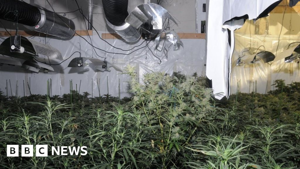
3 hours ago, MAF said:
That'll upset a lot of 'merchant bankers' >
Large cannabis factory discovered near Bank of England
WWW.BBC.CO.UKThe Square Mile's first-ever cannabis factory was found after a tip-off about a "strong smell".Markets hit a new high today though - I always thought b(w)ankers were more 'Champagne & charlie' types - which might be their only chance of seeing a few flakes of white stuff on Sunday the way the models are going.
-
3
-
-
2 minutes ago, Neilsouth said:
Hold me, I'm going to cry in a corner!
Why do we torture ourselves by watching this snow porn?!
-
2
-
-
43 minutes ago, slater said:
Its also gone so quiet on here as well, the rivers here in mid Norfolk not really gone down since the floods at Christmas...lots of the flood plains are full so not sure where it will all go. However weather quest said the far east of the region will escape the worst of the ? this week so hopefully the rivers will cope...I reckon we we be seeing devastating news In the northwest by Friday
Lets hope it is not as bad as feared, not sure the country can cope with a flooding crisis at the same time as a covid crisis and lockdown.
-
21 minutes ago, andymcpool said:
Dam
528?
-
2
-
-
The models are showing quite widely 10-20mm of precipitation so depending whether the majority falls as snow then totals could be quite high. The shift to amber has not added depth but has seen the likelihood increase.
-
1
-
-
When I were a lad in the 80s and we got these snow to rain breakdown events often because it was frontal snow it would arrive with lots of wind (a wind and rain event but snow first) and after the warm up and rain the general cover would clear but there would still be massive drifts behind the hedgerows. Are we looking at strong enough winds tomorrow morning that if there is a spell of snow it could lead to big drifts? My location is forecast 15mph, not sure if this is enough for drifting?
-
1
-
-
So yesterday's front that brought only rain was quite happy to stall, tomorrow's that might bring snow on the leading edge will sweep through....
-
3
-
-
23 minutes ago, Jamie M said:
There we are then.
Note it gets the warning more for its potential impact than its potential likelihood....
-
3
-
-
So it has finally got cold enough...and of course the precipitation has stopped
Personal Weather Station Dashboard | Weather Underground
WWW.WUNDERGROUND.COMWeather Underground provides local & long-range weather forecasts, weather reports, maps & tropical weather conditions for locations worldwide.-
2
-
-
2 minutes ago, yamkin said:
Harmonie model did very well with last Friday's snow showers off the north sea covering parts of Essex, London & Kent
Harmonie model is going for wintry showers further south covering London & Kent this Thursday from approx 16:00 - 21:00 hrs

Always remember, subject to change
I don't think Harmonie got there until right before the event, slightly earlier runs were putting the precipitation further N across central London and then before that N London.


South East, London and East Anglia regional discussion - 8th February onwards
in Regional
Posted
So bbc (ECM) is showing precipitation on Sunday but all rain (at about 3 degrees) - do any of the other models have this breakdown of the cold - ideally with snow?!