


jonnybradley
-
Posts
46 -
Joined
-
Last visited
Content Type
Forums
Blogs
Gallery
Events
Learn About Weather and Meteorology
Community guides
Posts posted by jonnybradley
-
-
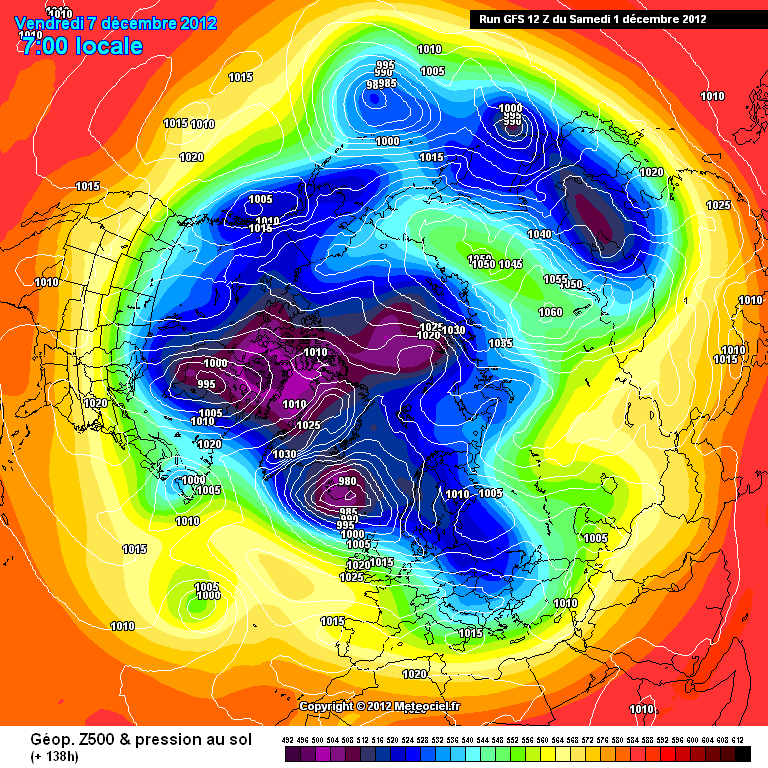
here we go guys 138 we have atlantic link up towards Greenland-
http://modeles.meteo...nh-0-138.png?12
WATCH IT BUILD
Help me out here guys? How dose this look picture look compare to what the 500mb anomalies are showing for this period, re John's PDF from yesterday?
any thoughts
-
Quick question from noob

You guys have been calling this patten change for a while from the 500mb charts, right and these still support the patten but are now a lot closer in time.
Just wondering how you read the same charts look forward now. Are they supporting the patten to stick around longer term? Or do these charts become less reliable until things settle down a bit more?
I think I saw GP eluding to the fact that longer forecast 500mb still show the pattern sticking.
Any thoughts?
Thanks
-
GFS wed 12z t66
GFS having a go at push some of that Siberian high towards the pole. Not really any heights in the high pressure (is that right?) and gets pushed back south into Siberia towards the end of the run.
Could the PV be weakening going into the new year?
Jon
p.s sorry if thats wrong about the heights need to read up on it me thinks!
-
Jonny, if you look at the ECM tonight you see an example of the link up that I meant. This link up does not cut through the jet but demonstrates a more amplified flow. In the short term this does not look encouraging with the jet stream firmly ensconced north.
However, in the long term and looking into January this is far more promising because when this wave pattern repeats there will be far more chance of undercutting.
Thanks chionomaniac,
No heights on these, but clearly show the High being pushed back south
That is the part of Mr Kelling's analysis I found hard to grasp, with the jet running like it is the Canadian model seemed a bit to eager to push the high through it? (god I hope that made sense:-)
But as ever thank you to all for you informative posts, really appreciate.
Jon
Edit 00:06 just meant to add, will be looking for 'wave pattern repeats', although it fails this time clear to see that it would change the situation in the Atlantic (right?)
-
It was the direction of meet up that I dismissed cutting through the jetstream. The meet up I suggest will be under the jet stream and we may have to wait a while yet. And the meet up I suggest is unlikely to bear friut immediately because of this.
Thanks Chio, I thought that might be the case. Thanks for explaining tho, still try to learn
-
I wonder how the models would have handled 1987's storm in the days prior, if todays output was available then?
The GFS track spares us the wind and could give a white bonus.
Looking further afield I see signs that the Atlantic high will try to link with the Siberian high at some point. I think it is the natural pattern evolution and would bring mild southwesterlies before it becomes established. Would the jet then undercut any Scandi high?
chio, weren't you flat dismissing the 2 high meeting up last week. In fact you had some very harsh words to say about somebody that was looking at this as a possible out come. Are we getting there via a different route or has the picture change enough to allow this train of thought?
-
certainly starting to look quite worrying for Friday. The Met Office are clearly not buying the GFS's earlier prognosis of a shallow low sliding to the south of the UK.
What is interesting is the beeb calling this system from Sunday onwards. There forecasters urging caution at this range as you would expect, but unusual for them to highlight a potential feature this far out.
-
Not sure where you saw that. Must of the alps are in for a good dumping, 30 to 50cm on friday across most parts, which is alot, but obviously not rare in the mountains at those heights. I can't see anywhere that is getting 1meter though.
I suspect the snow levels will decrease across the alps if the UKMO is right with the track of the storm, I think those snow levels are assuming it takes a track closer to the channel.
Yep spot on kmanmx. Sorry that last part wasn't meant to be taken to seriously. Saw it on the weather-forecast.com site, there 06 posting. Think they may have been on the GFS ott juice? (not certain they use GFS but I suspect)
As you say any snow fall is subject to the path of that low on Friday, which clearly is some way off being know at this point.
-
Interesting that all the models seemed in agreement about the Thursday/Friday out in low res but are playing out slightly different scenarios now the feature is into high res. Really is overload for a noob here.
I keep on seeing people say "due to the complexity" of Fridays system. Could anyone elaborate a bit more on the complex factors involved? Would be nice to try to understand and follow some of these factors building into it.
Many thanks
Jon
p.s I saw a forecast for Chamonix in the Alps today, is curently perdicting over 1m of snow for the 24hr period over Fri - clearly subject to change....
-
I wouldn't be surprised if by Friday that 'Storm' is downgraded to High pressure at this rate.
At a time frame of 144 hours that's totally respectable and as I have said, a trend setter.
As kold weather said its 72-96 when this storm has been on the charts since t192?
For sure I have enjoyed watching how the models have shown this storm, but would be very happy to see it not happen! 1 run is a bit to early to dismiss it me thinks, but I do hope your right
-
You can clearly see the control run is pretty much on its own regarding thursday/fridays storm.
Only like 8/52 perpetrations don't have a deep low.
Unless you got a diffrent link dude (please can I have it) there still at 00z. It's the 12z operational that lost the Fri low? They should publish the ensemble in a while.
But still fair point 8/52 on the 00z to the 12z operational with a massive downgrade
-
This is the link for the ECM ensemble maps upto 168hrs:
http://www.ecmwf.int...t!2009112700!!/
Generally though at this timeframe it's better to follow the operational runs because of their higher resolution.
That should update around 8.30pm .
Thanks Nick, will be checking those out later. Of course if you get the chance your self...
have found your analysis of these very helpful over the past couple of weeks -
Do the ECM ensembles update at 12z? Anybody got a link for the ECM ensembles, would be intresting to see what they think
-
Thanks Winters tale, very interesting update from Simon again.
Noob warning!! Again guys please correct if I am barking up the wrong tree here. *
Think I posted a couple of days ago that it is hard to see past Fridays storm (would this be where FI is at the mo?). I agree with Simon that the models are having a bit of a time sort out the period after Fri. As damianslaw points out, will be hard to pin the placement of Fri low till Tue has blown trough and Fridays is a bit closer to our shores.
I think it will be interesting to see how these lows interact with the high in the Atlantic and I assume this will effect the pattern of things to come. *
Very interesting times, certainly a lot more going on than when I started watching here back in mid Nov!
Thanks All, keep up the good discussions.
Jon
-
Thanks Jackone for the forecast. Very much appreciated!!!
Just wanted to post this from http://www.weather-forecast.com/ of there 06am 11/12 forecast for cham.
Now I must say that they keep changing there minds on what will happen after Tuesday but it this came of!!! The freezing level drops right down after Friday as well.
Thanks all
Jon
edit: ps sorry bit of topic, but intrest for those that live in the North and Scotland http://whitelines.mp...evis-range.html
-
This is quite interesting - particulary at the end.
Yes very interesting. The developments after Fridays low, wherever it tracks, do seem to be the time frame to watch at the moment and as we can see from the last few pages here is causing some strong debate.
-
Am scared, after 2 weeks or more of model chaos and 2 of the bigens are say the same thing, what gives.
-
Just been having a quick look at the output. Lot of talk about this Low feature on 12z ECM and GFS @ t192. Made me scratch my head a bit that the 2 models give such a similar output for this time frame yet by t240 they go of in such different directions? Although I can't say as I understand ECM's transition from t192 - 216 - 240, looks a bit odd to me?
Well still some time off, but def one to keep an eye out for, especially for myself living on the south coast and with a wee coach trip into France planned on this date!!!
Thanks all
Jon
p.s what the betting that GFS 18z tries to bring back the euro high for this time frame as it did last night and Monday night?
-
Another thing - these lows aren't being shunted north. They are being shunted east. And they're wrapping round the same PV roundabout. The latitude doesn't change much (in the greater scheme of things). We're looking at things too simplistically when we're talking about lows going north or south. I know the word 'meridional' gets bandied about here and I'd say that in this kind of flow it is much more important than the latitudinal terms being used. A little north and east is what we need to be looking at. Not south and east, for the down-the-line prospects.
kumquat, I am not going to argue with you but
would I be right in saying that these lows really only need to move a few hundred miles north or south to effect what happens with the Azores high. You say we need it, but this is subjective. Yes in the long but the Pyrenees needs snow at high levels and there best shot now is for one of these lows to move slightly south???
-
The GFS 18hrs run is another variation on the zonal theme, this time the Azores high is pushed east and puts the final nail in the coffin for European ski resorts which haven't been lucky with the recent snow.
Very disappointing output all round and the last thing you want to see is the high moving into Europe, let's hope we can at least get that high to remain in the Atlantic otherwise my skis will continue to gather dust and my grumpiness will increase significantly!
Don't give up yet Nick. I posted a similar thing on Monday night in the Alps forum only to see Azores high staying put in nearly all the models on Tuesday. GFS really still can't make its mind up past T+96 still.
I hope this is just a blip and not the real outcome
Jon
Edit
Could this bring some NW wetness to Europe and keep the high at bay?
-
On the plus side I often feel the models struggle especially in FI when we are experiencing so many low pressure systems crossing the Atlantic. Their positions are contantly changing so the possible outcome in 10 days time will be very different to what is being currently suggested. I am not saying that northern blocking will be around in 10 days time just that the changing track of low pressure systems will clearly have a knock on affect on the weather we will experience. Remember folks changes can and do pop up out of nowhere, last year and the year before were proof of that. The chart I have posted here is from the same time 2 years ago. As you can see conditions were similar to this years.
http://www.wetterzen...00120091207.png
Five days later from what looked like a contant zonal set up things suddenly changed, partly due to a pressure rise to the south of us from the euro high. And within a week we were experiencing bitter/snowey conditions.
http://www.wetterzen...00120091212.png
http://www.wetterzen...00120091217.png
I am not suggesting things will change that rapidly this year as other factors are currently against it happening this way, but who knows what will happen in a week to 10 days time. It was only a few days a go a rex block was due to form over us and dominate our weather.
Again as always please correct me!!
I see what your say here but isn't the PV much more intense than last year? From what others have put I not really sure that we can see any blocking in the near term with such a strong PV. Sure things can change quick but such a strong PV would seem difficult to move quickly. No?
Jon
-
http://www.chamonet.com/reports/news/20-ski-resorts-open-in-the-alps-this-weekend.html
Not looking so bad just now!!! Meto have issued high avalanche warning across the French alps till the pack stabilizes. So be careful out there!
carinthian posted on Tue? that there was no snow yet in Katschberghohe(?) where he is. Any body got updates for the eastern alps?
Jon
-
This is the problem unless you get some amplification upstream then theres only one way to go with a limpet PV, someone order an emergency SSW!
Whats the score with that upstream Nick? Not seen you post anything on that for a while so guessing there is nothing to report in terms of potential developments?
Jon
ps Had a look at CFS earlier. One of its runs t+700 and something it put a high pressure in to the vp (1050mb?), pushing in from the Bering Straits right into the North pole. lol really put the cat amongst the pigeons, if only.... shame I didn't save it, made my day
-
Still a bit nervous about the Christmas/New years period I must say. Sorry to be down beat but with the setup that we have at the moment this weeks snow may have to last a while.
With a very untrained eye on the models, they mostly seem to point to high pressure building up over Europe again.
Hopefully its only short lived am heading to Chamonix 17th Dec.
Fingers crossed


Model Output Discussion - 18z 31/10/15 onwards
in Forecast Model Discussion
Posted
Wednesdays NOAA 500mb anomaly 6-10 day chart support the continued Euro heights, even if it is pushing slightly further south, and an interesting picture up stream. Looking forward to tonight’s charts.