
- Popular Post


fergieweather
-
Posts
1,801 -
Joined
-
Last visited
-
Days Won
119
Content Type
Forums
Blogs
Gallery
Events
Learn About Weather and Meteorology
Community guides
Posts posted by fergieweather
-
-
- Popular Post
- Popular Post
8 minutes ago, bluearmy said:Rather than the ridge staying out west and bringing a wnw mean flow, it may drift further nne and bring a ene instead. the ridge staying out west would mean more pm source. If it gets further ne then it becomes pc. all indicative at the moment and a broad background against which to predict the likelihood of general conditions.
Yes, +ve MSLP centred primarily to W or SW of UK, maintaining temps below average; but some members shift it N, hence risk of much colder flow.
-
 11
11
-
6 minutes ago, Tony Beets said:
Forgive my ignorance Ian but what is a Pc flow?
Polar continental
-
4
-
-
- Popular Post
- Popular Post
Worth noting that UKMO prognosis for January has shifted now. They suspect PNA may be influential; GloSea5 has moved over weekend to suggest anticyclonic/blocked regime will dominate throughout Jan, with milder interludes only occasionally and temperatures generally lower than average. Although severe cold is still considered unlikely, they note that currently around 25% of yesterday's EC EPS members and several GloSea5 members allow reorientation of the block (principally expected to the W) to shift such as to bring a Pc flow. GloSea5 keeps the broadly +ve MSLP anomalies all the way to the end of January, maintaining a colder theme compared to climatology.
Deja vu, or on the money this month? We watch with interest... but gloves & scarves ready from next weekend (at least that initial bit of the story comes with high confidence, albeit cold front timing has wide error margin of 12-24hrs).
-
62
-
- Popular Post
- Popular Post
6 minutes ago, shotski said:No probs, my knowledge of such things is are far lower than most on here. I just assumed , obviously wrongly, that the Met office would use teleconnections and back ground signals in their forecasts.

Yes they absolutely do. However, global teleconnections influential for the UK remain extremely weak for the forseeable and thus of little forecast use.
The only consistent element in latest longer-term forecasts is the unusually strong SPV signalled to remain throughout January, which - taken in isolation - would imply a leaning to +ve NAO. However, longer-range predictions aren't so clear-cut on NAO and the sudden lack of almost any useful signal in ECMWF beyond 1st week of January is, in itself, considered very unusual.
If basing prediction on GloSea5 alone, the anticyclonic theme remains dominant - but weakening - further into extended range (ie by d15), with this sinking south to allow a mean westerly flow across us and a gradual upward turn in temperature. However, given that a conspicuously colder phase looks set for first few days of 2017 (scope/longevity/severity uncertain) and signals then suddenly vanish thereafter, forecast confidence beyond week 1 of Jan remains much lower than normal.
-
27
-
Just now, bluearmy said:
So with enso fairly neutral and the MJO in the COD, we should probably be at the mercy of the propagating strengthening strat zonal flow in conjunction with the west QBO. That means charts like we are seeing on the 12z and 18z are unlikely.
will be interesting to see if the 00z output is in the same ball park.
Well, we will see. There's no real support in 12z ECMWF EPS for anything so pronounced, albeit both it and the preceding 00z 15-d ENS do drop median TMax below avg (v model climatology) into early Jan.
-
5
-
-
- Popular Post
- Popular Post
46 minutes ago, Man With Beard said:So a very brief verdict - a dodgy start, but since 12th Dec the EC monthly has been fairly consistent on where ridging was going to occur for the period 26th Dec - 8th Jan, but underestimated the strength of the vortex. For the period 9th-15th Jan though, the signal appears lost for now, only Ian Ferguson can fill the gaps as a chart without anomalies could mean a split ensemble set or simply a signal for average conditions.
Interesting 2nd-8th Jan period with potential for ridging to pull back into the Atlantic - if it is on the right path.
Yes, consistent broad ideas into early Jan but no useful signal into extended range. MJO remains at very low orbit next 20 days, lending credence to ongoing UKMO view that it remains of no real predictive value into the forseeable for the UK.
-
10
-
- Popular Post
- Popular Post
15 minutes ago, Nick F said:While it's quiet in between runs, interesting how the models are handling the MJO at the moment.
Yesterday they initiallized it in the Circle Of Death (COD) and had it generally wandering around in COD, apart from GFS heading for 8/1 like previous days. Today all the model initialize MJO in phase 6 before heading back into COD - while GFS tries to sneek out in 1. The fact it is being initialized in 6 is an important milestone in that it shows, as has been suspected by some of us, that the MJO is active and that the models will start to factor this in over coming runs. So we could see some changes to the MJO forecasts which will bring out of COD probably in the phases favourable for HLB and cold 7/8/1 with the model runs adjusting to this over coming days
Hi Nick. Latest available (Mon) ECMWF ensemble mean forecast into extended medium range keeps it at persistently low amplitude phases from 6 nearer-term through to 8 into 15-20d cycle, albeit with a fair number of members leaning eventually to either moderate amplitude phase 8, or low amplitude 1 / 2. Will see how tomorrow's run compares.
-
20
-
- Popular Post
- Popular Post
3 minutes ago, Tim Bland said:Hopefully this is what Ian Means by "High west of Ireland"... I suspect he means a bit closer to Ireland than that though !?
Yes but it's something of a magical mystery tour. Monday’s EC Monthly offered rather uninspiring anomalies on face value, but masked a whole raft of spread from individual ENS stamps. It's understandable why UKMO continue to mention some risk of colder (N/NW'ly) synoptics manifesting into first half of Jan, but the most likely direction of travel is an imponderable at present.
-
16
-
- Popular Post
- Popular Post
13 minutes ago, blizzard81 said:It will probably end up the same result as now. Neither proper zonal or blocking, just boring. By boring, I expect something very similar to the gfs 06z with the block ending up just to our west but unable to retrogress. One of my worst winter nightmares - can't even get a frost out of that.
Latest DECIDER products lean to increased risk of NW'ly flow early into New Year; equal chances of high cell being centred over France or W of Ireland by that stage.
-
14
-
- Popular Post
- Popular Post
You'll note the to-fro in GFS deterministic runs between mobility to blocking/anticyclonic bias in extended medium range. This reflects the bimodal clusters at same range in ECMWF (majority favour blocking, but only just). Recall the same dichotomy from a week or so back... and how protracted it became until models settled into favoured outcome? Watch for plenty of this 'A versus B' conundrum in near future...
-
25
-
14 minutes ago, Newberryone said:
Unlike a few days back it's now looking doubtful that this resurgent atlantic will become the dominant player over a prolonged period as the return of the euro high next week is certain to divert the worst of those winter storms well away towards Iceland
Agreed: available evidence including this evening's ECMWF Monthly leans more towards +ve MSLP anomalies initially to our SE, then migrating west to sit just west of and across the UK through early to mid-Jan, with accompanying below avg ppn anomalies and broadly +ve temp anomalies. Looks promisingly more settled versus the next few days; rather similar to last week's run but without any 'colder blocking' evident in the pattern, at least on face value. I've only had a cursory look at the output however: will examine all the 4 week stamps & clusters later, when more time available.
-
9
-
-
- Popular Post
- Popular Post
1 hour ago, swfc said:hows things shaping up atm ian???
Well, very low confidence...!! As expected.
We will see whether ECMWF Monthly this evening keeps banging the blocked drum, or switches and offers the much more mixed signals of GloSea5 (slowly progressive, some blocking, but ensembles unconvincing re ultimate outcome). Dominant signal for remainder of winter (albeit as previously discussed, a divergence in ECMWF & GloSea5 output) is for broadly +ve avg temps (some colder phases possible); +ve NAO (mostly, with possible exception part of Jan) and SPV remaining stronger now. Broad GloSea5 pattern ultimately favours high pressure to S of UK, helping perhaps to keep things drier overall but there's equal probabilistic weighting on +ve/-ve PPN anomalies. December Contingency Planners doc offers further context.
-
11
-
- Popular Post
- Popular Post
3 hours ago, KTtom said:Don't really like bashing LRF, but what happened to the blocked dry December with hight to the north west..it's totally opposite. Surely it won't be long before the Met have to drop the bone, admit to a shocker, and change their outlook to a zonal theme....all the operational runs can't be wrong...Surely?
There's no dispute re poor broadscale performance of seasonal modelling for December and consequently all output into J-F-M is viewed with great suspicion. Matters aren't helped by the divergence between GloSea5 and ECMWF products: the former offering weakly blocked Jan; indeterminate Feb; mobile March. EC meanwhile remains steadfast for pronounced blocking Jan & Feb. Both models then lean to +ve temp anomalies during spring. Thus, albeit the ongoing output opts rather more for a blocked/likely colder period developing 1st half Jan (and 00z EC clusters show over half of members heading to a mid-Atlantic ridge early Jan), this has very low confidence, given conflicting signals; weak global teleconnections and the upsurge in SPV apparently at odds with longer-lead output.
-
28
-
- Popular Post
- Popular Post
6 minutes ago, Sperrin said:@fergieweather Hi Ian, really appreciate your input into this forum. You and many others have significantly improved my understanding of meteorology over the past years.
Are the ECMWF clusters seeing interest from the east or from the North/N West?
Both possibilities are strongly represented. By 31 Dec, only 6 members offer +ve NAO. That *shouldn't* be read as all the blocked solutions being colder (at least not at that timeframe: *may* be different further into 1st half Jan).
-
38
-
- Popular Post
- Popular Post
1 hour ago, swfc said:Looking at the current output even given the rather downbeat atmosphere and quest for something better im struggling to see much of interest towards the new year?
Plenty of interest starting to emerge in the spread of extended ECMWF clusters. Let's see if these nascent signs of pattern change into Jan (as per EC Monthly & GloSea5) continue to gather pace now in the ensembles from operational centres.
-
46
-
- Popular Post
- Popular Post
EC MONTHLY: again like last run. Blocked & dry anomalies developing 1st half Jan as heights move W to north of UK. Colder than avg anomalies southern UK 2nd week Jan (not seen that signal for a while!). East-NE flow. So continuity between last runs and ditto with GloSea5.
Don't shoot messenger. Just describing the output: not making any comment on outcome.
-
78
-
- Popular Post
- Popular Post
7 minutes ago, knocker said:Towards the very end of the EPS mean anomalies there are signs of the pattern change and that the EPS is reconsidering it's position A rapid weakening of the vortex lobe over Greenland and associated trough and indication of positive anomalies to the east once more. It may be girding for some retrogression
The notion of MSLP rising in Atlantic into Jan, with increased chance of blocking and a shift from SW to E mean flow (with risk of colder periods), remains the UKMO longer range assessment (low confidence of course).
-
23
-
- Popular Post
- Popular Post
1 minute ago, northwestsnow said:Ian, if this is correct,and I'm sure it is,it begs the question, where did the front loaded winter come from?Bearing in mind a strong PV generally speaking is not a precursor to UK cold?Apologies if the front loaded winter snippet was not related to the met office..
This "front loaded" winter thing isn't a phrase ever used in any UKMO assessment. They talked about a higher *risk* of cold weather in 1st part of winter, due to background signals (weak SPV initially; blocking which could result in increased E/NE flow). Whilst we've seen both blocking and recent E'ly phases, the probabilistic risk of *prolonged* cold weather was never high in previous diagnosis and in very latest seasonal update this week, any such signal is lacking anyway. So in summary: yes, there was a clear potential for cold weather into early winter, which was flagged to contingency planners and public; however the caveat re this not manifesting was also made very clear (eg in Adam Scaife's UKMO blogs).
-
17
-
- Popular Post
- Popular Post
7 hours ago, Steve Murr said:The only real assessment that really needs to be made by METO is why that 'strat top' models missed the boat on the 40M/S swing in the 10HPA 60N zonal mean from 10M/S on Nov 25th & again @ 13 M/S on Dec 3rd to where we are now 10 days later @ near 50M/S -
If the models cant model the variability in the strat then they cant progress forward.
ECM shows continued clear downward propergation
PS I will add this daily
CFS DATE FOR SSW IS 14th Jan ..
Hi Steve: not sure which models you mean (missing the stratospheric trend), but GloSea5 certainly didn't. Here's snapshot of output from way back in late October (hence not latest modelling, which I can't show). Red is forecast mean; blue the hindcast mean. Note much weaker period foreseen during Nov; then marked uptick in 10hPa zonal winds (most members heading above average) during December. This signal was repeated and strengthened each run thereafter. UKMO were confident on the turnaround in SPV that has now unfolded, and GloSea5 timing for this was actually good. So it's incorrect to suggest UKMO missed this: quite the opposite; they were ahead of the game.
-
24
-
- Popular Post
- Popular Post
4 minutes ago, nick sussex said:5 minutes ago, nick sussex said:And yes I understood what went wrong.
:-) 'phone Adam Scaife and his team before they meet on Monday, Nick... as that's the very enigma they're trying to resolve even before discussing the next 3 months!
The fact remains that trying to fathom where these longer range outputs lead us *is* creditable: after all, they underpin everything we later see modelled at shorter range. And just as we see UKV misrepresent (or even miss altogether) the behaviour of a shortwave trough even at T+6hrs, we'll sure as dammit see times when a seasonal coupled model messes-up at T+600 hrs. It'll happen. We accept it. We run hindcasts; we learn; the model learns. Science advances. Snippet by snippet...
Whilst it's very easy to trash the seasonal or 30d models (primarily by people seemingly obsessed with some sole desire of snow, or who wrongly assume blocking=frigid), it's intriguing that many of those who devalue the long range bespoke models then willingly accept deterministic output so faithfully at those extended ranges as 'proof' of the extended lead models being 'wrong".
That's a judgement we can reasonably make at around 5-7 days. But not at 10-15.
-
26
-
- Popular Post
- Popular Post
6 minutes ago, Weather Boy said:I know that's an anomaly, and so shouldn't be read like a pressure map, but comparing with the anomalies yesterday and previously, that's a lot further east, with the highest around Finland. Previous efforts had HP mostly around North Sea or SW Scandinavia.
....albeit ECMWF has it focused in exact same area (bear in mind these are 500hPa GPH anomalies in both charts: not MSLP)
-
15
-
- Popular Post
- Popular Post
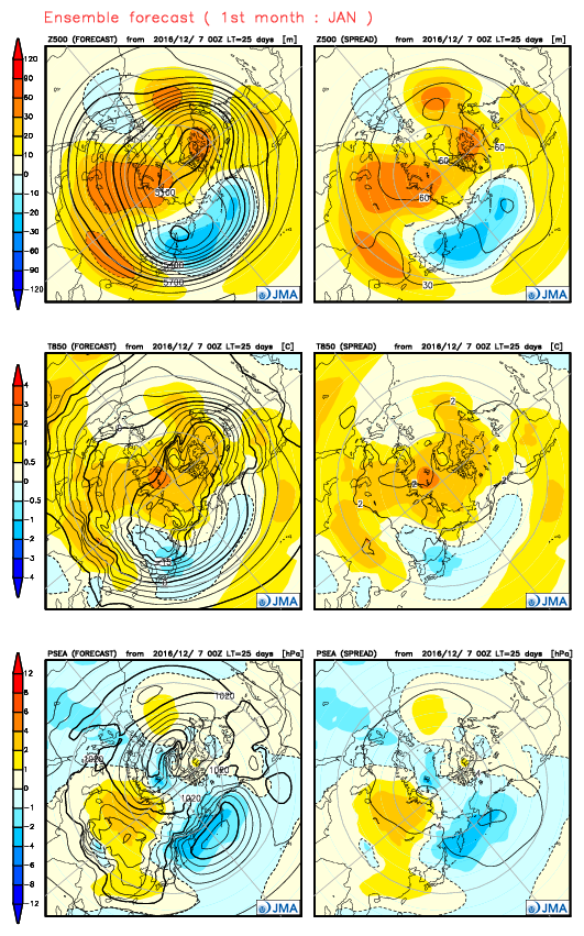
5 minutes ago, Nouska said:That's interesting because the JMA has done a fairly quick change between the output on the eighth of the month to that of the twelth. Albeit, one is weekly and the other is monthly the indication was more of the same for first two weeks of January.
Latest seasonal for January 'might' depict what you are seeing in your models?
At least, it is the first indication of low height anomaly to the south - an artefact of the digging trough leaving residual cut-off troughiness in the westerns Med?
http://ds.data.jma.go.jp/gmd/tcc/tcc/products/model/map/4mE/map1/zpcmap.php
It's hard to fathom any semblance of favoured direction, isn't it!? I'm awaiting what UKMO Seasonal meeting on Monday makes of it all (they're discussing J-F-M in entirety). Of course, any possible SSW in Jan would throw everything akimbo anyway.
-
16
-
- Popular Post
- Popular Post
12 minutes ago, Seasonality said:Hello Ian, once again many thanks for your invaluable contributions and the insider knowledge you give us on the workings of the met office. If I am reading what you say correctly, could it be said today's ECM 00z evolution is a genuinely feasible outcome, albeit with low confidence and possibly less extreme?
Current thinking for festive period via ENS is 60% likelihood HP remaining proximal to SE/E (more settled); more unsettled to NW/W. Alternative is 40% probability more widely unsettled with cyclonicity spreading across entire UK for Christmas, with resulting temps ranging normal to a bit below (showery; some wintry).
-
22
-
- Popular Post
- Popular Post
2 hours ago, Gael_Force said:Is that not what they were discussing on Monday? ie. switch of emphasis on the daily ensembles from blocking over us to trough situation instead. The EC 46 would have been initiated when the bulk were in favour of the high holding on and hence the positioning of the anomalies.
Yes, but it's the evolution on into January that is a focal point of ongoing interest (certainly at Exeter), with GloSea5 continuing each run to support Monday's ECMWF theme of migrating height anomalies westwards during week1-2 of Jan, with lows tracking much further north over this. The net result is a generally blocked output 1st half Jan, with switch from mean SW or at times perhaps NW flow (Xmas period) to E'ly into Jan and resultant higher likelihood of colder outbreaks. Confidence is of course very low at this lead time and not least - as UKMO point out - hindered by a lack of clear global teleconnections into that period.
-
41


Model output discussion - 5th December 2016 - Into Winter we go
in Forecast Model Discussion
Posted
The 00z EC ENS to d15 and clusters look anything but mundane to me. Markedly below average TMax against climatology (taking Reading as an example).