


SnowBlake
-
Posts
95 -
Joined
-
Last visited
Content Type
Forums
Blogs
Gallery
Events
Learn About Weather and Meteorology
Community guides
Posts posted by SnowBlake
-
-
- Popular Post
Priecīgus Ziemassvētkus
Happy Christmas!
Slightly unexpected but here 20km south of Riga, due to a streamer set up, although not intense, we have moderate snowfall this morning, adding to the 8 or so inches from yesterday.
If the wind direction remains the same, could end up with several centimetres on top of this.
In Latvia celebrations are mostly Christmas Eve but saved some gifts for myself and my partner to open today.
Going to pop to the supermarket (everything open as usual on 25th here) to get milk and rosemary for the cauliflower cheese and roast chicken later I shall be cooking as part of Christmas Dinner for the family.
Hopefully next year, or maybe something miraculous for New Years Day for you back in Blighty, who missed out this time round.
Although over 2 weeks away, we have something new to chase on the GFS...
And have some photos from the past hour.

-
 17
17
-
- Popular Post
Just popping in to wish all a very merrry Christmas from a snowy Latvia. Heading from the East to just south of Riga shortly for Christmas with other family members where it is snowing moderately and expected to for the whole day. Could top the 8 inches last Christmas eve/day.
Very odd yesterday, we went skiing at the highest point in Latvia and in the cafe an English guy was trying to choose a beer and I asked if he needed some assistance.
I then saw his LFC grey top and thought I recognised him from my flight over as i remember someone wearing this. Turns out he was on my flight, not only that, he is returning on the same flight as me also.
Anyway, eat, drink and be merry all
-
12
-
- Popular Post
A few days ago, many comments about southward corrections this, southward corrections that...
What happened? Was it wishful thinking?
Unlikely things will change in time now but still 3 months of chances ahead. We will get one of those winters to talk about again.
In a couple of weeks, grab a return flight to Riga (2 hours 30 runway to runway), catch a train if no snow in the capital to an hour away for a fiver, enjoy the snow for 1 day, explore the old town the next, hotels in Riga £30 a night for 2 including breakfast. Bus from airport to city 30 mins for €2.
Lateral flow test €24.
All in all including food, flight and accommodation doable for £150 for 2 nights, £200 for 3.
Meanwhile here in Eastern Latvia, minus 9 this morning (minus 16 in Riga), I'm off skiing shortly to the highest point in the country, about 312 metres.
Few snaps from the last couple of days out and about. Only an inch or snow after it all melted last week. More snow due later today and most of tomorrow, several inches perhaps.
Hasta la piste-a.
-
10
-
Just now, Kasim Awan said:
Consistency indicates a model has better handling compared to the inconsistent model.
Handling means nothing if come T0 it is completely different to 48 hours prior.
-
6
-
-
Consistency doesn't make a model more credible. It could consistently show a particular outcome for a week but at T-24 change completely.
Its verification stats are a better indicator of how reliable it is. But each model seems to handle certain situations better. The thing is, we are transfixed on the NH mostly and in particular what is happening around the UK.
A 10 mile shift of a LP system 10000 miles away can cause a 20 mile shift elsewhere, which becomes a 100 mile shift 1000 miles away and so on and so forth.
Many see the 850s for example as oil in a puddle, almost 2D and forgetting that events above and below aide the changes we see. If there is a 500 mile wide area with a 1 or 2c lesser temperature difference, this can cause all sorts of havoc. 1 or 2c can be the difference between a frozen lake, cloud build up, evaporative cooling... tshirt or jumper.
No model ever has been 100% at T-24, but can give us a very good idea of what will happen.
T-48-96, again, an indication.
T-120, an indication perhaps but I wouldn't plan a day around this.
Beyond that, we have seen too significant a change many a time to worry about it.
We know that events such as SSW can bring us colder weather a couple of weeks down the line, but not guaranteed.
Every model this past week has toyed with an idea of colder weather, some with dumpings of snow, some cold and wet, some cold and dry, some with average temperatures, and 2 days later showing a different one of the aforementioned, but for me, I have no preference over any model, and I certainly wouldn't pay for premium viewing, nor for any non-weather model... *cough*
Meanwhile here in Eastern Latvia, minus 12.8 and I brought button up fly jeans on this trip. Could do with having zips today outside. Will have to dig out my thermal undies.
Čau for now.
-
7
-
 1
1
-
-
- Popular Post
19 minutes ago, mbrothers said:What a great idea
Always the option of relocating...
Meanwhile here in Eastern Latvia, 95% of the snow melted the past 3 or 4 days, (barring several inches that hasn't melted in the woods/forest area 2km down the road) but the temp dropped gradually from 4c down to 0c throughout the day yesterday and a little light snow overnight last night and a further drop to minus 5 has given 2 to 3cm of snow, making the horrible browny soggy green colours disappear under a fresh blanket of white which for the next week at least will remain.
Here it is likely we will continue to have the odd flurry between now and Friday when some more persistent snow is due, and perhaps over the weekend, but probably not the 8 to 10 inches we had on 25th Dec last year.
Due to get down to minus 10, perhaps 12, but not the bonkers minus 20 something of 2 weeks ago.
It doesn't usually snow here when below minus 10 as it usually coincides with higher pressure, but between 2c and minus 6/7 is when snow often falls here.
So the whole "too cold to snow" thing... yes and no. In certain places, the colder it is the more likely it is that high pressure is in place thus less in the way or precip and less cloud. But even where it is minus 40 and it snows, I think it has to shift from one temperature to another i.e. from minus 30 to minus 40 or vice versa, creating some sort of convection I guess but that brings more dry, powdery snow rather than the big flakes we like to see.
Last night's snow was forecast but didn't appear on the radar as it was very light, but when moisture comes directly from the north or north west, even the west, it either arrives with cold from the Nordics over the Baltic Sea of Gulf of Finland (sort of creating the lake effect) or bumps into cold from the East/North.
Here, although it is very much hit and miss, streamers can set up if you're in the right place here, however unless in the far West of Latvia, you'll be unlucky not to have snow. There are only a handful of ski slopes in Latvia being that it is a flat country, but where there is a hill 250m or above, you'll probably find a ski slope.
Christmas 2019 we had minimal snow where we are located, but a 10 minute drive north and south had upto 20 cms of lying snow.
Sincr typing this, it has gone from minus 4.9 to minus 5.4.
Anyway, back to the chase, as much as everyone would love it to snow on Christmas Day/Boxing Day, some families travel which could make it dangerous, and key workers over Christmas could do without it, so a day or two delay could be better perhaps.
To have signs of cold still early into winter is great. 3 and a half months of usually colder weather yet to come.
-
11
-
7 minutes ago, damianslaw said:
There is a strong resemblance to the charts of late Dec 2000 at the moment.
Even the mods churn out one liners without charts to back them up
-
1
-
-
Well the signs for colder conditions are apparent, although still a few days out, and we know how this ended a few years ago with that ECM...
Whilst I would be mega excited about the prospects of colder and possibly snowy weather, alas, I am 1000km or so east in the Baltics, where the foot or so of snow which fell over 2 spells around the 5th a few days apart has 80% gone due to temps up to 4 or 5c, as of tomorrow mid-morning, it looks to drop to below 0c and down to minus double digits. It was -25c or so just 10 days ago with -16 uppers.
Much of the snow which fell, barely showed up on the radar at all, but it was persistent for 24-30 hours during one period.
Tomorrow there is a chance of snowfall and more nearer Christmas Eve and over next weekend looking at the mid-longe range models. Last year 8 inches fell on 25th Dec, on top of 2 or 3 inches which fell from the 19th. Come mid-Jan it went down to minus 26. I do recall minus 14 in Feb 2012 in Surrey for 2 or 3 consecutive nights which froze parts of the river Wey and some snow fell.
Looking at the current output, the temps could well fall 10c or so lower than suggested.
If all else fails, I'll grab a thermos and see if I can transport a little snow back to Blighty in Jan so those with big enough wallets can meet me at Stansted and have a poke, and maybe a taste*, of the white stuff.
*proof of negative test within 30 minutes of licking will be required.
-
1
-
1
-
-
7 minutes ago, Kasim Awan said:
Narnia
Narnia business...
-
37 minutes ago, CreweCold said:
Shame this isn't being shown for Christmas Day...dumps about a foot across Wales and the Midlands

It's a hand we need
-
30 minutes ago, northwestsnow said:
Western Europe cold.
Eastern Europe mild
very rare set up...
I can live with transient rain events if colder air is incoming...
This whole idea that -8 uppers are needed for the temp to be 0c more or less at 2m to me is nonsense.
I spent large parts of winter in Eastern Latvia, and what you see as being above 0c 850 temps will actually still be minus here at 2m. On 6-9th it was minus 18 to minus 24, and uppers were not minus 26 to minus 32.
It is forecast to be minus 15 in a few days and the uppers are looking around minus 12.
The 12 inches of snow we had last week is melting rapidly today as it has been 1 to 4c for a couple of days now but Sunday due more snow and temps to start dropping with more snowfall next week in the run up to Christmas. 8 inches fell on 25th here last year.
Anyway, things are looking up, may start looking at staking some chocolate coins on some white stuff in various parts of the country.
-
3
-
-
33 minutes ago, TSNWK said:
Wow! You understand that squiggle chart.. I simply have no idea.
Just looks like spaghetti cooked and plated by a blindfolded chef. Even has burnt strands.
That aside, looking forward to snow so long as w/c 13th to 15th nothing disrupts flights out of Stansted for my winter in Latvia where snow has and is already falling. Got down to -20c to -26c during the day mid Jan 2021 for a week or so in rural parts. You don't want to leave the house for more than a minute.
A warmer weekend upcoming here though looking likely just about in double figures in most parts, or maybe just below.
Let's see come the weekend what is in store for next week.
-
1
-
-
1 minute ago, SilverWolf said:
Can we say things like that on this forum?!
Oh, i meant in gas form.
-
2
-
-
5 minutes ago, Robbie Garrett said:
That MCS NNW of France is pumping out Tops of FL350+
I'll be pumping out all sorts in excitement if this does make it to me.
-
4
-
-
Camera batteries on charge, phone on charge, action cam on charge. Although as per usual, it approaches Hastings and dies out and peps up again toward Kent/inland.
I'll be down Bottle Alley west of the pier if it does kick off here.
-
2
-
-
Can hear non-stop thunder with strikes 30km away here in Hastings. If this reaches us it could be epic. Formed over land not sea, usually dies out near us when over sea.
Camera at the ready, will pop out shortly to Bottle Alley.
-
3
-
-
2 hours ago, PiscesStar said:
Best free radar for lightning and storms please guys?
Blitzortung for me. Shows rates, hits per 10km for example, colours to help identify which way it is heading etc. Free app, no ads, covers all of Europe.
-
2
-
1
-
-
Nothing much exciting from where I was. It died down as it usually does when it approaches Hastings but seems to have picked up again over the far Kent corner.
Very pink flashes, mostly IC, no forks or anything, very much sheet.
Perhaps something may pop up later.
The rain however, that was something at times.
-
Going back frame by frame on lightning radar, it seems Hastings might, just MIGHT be a good place to be. Bag packed, ready to pop over to Bottle Alley with the gear.
-
2
-
-
1 hour ago, thunderhead 2005 said:
Looking at the risk chart it seems anything south of the M4 corridor could be in for a good light show, i have seen similar setups to this and normally anything east of Salisbury is where the action happens but i wonder if it will be like the bournemouth supercell that happened some years back
Lived there at the time - I remember getting on a bus in Winton, everything looked fine, nice weather, until the bus started heading down into Lansdowne after Asda/Station, you could see the dark cloud in the distance. As the bus approached the Royal Bath hotel, hundreds of people were fleeing the beach, all sorts were blowing around - food packaging, carrier bags, inflatables - and I dinged the bell and got off by the Imax, and as my foot hit the floor getting off the bus, BOOOM, i felt the static, there was panic, hundreds were now thousands - when you see photos in the paper of Brighton beach "packed" when the angle of the camera deceives, Bournemouth beach is another level, when it is packed by the pier, it is packed, well maybe less so now - then the rain started to fall. I made it under the flyover just in time for shelter but boy did the heavens open. Within 7 or 8 minutes, drain covers popped open, 5 minutes later the river through the gardens was level with the grass, 10 minutes later it was knee height. I had never seen anything like it. I had loads of photos on one of those storage sites but I have no idea which account or details from 15 or so years ago. Was it really that long ago?
Anyway, back to the output, looks promising for Hastings, I have charged all 4 batteries, my portable charger - for those photographers who have USB cable battery chargers, these portable phone chargers can charge your camera batteries - worth getting a 20000mah minimum portable charger to charge your camera batteries on the go. If you need any assistance with this, do message me!
Tripod for camera
Tripod for action cam
Tripod for phone
All ready to go
All eyes on the radars later
I am hoping I do not need to chase the storm and it will be delivered to my door, contactless.
-
5
-
-
I'll be down at Bottle Alley with the cameras at some point. A good 500 metre sheltered under promenade west of Hastings Pier, ideal for filming and a view right across to Eastbourne. Often it mellows out as it gets near us but we'll see. Message me if you plan to be down there at some point over the period we expect thunderstorms!
-
3
-
-
Afternoon all!
Few models toying with possible colder air, but confidence low. Perhaps come the weekend we may have a clearer picture and who knows, someone may get lucky.
Meanwhile...
Currently in Riga, helping the Brother in law following their recent move to a bigger place - has been -7/-8 over a few nights but nearer 0c. Light dusting and flurries now and again but overnight where I have been since before Christmas in the east of the country we have had 8 to 10 inches of snow fall. Light snow around 3am but heavier between 6 and late morning.
Screenshots from our CCTV below.
We have had laying snow from around 18th Dec to mid Feb, temps up to 10c, then down to minus 15, snow coverage on and off and suddenly this. It seems moisture is building as air moves across the country and we hit the sweet spot.
This link is live from about 30km away.
Live Stream Webcam of the Weather in Rezekne from Hotel Latgale
BALTICLIVECAM.COMTravelling to Latvia? See the weather forecast in Rezekne with the HD live stream webcam from the Hotel Latgale. See this and other Webcams in Latvia.Due to head back tomorrow morning - we had 7 lambs born 2 weeks ago from 2 of our flock that fell pregnant in the Autumn so need all hands on deck to help. Plus clearing snow off all branches, roof tops etc to keep buildings warmer inside.
And more snow forecast for the weekend.
Will be looking to head back to Blighty around mid-April. Missing the sound of seagulls... never thought I'd say that.
-
6
-
-
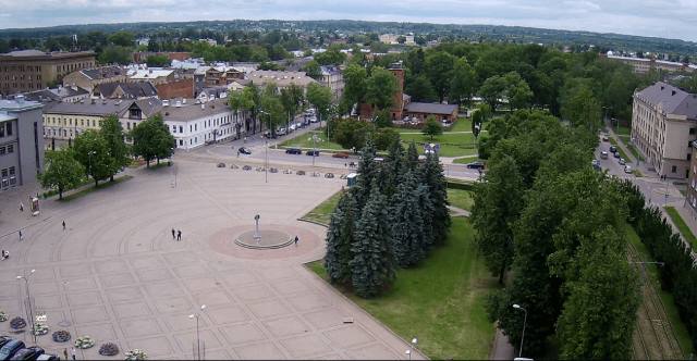
1 hour ago, Daniel* said:
Beautiful day in capital.
Helicopter crew, drone owner or very tall man. Which are you?
-
1
-
-
Even Hastings has snow falling. I am out of the country for the foreseeable but keeping an eye on it still, to see what I am missing out on although I am 1000 miles east experiencing minus 10 max daytime to minus 22 min night at the moment, snow on the ground for 51 days now, only 5 days have been above 0 here, and that was only 2c for a couple of days under overcast skies so not much melted. But max depth has been around 15-18cm.
Anyway
Hastings live webcam. If it snowing here then it means somewhere not too far away is doing very well such as Kent. Fizzles out by the time it gets to Hastings usually. I heard 2009 or 2010 was good... Jan or Feb.
Hastings coastal webcam - Beaming
WWW.BEAMING.CO.UKThe Hastings coastal webcam takes in Hastings Pier, Hastings Old Town , Hastings Beach and the English Channel. Brought to you by Beaming, the business ISP.-
1
-


Model discussion - hunt for cold Christmas period 2021
in Forecast Model Discussion
Posted
Unless you're down the pub