


Jonathan Rhodri Roberts
-
Posts
235 -
Joined
-
Last visited
Content Type
Forums
Blogs
Gallery
Events
Learn About Weather and Meteorology
Community guides
Posts posted by Jonathan Rhodri Roberts
-
-
2 hours ago, Weegaz said:
I would have thought this would have stirred some interest in here. Euro4 showing wintery precipitation through tomorrow as front approaches from the west.
Saturday is of interest on the Emerald Isle.

Interesting to see all that snow streaming into west Wales especially with the gales or severe gales that's also forecast

-
I'm optimistic of a half decent weekend here in S Wales and also across S England with that higher pressure just about edging in from France on the GFS 12z

-
Hooray GFS 6z has a high 1025mb across S Wales & S England this weekend so no torrential rain/thunder or gales for a change
 ️
️
-
 2
2
-
-
6 hours ago, West is Best said:
Honestly the above really is extreme straw-clutching. There's almost nothing on the latest 6z GFS to suggest anything other than continued mobility across the UK. The T144 extension of the Azores high into a nascent high pressure forming over the Bay of Biscay is itself fairly fraught. But even if it materialises it does nothing to alter the south-westerly conveyor belt across the UK. We would need it extending 300 miles further north and I can see no sign of that?
I've been studying the weather for 45 years and I don't think I have ever seen anything like this. The idea that we are going to pass quickly from 1. The strongest jet core probably ever seen across the Atlantic, 2. One of the deepest Atlantic lows ever recorded, 3. The stormiest February on record, so far, ... into something blocked and cold seems to me quite implausible. The upstream drivers look to me to be continuation for the foreseeable future of the powerful jet and cyclogenesis.
I wish it weren't so, but I can't see much to restrain this westerly onslaught. It's astonishing, to be frank.
Not quite as stormy (at the moment anyway) as the infamous Feb 2014 that really was horrendous
-
4 minutes ago, Mr Frost said:
First gale/severe gale event Saturday night/Sunday covering a huge area of the UK/Ireland. (Hence the early Met Office warnings that are out for this weekend)
Some insane torrential downpours, thunderstorms and hail likely I would imagine along with the wind!
Next Tuesday’s/Wednesday’s will it/won’t it storm can wait for now - let’s enjoy/not enjoy this first.
Plenty of showers but nothing thundery showing up on the CAPE/LI, I guess that's because the upper air is milder. Cold unstable air usually brings the thundery downpours at this time of year from off relatively mild seas
-
2
-
-
18 minutes ago, Climate Man said:
I am already starting to think about what this "stuck" pattern will mean for summer - hot or will solar minimum, smoke and volcanic activity result in a poor summer with little distinction between seasons. Erring on the side of the latter unfortunately.
I worry if we can't break out of these prolonged periods of overcast skies even within high pressure systems, sunshine amounts could be lower than average and therefore keeping the temperatures down too I'd have thought
-
Latest CFS is dreadful as it resembles a February 2014 repeat: Storm after storm after storm...... That's not good
-
2
-
-
1 hour ago, mountain shadow said:
Should weaken I believe as the month progresses as the sunlight moves further and further North
'Should' being the keyword there, remember February 2014? Storm after storm. The railway line got washed away in Dawlish, Devon and a week later on the 12th wind gusts reached 100mph in Swansea
-
2 hours ago, mb018538 said:
Looking like that @Dennis. Late January is the next potential opportunity.
I've also got a horrible feeling that we're going to see another slow trickle down final warming like last year and have a terrible -NAO late spring spring and summer again. That's a long way in the distance, but will probably be here before we know it.Well I must say last Summer wasn't too bad at all especially July, now that was very dry.
Doesn't a -NAO mean low to the south and high to north though? if so it managed to bring us a reasonable Summer here in South Wales and across southern England but I'm sure the high was close to the south and lows were further north so I assumed that meant a +NAO?
-
3
-
-
Well a what a turnaround on the cards from a rainfall/flooding point of view, now this is a marvellous GFS run for southern UK with it becoming much, much drier (finally, especially in South Wales & SW England) while NW Scotland becomes much, much wetter than its been this Autumn a good hint the jet is moving north taking it's lows with it and higher pressure is becoming more influential in the south
Thanks Santa
-
54 minutes ago, SLEETY said:
Hopefully the models are over doing the rise of pressure to the South,they have done it enough times with high pressure over scandi and Greenland ,where the pattern nearly always flattens out to nothing !
As nice as it would be to see a bit of snow, a decent period of fine, sunny weather would be equally just as nice, wouldn't you agree?
-
1
-
-
Hi, I'm not sure which thread I need to report data issues but I don't know if you're aware Netweather team, the storm forecast seems to be having data issues with the LI index over the past week or so as you can see from the screenshot for tomorrow for Porthcawl, south Wales. There is a further thunder risk through tomorrow showing on the models but LI around 0 to -1 not -30 lol
-
2
-
-
39 minutes ago, Stuie W said:
ECM certainly looks like it wants to go down a milder path, no outliers in here.
Still a drier path though hopefully?
-
2
-
-
Well the GFS isn't feeling very festive this morning with the low teens making a comeback all thanks to a long fetch of southerly winds for Christmas Eve's Eve
-
3
-
-
- Popular Post
- Popular Post
Great to see to the GFS pumping out lots more instability with some decent CAPE again early next week towards the W & SW of the UK
Fantastic cloud structures towering behind South Wales teatime yesterday, best I've seen for years around here but not a single flash of lightning! This was the view from Porthcawl
-
15
-
23 minutes ago, Iceaxecrampon said:
@StretfordEnd1996 Meteociel agreement? Lancashire and the Fylde snowstarved as per
Along with the entire south coast of Wales, like what happened in December 2017
-
2 hours ago, booferking said:
Not bad if you live across the pond east coast blast.
That should fire up the jet before Xmas.
Same old, same old, USA once again gets the cold & snow so I presume while this is going on the jet will be firing on all cylinders so it's going to be very unsettled and stormy for the UK & Ireland?
-
3
-
-
A fine spell of weather still on the cards for early December as high pressure builds in for a short time, but after what's been the case during Oct & Nov with frequent and often persistent rain, even that is better than nothing
️
-
So nice to see high pressure becoming more dominant down to the SW from December instead of low, I know that's not good news snow-wise but after another very wet period coming up this weekend and lasting into next week for SE Ireland, the Westcountry & S Wales a much drier spell will be very welcome by many
️
-
2
-
-
18 minutes ago, IDO said:
^^^ Yes, as we head into December nasty developments this morning runs (FI
0z>>
06z>>
High to our south bringing a waft of warmth. We do not want this to compete as the next change in pattern, although a drier period is welcome. More runs needed...
Totally agree, it's getting to the point where I personally don't mind if it's going to be mild or cold but let's just get some drier weather for a change
-
3
-
-
So the chase for the first snowflake to fall for this season is already over for some of us in South Wales as well as parts of Ireland & down into the Westcountry in mid-November lol, even on the coast it was 2-3C with some sleetiness, not as good as snow I know but it's not bad going considering the sea temperatures are still around 12-13C
Through next week the lows take a different track though and a result winds begin to turn SW'ly bringing temperatures back up to normal or possibly a tad above by the end of the week but unfortunately still no sign of settled weather returning for the foreseeable future
-
4
-
-
4 minutes ago, Met4Cast said:
The new and updated GLOSEA makes for grim viewing.
Doesn't that chart mean higher pressure though so we could finally see a gradual drying out process from December after several weeks of very wet weather?
-
2 hours ago, I remember Atlantic 252 said:
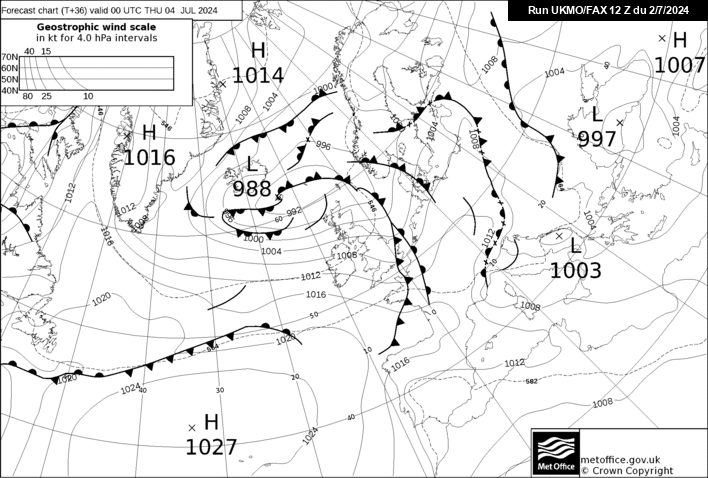
FAX looks a bit wrong for tomorrow? looks like a dry day here
Arpege suggests the band of rain with some sleet/snow on high ground will have cleared Wales & SW England by around dinnertime, so perhaps a half decent Saturday is possible along with a fine Sunday
Ed. Met also showing this scenario
-
34 minutes ago, knocker said:
The Pembroke Dangler has been in full swing today with frequent showers
Must be quite far out in the Irish Sea from Pembrokeshire then today as there's been blue skies & sunshine here on the SW coast making a welcome change


.png.ecea2d1135fd83c5c41434612fffa2f7.png)
.png.48af63a196eaa5e2f9da6263bd0a2df5.png)


Model output discussion 02/02/20
in Forecast Model Discussion
Posted
It's so nice to see GEFS still bringing a half decent weekend with a ridge on Saturday but more especially from Mon - Thu next week giving us in South Wales (and elsewhere in southern UK) some much needed drier weather, thereafter a hint of low pressure returning but obviously that's a long way off yet.