


AFCBSNOW
-
Posts
46 -
Joined
-
Last visited
Content Type
Forums
Blogs
Gallery
Events
Learn About Weather and Meteorology
Community guides
Posts posted by AFCBSNOW
-
-
1 minute ago, That ECM said:
Maidstone area would be my shout to see as much as most.
Well it won't be us in Bournemouth lol. My partner lives on the Thames estuary and we have actually watched these streamers come in and what looks like a small accumulation, actually ends up being a dumping, especially 2 plus Miles in land. Definite nowcasting.
-
 5
5
-
-
10 minutes ago, Kentspur said:
10 was epic 3 days of near constant snow here, 09 was best around Surrey/South London pretty decent in my area but only half the snow 2010 gave us here IMBY. 2018 too much of a ESEly/SEly looking at the reanalysis I can see why it failed to deliver as much for London Surrey and W of Kent and more places further north and likes of East and Mid Kent did better
I got caught in Gravesend for that. I couldn't get my car out of the Premier Inn car park.
-
1
-
-
- Popular Post
42 minutes ago, Polaris said:Hope so mate. Just feeling a little underwhelmed- whilst the NHF is eye watering, none of the major models bring 850s for snow away from mountains in the reliable. Just hoping it’s a slow burner.
If you underwhelmed by this, then its the wrong hobby for you my friend. Its simply stunning for this time of year.
-
17
-
- Popular Post
16 minutes ago, Joao 02 said:Yes very mild on the GFS and GEM this morning and it would not take much for the ECM to have similar pattern, people round here were saying they have seeing no frost and yet and I have not recorded below 6C - I wonder what the record is for lateness of first frosts, certainly there appear none on the horizon this month.
Morning all from a glorious and FROSTY Bournemouth, where real life ice had to be scraped from the car before work. Just a note on the models, the fact that 50% of the people here are saying mild and 50% says trend is your friend, really shows that there is vast uncertainty. I tend to fall on the @MattH side of the fence. I think there will be some great surprises this year, and we are still weeks away from winter. Keep the cold bottled till then. Have a great day!
-
11
-
5 minutes ago, Mapantz said:
76mph at Hurn airport. That's huge
I know, i live at the bottom of the runway, every fence panel has gone, gate has been blown off the hinges and my metal arch has been twisted into some weird shape that can only be described as modern art lol
-
4
-
 1
1
-
-
16 minutes ago, Mapantz said:
South Wales looks to be a sweet spot for a red warning..
We look right in the firing line, I can see the Christchurch storm defence being breached and I'm sure the cherries game against forest will be off
-
10 hours ago, mb018538 said:

It was the same here - crystal clear and only just below 0c. Upper air is very mild, so a very cold night not as easy to achieve. Usually with very warm upper air we don't get clear highs as they tend to get a load of muck trapped underneath.
That said, with the air not mixing and the high just sitting there again today, tonight looks colder than last night:
Ironically, on the south coast it was one of the coldest nights of the season, i woke up to -2 in Bournemouth and it was a real shock at 7am
-
4
-
1
-
-
4 minutes ago, ICE COLD said:
T144 it could be a lot worse
I will take -7 uppers over Bournemouth, any day of the week!!
-
4
-
1
-
-
The angle of the low has a better tilt as far as i can see?
-
1
-
-
14 minutes ago, Cymro said:
Are there no other countries in the Uk bar England?
Not if Nicola gets her way mods please feel free to remove, just some light hearted bantz!
-
1
-
-
1 hour ago, That ECM said:
South of the m27 event.
We will have some of that. You know at the elevation of north Bournemouth (kinson) we will get pasted
-
1
-
-
- Popular Post
As a new member I do find it amazing at some of the comments. Its so IMBY. Coming from deepest Dorset, I of all people know what its like to be snow starved and have raging westerlies overhead. I get that some of you are disappointed with the output, however, look at the overall patterns, when, in real terms have we had set-ups like this??
-
8
-
2
-
what's the order of play for the 12z's?
-
9 minutes ago, sebastiaan1973 said:
The winds east of the warm advection are to much from west to east. I don't see a powerfull cyclone to create a more potent warm advection. We get stick with a anticyclone at the British Isles/ north-western Europe. 168h ahead is not to much time for improvement to provide a better synoptic situation with better warm advection from south -> north.
Thats the case for the Nederlands, but for us we will see seasonal weather in this pattern.
-
1
-
-
1 minute ago, Catacol said:
Don’t often see these charts chucked out on the model thread…..but I’m doing my best at the moment to grow an understanding of the tropospheric precursors for +EAMT, thereby adding further amplification to the pattern.
I posted one of these before at longer range, and while +EAMT has been gently positive for a while we didn’t see a spike. We now have this for the end of the week, shorter range than my previous effort
Note the semi-permanent low to the east of the Himalayas but note also high pressure to the west and the descending nature of a high pressure cell NW to SE through China. If this chart verifies (and like all NWP it has to verify first before brining impacts!) then it would suggest a +EAMT event at the end of the week, extending the pacific jet and bringing more amplification. Add lag impacts into the equation, and this may be perfectly timed to force the UK high up to Iceland at Xmas and the days after.
Definite reasons to be optimistic today.
Thank you for the explaination. I find your posts, and others on here, the ones i look for when looking at the direction we are heading. There seems to be too much personal bias, both ways with interpretation and personal preference, which can deflect from what the charts are actually saying. The trend is your friend! It, to my untrained eye points to a colder period of seasonal weather, snow or not, that to me is enough to have some xmas cheer. Keep the posts coming!!
-
2
-
-
15 minutes ago, Anon90 said:
As others have noted the current profile to the north/north west just isn't favourable enough as things currently stand, may well need a full on SSW to salvage anything from this winter.
This winter?!! Its the first day. I love this forum, but seriously i am so close to giving up on it now, to much hysteria, the truth is, nobody, including the models have this pegged.
-
8
-
-
Hi all, so back for another chase. Only my second year of really watching what is going on, but to my very untrained eyes and memory, didn't we have some serious flip flopping on GFS last year, picked up day 10 then dropped it as soon as the other models were on board? Only to pick it up again around T96. Of course i am probably wrong, but seems to have a real issue with amplification and any stress on PV?
-
5
-
-
1 minute ago, Mike Poole said:
Look, you can shoot me down, call me whatever you want if I’m wrong about this, but it isn’t going down like this:

T174 that big fish ain’t happening. Learning point, ECM and UKMO can handle sliding lows...
I just wonder, if this bounces Biscay and the South clips this one?
-
Just now, Mucka said:
ECM looks okay and should be good for some widespread snow but it is a large move toward GFS from last night with the low much further N
ECM 120 today/yesterday
What we need now is consistency from the Euros and the GFS to move more toward them
Still time IMHO for that to track 100-200 miles further SE
-
1
-
-
- Popular Post
My Ignore list is expanding rapidly, the clickbait is just appalling at the moment. If your seeing something other people and models are not then please back it up with facts. Otherwise what's the point of being on the model thread, go bait people on twitter.
Also looking forward th the ECM, everything is crossed tonight.
-
40
-
5
-
3 minutes ago, kold weather said:
To be fair even the GEM is still probably classed as a 'cold solution' for the south, its just not cold enough for snow, cold rain!
Most models look distinctly below average, very little signs other than maybe the extended 00z ECM op of anything that could be described as mild other than maybe Wednesday-Thursday for the south.
Ironically, ground level temp in Bournemouth is 2c lower today than forecast. I don't think the models have a handle on the anything real wold at all.
-
1
-
-
Just now, Allseasons-si said:
Hey up!!!,...what goin on here then...
get ready for a cracking fl,...mark my word.
90 degree Duck incoming!
-
2
-
-
- Popular Post
I have been lurking on and off of here for years, and this year has piqued my interest far more than any have previously. The fact that our 'best' model ECM, can wobble like it did, IMHO completely against all other signals, to my mind shows just how hard it has been for this event to be modelled. Anyway the Pub run looks like delivering again so I will leave it at that. Keep the great commentary going guys.
-
11
-
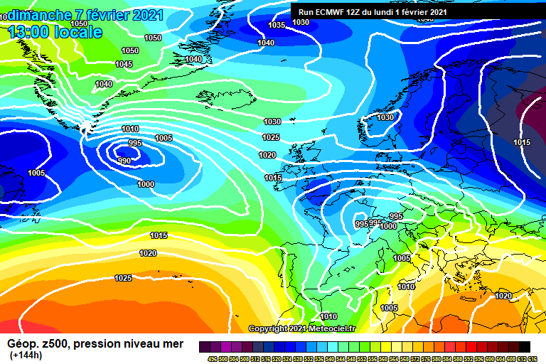
1 hour ago, Drifter said:
Day nine and the south still doesn’t have uppers below -4c.

To be fair, nothing below -4c has been in any of the models before 6th Feb, I wouldn't sweat the small stuff, plenty of time to change. Pattern first, uppers after.


South West and Central Southern England Discussion - Dec 2023 onwards
in SW and CS England Weather Discussion
Posted
Well it's still snowing here in North Bournemouth about 5 miles inland, settling on the cars and patio furniture.