


Just Before Dawn
-
Posts
918 -
Joined
-
Last visited
Content Type
Forums
Blogs
Gallery
Events
Learn About Weather and Meteorology
Community guides
Posts posted by Just Before Dawn
-
-
Another light graupel shower currently - the wind today has really dried everything up so it's blowing around like sand.
Gritters are out (they've been past twice) and a couple of snow ploughs went through about 20 minutes ago, presumably being re-positioned, so Lincs County Council must have had a head's up about the overnight period and tomorrow.
-
 1
1
-
-
Just back from enjoying the salty scouser tears - we had a brief graupel shower about 20 minutes ago but it looks a bit patchy on radar for the next hour or two, so probably little else for here before bedtime. Still, fingers crossed for tomorrow.
-
5 minutes ago, The PIT said:
Now here's a proper winter
 The Winter of 1978-79
WWW.THEWEATHEROUTLOOK.COMThe Winter of 1978-79 : Latest weather news and forecasts updated every 6 hours, every day of the year.
The Winter of 1978-79
WWW.THEWEATHEROUTLOOK.COMThe Winter of 1978-79 : Latest weather news and forecasts updated every 6 hours, every day of the year.That winter was brutal - we lived out in the sticks (even for Lincolnshire!) and it seemed to go on forever. The mid February spell of snow and gales is about the most apocalyptic weather conditions I've seen in the UK away from the Scottish mountains. I had three weeks extra off school between November and March, a joy offset by the fact we lived in a house with no central heating and several spells of no running water because of burst pipes. I doubt I'll ever see another winter like it in this country.
-
2
-
-
1 minute ago, alibabba said:
My little girl had some wrapped sweets in her pocket. got home unwrapped one...and it had sand in it!!
Yeah, it's like Sahara-on-Sea. Well, except for the temperature and sunshine.
-
1
-
-
Just now, alibabba said:
the sand facial isnt pleasant is it lol
I'm still shedding it. I dread to think where else it got.
-
1
-
-
Just popped out to the coast to do a few things for work and that wind has some poke, must be gusting close to 30mph. Certainly feels chilly. one or two very light graupel showers, but not much else, and not much off-shore that I could see though it was tough to tell between eyefuls of sand.
As for prospects for the rest of the week, why not just let it play out and see what happens? It's not like we can influence it anyway.
-
4
-
-
3 minutes ago, Winter Cold said:
Yeah I think a few of us, including me have been a bit jittery this morning. But I think today was always forecast to be light showers wasn't it. Main action looks from later tonight and Monday, Tuesday doesn't it.
I just need to be patient lol
I'm more nervous about this afternoon's football.
If this cold spell has taught me anything, it's that my windows need a damned good clean.
-
2
-
-
The odd short graupel shower in Louth this morning, but the wind is raw and has dried the place up considerably overnight.
Whatever fell today was always going to be gravy down here, our main window was always overnight tonight into Tuesday afternoon.
-
2
-
-
Just nipped out to the supermarket - light rain going in, heavy sleet coming out. The effects of evaporative cooling, but it does generally feel on-the-cusp.
-
6 minutes ago, summer blizzard said:
Seeing sleet between Gainsborough and Horncastle in the next batch. Any idea how high that area is.
Also any temp reports between 100-300m so we can track the current snowline.
That's about 30 miles! I guess it probably tops out at about 400 feet at the highest point.
-
3 minutes ago, LeeSnowFan said:
sorry I meant for rain ..
Oh OK - I guess they don't think the rainfall amounts will be sufficient to cause any issues except to add to river levels, which the EA warn for. The warning process around flooding has always been a bit of a grey area. The US does it better.
-
1
-
-
5 minutes ago, LeeSnowFan said:
flooding is certainly an issue for parts of our region today, lack of warnings is poor! been raining here for over 12 hours and still coming down
There are loads of Environment Agency warnings and watches going up in and around West Yorkshire at the moment. The Met Office doesn't warn for river flooding.
-
1
-
-
It's certainly very wet here - the irony is that the 24 hour spell between Saturday night and Monday morning when Lincs is under the influence of the southern front and therefore shower-free might actually help to dry things off before it heads south and we get in on the convective shower action on Monday.
-
21 minutes ago, Craigers said:
ICON 6Z sends the low back north on Monday!!! NOW WERE TALKING
That's an interesting new wrinkle!
A good example why the there's little benefit from hanging off every GFS run with this thing getting within the 36 hour range. I'm going to log off now, go for a walk, watch something dumb on Netflix and come back tomorrow morning when I can actually look at radar and Hi-res stuff like Euro4.
-
3
-
-
11 minutes ago, sheikhy said:
Any charts buddy?!5 ice days in a row on this run
Sorry - Interloper from the Yorks and Lincs thread - how's this for a graphical interpretation of a streamer?
-
1
-
-
5 minutes ago, adrianh said:
I wouldn't stress over the warnings too much - they often seem to be miles off/slow particularly when it comes to easterlies. During the 2018 Beast from the East, we had a good 20cm of snow on the ground before we finally got upgraded to an amber warning. A shift south (or north) of that initial low would be nice though just so we don't have a dry area over some of our region on Sunday.
Was just going to post the same thing! The warning is just a placeholder and a 'watch this space' alert at this point. The warnings for Today/Tuesday will change multiple times between now and Sunday. It's genuinely not worth getting stressed about at this stage.
-
1
-
-
Can't really fault the overnight output or ECM this morning - all staying pretty rock solid so far when it comes to the weekend and next week.
Particularly interested in Sunday evening - this has been consistent for three days worth of runs now. I've been in three meteorologically defined blizzards in my life - one walking up Glen Clova in 1991, one in South Dakota in 1998 and the third driving, then stopping the side of the road for four hours between Varangerbotn in Norway and Ivalo in Finland in 2017. Sunday night *could* be number 4. Further inland - S Yorks and bits of W Yorks, North Notts, who will already have had snow on the Saturday could see some pretty impressive drifting as those showers penetrate well inland. The 2010 event, great though it was, never had winds gusting to 40mph, at least not down here.
-
5
-
-
43 minutes ago, alibabba said:
hey everyone coastal lincolnshire here (skeggy) how we going to do with this being right on the coast? should I be stocking up my fridge . sorry if its the wrong regional but the lincolnshire one doesnt seem to be very active
It's the right regional thread, this covers Yorkshire and Lincs.
Let's put it this way, I'll be doing my Boris-mandated exercise on Sunday afternoon at Saltfleetby, on the coast north of you. With my camera. From then until Thursday, it's snow showers all the way, with very little marginality.
-
4 minutes ago, Frostbite1980 said:
Hi all just moved to swineshead in Lincolnshire from hertfordshire so is this my new regional thread or is it really only for north Lincs? Thanks all
I went to 6th form college in Boston, so I know Swineshead well. You're in the right place.
-
 1
1
-
-
Well I've booked Monday as annual leave, put the winter gear in the car and charged the camera batteries, so that's probably screwed it.
Sorry.
-
4
-
-
The GFS 18z op continues the theme of some fairly tricky winter weather on the eastern fringes of the region on Sunday night.
-
1
-
-
6 minutes ago, Craigers said:
This is the resolution from the UKV that picks up convection.
Looks good and keeps that LP further east so the flow is N of due E - good for getting the showers further inland.
EC ensemble mean suggests the LP is south of where the op run put it, so that's a bit better too.
-
4
-
-
33 minutes ago, LeeSnowFan said:
but if you look in the mad thread charts are bad lol then look at the location of the poster and there from the SOUTH!... this is why confusion sets in for many lol .. this is why we also have great posters like you on here
It is a bit like a six hour rotating freak-out on there at the moment. I think I'm probably going to sack it off until Thursday or Friday and have a look then, when it's a bit closer to the reliable.
Getting a bit foggy here - feels like a good night for some exercise.
-
3
-
-
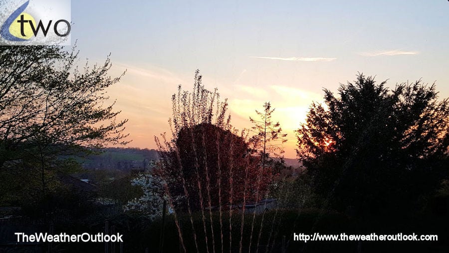
Some fantastic photographs this morning - keep 'em coming.


Yorkshire and E England regional discussion
in Yorkshire & E.England Weather Discussion
Posted
Is that Cleethorpes or in The Isle, Richard?
Love the youtube channel BTW - subscribed!