


virtualsphere
-
Posts
696 -
Joined
-
Last visited
Content Type
Forums
Blogs
Gallery
Events
Learn About Weather and Meteorology
Community guides
Posts posted by virtualsphere
-
-
22 hours ago, Premier Neige said:
Question for you as I'm bored with this so called summer and my thoughts are turning to winter already. As I understand it, a weak to moderate el niño gives us a better chance of a colder winter (other factors allowing). Does a strong el niño tend to scupper our chances and have we had a cold winter during a "super niño"?
I've dug out and updated some data visualisations I created in Tableau a while back on this. Essentially taking a broad brush approach, the weaker Nino the better for a chance of a cold winter - these are comparing the average Nino data for Sept, Oct & Nov with the CET for the following winter (year is the start year of winter, so 2009 for 2009/10 etc). Nina winters give a wide range of temperature outcomes but it seems the stronger the Nino gets, the narrower & warmer the range of CET outcome.
Nino 1+2 region: for a sub-3C CET overall, there's only one example here above +1.0 (1941/42)

eQBO years highlighted (gives a far smaller dataset and very few strong positive ENSO + eQBO examples):
Nino 3.4 - similar pattern, perhaps slightly less pronounced: 2009/10 probably as high as it goes in the sub 3.5C range:
eQBO highlighted:
Obviously this doesn't really indicate cold spells in otherwise warmer winters, or the synoptic conditions as shown in the charts already posted by SqueakheartLW. I'll try and take a deeper look at individual months when I get a chance.
-
 1
1
-
-
17.9C and 103mm please. Going for generally unsettled and westerly, but warmer than average due to the high SSTs in the Atlantic.
-
-
16.1C and 57mm please
-
10.4C and 81mm please
-
6 hours ago, Snow tyre said:
This interesting dog leg structure (the green 'river') running through Wales and dropping across Hampshire looks almost exactly like this morning's rain radar. Is there a reason this is persisting?
The animation looks like it's taken from the GFS 0Z run so will show all accumulated rainfall after midnight & so include this morning.
-
1
-
 1
1
-
-
8.7C and 92mm please
-
1 hour ago, Ali1977 said:
Interesting stuff
1 hour ago, Bricriu said:So was April 1997 notably cold? Or is he suggesting that we are going to end up with a very warm March as was the case in 1997?
I think this is a US Twitter account - I wondered if they were referring to the super Nino of 1998 given their previous tweet:
-
3
-
2
-
 2
2
-
-
6.3C and 82mm please
-
5.0C and 78mm please
-
- Popular Post
Thundersnow here at 7am, a couple of bright flashes and loud rumble of thunder. Left a covering of snow and small hail in the garden, brightened up now but more sleet and snow showers forecast for later.
-
12
-
6.0C and 97mm please
-
Some picturesque winter convection popping up here this morning.

-
7
-
-
Thunder here for two days in a row, Weds and yesterday. Unlikely to get a third day today, but certainly some photogenic convective cloudscapes around.
-
7
-
-
3.8C and 66mm please
-
1 hour ago, Vorticity0123 said:
It's quite remarkable that up to now this year has seen a strong tendency towards ridging over Central-Southern Europe. If you look at the 500 hPa gph anoms for this year from January 1 up to November 6, the anomalous ridging over Central Europe is quite clear...
What I am wondering is whether these anomalies could persist throughout the winter as well. Of course it is far too simple to assume that the observed anomalies this year imply that the winter of 2022-2023 will continue in the same way. Still, I wonder what factors like the persistence of La Niña or other tropical / extratropical forcings have led to the tendency for European ridging to occur, and whether similar forcings could result in a higher likelihood of European ridging for the upcoming winter.
Yes the anomaly over Europe has certainly had an impact this year - interestingly if you look at some of the variations throughout the year, the ridging has varied in intensity and location, and taking this example for April combined with some of the modelling recently suggesting ridging to move further north (which admittedly has backtracked recently), it's possible the high could move to a more favourable location for seasonal weather as the winter progresses.
-
-
11.9C and 101mm please
-
Well according to Roger's stats on the CET thread Sept 1906 started higher than this year and finished at 13.9, so anything is possible...
-
1
-
-
14.1C and 63mm please
-
Dug out this analysis I did a couple of years back, La Nina is not necessarily bad if it's a colder winter you're after, its the strong El Nino event that you probably don't want to see. This doesn't take into account the longevity of the Nina though.
@StretfordEnd1996There's some other data sources here https://climatedataguide.ucar.edu/climate-data/nino-sst-indices-nino-12-3-34-4-oni-and-tni and back to 1870 here https://psl.noaa.gov/gcos_wgsp/Timeseries/Data/nino34.long.data
-
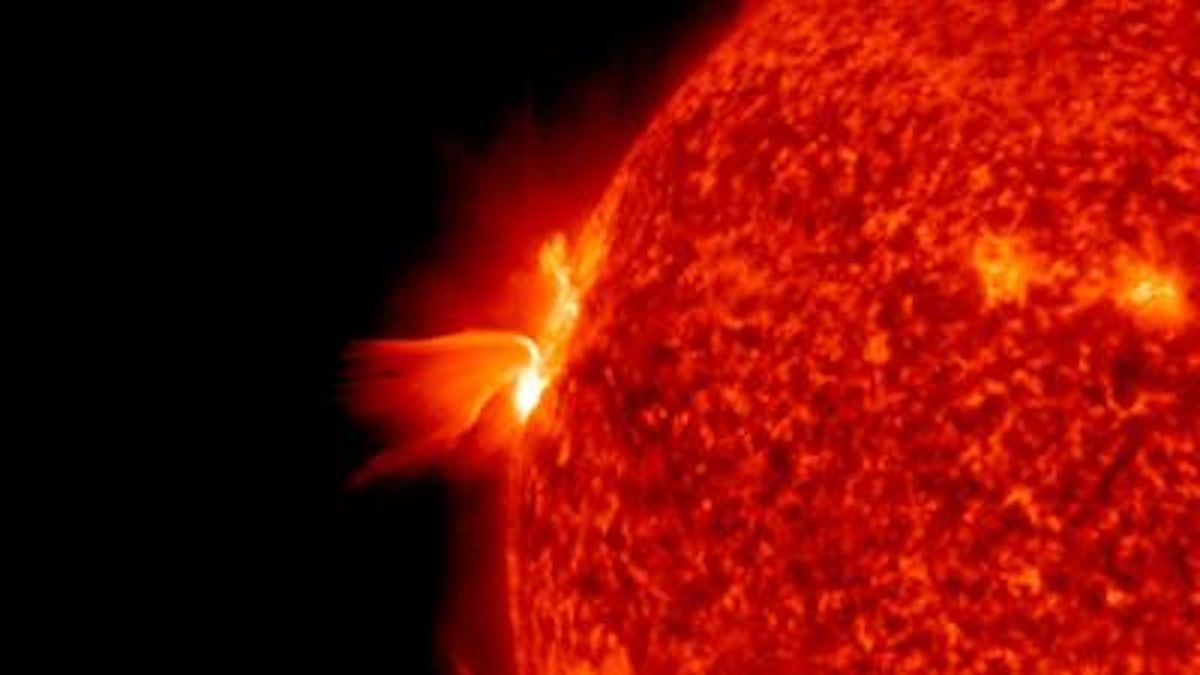
The forecast for a stronger cycle seems to be on track, according to this.
NASA's solar forecast is turning out to be wrong. This team's model is still on track. | Space
WWW.SPACE.COMOne heliophysicist's model of solar activity is on track.-
3
-
-
16.9C and 74mm please
-
2012 was definitely the worst here, followed by 2008: both complete washouts. 2007 probably third, though we did at least get some dry weather that August. 2020 was poor after a very nice spring, though I'm not a fan of heat so am rating that one on the lack of dry sunny weather and can understand why those who like heat would rate it more highly with the very warm August spell. 1992 seemed poor at the time, May was decent but I remember the school summer break being very wet.
Then summers like 1998, 2009, 2011 which didn't feel quite as bad overall but lacked a nice dry and sunny spell here as far as I can remember.
2013, 1995, 1996, 2021 and 2018 would be my favourites from the same period. I think we did much better here in the far west last year than much of the country (but again, from the perspective of preferring dry and sunny rather than extreme heat).
.png.367ff48047bb2be2d7595c85f91c1d75.png)


E.N.S.O. Discussion
in Spring Weather Discussion
Posted
Following my last post I've been comparing the monthly CET figures for winter against ENSO data:
December
Similar to the seasonal charts I posted yesterday, the stronger the El Nino, the less likely the chance of a cold December CET. La Nina has delivered a wide range of outcomes and even a strong La Nina in either 1+2 or 3.4 regions doesn't seem to inhibit a cold December. This is based on average ENSO for the preceding Sept - Nov:
January
As with December, the strongest El Nino values are associated with warmer Januaries, however there are some examples creeping in here of moderate El Ninos with a colder January CET, especially in the 3.4 region (2010, 1942 etc). Stronger La Nina values in the 3.4 region also seem to be associated with warmer Januaries, unlike in December, so a neutral ENSO would appear to be the best bet for a particularly frigid January. Here, ENSO data is for the preceding Oct - Dec. Apologies for the weird +1 on the year, I couldn't get Tableau to add 1 to the year of the ENSO data!
February
This is more interesting and, in line with some of the earlier comments, you can see a few stronger El Ninos associated with colder Februaries. The 3.4 region shows a lot more scatter while still trending slightly to warmer for the higher El Nino values. 1983 is a stand out particularly in the Nino 1+2 region data but 1889, 1942 and 1919 were sub-3C Februaries with +1 ENSO values. 1998 shows that exceptional warmth is still also a possibility. Here the ENSO data is for the preceding Nov - Jan.
NB: in all the above, the colour represents the 3.4 region in the 1+2 graphs, and vice versa to try and give an idea of which region the strongest ENSO values are located. eQBO is represented by a square, wQBO by a cross, though the data only goes back to 1979 so there's not much to go on here and earlier years are all represented by circles. I was just going to ask if there's any older QBO datasets when I saw @BruenSryan's post above - so will have to take a look!