


Snowynorth
-
Posts
86 -
Joined
-
Last visited
Content Type
Forums
Blogs
Gallery
Events
Learn About Weather and Meteorology
Community guides
Posts posted by Snowynorth
-
-
Hmm CFS model goes for a block from the 18th of December through to next year!!! I know this is a unreliable model for specifics but the pointer is there. Be very interested in the GFS in the next few days!!!
http://modeles.meteociel.fr/modeles/cfs/runs/2013112600/run1m/cfsnh-0-534.png?00
-
Big ramp needed after this cfs run for xmas day. With uppers like that and low pressure near by snow is a gimmie!!!
http://modeles.meteociel.fr/modeles/cfs/runs/2013112600/run1m/cfsnh-0-714.png?00
http://modeles.meteociel.fr/modeles/cfs/runs/2013112600/run1m/cfsnh-2-714.png?00
-
I think it's fair to say that none of the so cold "pro" forecasters have a clue what's going to happen. I find Simon Keeling very irritating, he changes his forecast in every video.
Simon Keeling did state this wasn't a forecast just facts what the charts are showing!!!!
-
 2
2
-
-
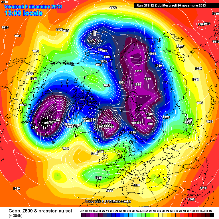
What is the story on the PV then??
Looks like it will be under pressure in December. This chart would signify a weakened vortex
http://modeles.meteociel.fr/modeles/gfs/runs/2013112012/gfsnh-0-384.png?12
-
As for the Jamstec here is the chart from November 2010. Need i say more lol
http://www.jamstec.go.jp/frcgc/research/d1/iod/2007/forecast/temp2.glob.DJF2011.1nov2010.gif
-
2
-
-
Interesting viewing!!! Thanks for sharing. It seems like as in 62/63 and 2010 that the vortex repels the attack of the highs in november and re organises itself only for it to get breached in December. We have seen some stress on the vortex this month yet as its November it repels. Hmm interesting!!!
-
Matt Hugo changes his mind with every run. I don't pay attention to him.
Look at this chart for the start of December

If this comes off we will be going into the freezer.
Yes will be interesting to see the next couple of runs to see if it continues. Lets hope some other models come on board!!!
That Jamstec just looks strange. Below average for the British Isles yet above average for everywhere around it?
A procession of Northerly topplers perhaps as a prevailing Winter synoptic?
Weird just posted the same thought at same time lol
-
That jamstec run had the whole of the northern hemisphere warmer or slightly warmer than average. This i cant see, the whole of the NH cant be above average. UK gets a slightly cooler look but i suspect this is a model run like many others struggling with the various factors involved in forecasting a sudden event!!!
-
Latest gfs run now suggesting a vortex split early December!!! More and more models picking up on this!!!
-
1
-
-
I could be because the northerly winds would blow some milder air from the sea (sea surface temps will be warmer than inland temps) towards the northern extent and under cut the cold air inland.
warm air doesnt 'undercut' cold air. however, your first sentence is probably right as the flow comes onshore and probably brings the dewpoints above freezing. there;s a lot more to snowfall than just uppers as JH always reminds us.
Yes ' undercut ' wrong term lol but you knew what i meant lol
-
One quick word on the model debate, I think we can all see that the models are having a very difficult time of it. One model suggest one thing and another model the other. What i can deduce from this is there is much uncertainty and wouldn't look past 7 days in that regard. However when a zonal pattern is apparent, the models tend to have no problem in 'coming together ' and agreeing with each other so the fact they are all over the place is very interesting to see and very difficult to predict weather after a 7 day period with confidence. Maybe we are going to get a cold period and the models are struggling with the pre blocking pattern and certainly don't have any fluidity on a zonal period or blocking. Were in weather limbo people!!!!!
-
Could someone with ample knowledge please tell me why the met office are forecasting rain for low levels in Northern Ireland on Tuesday with -8c uppers???
(someone with no bias)
I am puzzled to be honest because I would've thought -8c uppers would sustain snow to all levels.
Funny they are also forecasting rain for western scotland too.
I could be because the northerly winds would blow some milder air from the sea (sea surface temps will be warmer than inland temps) towards the northern extent and under cut the cold air inland.
-
Sounds great but the problem I have with their monthly forecasts are, they are always wrong!
a few days ago the the forecast said westerlies will dominate December, so they have changed their minds already lol
-
1
-
-
note caution for anyone thinking we are in a good position because we might not be and will be hoping for a either a second bite at the cherry or things can go horribly wrong in a hurry
Greenland or bust
here I will show you from the ECM 12z and note the bit I have circled in this first chart and this is our killer for getting deep cold with this first bite and why we don't want Scandinavia
now if we do see the heights heading for Scandinavia the two highs will link and as we can see from the arrow in this chart it will clearly cut off the cold uppers
this is why we have been seeing anomalies charts like these over the past while because of that big high pressure out toward Russia which only leaves us with a window to deep cold through a Greenland high as the high to our east will kill everything else and will leave us looking for a second bite at the cherry if one ever comes along as it will sink any height rises over Scandinavia.
so we want Greenland people and nothing else for a chance at prolonged deep cold at this stage
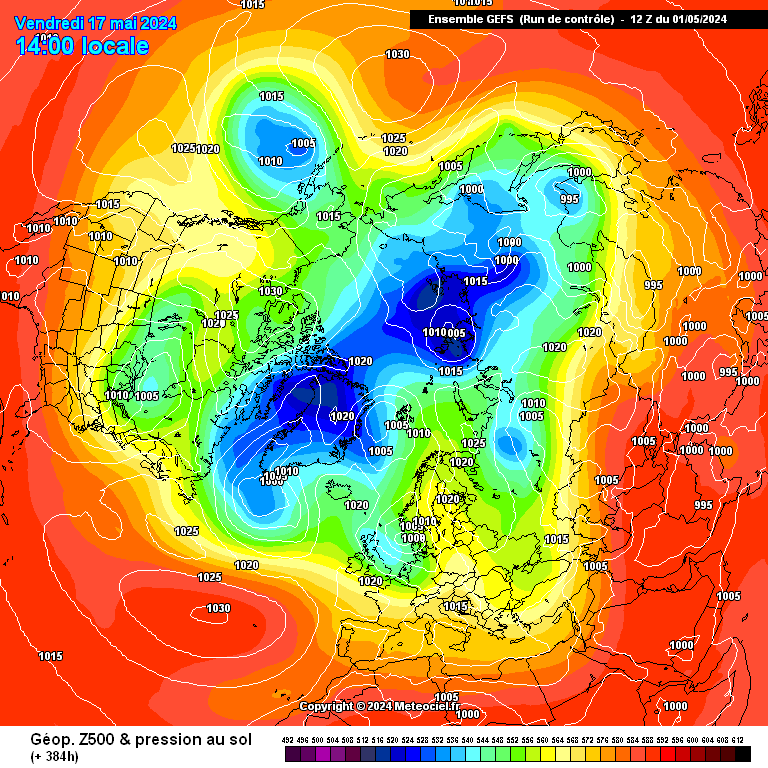
Dont worry i always believed the end of November had the real potential and more so of this model run.
http://modeles.meteociel.fr/modeles/gens/run/gensnh-0-1-384.png?12
-
2
-
-
Not sure what you mean by gulf stream reduction - are you trying to imply that it has decreased in size or potency? As far as I'm aware, even if the gulf stream disappeared completely, our winters would only cool by a few degrees at most - London would probably have a climate more akin to Prince Rupert, Canada or Ketchikan, Alaska in terms of winter temperatures - cold by London standards in any case. The gulf stream isn't actually the largest influence with regards to our mild winters.
Regardless, I'm merely saying that even the coldest periods of weather have mild winters - sometimes record breaking - so getting a mild winter now and then amongst colder ones isn't a big deal - if we are entering a period of colder winters, that is.
If the gulf stream stopped we would not have mild winters period. And the temperature drop would be 5° minimum in winter on average. The low pressures would not be half as potent as they are now and ice growth would increase towards Iceland. Not saying that the gulf stream has stopped, I just believe it has changed somewhat and has had an effect on our climate!!!
-
1
-
-
It's the UK - not every winter will be cold. Even the Maunder Minimum and Dalton Minimum had some mild winters.
Maybe so but the hot topic at the moment regarding global shifts and the gulf stream reduction were not an issue in these periods. Comparing two periods of cold is useless. Like comparing Vettel and Schumacher, it cant be done, different cars different era. Tbh we may get a mild winter somewhere down the line but it isnt going to be this winter and any mild winter is now going to be isolated event to the norm. We have more science now then ever before and NOBODY has come out and said these colder than average winters are going away, if fact most say they will become more frequent!!! I don't base this on preference to liking cold weather, just using the facts available.
-
I'd also add a note of caution to anyone thinking that late November cold and snow means the forthcoming winter will be memorable in terms of cold and snow.We had dreadfully mild and virtually snowless winters from late 90s through to late noughties.But one year, i think it may have been 2006 (but i'm sure someone with better knowledge will know for sure) we had a cold and snowy few days in late November here in the south west, after a run of virtually snowless years.I thought at the time "At last a decent cold, snowy winter to come after the mild mush of previous 10 years" But alas.....the rest of that winter was rubbish.Sorry to be a party pooper
Personally the colder winters are here to stay for a while yet. The trend of winters in the 90s are well in the past. We have seen a global shift since 2006, not just the winter but summer as well. I understand that people want to get carried away with headlines like 'snowmageddon' and i agree a note of caution should be taken and all aspects of cold and mild should be taken seriously. However having looked at the way the models are behaving i thinks some have it nailed and others just cant process the blocking pattern. I think this winter has a similar vain as 2010 did tbh.
-
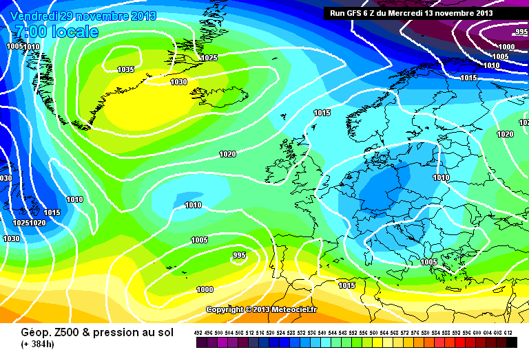
Would love to see them if someone can dig them out to compare. 2010 was magic.
http://www.wetterzentrale.de/archive/ra/2010/Rrea00120101129.gif
29/11/10
-
Think, as before the ECM could grab the leading hand on coming prognosis.seems to nearly always take lead in regards heights building to Greenland,.....could be some very intresting viewing coming up...and who knows even verification!!!.
Gfs showing some promising signs now all of a sudden.
http://modeles.meteociel.fr/modeles/gfs/runs/2013111306/gfs-0-384.png?6
-
How cold you talking??
it can vary but i would expect minus double figures!!!!
-
Does anyone know what would happen if the PV splits and a part of it sits right over the UK?
you will need to turn the heating on max!!!!
-
How is Eastern Europe into Russia cooling down compared to recent years? Has anyone taken a look?
Quite similar to 2010 with Moscow having a mild October and even in November 2010 they only got properly cold in the last 3rd of November. So a similar pattern to this year. It will be interesting to see if Moscow get some extreme cold next 3 weeks. Charts are very similar to 2010 at present.
-
1
-
-
Funny that because i see no evidence of support for a mild December, in fact just the opposite. I cant see Russia being above average either!!! Seems a little cfs dependant forecast to me!!!
-
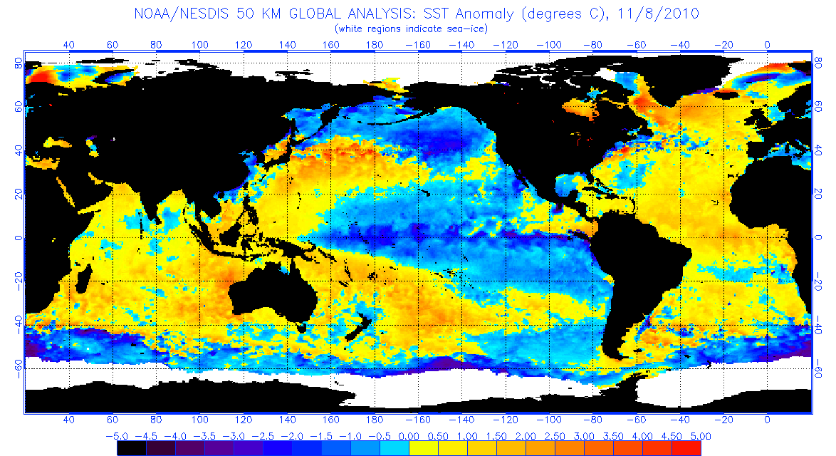
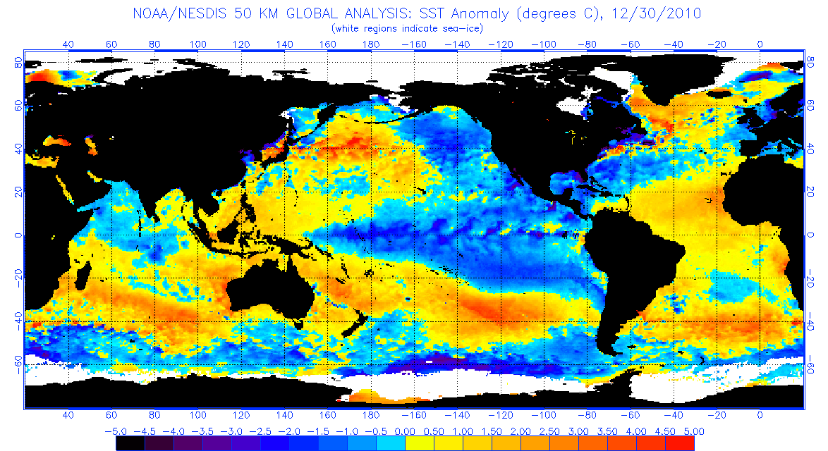
Yup we do indeed, roll that on 5 months and we'll have a fully grown frog :-)
http://www.ospo.noaa.gov/data/sst/anomaly/2010/anomnight.11.8.2010.gif
Same time ( 8/11/2010 )
http://www.ospo.noaa.gov/data/sst/anomaly/2010/anomnight.12.30.2010.gif
End of December 2010.
Not exactly a 5 month span!!!!
-
1
-


Winter 2013-2014 Discussion- Part 2
in Spring Weather Discussion
Posted · Edited by iamstuart
Cant all be wrong about a disturbed vortex surely!!!!