


GraemeB
-
Posts
690 -
Joined
-
Last visited
Content Type
Forums
Blogs
Gallery
Events
Learn About Weather and Meteorology
Community guides
Posts posted by GraemeB
-
-
Lol at MUPPET.

We had about 3-4cm in Stirling, so happy overall with the event last night, moreso probably because I suffered a brief spell of Toorp when the initial front fizzled out.....
-
Please continue...Previous: http://forum.netweat...4entry1763834
Dont mind if I do
Have pasted over the last reply
Lovely GFS run this morning - the cold has been brought in sooner, maybe through Tuesday evening into Wed, but it looks more NE'ly to me ?Interesting, I think, the 528dam dissects us right through the middle on Tuesday night - that's been a few runs now that the trend is heading towards something rather exciting early next week.
TOORP still on high alert though.
-
Lovely GFS run this morning - the cold has been brought in sooner, maybe through Tuesday evening into Wed, but it looks more NE'ly to me ?
Interesting, I think, the 528dam dissects us right through the middle on Tuesday night - that's been a few runs now that the trend is heading towards something rather exciting early next week.
TOORP still on high alert though.
-
The Invent weathermap for rainfall is beautiful viewing - the showers are packing up as they come across the cold air.
No TOORPing yet....
-
Did you notice if it was a perfect six point star shape of a snowflake? When I picked BoyCatch up from school earlier the snowflakes were perfect 4mm across stars. Funny thing is that we had exactly the same type of snowflake last week!!
That's the very blighter that just assaulted me.
You wouldn't get that with the 5 pointed ones :blush:
-
I like it!
If this goes pearshaped it will be TOORPing down all night. Prepare to be TOORPed in by the morning
-
It's falling at a rate of 3 SPH (snowflakes per hour), of which I successfully just caught one of them square in my eyeball.
Do Claims Direct cover me for Actual Body Snow Damage ?
-
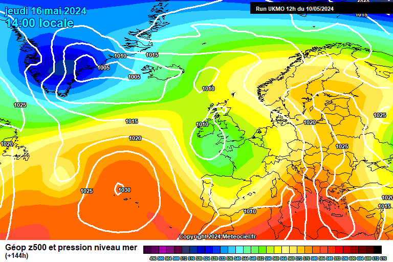
All we really need for a biggie is either a warm front bumping into the cold air and stalling over us a la march '06 or a 48 hour easterly with uppers of -10 or 36 hours with uppers around -15. The latter looks the more plausible in the medium term anyway, simply because the cold surface air is only likely to arrive from an easterly with similarities to the one shown above. I will edit this in a minute to update on the ECM 12z.
edit: FULL MODEL AGREEMENT ON EASTERLY BY ABOUT 120 HOURS!!!!! http://www.meteociel...M1-120.GIF?03-0
http://www.meteociel...44-21.GIF?03-18
http://91.121.94.83/...fs-0-126.png?12
http://www.meteogrou...thgt850_120.png
Uppers at -5 already at +120 on the ECM, with nothing to stop the coldest uppers reaching our shores. My confidence of an easterly/northeasterly has sky rocketed - around 80% for me - I mean full model support at this stage is almost conclusive, note the word ALMOST, and the other 20% which wouldn't even be vaguely cold or snowy, but my money is now on the cold solutions.
If tomorrow morning's runs back this up, I don't see it going any other way, so the next 12-24 hours will be the key to a cold spell, I feel.
Cue MTM (Model thread Meltdown), swiftly followed by a brief spell of TOORP (Toys oot o Ra Pram)
-
Jeez - that's some cold there in those ensemblies...
That fits in with the 12z run for around that time frame...
Day After Tomorrow and all that...which probably equates to some chilly days up here, and a roaster down saff.
-
That's the leading edge of it just hitting Stirling, so I'm guessing we'll get around an hour of it...fast fizzling out by the looks of it.
-
Bugger all in Stirling..
Cold with a whitish sky...
In fact, it's freezing....
edit - this is Ayr cam just now, so even if it does start, it's obviously not going to come to much.
-
I will not believe any charts now.
Not even this one...
Copious amounts of all that we want :lol:
-
Um - what's happened overnight ?
Beeb had warnings and heavy snow for Stirling but this morning, on the early weather as well as the site, it's all but gone ?
Is the front moving up from the SW fizzling out as it moves ?
See, this is why I hate trying to learn about the weather - infuriating it most certainly is
Also - is the PL still there ?
-
Unexpected snowfall overnight!
Got about a cm, which is impressive given the dewpoint is above freezing and the ground is wet!
Brilliant!
Roll on Wednesday night
Off to check the models now.
LS
I hope you've hidden the kitchen knives....
-
Wow - Just checked the beeb online weather and it has heavy snow for Stirling, backed up by a meto warning for Heavy snow tomorrow night..
Off to peruse latest models....
-
FI would appear to be T72/96 - I'm now trying to ignore anything beyond that, as last week, we were almost into Day After Tomorrow scenarios
Maybe they should split the model thread into 2 - discussions over what's happening 0-72, and another for post 72 apocalyptic doom talk.
I know which thread I'd sit in
Still, bright and cold here in Stirling - so no complaints (apart from the lack of snow)
-
Ensemblies are showing a "mildish" interlude on Tuesday with rain before dropping back to colder air on the Wednesday..
Not sure, other than the North of Scotland, that I can see any snow for the rest of us...
-
Morning all...
Just found this in the Model Thread - and it made me chuckle..
"AGREE with that completely. Also models are suggestive and not fact."
-
A couple of nice pictures
The fax for tomorrow looks interesting (I think)...and the chart for Friday from GFS morning run...
Interesting week ahead - but I'm staying away from the model thread - last time I dipped in, I singed my fingers and my PC screamed for help.
-
Looking at the gfs this morning - where's the snow for Tuesday coming from as I'm not seeing anything ?
-
It certainly looks like that Graeme
I would say that even before then we could have some fun, well, at least those of us who live in the north of Scotland
I feel a full scale rampede coming on at some point in the 24 hours.
I give it until the 12z comes out, and if it keeps the same theme, coupled with decent Meto fax charts, NW could very well hit 10 on the Rampede scale.
Wonder if the meto will be issuing some early warnings for Fri/Sat/Sun soon...
-
I will NOT get excited by this....
Does the attached fax chart for Saturday, not show some decent activity across Scotland from even then ?
-
There weren't any warning whatsoever for Edinburgh's heaviest snowfall for 25 years Graeme in the small hours of Weds 23 Dec. Was all a bit of a Meto cock up.
Yeah, thanks shuggs, I kinda thought I had missed the warnings...even up here there were about 5-6inches over that period...I just wondered how it all came about and how it was "missed" ?
Did the guys over on the Boffin Thread nail it though ?
-
Sorry for the blonde question - but I was in Oz pre Xmas and missed all the fun...when was the event back in December actually nailed on ?
I don't remember seeing any warnings as I was going into Barby-mode...


Scottish Cold Spell Discussion 22:
in Spring Weather Discussion
Posted
Hehe - I called a NE'ly this morning