


The Giant Daddy Jackpot
-
Posts
150 -
Joined
-
Last visited
Content Type
Forums
Blogs
Gallery
Events
Learn About Weather and Meteorology
Community guides
Posts posted by The Giant Daddy Jackpot
-
-
Good signals of strong HIGH ridging over Scandinavia, the Atlantic jet may well be forced south.

-
 2
2
-
-
A time for some reflection on the latest models and wait for further runs before we start getting the snow shovels out in southern England. The focus is definitely going to be that LOW to our SW.
-
Seems that the 'Beast' opened one eye, yawned and went back to sleep again.
How many times has it been said that putting too much emphasis past D06 is a mistake?
-
3
-
-
Quite likely that the met will extend the RED zone further East as they have done with AMBER warning.
-
Certainly intensifying as it heads across the channel and widening too, if it stalls over the South it could be a 12 - 18 hour blizzard. Something we haven't seen since 1978/79
-
1
-
-
18 minutes ago, Skullzrulerz said:
Its still snowing here at st Austell
And that is a rarity!
-
2 minutes ago, Bristle boy said:
It's coming! And it's going to be roughhhhh!!!
So you take back your dismissal of my forecast for a monumental snow storm do you, Bristle Boy?
-
Southern England is on the cusp of a monumental snow storm and snow/ice storm for the south west. If this comes off it could be the worst for 30 years. No wonder the met office is on their guard.
-
3
-
-
Significant snowfall across the Southern part of England and along the east coast looks highly likely now with active systems running up the English Channel notwithstanding agreement across the models for a severe easterly intrusion due to the SSW. This kind of event, should it occur, is of course a rarity indeed for the whole of the country (about once every 30 years) but when they occur they shock England in particularly and they always bring road traffic chaos, schools close, shops run out of supplies due to problems with delivery etc. But when it gets this cold it does catch people out especially the elderly so please keep an eye on them! Note that 7 February 1991 was one of the coldest days in the 20 Century and equaled the intense cold of February 1956 and the same with 12 January 1987 but February 1986 was one of the coldest months in the 20 century. I wonder if we will see any records broken in the coming spell and note that the infamous severe winter of 1947 began late and didn't finish until the end of March! The last 30 years of relatively mundane winters may well have put people into a false sense that such events can never really happen here in the UK.
-
2
-
-
Quite extraordinary charts, ridging over Greenland and Scandinavia with subzero temps we haven't seen for over 30 years, I believe that's 1986. Could even be as cold as 1981. Wow, after all these years of disappointment we may be on the verge of another memorable winter. Exciting chart watching over the next few days.
-
1
-
-
The charts are beginning to hint on agreement now. I believe we are on the cusp of seeing a monster Easterly incursion that will give the British Isles sub zero temperatures not seen since 1987 with high probability of deep snowfall especially across Eastern and South Eastern areas. Exciting times ahead for chart watchers.
-
2
-
 1
1
-
-
Nothing sustained about the current models predicting a cold snap. No ridging across Scandinavia or in mid-Atlantic, just business as usual with the jet. These Arctic incursions via the NW rarely bring in a change for anything resembling long-term and the jet will bring in SW's and a swift change back to normality. Ensemble data indicates nothing to get excited about.
-
2
-
-
As we move into mid-winter cold and snow lovers are persistently frustrated by an Azores HIGH which re-emerges time and again sometimes slipping across the British Isles and keeping the Polar and Russian cold air teasingly close by to our North and East. This has been a similar set up for many years now with rare incursions to the North of Britain but never lasting long enough to take hold. Unless we see long-term ridging heights over Scandinavia and to our West in the Atlantic little will change. Even the NAO seems to have made little difference when one studies the cycle and the resulting winters across Britain. Ensemble data doesn't give much hope either in the short-term and suffice it to say, if we enter February with a solid Azores HIGH then its game over for yet another winter for real snow and cold lovers. Sorry!
-
1
-
-
Just a hint that heights will build towards Scandinavia as we head into the new year. The solutions have been showing some positive signs in the past three to four days and all eyes on the next 72 hours to confirm a real trend towards some real winter. Mid Atlantic blocking ridge and heights over Greenland looking good too. All in all very positive but all to play for.
-
Well a massive difference between the American and the Euro model. I feel the UKMO may be going for a short sharp cold spell and return of warmer airflow in their outlook. Will be speaking to our forecasters later this morning with their view on the Scandinavian High development as they tend to use ECM in there longer term progs.
C
As usual the GFS solution looks wildly off with the ECM the better bet. Heights building over Scandinavia is looking the better prognosis but certainly not nailed down. A lot of solution watching with one eye on the Met Office over the next few days I think!
-
Gibby, I fully agree with your prognosis. With a strong zonal influence and no sign of any blocking heights to our NW or NE, this looks like another very short lived spell and Dec looks increasingly like being an average one.
-
1
-
-
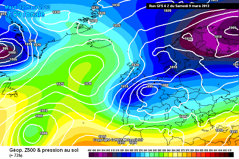
http://modeles.meteo.../gfs-0-72.png?6
9999 Posts!!!
The GFs seems to be wanting to push the low up into the SE moreso than the Euros- this is still a developing event-
My own personal opinion is the UKMO model suite for muted PPN is still a little out of kilter, but the models do struggle with dynamic PPN so I guess its to be expected-
For example- the perfect windflow & allignment for a Streamer will deliver endless snow showers but the depth signal is always to low in the models-
I note the NAE starts to drive the shower train 06z T 48...
the rather crude GFs PPn rates has moved the core of the depth from the South central zone east along to Sussex & Kent & Outer london south-
30 mm totals-
http://91.121.16.5/m...84-777.GIF?09-6
S
And just look at those totals for the Normandy area - they will be absolutely deluged!
-
Well well well, just when we thought that winter was over there could be a real punch at the end. GFS looks pretty sure of itself so all eyes on the models for this one because it could well deliver a real energetic NE'y and put the East of the country into standstill mode.
The METO are keeping tight lipped at the moment but maybe they realise the 'egg on the face' value if they call it wrong either way!
-
I wonder if you saw the fascinating documentary about the 1963 winter on BBC2 last night? I don't know if you are of the generation that experienced it, but when the SW DOES get snow, it can get it on a phenomenal scale as happened back then. Plenty of winter left yet for everyone to get their fill of snow!
A fascinating look at an incredibly severe winter: Intense cold with sea, canals and rivers entirely freezing. Roaring blizzards on an epic scale with 90 mph gusts and people being caught in their vehicles and suffocating to death. Monumental drifts even half burying racecourse stands etc. Stuff that, although in living memory, is still beyond belief for here in Britain but it happened nevertheless and we should be aware that it will happen again!
-
How often do we see a frontal system move North across the SE and end up in the NE and NE Scotland? Not very often.
-
Looks like East Anglia is going to get a good period of moderate to heavy snow soon, as the front rotates.
-
Coming down hard now. Stronger echoes on the radar and looks like Eastbourne in a sweet spot at the moment.
-
Perhaps we might even get an upgrade to this - we are due one!
-
Or more likely Sunday:
GFS not looking wonderful for the end of the week currently for us.
But on an optimistic note, our old friends at the METO have HIGH confidence that the cold block will be maintained into next week.


Model thread discussion - cold spell looming
in Forecast Model Discussion
Posted
Yep, that ridging HIGH over Scandinavia is going to be key for longevity of this cold snap, likely to pull in even colder air if it establishes itself. Possibly extending the cold snap to 14 days or more if it holds.