


Gorky
-
Posts
1,028 -
Joined
-
Last visited
Content Type
Forums
Blogs
Gallery
Events
Learn About Weather and Meteorology
Community guides
Posts posted by Gorky
-
-
Super cam by Gorky...
Yeah someone took to the controls as the storms came in.. They were focusing on all sort of features.. I feel ashamed but I couldn't look away to post about it sooner
 They were zooming on some small scuddy features which may have looked like a wall cloud to the untrained eye. I see it's been reset to looking at the construction site again. It was much more fun pointing at the clouds :lol:
 -
The cell over Fort Worth is showing a nice hook. SRVs aren't overly impressive but it's hard to make out with it being so close to the radar site.
-
http://www.austinprojects.com/Omni/webcam.html
This cam view was aweseom watching the rain come in.. you can get a good idea of the visibility... pretty much none :lol:
I notice that the metro area is now under a tornado warning also
-
Another event kind enough to fall on a friday so I can follow this through the night. I will be watching this with interest especially regarding the Nascar racing going on in the area. I think the capacity of the speedway is close to 200,000 although chances are it will not be so full as only support races are run today. Being open air, I really wouldn't like to see a hail storm go through the area, never mind a tornado. I usually follow the racing anyway so I may end up combining two hobbies into one tonight... but hopefully not. A couple of tracks have been hit recently by tornadoes, but not during an actual event. Thousands of people camp in trailers in the infield at the larger tracks like texas so the worst case scenario is present here.
-
Big thanks to the team for giving me this chance to chase for real this year as opposed to the virtual chasing last time out
I hope a few of you who aren't so lucky will be able to take part via the forums. Your ideas and suggestions will be a great help and I hope we can bag some awesome footage to share with you. -
I'm sticking with North Eastern Arkansas into the Missouri Bootheel. There is some reasonable chase terrain in the area, although you would want to plan any potential river crossings in advance by not positioning too far from a bridge over the Mississippi River. Hopefully things will have less of a tendency to turn linear further south and the storms can tap into some of the best instability in the area.
-
Tomorrow looks like it is shaping up to be a pretty big event. I'm wondering if they'll upgrade to a moderate risk with the next outlook. Things could get pretty hairy down towards Arkansas given progged instability and shear... should the cap not be too strong.
Edit:
SPC beat me to the post with their update and chose not to upgrade yet.. They have hatched a large area for significant weather chances however including parts of Texas/Oklahoma and Arkansas however.
-
Yes.. Quite an evening. Sounds like a few towns may have been hit by large tornadoes unfortunately. Reports are pretty scattered, but there are now 50 reports with at least a handful of other confirmed tornadoes mentioned in warnings but not posted to the reports page.
-
34 tornado reports and climbing. Still several cells with confirmed large tornadoes on the ground around and about. 1 fatality confirmed in the Oklahoma Panhandle already, and that storm still has a large multivortex tornado on the ground in Kansas 2 hours later. It's probably cycled but that is one impressive cell. McLean may well have been hit by a large tornado as one was confirmed just southwest of McLean and the hook went right over the city.
Another storm which headed just east of Goodland is currently displaying 186kt gate to gate shear on lowest tilt atm too! This has apparently also had an incredibly large long track tornado associated with it as it passed through mainly rural areas. It will be approaching a few mroe populated areas soon hwoever, passing just between Bird City and McDonald in KS if they are lucky.
-
I've had time too examine today, and I'm happy that the SPC have shifted the fatter portion of the tornado warning area from the north end to the southern end of the risk. I think I'm in the right area roughly, but probably should be positioned further west, into the Texas panhandle. To be honest, I don't think you can be in the wrong area if you are anywhere in that moderate risk... Severe threat should be pretty widespread today.
-
Put me down for playing the southern part of the dryline here. I think the biggest tornado threat will be up into Nebraska but I worry about the storms staying discrete for any length of time. I think there may be fewer tornadoes south but possibly stronger and longer tracked. Would be sacrificing beter shear for better instability and I think it may jsut apy off. Targetting Woodward, Oklahoma (It seems that place comes up as a possible start location every time there is severe threat in the Mid West. Maybe we should book somewhere there in advance for the real Chase;))
-
Snowing here at the moment. Not settling but it is reasonably heavy. It sleeted for a few minutes before so it struggling to stick around.
-
I thought I'd missed something out
They've shrunk the area on todays update, but increased to a high risk for much of Alabama and Mississippi. 30% chance of significant tornadoes there and a large swath of 15% chance of significant tornadoes. Since I probably bored myself to death in Tulsa yesterday watching all the Kansas action on my laptop, I hope for a better chase day today
I'm nto going to position myself to chase the Highest danger area, but will sit in the Missouri bootheel instead. Nice chase country around there with the river being the only hindrance. It gets way to wooded down in alabama and Mississippi for my liking -
First High Risk of Severe Weather in 2007 has been issued....
-
In relation to tomorrows event, I think it's been a while since we've seen a moderate risk as large
Very scary indeedLarge parts of Indiana, Illinois, Missouri, Louisiana, Mississipi, Alabama, Georgia, Tennessee, Kentucky and South Carolina are all under a moderate risk...45% hatched.... I think I'll just put a pin in a map of the eastern half of the states for tomorrow's chase and I'll probably be ok position wise
-
I'll be parking myself on the North East side of Tulsa near Claremore hoping for some early daylight convection. If not I can follow I44 NE into Missourri for the evening light show although it may well be a case of dodging nocturnal tornadoes
-
The SPC is very bullish about the next system with a severe weather outbreak for tomorrow and especially Wednesday. Looks like I should have gone storm chasing during this week which I have off work and not in May
Day 2
Day3
-
Dumas, which was hit by a tornado causing extensive damage earlier today has another very pronounced couplet bearing down on it. It could well be hit again as that couplet is as strong as the the previous one which passed through.
This is the radar as The earlier tornado hit:
And this is what is bearing down on the town now
-
I too have recently reformatted and forgot to save my favourites
I have been just googling key phrases since then to find some of the pages I used. I'll try and recompile a list and let you know them.
Out of interest. I've been following this through the night and there is one hell of a nasty lookig cell about to slam Dodge City - Kansas. Has had two confirmed tornadoes already and despite being almost over the radar site, it still looks tornadic at the moment. I hope to hell it isn't laing down a tornado at this hour.
-
Yep.. very pleased with my position today
Not sure if a tornado dropped near Wheeler, but I would have been in prime position if it had. Then again if I'd continued over to Mclean like I originally said this afternoon, I probably wouldn't have had to chase at all and I very likely would have bagged the tornado without moving a mile from my afternoon start point. -
THE NATIONAL WEATHER SERVICE IN AMARILLO HAS ISSUED A
* TORNADO WARNING FOR...
SOUTHEASTERN GRAY COUNTY IN THE PANHANDLE OF TEXAS
SOUTHWESTERN WHEELER COUNTY IN THE PANHANDLE OF TEXAS
* UNTIL 645 PM CST
* AT 602 PM CST...LOCAL LAW ENFORCEMENT REPORTED A TORNADO NEAR
MCLEAN...OR ABOUT 20 MILES WEST OF SHAMROCK...MOVING NORTHEAST AT
40 MPH.
* LOCATIONS IMPACTED INCLUDE...
KELLERVILLE...
MCLEAN...
This is the storm currently heading for my current position in Wheeler
-
The 2 northern cells appear to be struggling slightly, but the third southernmost cell is looking good at the moment. It's also heading right for Wheeler down the line which is close to where I would be positioning myself right now.
-
OK.. Sitting in Shamrock still I should have a nice view of the explosive supercells forming to the south west. Preparing to head north as I think the storms need a little more time to get organised and I'd rather not chase these storms from behind iff possible but be in position if and when they go tornadic.
Severe thunderstorm warning now in effect for Donley County - Southwest of Wheeler County...
-
I'm tempted to move a little further west now. Seems like some nice CU fields in the Texas panhandle and also up into Kansas, and if anything does go up, it would not take long to go severe and then tornadic. I wouldn't venture too far into Texas though as with fast storm motions, I do not want to get left behind. McLean would be the farthest west and I'd like to stay on I40 for quick travel back east should it be necessary. I would have probably started moving a little earlier once the CU fields started to become apparent on satellite but I had real life duties to attend to :lol:
Edit: I think I'll actually stop at Shamrock. Gives me better road options south towards Childress whilst maintaining east/west options.
 They were zooming on some small scuddy features which may have looked like a wall cloud to the untrained eye. I see it's been reset to looking at the construction site again. It was much more fun pointing at the clouds :lol:
 I hope a few of you who aren't so lucky will be able to take part via the forums. Your ideas and suggestions will be a great help and I hope we can bag some awesome footage to share with you.
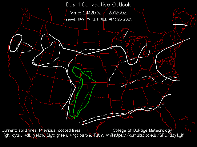
 Very scary indeed


Virtual storm chase
in Hurricanes, Cyclones and Extreme weather worldwide
Posted
Would be nice if that was delayed by a day or two as I don't get out until the 30th!