


jules216
-
Posts
1,160 -
Joined
-
Last visited
Content Type
Forums
Blogs
Gallery
Events
Learn About Weather and Meteorology
Community guides
Posts posted by jules216
-
-
I trust UKMo month 1, not the other 2. The month one is 99% nailed. Positive ENSO Phase 8-1 Sceuro high which gets flattened at times with the energy from nw trough. My analogs agree with it well.

-
13 hours ago, Redbull165 said:
The ENSO area around 1+2 is cooling consistently in the last few weeks. The warming is going more towards 3.4 area. Also SOI (Southern Oscillation) index in the last few days is actually on the positive side.

I see quite a big chance for central based (hybrid) el nino developing, towards the second part of the winter. But just my opinion of course.
Glosea SST prediction. I am still waiting for a new update now in november.
Different types of El nino events.
Dont look at tropical tidbits site it has the ENSO far too cold. The temperature distributions are far more close related to 1982/83, 1997/98 and 2006/07 then Modoki winters that correlated with more cold in Western Europe. Also its a strong Nino borderline Super Nino not moderate.
-
 1
1
-
-
The spatial distribution of this EL Nino is much more like canonical events of 1982/83,1997/98 or 2006/07. Sometimes its funny to read some American hopefulls talking about Modoki. Its like every autumn when you arrive at same time people always looking for what they desire to see,not reality

-
Biggest issue is that Ural or East Európe high pressure all the way from Arabic counties in nov/dec does often more damage then good. Examples only recently 2019/20, another one to note is 1960/61 as both viable options on the table. Particularry that early november pattern looks like a copy of 1960. I ve never understood the fascination/excitment in UK about the blocking E Európe/Western Russia high that at times reaches Ural.
-
Here is how my november analogs look like. A ton of similarities next week with a blend of 1999,2007 and 2017. Also UKMO on Board with settled start in UK. I am getting good wibes here in central Europe fór cold shots in November.
-
 1
1
-
-
ECMWF now looks very close to my superblend DEC-JAN in Europe. i made my mind up way before those fantasy september updates.
-
2
-
-
If we see a major cooldown in October early in central Europe a la 2002,2009 and 2016 then its good. If we move to freezer end of october a la 2006 or 1982, the crap. Because the MJO Has approx 60 days lifespan and MJO induced cooling around 6.10 then timing wise permits chances of decent timing come december. MJO induced cold late oct then means Indonesian forcing in december and crap to follow. Its almost as clear as it can get after studying All ENSO+ analogs. This is applicable for me in Slovakia as 2002/03 and 2016/17 were great winters.
-
1
-
-
I think that with very high solar activity +IOD and water vapor post HT eruption in stratosphere any -NAO will be reserved "if" to very back end of winter,something like 2011/12 maybe.
-
3
-
-
30 minutes ago, Met4Cast said:
Interestingly after a long period of easterly wind anomalies in the Pacific there are signs of westerlies returning, at least in the western Pacific. Perhaps a first indication of Nino/atmospheric coupling.
We've also finally got some coherent MJO signals of reasonable amplitude through phase 6, 7 and then potentially into 8. Assuming we do see +AAM beginning to rise through early October, with the arrival of the MJO transitioning into phase 8 i'd not be surprised to see signs of blocking across Greenland. Pretty good timing if a disrupted/muted SPV through a vital part of it's development process.
MJO phase 8 also correlates to HP over Scandi/Urals, albeit the signal is less strong compared with the Greenland high signal. Some interesting stirrings showing now for sure, personally would like to see those WBB anomalies grow much stronger.
There is no Ural high signal in EL Nino years when MJO is in Phase 8 in October but the signál is decent for Snow cover in Siberia.
-
The premier site did well, unfortunatelly the second one around Braemar must have been plagued by mist. So for now it is Foregin with -4.7°C unoficial september low.
-
 1
1
-
-
Foregin near Carrbridge this morning was -3.9°C. Station was installed at the fence close by where the image was taken in early summer.
-
5
-
1
-
-
1 hour ago, MattStoke said:
Common for Scottish glens to have their first frost as early as August.
Its much easier to achieve frost now in Scottish glens as out of 5 coldest locations this morning i think 4 are recently added stations and some of those were carefully chosen by me to be some of the coldest dolines in the whole of UK

Dont want to take the full credit for it of course but guys running the network needed the last 5% of fine tuning and scientific and graffic tools(Landsat maps).
I am only passing on the expertise as I was in the same position few years back when building my own Network and needed to undertand how the cold air pooling works as its not as simple. So I am happy that in nation of 67 milion people and thousand stations we were able to achieve further 1 to 1.5°C colder minimas last night then if those stations didnt exist. And imagine I was not once in my life in Scotland

-
2
-
1
-
-
15 hours ago, Catacol said:
Maybe Jules, but I think analogs are losing their usefulness with what is happening globally, and if forecasting was as easy in any case of lining up analogs then we would all famous by now.
Don't disagree that a SE Euro High has been as omnipresent as the North Pacific High in recent years and that is a frustration for many. But regardless of CC that is a pattern that will shift at some point and who knows....maybe this will be the year. One thing that seems certain to me - unpredictability is fast becoming the truth of things. The general envelope is warm - and the heat extremes are there for all to see...but this summer has also seen downpours globally on a significant scale. The pressure pattern over the UK in July and August was very stubborn - there was a feeling that the wave pattern would move on....but it didn't....and then it didn't....and before we knew where we were we had 6 weeks of entrenchment. Both the downpours and the stagnant pattern this summer offer hope for those looking for a winter with a decent cold spell.
They also offer significant potential for sustained flooding, long periods of mild and generally a grim situation. But we all know this already. Wet and mild winter lovers are in for a treat in the decades to come!
I dont know about the pattern in summer with regards to winter but 14.08 until about 24.09 will be basically unmowable high pressure here and really warm. MJO is in Nina atractor phases and despite this strong EL Nino rubbish ever since June we are in a Nina like climate here in central Europe. And by time middle of november arrives we know that in EL Nino its make or break with winter if we achieve Pacific forcing MJO 6-8 this Has Been consistantly not happening since June despite the model fairytales and you have seen unanimous error in all models fór Júly. This will happen in January as well with its -NAO fantasy, that will arrive in a fashion like 2004/05,2017/18 as a watered Down version in February so we firmly remain in top 10 mildest winters as we did with this summer here is Slovakia,because EL Nino forcing readily dissapeared. The anomally now Can show -4 Sigma NAO but we know NAO is not forecastable beyond 5 days not 4 months! We will see anyway.
-
1
-
-
11 hours ago, damianslaw said:
Time for this thread to come out of hibernation.. it plays hide and seek in September...
Alas Highland valley spots in the Grampians could drop close to freezing early hours tomorrow, with greater risk early hours Wednesday.
A light grass frost just about possible N Pennine cold spots, Shap and Redesdale Wednesday morning.
Welcome observations next couple of days.
North of Carrbridge.
-
1
-
-
4 minutes ago, jules216 said:
Even better example is the UKMO september update. It "could be seen by many clowns" as great update when using the MSLP. Yet using the geopotential its the same story as I dont know how many winters now in a row.
By the time we hit winter the seasonals will not look much different then the "superblend" of analogs for this winter. Favorable blocking if it even arrives wont be before february.
-
4 hours ago, RainAllNight said:
Perhaps because the signal looks better on the MSLP charts?

Even better example is the UKMO september update. It "could be seen by many clowns" as great update when using the MSLP. Yet using the geopotential its the same story as I dont know how many winters now in a row.
-
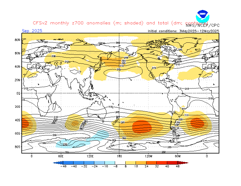
I am wondering out of curiosity why suddenly the seasonal maps that are floating around are of MSLP anomally rather then geopotential height anomally that is always exclusively used in model outputs. These always appear on the face value that pattern to the east is rather OK but when you look at height anomally its not and the T2m temperature anomalies in seasonals reflect that very well which on the EC seasonal as example show Well above average temperatures. I ve seen too many of these west based -NAO setups with +4°C and rain. They bring nothing but missery at elevations under 800m. I would take múch rather inversion dry cold then poor pattern to the east. Luckily the analogs(not seasonals) do not indicate "wet" blocking until February.
-
My provisional analogs tend to agree with December pattern on Euro seasonal but have the -NAO flip in Feb/March which I think would happen in strong east based Nino. From my experience winters with too strong Nino had about 2-3 week good spells of cold in Slovakia in overal a very mild winter,yet in a coolish decades compare to now - 1951/52, 1972/73, 1982/83, 1997/98,2015/16. Most of these ended as second or third mildest in their decades,appart from 1997/98 which was mildest ever up to that year.
-
At least 7 Highland stations with air frost this morning..Coldest Duthill with -1°C. Very impressive 15°C inversion T850hPa vs T2m.
-
4
-
-
On 03/09/2023 at 01:25, damianslaw said:
Thanks, surprised so low and little comment. The forecasts didn't mention any chance of sub freezing. Shows how cool an airmass we've just had. Very under the radar.
I am sure its because these are not official stations. There was another frost today in Highlands I ve counted 7 station below 0°C in Invernesshire and Aberdeenshire despite T850hPa being +14°C! It just shows what a carefully considered scientific approach does, re.cold doline placements. Out of those 7 I think at least 5 were installed this year using Landsat Thermal images.
-
3 hours ago, John S2 said:
Jules216 - what made you reject 2009 from your analogues? Just curious, not saying you're right or wrong to do so.
I had many more years in the list but narrowed it down a bit as I liked these more. I just dont trust such a -NAO outlier although one can argue fór it to be a good analog. We will see. I dont think big blocking will occur until February.
-
26 minutes ago, CreweCold said:
Hey CFS paint us the worst possible picture for December
CFS: 'Right on it boss'
Yeah, errr, please don't actually do that...
Hopefully we see these charts flip 180 over the next few weeks...
Uncanny as I was doing my analogs other day it looks almost identical.
-
If anybody is curious, my obsesion changed from long range,GSDM,stratosphere etc. to "Frost Hunting". We have installed about 15 stations now in Slovakia with almost WMO quality readings - Young or Barani radiation shields in frost hollows. Our premier location Poľana can achieve air frost even under +14°C T850hPa with increddibly nearly 15°C inversion. In May we measured -12.8°C about 4°C colder then May offical record in Slovakia below 1000m.asl. Here she is
-
3
-
-
45 minutes ago, Metwatch said:
Lots of personal stations recording an air frost in the Highlands last few mornings. Nothing overly rare at this time of year.
This is Felagie Glen station. Image 3 looking towards west, station is towards 2/3rds bit to the right. I think we didnt nail the spot 100% perfect as there is about 4 mtrs lower altitude we can go. Very rapid cooling 2 nights now where its almost frost before midnight while other cold hollows are about 1.5/2C warmer,then the drop slows and Corgarff or Carrbridge come close within minimas. Might be some valley low cloud or inversion also which slows the absolute drop. But I am happy. Yesterday it was coldest reading measured in whole of UK to date, previous -0.6°C in 2004 elsewhere in Scotland which is UK absolute minima for 1.9.
-
1
-
2
-


.png.647017d633f40588a7158c576e908264.png)


Minimum Temperature Watch 2023-2024 season
in Spring Weather Discussion
Posted
There is no comaprison with those offical UKMO stations against the location that we managed to find in summer, myself Lansat analysis and Highland weather sorted the placement - Foregin last night -7.8°C and now already -1.5°C coldest by 1.1°C vs other frost hollows