
- Popular Post


Derbyshire Snow
-
Posts
133 -
Joined
-
Last visited
Content Type
Forums
Blogs
Gallery
Events
Learn About Weather and Meteorology
Community guides
Posts posted by Derbyshire Snow
-
-
- Popular Post
- Popular Post
Good Morning all
I hope Mods do not mind this rarish post from me, but I will give a brief summary of the present offerings at the end
I usually only post when prolonged severe cold weather is very likely and that hasnt happened again this winter. I was born in the 50`s and seen years when each morning waking up to fresh snow on top of existing snow, often drifting well over hedges. These conditions were always under battleground conditions when you have an intense high pressure over Scandinavia in to Siberia and fronts from the Atlantic finding it impossible to reach any further than the British Isles dropping copious amounts of snow, and it happened throughout the winter , not just in late Winter/ early Spring.. South west England , often badly hit, areas were often cut off for weeks in the worst winters. Eventually this was usually followed by cold and sometimes bitterly cold easterly winds. There was sometimes a little melt during the day but the severe frosts over the snowy landscapes resulted in incredibly long icicles from the roof gutters. We used to have to knock them off, as they were so dangerous. When did you last see that. Ok , this didnt happen every year, but in the modern winters ( last 30 years) its extremely rare to see any prolonged spells as bad as that. One noticeable exception was December 2010 when a large area of extremely colder air hit us directly from the North Pole but that was gone by beginning of January. This was not a severe Siberian Easterly and it did not reoccur that winter, we need that intense cold from the East if you require a long cold spell as i would like to see again too. The climate is undergoing change... i am unsure what the future holds as regards the weather. Unfortunately we are surrounded by water and its warming up a little each year, the shortest track of water is to our east and thats where the severity we long for has to be from there. Its been lovely to have a colder than usual winter and its been prolonged cold, but would you call it severe. The snow has been lovely to see, thick and sometimes blizzard like for some, but did we all see it.... and those that had it, did it stay deep for long. In a blink of an eye, weatherwise its gone.
The take on the synoptics as now, looking at the models, and my long fascination with the weather.
As most of the winter, the models have shown incredible severe synoptics in La la land but none within 7 days. These have often been watered down to some average cold spells. I can see no change in my eyes. I think as the models stand, there isnt any sign of an intense Scandinavian/Siberian high that will benefit us, so that avenue is limited, but you never know. Ok we look North and that usually means temporary cold spells and if we are in luck some snow , but persisting more than a few days, that is unlikely,I cannot see a repeat of 2010 as the models are at present showing no signs of that. So that means probably a continuation of this rather cold weather unlikely to produce anything memorable.
This week we again have the jet stream a little further south than normal and fronts will be trying there best to make progress through the British isles but there is no intense cold air in situ or to our East or in Northern Europe and unfortunately its just that bit too mild for widespread snow, if any at all in the South. If we are lucky we could have temporary accumulations. I think eventually one of the systems will break through and will leave us again with polar maritime types of weather again with a succession of maybe not intense low pressures generally to our west.
The future this year
I feel as though we are unlikely once again to get any severe weather but as usual the case in these modern winters i would expect high pressure to become intense to our North east again in early Spring and we could have some interesting weather then. That is not to say this winter hasnt been one of the most exciting to follow in recent years.... and some have seen the first good settling snow for years
I end hoping that we all have at least one good blizzard. We deserve it, with all these promising synoptics
I love the banter on here, keep it up
Philip
-
 15
15
-
Thanks
Thats the guy . THE EYE IN THE SKY . I think he had some health problems. He was always hoping for a beast from the east,,, i just luv reading his posts
-
6
-
-
Just a quick one, particularly to amateuermet1963, dont give up. I am in my sixties and have been interested in the weather all my life and often just love reading the posts when something more out of the ordinary might happen. I admire the work that many take time to show all these maps and graphs etc .... a bit of it is a little out of my depth though.
My general thoughts:
We have been very very lucky that for the last 2 or 3 weeks we have had northerlies, north easterlies and easterlies but because of the warmer waters and warmer Northern Europe they have been watered down before reaching our shores. I feel the only way of getting what we want (proper snow) is for a huge area of minus10 or more to be exported from far Northern Hemisphere and be therefore still be strong enough when it reaches our islands , and even though quite a few of the runs have shown this, I have yet to see anything like this area reaching us within 3 days, only occasionally strips of minus 10 just about reaching Northern Scotland.
I know its been one of the longest spells of below average temperatures for a few years but severe cold it has not been. It is such a shame as we are now in the best part of the winter with such short days and to have snow now, that once settled, to be down for quite a while..... and the clock is ticking
I know this seems a bit pessimistic but its just what i see. i do really hope a SSW does the trick for us and if we get the rewards from this, and being in January or early Febuary it could be something special.
I will keeping reading and will be looking to the north and northeast parts of the charts with fingers crossed.
Its not really a model post but hope this one is Ok
Happy New Year to all
Ps Does anyone know what happened to Beast From The East. He used to post regularly in winter.
-
7
-
-
that was a classic run on how to obtain severe cold for the British Isles. The period around t135 , the trough disruption to the west of Greenland allowed most of the remainder of this run to pan out in to some sustained cold and what a result at the end , and very feasible if the mid run behaves.
-
3
-
-
13 minutes ago, mulzy said:
All FI of course but I'm loving the trough disruption to the west of Greenland at 156h from the 6z GFS

agreed, one of the best ways to sustained cold in North west Europe is trough disruption to the west of Greenland and heights usually developing strongly over the Greenland area. This can be an excellent indicator to a sustained northerly over our area of the world. We still need our share of luck but the percentages for a long cold spell are much better. Excellent looking run
-
3
-
-
First post since Christmas and what a complex situation we have now. The constant west to east jet stream in December and the high over Europe constantly trying to extend westwards to no avail has at last been binned and we have now a completely new set up to work on. In my opinion i am finding it really difficult to predict what will happen next,but all the models are predicting some sort of cool/cold spell but how cold and how persistent is the real question. The first colder spell from January1st looks certain but i expect it to be just a normal cold snap with some snow showers in far north and down the east coast. The key to a longer more severe cold spell is this high pressure in the Atlantic.Thankfully low pressure near the Azores should stop the high sinking and maybe drifting in to France ( worst possible route allowing the jetstream to be similar to December).
By far the best way to a lengthy severe spell are for heights to develop over Greenland and hopefully this should encourage the Atlantic high to ridge northwards and build in intensity, strong enough to either split the jetstream and sending low pressures to west of Greenland or deflect the jet much further south. If this happened then because of little heights over Europe the lows to the north of the British Isles would drift over Scandinavia and maybe in to North Europe resulting in possibly a very large unstable north and north easterly airstream, so many possibilities of severe cold from this position. Scandinavian High! Polar troughs! would be mouthwatering
What happens in the next 7 days i think could decide our weather for January. All i can say its great model watching. The building blocks are there but lots of luck required as usual for our islands.
-
6
-
-
- Popular Post
- Popular Post
3 days since my first post this Winter and as expected nothing really changed and its very hard to be optimistic as regards a cold wintry spell in the near future. Strong high pressure over Russia and Eastern Europe holding its ground and very reluctant to extend westwards.The position of this means that lows crossing the Atlantic reach a wall near our shores and push north or north east leaving us in sometimes quite an unstable but generally cool flow with the potential of some severe storms as the Russian high weakens and potential rapid cyclogenesis . The main culprit of course is the jet stream and unfortunately its starting to show firing on all cylinders.
jetstream over North America today, thats some force heading in to Atlantic
jetstream over North Atlantic forecast Christmas Day. Need one say more!
OK how do we get cold in this situation and its not easy.
My thoughts:
1. We need the Siberian High to push North westwards towards Scandinavia and hopefully deflecting a substantial low south east in to Europe thus bringing in some very cold sustained north easterlies. Even better if it would link up to a Greenland high. Highly unlikely because of this jet stream strength
2. The Siberian high to move away eastwards rapidly allowing depressions to move right through the British isles in to Northern Europe and Scandinavia allowing hopefully heights to develop in the North Atlantic. This could bring substantial northerlies to the UK, however topplers most likely as well. Unfortunately the depth of cold in Siberia is unlikely to dissipate enough, and to be honest looks set there for the winter
3. Or the best scenario a SSW which could bring a dramatic change of weather in a relative short space of time.
Lots of interest however later next week and hope the storm at present forecast for Christmas Day does not materialise. Possibity of snow on Northern Hills but nothing special
-
11
-
but when all hope we think has gone
tomorrows pub run goes off on one
and there is still ten days to go
till it snows till it snows till it snows
couldnt resist forgive me
-
6
-
-
- Popular Post
- Popular Post
First post this winter as i have seen nothing as yet to get really excited about for snow/cold lovers, and i am afraid to me it looks more of the same for a considerable time yet
Our main problem to overcome as last year seems to be the jet stream again, even though not as strong or persistent but still enough to push troughs and depressions across the atlantic and stop any western regression of the heights that are over over Eastern Europe and Russia, hence the very cold air stays put only making occasional teasing westward movement.
In my opinion there are two ways for very cold to hit our shores and that either would be a breakdown in this jet stream or significant southward movement of it to allow heights to develop over North Atlantic and join forces with extending high pressure from our East OR a complete breakthrough of the atlantic and through British Isles and pushing away the Northern European high completely, leaving us with low heights over the continent and a build of a high over Greenland and north Atlantic. In both these scenarios we with luck would get our really cold snowy weather from the north or east.
However after saying that there are still more optimistic signs than the rubbish winter of last year, and meaningful severe weather usually never starts until after Christmas, so lets enjoy Christmas and bring it on after. Even though it doesnt look promising now much can change in 2 weeks time.
Love reading all the comments on here and even after 60 years i never get tired of trying to comprehend the British weather, its never really boring
-
15
-
As i mentioned in this mornings post winter is a long way from being finished yet, and this run is proving what might happen. Snow potential for many areas , particularly for Scotland. Better and stronger ridging over Greenland slowing the atlantic attack at last and pushing lows further south . We are i believe heading for a late winter big battle between a developing Scandinavian high with assistance from heights to our north against our prevailing jet stream. We could be lucky and be right on the front line of this with some well deserved copious amounts of snow.
Climate does tend to balance out to a degree and we are overdue a proper cold spell. And what better time to have it now. This time of year fronts and showers can produce blizzard conditions.
Blizzard means snow so heavy you cannot see the car in front when you are driving.
-
1
-
-
Good Morning,
I have not posted for 3 weeks, hols but also nothing to get excited at in the models, but at last i see some light, all being a bit late but better than never. Late February and the first three weeks of March can still provide real winter and persistent snow on the ground, obviously some heights help and that 4 week period, if we are lucky, could provide some tasty synoptics and patterns to drool over.
Well whats changed
1. Time of the year ...traditionally one of the best periods for heavier snow showers and heights developing over Scandinavia or to the north
2. The raging jet stream over the Northern Hemisphere which has been our problem all winter has recently become more meridional over the Atlantic providing some colder polar maritime interludes, even though not providing the goods as yet. We just require some real heights to develop to our north and push the jet stream permanently further south. At present they are temporary ridges but my feeling is we are due a stronger block
3. AO is predicted a lot more negativity, unfortunately NAO isnt on board as yet
I have being looking at charts for over 40 years and my gut feeling is that we will get our strong Scandinavian High and push the Atlantic depressions further to the south giving UK the cold side of the jetstream, and if we are really lucky these heights may link west and join forces with a substantial Greenland high and bingo!!! Jet stream knocked out!! Battleground scenarios.
Heads up, i know its frustrating but the let downs dont last for ever and i feel our turn is coming. Hang on another week guys.
We might all see some snow falling Sunday, Monday anyway but the model runs later in the week could be even more interesting to view, and they are not really boring as in December and January
-
9
-
-
might have looked at wrong run there
-
35 minutes ago, Ravelin said:
That's a 'glass half empty' post and a half.
If, and it's a massively huge 'if' , the GFS is correct at "the end of the run", we've still got the bulk of the tropospheric PV to our NE and the "euro high" is off to the west of Portugal. I'm not saying it's fantastic but it's far better than we've had for most of this winter so far.
I do agree that the high is marginally better to the south west of us than in Europe. Unfortunately we have a strong jet steam which is steering lows over the top of this high. If we had a weaker jet stream the high positioned there would be then ok as it could link up to a ridge from Greenlnd and lead to a more persistent cold north westerly with air more likely to be from the north
-
1
-
-
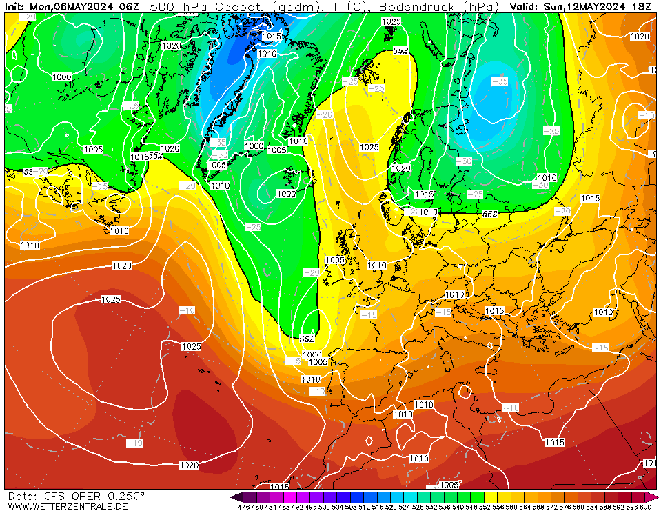
ECM at t240. Thats what i call interesting weather. If that verified we would have the following 2 or 3 days in Scotland very wintry. Without the strong jet stream that could easily become special nationwide. GFS in agreement with this chart at t240. I will certainly take that
-
I dont know what happened to my last post, but here goes again.
This latest run from the GFS shows the atlantic well in charge with a strong jet stream flowing throughout and unfortunately at the end of the run the jet trends back north. We do once again have some heights developing around and over Greenland mid run but not strong enough. AO and particularily NAO still positive in the next 7 to 10 days.
Its good to see the Euro high displaced but is now showing late in the run, to have transferred south/southwest of the UK. Still not a good position
However some Northern areas early next week according to most models , particularly on the hills, should get some snow during the passing of polar maritime air.
-
1
-
-
Afternoon
Jet stream as most of this winter is the driving force of our weather and it will not let up and looks unlikely for awhile yet. Our most important teleconnections do not encourage the jet to weaken or move significantly south. There is plenty of cold locked in to the north. For example this frame at t240 shows potential but while the energy is charging across the atlantic we are only going to tap in to it temporarily
A SSW is very important, even a minor one would help somewhat. It could split the PV, and encourage heights to develop over Greenland, halt the Atlantic flow and hopefully allow a substantial low to dive south in to Europe, leaving us in a very cold and long lasting north to north east flow. Not much to ask for i know, but its happened in winters gone by why not now. Unfortunately there isnt a major SSW predicted, but this could appear in days without much warning
As several have been commenting on here. The outlook at the moment is for some incursions of polar maritime air, great for Northern Hills, hardly spectacular south of the border.
The models are however still interesting to watch. We will get more cold and its fascinating to discover where it arrives from. Then as soon as we have a severe spell we are looking for when it breaks down. Thats model watching for you.
Will be on this evening, hopeful as ever.
-
6
-
-
Conclusion.
I was trying to look for positives in this run but deep down in my heart i knew with the very strong jetstream, it was going to be difficult to halt it. Flattered only to deceive mid run. A bit disappointed but the ensembles might be better
SSW, we need you. Lighting a very big bonfire in back garden, see if it will help
-
1
-
-
Later in the run the high in the Atlantic is trying to ridge north instead of defaulting back in to Europe. If we could only get a good strong Greenland high then we could have a block on our hands
A nice end to the run i feel is coming
oop! just seen the end. bad call. There always next time
-
1
-
-
That jet stream out of US again is relentless and is going to smash straight through the atlantic ridge i believe, Not liking this run at all. I am sure we will get a teaser at the end again. Keep us all to come back tomorrow
One positive, we are losing the heights over Europe
-
I wish i could say that teleconnections were better, but because our region of the world weather is so difficult to predict, regional variations can sometimes override teleconnections. It would be great to see negative AO or NAO and a SSW to split the PV , rather than just displace it. In the latter part of the GFS op i am hoping that this run proves we can get what we all want despite background signals not good.
Fingers crossed, taking a look at the run now from back of sofa
-
1
-
-
I like the way the jet stream predicted tomorrow for the US has a north south look. Should be interesting how GFS will interpret that about half way through the run. Will we get a proper blocking high develop, or one of the transient ridges which would still give our UK some welcome polar maritime precipitation and in this winter thats a bonus.
-
1
-
-
Evening,
the split jetstream over the US i mentioned last night that i thought just might slow down the atlantic or at least push the jet south a bit, and encouraging some developments on this side of the pond. That possibility is now being picked up by some models. I will be interested to see what the GFS run does this evening when i log on later. It would really be a positive move if we can obtain some better heights over Greenland to push the jet stream even further south . It would be the perfect time now for an arctic high to make an appearance.A change is afoot.
-
5
-
-
1 minute ago, Rocheydub said:
It's all good folks, I just found the ultimate chart on the CFS... Just ignore the date and the T-1000000 hours away, and you should cheer up!
ah the ssw at last
-
1
-
-
4 minutes ago, TomDav said:
The frames after this would be interesting. Nice WAA into Greenland as well as low pressure near Italy
The look of our area of the world does look different at the end of the run, but i get the feeling the jetsstream is going to ruin all the promise again, but happy after all with this run. A bit of a rollercoaster


 Later in the run the high in the Atlantic is trying to ridge north instead of defaulting back in to Europe. If we could only get a good strong Greenland high then we could have a block on our hands
 I like the way the jet stream predicted tomorrow for the US has a north south look. Should be interesting how GFS will interpret that about half way through the run. Will we get a proper blocking high develop, or one of the transient ridges which would still give our UK some welcome polar maritime precipitation and in this winter thats a bonus.


Model thread discussion - cold spell looming
in Forecast Model Discussion
Posted · Edited by Derbyshire Snow
Afternoon all.
I thought i would do my second post this year and i am a guy who loves extremities of weather. I have never really been truly taken in by this easterly as being a severe one , yes very cold and snow showers but where are the blizzards and snow fronts that arrive from Northern Europe/Scandinavia . The cold we have now originates from low pressure that has originated over Spain and as this moved north east and reached the Netherlands easterly winds formed that has introduced this colder air. A BFTE is more likely to take place when intense high pressure has built up and in place over Scandinavia/Siberia and if possible links to a Greenland high and then low pressures from the atlantic are diverted to the south of us and well in to central Europe. The charts do not show that but however they are once again showing possibly in the near future of some heights to our NorthEast but long lasting , i doubt.
This winter so far has been remarkable for the length of moderate cold we have had and no really mild spells. It does look this week after the snow showers of today and nearer the eastern coasts tomorrow, we will have several dry days at last and some hard frosts with daytimes nearer zero. Thats not a BFTE . Being as I am now in my sixties and have had a lifelong interest in weather and some years ( primarily sixties and seventies and odd exceptions later) i can rememember that roads became so bad with the accumulations of snow , and had to be dug out and became virtually a single lane down the middle with drifts either side over the hedges and we are in Chesterfield at only 80 metres.
Models as they look now and near future.
Easterly and then south easterly winds seem to dominate, and after early snow showers, from midweek lots of sunshine but cold and dry with very hard frosts. Great for your daily exercise. Then it looks like we will have some sort of battleground developing next weekend . This looks a bit iffy and very unlikely that we will have l have a classic blizzard stalling front, and then more stalling fronts to follow producing even more snow before the melt takes place. If this does happen and we do get stalling fronts and they go under in to Europe then this will give time for heights to really develop to the north and east of us and that could produce something very special. I cant see that, but one to watch.
Models after next week.
Once again this long rather cold winter looks like continuing with mixed results. High pressure developing to the north east this week looks to be gradually pushed away as depressions start pushing towards British Isles trying to introduce milder air. I am sure this cold air will not be lifted quickly . We do however need one of these depressions to swing in to Europe and not stall to the south or west of us. With the jet stream still further south than usual in the relatively active atlantic, the prospects are still there for significant snowfall particularly the further north you live
My feelings beyond that
I do think we will have a continuation of this cold winter and during early March we may hit the jackpot. To have a winter with such beautiful synoptics ( often 10 days away)it would be a shame to not have a memorable spell of severe weather. In this modern climate it could be years before having another winter like this with so many chances
There is still time, as it would not take much movement of this winters pattern in the Northern Hemisphere to produce the real goods. and dont forget the SSW which may or may not move this pattern to our advantage very quickly.
Hope you all receive some snow in the next 24 hours and it should last on the ground all week. At the moment i am looking at all the blobs over the North Sea and hoping that they will clump together to give all of us settling snow. My weather radar updates every 15 minutes and there does seem some development taking place over the North Sea nearer Norway . I will be watching it closely next 2 hours . It looks in line for Northern England ... sweet spot would be Yorkshire looking at the flow. If it develops i would expect nearer 5pm it could get interesting
Philip