


Updated_Weather
-
Posts
905 -
Joined
-
Last visited
Content Type
Forums
Blogs
Gallery
Events
Learn About Weather and Meteorology
Community guides
Posts posted by Updated_Weather
-
-
19 minutes ago, seb said:
Not sure if it's 30% (the text states confidence is very low) but considering the struggle of the models at the moment, I wouldn't expect anything else.
I’m talking about the cold weather alert warning as it’s been extended & they said stated this event which could affect London and the S/E has a 30% chance at this stage. As if it did occur could cause disruption.

-
 1
1
-
-
8 minutes ago, seb said:
MetO warning for Sunday's SE feature just out. 2-5cm widely, 10cm in places.
They’ve currently placed a 30% of this happening
-
 1
1
-
1
-
-
Just now, Snowy L said:
Not much difference between 12z and 18z out to day 4. Atlantic low maybe a tiny bit weaker.
And slightly further west
-
I really don’t understand the panic and the “it’s over” comments..
this low which btw is only just forming and we don’t know how strong/how quickly it weakens (because it will weaken before it gets close to the UK.
it’s only normal models are playing with some ideas on where they think it’ll head.
but from my POV, I won’t comment on what could possibly be significant snow or just cold & dry, or maybe a mild blip. Who knows. I’ll wait until Friday when we will know a lot more on what position we will be in.
for now we will just keep seeing a lot of chop and changing.
-
2
-
1
-
-
When does the 12z ensemble come out?
-
Just now, Eagle Eye said:
3 all. Penalty shoot out anyone?
Just goes to show.
No-model has any idea.
One thing I have learned whilst being on this forum is, we get into these scenarios time and time again & the reaction is always the same.
Everyone just needs to remain calm.
We don't know the outcome yet. ECM could be wrong. or right. It doesn't matter, weather will do what weather wants.
We await the ensembles to see where everything stands.-
7
-
-
10 minutes ago, Bats32 said:
The "Azores hurricane" is forming https://twitter.com/NHC_Atlantic/status/1599768945380454400?t=6lYfOi3TofNfPeLJTdsJjg&s=19
They don’t seem to think it’ll do that much

-
5
-
 1
1
-
-
18 minutes ago, mathematician said:
I hope I'm very wrong here, but I don't see much precipitation with these synoptics.
I'm afraid we will see cold weather, hard frosts but not much in terms of snow.
Like I said if I'm proved wrong I'd be the happiest.
you aren’t going to know if any snow/precipitation is on the way until much closer,
Most of the case, things pop up at short notice, little features.
as long as we see little kinks on the fax charts, there is always that chance is some sort of precipitation being shown.
-
8
-
-
-
2 minutes ago, MAF said:
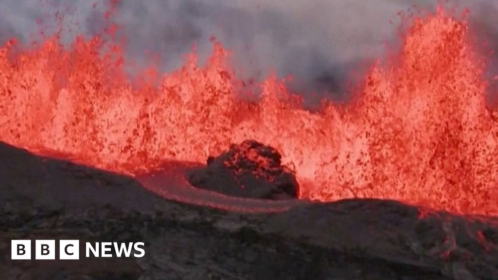
I wonder if Mauna Loa will have an impact in the near future?
 Spectacular scenes as Hawaii volcano erupts
WWW.BBC.CO.UKAerial footage shows Mauna Loa, the world's largest active volcano, spewing lava into the air.
Spectacular scenes as Hawaii volcano erupts
WWW.BBC.CO.UKAerial footage shows Mauna Loa, the world's largest active volcano, spewing lava into the air.not model related, I know, but still, it could affect things in a week or so depending on what's blown up into the atmosphere.
Pretty sure that volcano will mainly be lava and not much in the way of ash etc.. Could be wrong.
-
1
-
-
1 minute ago, Lukesluckybunch said:
We need to be in the same stage as this come Saturday evening I reckon,if we are..then it's almost nailed on that we will turn very cold end of next week..as of now are still 8-10 days away from it..But even still it's looking more and more likely..the consistency of the ECM is quite brilliant!
Nothing is never nailed on. Unless 48/96hrs away imo
Things can pop up at short notice.
But I guess it does depend on the pattern. When high pressure is involved, you usually can get increased confidence.-
1
-
-
Just now, Neilsouth said:
Glad I told everyone to ignore the GFS yesterday, especially as it was throwing up dartboard lows again! Always ignore it when it does that.

When it’s confused! It tends to always try and revert to a flatter pattern. I.e dartboard lows, or raging westerlies!
-
3
-
-
I guess I’ll join in again.
Another year and another chase.
Absolutely loving the prospects and what possibly could be on the horizon.. GFS started with its usual tricks. But the mighty ECM holding strong and remaining consistent kept me relaxed, and look where we are now. GFS following the ECM. ECM is king, and it’s showing why at this stage.
We are in a VERY good position here folks. Remember get the cold in first, then we look at snow opportunities - Strap in!
-
7
-
1
-
-
On 19/07/2022 at 21:07, mb018538 said:
Looks like UKV went a bit mad with its 42/43c predictions. I think without the wind we probably would have got nearer to that today. Was very weird having 40c and gusty boiling hot winds.
Maybe not..
Some weather stations report weekly so won’t know yet if some areas did reach more than 40.3c
-
1
-
-
On 18/07/2022 at 07:19, Alderc said:
Absolutely none of the models handling the current showery activity in the south well at all. In fact most have absolutely nothing, I wonder whether that could be a spoiler for south today? It’s actually quite cloudy where I am currently.
doubt it.
wall to wall sunshine here in Essex.
-
1
-
1
-
-
Latest outlook for this weekend from Matt Hugo - “Troublesome transition this weekend continues.. 00z GFS ENS highlights for N Eng. Note the ‘clean’ drop in theta-e from yesterday’s 12z on Sat which is no longer present on the 00z run. Possible developing low (00z UKMO eg) over France the catalyst for delaying clearance of heat’

-
3
-
1
-
-
Tbh.. I can sense this going one way,
we’ve had this high pressure for a while and continue to have it.. quite similar to 2020.. and look what happened in feb 2020.. high pressure made way for several named storms and wind.
-
2
-
-
I mean.. Not saying its right or anything, but GFS has been quite consistent with itself recently.. Whether that is wrong.. Remains to be seen just yet.
Quite interesting imo-
1
-
-
-
-
On 15/01/2022 at 22:11, Tim Bland said:
Can’t be the only person wondering if we can shift this pattern west a few hundred miles west in 5 days…
All very possible of course.
-
1
-
-
On 15/01/2022 at 10:31, Lukesluckybunch said:
how frustrating it is,at 192 we are close to somthing very cold! in terms of a easterly again we miss out!
Not really frustrating when imo it’s FI so changes are very likely. In our favour or not.
-
On 14/01/2022 at 11:04, Hull 1963 said:
We have a full moon on the 17th some solar/lunar forcing, which models do not account for, this may nudge the cold our way via activating the Atlantic.
We shall see.
Yeah don’t think that’s how it works..
-
5
-
1
-
-
On 14/01/2022 at 05:07, northwestsnow said:
GFS 00Z =
Victory
Very different from 18z in FI..
-
4
-


Winter 2022/23 - Moans, Ramps & Chat
in Spring Weather Discussion
Posted
It does seem like all models have massively underestimated this PPN & the extent of it,
closely watching the radar as it pushes N/E -
areas like
- Essex
- Kent
-Sussex
- surrey
- possibly London,
all look in a firing line - maybe 2-5cm expected here, maybe 10-20cm on higher ground ofc
we will see how far west this could push and how heavy this PPN stays as it pushes N/E
As I say this,
MetO increase the likelihood and bring the time forward