


Lakes Tom
-
Posts
82 -
Joined
-
Last visited
Content Type
Forums
Blogs
Gallery
Events
Learn About Weather and Meteorology
Community guides
Posts posted by Lakes Tom
-
-
Light rain/sleet Leeds city centre now

-
Lots of talk of the low being moved further South by the 12z and 18z, but there still appears to be a fair bit of precipitation for West and South Yorkshire. The GFS precipitation chart up to T36 is usually pretty accurate. Game on! B)
-
Yeah - On Thursday night, the precipitation is definitely heavier for Yorkshire and pushes slighty further west too!
-
There appears to be a distinct pattern over the last week in terms of GFS outputs. The 06Z in general, seems to have downplayed the potency of this cold spell, with much doom and gloom on this forum. In contrast, the 12Z and 18Z seem to have hyped up the potency. I suspect that somewhere in the middle lies the true picture.
-
...and now it's snowing again in Leeds. Moderate to heavy.
Where abouts are you Skywatcher?
Definitely a bit more of a sleety component in the city centre
...and now it's snowing again in Leeds. Moderate to heavy.Where abouts are you Skywatcher?
Definitely a bit more of a sleety component in the city centre.
-
Really quite heavy rain in Leeds city centre now. My school is 900ft above sea level in Bradford - Must be starting to give a fair coating up on the tops now! Here's hoping anyhoo!
-
Just watched the 10.27 BBC weather. Definite shift of the projected snow risks - now includes area up to and including North Yorkshire!
-
If I remember rightly the GFS had things about 20 miles further S than they actually reached although it did a pretty good job. No idea about the ECM, didn't see it.
Basically if you want to nowcast, watch for two things - the low deepening more than forecast (as this will expand the baroclinic zone, basically where the fronts are) and look for it moving as N as possible. This site is good:
http://cimss.ssec.wisc.edu/tropic/real-tim...ges/images.html
Use the grid squares to work out exactly where it is, then at every 6hr interval compare this with the GFS/ECM/UKMO e.g. look at the satellite at midnight and see how this compares with the ECM and UKMO for the same timeframe, with the GFS 18z obviously this will have to be 3am! The bigger and further N the difference, the better.
Cheers Yeti. Hehe - might leave that one til tomorrow though!
-
Sorry there mods got a bit carried away in all the excitement.
Very good news tonight re. the channel low, we now have this 50 miles further N and this is making all the difference. All models now are moving N in line with each other, except for one model which has remained steady throughout - the ECM. Now, this might make you think it must be wrong but IMO this may not be the case. All other models have shifted about a lot (and are still shifting) except the ECM which has kept consistent:
(chart of the day for Yorkshire and Durham): http://en.vedur.is/photos/atlant_evr_urkom...208_1200_36.png
We may see that this trend continues N and we see the ECM right in the end, on the other hand the ECM may back down. But its consistency must mean something and it is the most reliable model in general.
Other two great pieces of news tonight are the GFS 18z, which only needs another 20 miles for a snow fest for all of N Yorks even, and the UKMO, which is almost identical
Can you remember what the ECM and GFS precipitation charts showed for last Fridays (or was it Thursday?! - so many snow events!) low at the last moment? Were the charts like this (and the snow frustratingly didn't make it into West/North Yorkshire) or are this evenings chart better?
-
Draw a line indeed :-)
Curve then! Optimistic Northerner :lol:
-
"QUOTE (Delta X-Ray @ 8 Feb 2009, 08:41 PM)
Check out the speed of the clouds approaching from way out west of Ireland. Makes me think even Jockistan could get caught up in this system - not wind wise, but ppn. Temps are still way cold up here with snow already falling tonight.
Also makes me wonder if the system has nudged northwards more than we think?"
Perhaps a bit of a simplistic way to try predict where this system is going (I appreciate the earth isn't flat!), but if you draw a line from where the system enters the screen at 4.00pm and where it is positioned 8.45pm, it would appear the Northern most edge may actually clip southern Scotland, but certainly Northern England!
-
Check out the speed of the clouds approaching from way out west of Ireland. Makes me think even Jockistan could get caught up in this system - not wind wise, but ppn. Temps are still way cold up here with snow already falling tonight.
Also makes me wonder if the system has nudged northwards more than we think?
Perhaps a bit of a simplistic way to try predict where this system is going (I appreciate the earth isn't flat!), but if you draw a line from where the system enters the screen at 4.00pm and where it is positioned 8.45pm, it would appear the Northern most edge may actually clip southern Scotland, but certainly Northern England!
-
The 8 O'clock News 24 weather was a lot more vague than they were this afternoon. Earlier they were saying rain in the south, with snow on the Northern edge (i.e the Midlands). 8pm - No areas mentioned, but the graphics showed the front up into at least South Yorkshire. Added to that the numerous positive models getting on board. Changes a foot i feel! Yorkshire and possibly areas slightly to the North could be in with a good shout!
-
What a turn around! Looking pretty good with UKMO, ECM, JMA and NOGAPS on Board! The Met office as of 4.30pm have extended their weather warning for Monday and Tuesday to include areas further North, including... Yorkshire! Lets see the GFS 18Z come on side.
As for the immediate snow risk in West Yorkshire. This Band of precipitation does appear to be diminishing somewhat and could be describe as a bit of non-event! Bring on the 18Z!
-
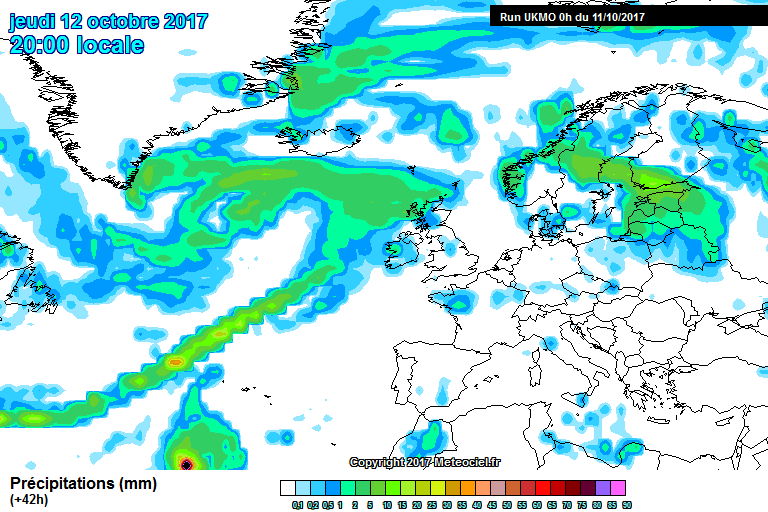
MAJOR DEVELOPMENT WITH THE CHANNEL LOW!!!!!
http://www.meteociel.fr/ukmo/run/UW42-594.GIF?08-17
UKMO SAYS NORTH - this means the snow risk encompasses the whole of Yorks :huh:
Yeti.............I think I love you! Get in......lets hope the GFS 18Z shows a shift northward too. The 12Z unfortunately didn't, with the precipitation only making it as far as the midlands. Come on GFS 18Z, throw us guys in W Yorkshire a few crumbs!
-
Really light snow in Leeds city centre. Interesting it's moderate and settling up at Leeds/bradford airport!
-
Hi Brian, hope you are keeping well
There is a shower appearing on the NW radar that looks like your way - it just went right through my postcode but nothing happened, no threatening clouds either! So don't get excited about that I would say.
Precip now at the Pennines and crossing over OK, but it will probably diminish. Notice how thin the front is compared to other areas of the UK - that's heading for us
Bad luck again probably, let's just hope the ECM is right with the storm tomorrow. GFS 18z will be out very soon so within 20 mins we should get another look at the potential track.
Dave
Really hope it shows the low track slighty further North. Was so frustating to see those showers from last weeks low make it as far as North as South Yorkshire and No further. Leeds has had it's fair share (If you compare it to NW England!), but another hit would be most welcpme!
-
You lot are pessimistic bunch. Of course the pennines will take some of the force out of the precipitation, but the main band has not made it into West/North Yorkshire due to timing. Give it a couple of hours and the main band will make its way over!
-
Yeah pretty heavy in Leeds city centre now.....All schools run by Bradford Education closed tomorrow.......Beers for me tonight.....Let it snow, let it snow..........
-
The large band of precipitation looks on collision course with Leeds/Bradford!
+ Harrogate!! -
Im in Leeds centre, by the armouries. Got a couple of cms. With such low temps, don't think altitude is going to be such a great factor. Extremely rare to see snow falling and lying in the centre. With the snow in November, it was amazing how even a 2 minute drive out of the city centre bowl, there was a gd couple of Inches, but nothing in the centre!
-
yeah - ace shower in Leeds at moment! All surfaces very quickly turned white...keep that up and my school/work 'll be shut tomorrow!
-
We (West Yorkshire) are definitely in the firing line of the large bank of cloud out in the North Sea....Reckon another couple hours before it hits land - but should be some fairly beefy showers asscociated with it, which should carry a long way in land! :lol:
-
Have just watched the video and it worked fine - don't know loads about the charts so this video was really helpful. Cassie on Lakes Tom's login.


Yorkshire, Lincolnshire And The Pennines Cold Spell Discussion
in Spring Weather Discussion
Posted
Clouds looking really heavy in Leeds city center....can't believe it's not actually snowing, the sky looks so full......Rain today looking pretty good for a few direct hits in the near future.