


swilliam
-
Posts
498 -
Joined
-
Last visited
Content Type
Forums
Blogs
Gallery
Events
Learn About Weather and Meteorology
Community guides
Posts posted by swilliam
-
-
The heavy stuff has our name right on it here in Northampton if it keeps going in the same direction

-
Certainly fasinating to watch it develop later on.
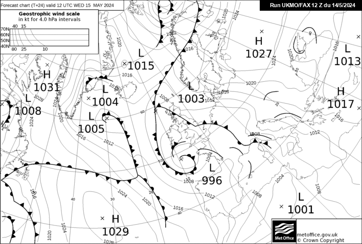
Looking at the updated +24 fax chart and we can see another band of snow moving into E Midlands/Norfolk tomorrow morning which moves S during the day.
http://www.meteociel.../fax/fax24s.gif
The GFS supports this at the moment.
Maybe the MetO are supporting the GFS as well - they have just issued a warning for Northamptonshire (and other areas - including Peterborough) possibly more the 20cm of snow this evening.
-
I disagree.
During the cold spell last Feb I found on a few occasions the Met O disagreed with the GFS charts and the GFS was proved correct. I would never go against the GFS precip charts from 0+ to +48.
As i've said in the regional thread this will come down to nowcasting.
I hope you are right - it would be much better for me. It will be an interesting comparison after the event.
-
Latest gfs looks like a huge upgrade for the east midlands towards london and a huge downgrade for the likes os south east wales/west midlands...
http://www.wetterzen...cs/Rtavn184.png
http://charts.netwea...6/18/ukprec.png
looks like the heaviest preciptation/developing low may be further east now
I would not bother with the GFS for this short timescale and detailed ppn. The latest (06Z) NAE is just out and is still showing the ppn intensifying over CS England and the West country
Still over 20cms snow predicted
-
Yes i agree to some affect, but you can't have long range without short range, a lot of people are not specifically experienced or interested in the models in regional threads, they are more interested in guidance and information (other members forecasts etc, and reading John Holmes verdicts on things "including his LRF'S which i must say are spot on").
It's down to the moderators and Paul,
I can only say so much, and if a lot of members don't agree with me then it's no skin off my back, all i want to have is a place were we can discuss reliable time frame, and enjoy it. And not having to go through 3 pages of posts just to find something discussed on the short term models.
Lewis
I think if a major or interesting event such as might have happened Fri/Sat comes up to the reliable time frame then there will be a lot of discussion about the short/medium term models. There were two cases recently. The first was the easterly before Xmas with the track, position and alignment of the SW that came down the North Sea and introduced the Easterly being endlessly discussed. Similarly we had the case recently when we had the infamous low that introduced the current cold spell. There was much detailed discussion about the movement of the low and the prognosis from the different models. In fact there was even discussion afterwards about which models called it correctly. If the possible SE event becomes more likley again there will be plenty of discussion (and not because it is in the SE!) as there will be when we finally get the Atlantic trying to break the cold spell - which appears to be likely in a couple of weeks time.
PS I concur with NS above - the regional threads are almost impossible to read except for reporting of snow events.
-
If you closely looked, it's the same regular posters in here, Kold weather, TEITS, Steve Murr, Nick F (which don't get me wrong, know what they are talking about) but it's the rest of us that have to pick up the scraps and scratch our head to what they are talking about, because 9 times out of 10 they are always talking about FI and trends, and if anything is in short-term/reliable time frame, they only mention "IMBY".
Short term/ realible time frame too me is 0-72 hours generally, but out to 120 hours would be fine.
And to the moderators, i'm terribly sorry for going off topic, and i really hope i don't make work much harder for you, because i appreciate your busy enough.
Lewis
I believe that 0-72 hrs is pretty well covered by either regional threads or will it won't it snow type threads - perhaps the mods could give you some guidance there.#
And one other thing - people are interested short term with the current set-up - if we had 5 days of mild dry SW winds or anticyclonic gloom progged then you and a lot of others would want to be talking about upstream development.
The usual people as you suggest are discussing this most of the time - then when some cold weather comes into the semi reliable time frame this thread becomes clogged up with the will it won't it snow brigade.
-
Thanks,
I already made a proposal about that to Paul via pm, i also made a thread for it to be deleted right away, a lot of people don't realize that the model is not all about FI and trend spotting, 99% of people are more interested in what the models are showing now and in reliable time frame, because anyone with common sense knows things change so much with models!
If people want to talk trends and bicker about FI, then this is the thread to do it;
http://forum.netweat...del-discussion/
In depth and technical model discussion
This thread is for general, a lot of users may not be "experienced" with charts, like me, i'm good with reading charts, but not at patterns or trends, i take every run as it comes. I don't look into FI, i'm more interested about now, and tomorrow not next week. Or in 3 weeks time.
Thats why so many people get confused on here.
How do you know that 99% of people are more interested in what the models are showing now - if that was the case 99% of the posts would be about that. What do you define as the reliable timeframe, it could be anything between 24 hrs and +144 hours depending on the setup. Some people might be interested in 1 day, some 3 days, some 5/6 days - do you want a thread for each of these? Also if it is the reliable timeframe then there is nothing to discuss? This thread is currently for everybody to use to discuss the model output and you should respect that. If something does not interest you then do not read it.
-
A NE/NNE,ly was always likely at first based on the model output I have seen recently.
This is reminding me very much of what happened before xmas. Personally aslong as the UKMO/ECM/GEM continue with the same output then I reckon the GFS will revert back to the E,lys.
If anyone can't remember what happened before xmas I will remind everyone. The GFS had a 24hr wobble and then the ECM 12Z followed with dreadful output. However the next day the ECM returned to normal i.e blocking and then finally the GFS reverted back to its previous output. During this period the models indicated a very slack E,ly and it wasn't until the cold spell came with +72 that the E,ly upgraded.
Obviously this doesn't mean it will happen again but its worth remembering. I will say though that members looking for the snowstorm at the weekend should forget about it.
The thing though TEITS is with the pre-Xmas Easterly this was being determined by the position of short wave moving down the North Sea - where it it went and how it was precisely aligned. In this case we are looking at the low over the med - how far North it is, what is the alignment and does it engage with the upper cold pool that will be over us (the most important ingredient I think). So it could upgrade - especially if the GFS is being too progressive moving the low East before coming North but I think this will need to be a real upgrade rather than an option - if you see what I mean!
-
Not much sign of undercutting at T204 on this run. The Atlantic low is too far North, too deep and poorly aligned.
-
FWIW the GFS control run shows the other option, with the Atlantic attempting to come back in, probably a big snow event but the less cold air wins out in the end, still not what I'd call mild mind you BUT a far cry from the 18z synoptics.
I have had a quick look at all members 192-384 to look for some trends.
A lot of the members have lows trying to undercut the high with varying degrees of success. in some cases it results in some very impressive synoptics (with extensive Northern blocking) but not that cold uppers. If a cold pool remains over SE Europe then that can get advected over us and in a couple of cases a cold easterly is reestablished. Sometimes the high retreats to SE Europe. There are a few members that just sinks the high with inevitable results. What is not shown in any members is retrogression of the high towards Greenland and then a reload from the North - so we can possibly rule this out even in fi. So for any reload we will probably need to look to the SE and then the East. Best members if you want to look at some nice charts are 1,3,7,8,16, and especially 15 (other than the ones that are not in FI of course - can't even say eye candy now!)
-
Am I not reading that chart right then? What are those lovely blue and green colours covering the SE & EA?
Light to moderate ppn totals probably due to showers. The main ppn from the low is centred over most of germany
-
the snowfest at the weekend never makes it out of germany on the ensemble control run.
-
Nice GME for cold and snow in the South and East as well.
-
Quite cold predicted by the GFS in the highlands for Friday morning
-
Another great run from the 18z including the ensembles.
This is showing nearly 2 weeks of cold weather. This was backed up by Chris Fawkes on the last BBC N24 weather forecast where he boldly stated that the cold 'snap' may last for as much as perhaps the next 2 weeks. This is almost unheard for the BBC/Meto to stick their necks out like this. They obviously believe the ensembles unlike some posters on here. I would like to know what they think a cold spell is if this is a cold snap though.
-
An improvement in the long term from the GEFS ensembles. Looking at the T240 charts many are now showing the Scandi/NUK high with an easterly in the South where as yesterday on the T264 more were not.
This is demonstrated by the mean which, even at this long range, shows the high between Scotland and Norway. The mean T850 has <-10 air over the SE - quite unusual for T240 chart.
So I think we can say that even at this range it is more likley than not the cold will be sustained by building of the High to our North with a v.cold easterly possible in the South.
It seems to me that there are two key features needed for this to happen;
1 the v.cold air needs to reach the Western Med which then causes the European low to deepen significantly and support the high
2 WAA to the West of the UK promoting the growth of the High somewhat west and North and so avoiding the Northern arm of the jet going over the top.
Both these effects can be seen on the ECM and the 06GFS
As a final note I do not know if this has come up before but I see the Meto have changed their long term winter forecast and now give chances of a colder winter to 45% and milder is now only 25%. Seems like nowcasting to me.
Just a quick point regarding some comments being made regarding 47-63-78 ete.People comparing the current outlook to these specific years should really take a deep breath and relax.T he current outlook is for cold weather showers towards the coast ete,which is now the case.Looking out of the window now its a dry cold winters day ,nothing unusuall really.Models out 2 144 hours may change this but to me nothing spectacular.
63 was very dry as well as cold - I think we would say that was quite spectacular.
-
http://www.knmi.nl/e...M_06260_NWT.png
These have now updated- the crucial thing for me- ( apart from the fact that its one of the mildest) is that at day 8 when we all said it would be wrong the 12z operational temperature profile is going against nearly every other member-
the Operational has it warming up- whilst nearly all the ensemble suite has it dropping off a cliff again-0
S
The odds looks about the same for the ECM ensembles as for the GEFS ones I posted previously.
-
Looking through the GEFS members at +240 there is some support for the ECM OP evolution - maybe 20-30%.
Looking towards the end of the run probably over half do not support much of a cold continuation (including those with a Sthly wind)
So guaranteed cold for 6/7 days, then maybe 30% chance of losing it around by 10 days followed by something around 60% at far FI. Pretty good odds I would suggest. If we were in mild sw winds at the moment we would be talking about the possibilities for cold solutions in FI - not the opposite.
-
Guys, I've been analysing most outputs on this site for the last 2 years, and am what you call in England a Scientist by profession who inputs into the virtual soup we all are reflecting on. I remember Winters from no earlier than the 70's, but certainly recall and smell the air of the times we used to skate on a frozen pond, certainly not every year, up until the mid 80's in farm land in a part of southern Ireland. The farmland was named "Ice House Hill" (which was a parkland area named as a result of a building situated nearby that the Victorians used to store ice in from the very same pond that we skated on that would freeze up on occasions, and they would grab the ice to store for the summer) anyway the ice formed as it did last when I was a little chap and for the first time in 20 years, this year (I have not been here every winter since I was a boy) the ice froze hard enough for me (13 stone, 6 2") to jump on it on Boxing Day. No it was not as thick or covered as '87 but it held my weight!
Having wished for hot summer weather these last couple of years, and not got it, and now having cold winter weather and living in it I can't help be feel sad for folks that are being anal about the output, why not take this and enjoy it, go for walks with your loved ones or yourself and enjoy the countryside and feel the weather on your face and feet and come home and feel housed. Rant over and sorry for any spelling mistakes
Nice rant but I am afraid some people are never satisfied and, worse, seem to think that every winter in the 60s, 70s and 80s, had endless cold periods and massive snowstorms. My teenage years were from 1970 to 1977 when we had a succession of snowless winters (like recently) but despite this I became really interested in weather. When we did get some cold winters 78/89, 81/82 Jan 85 (although I was in Scotland that year and this was quite an unmemorable event), Feb 86, Jan 87 and Feb 91 these were characterised by either single very cold events (87, 91), some longish events (eg few weeks but only 1 or 2 snowstorms 81/82, Feb 86,) or cold periods (say 1 week) interspersed with milder periods . The forecast charts we have now are remarkable -especially when added to the cold spell we have just had. I am personally enjoying them and the speculation we can have about what weather they might bring were they to verify (or come close to this). I agree with you that it rather depressing reading the post moaning about lack of snow/cold etc and try to ignore these posts as much as I can.
Based on the current model output I am hopeful that we will have some interesting times over the next few weeks and we will have memorable weather to recall in future years when we are going through the next fallow period.
-
Has anyone got the ECM ensembles, or the link to them?
The op was not the coldest by any means!
-
Looks great but that is way too far off, and fraught with even more risks as the milder air sweeps in on the 6th on those charts. At least the low from the SW (although being 6 days away) is in a semi-reliable time frame.
I knew somebody would say that. Yes it is only extreme FI - but shows what could happen
-
Last one from me for a while-
Ensemble 20 is where its at for sustained cold & heavy snow a la 85 for the SE-
S
Surely 3 is better in general? A brief milder period for the SE admittedly
but worth having because then look what happens.
then we end up with a picture perfect Greenland Scandi high block
Shows what could happen if things go well for us!
-
As promised. Please continue...
Hi Pete,
You forgot to add the link to this thread when you closed the old one again.
-
The level of unknown for the current situation is exemplified by the current GFS ensemble.
We are 24 hrs away from the maximum Northward extension of the mild air and still the GFS ensemble cannot resolve this. There is a spread from -6 to +2 for the peak T850 temperature here.
Looking further out the mean stays below -5 till 11th Jan which is pretty amazing really - almost 2 weeks of cold weather. We just need to wait for some developments on a relatively small scale or the low to the SW to produce some snow for us.
I also agree with what TEITS said earlier about the De Bilt ECM emsemble. If the mean is very low then it is bound to rise in FI - there will always be some mild options and these will bring the mean up (if the run went on then eventually it musty default to the mean). However we should keep an eye on how many of these mild solutions there are because as KOLD said there do appear to more on this run.


Midlands Cold Spell Discussion
in Spring Weather Discussion
Posted
Been heavy here in Wootton (NN4) South Northampton for about 20 mins