


craigore
-
Posts
569 -
Joined
-
Last visited
Content Type
Forums
Blogs
Gallery
Events
Learn About Weather and Meteorology
Community guides
Posts posted by craigore
-
-
Yea. I'm watching this too. Why is no one talking about this?
http://www.netweathe...l-it-snow;sess=
Like the % but it is just generated from raw gfs...... Oh well
Most kent folk should be looking ne on the radar over the next few hours..... Aka what may prevail before tomorrow and is why warning by met was issued....
to warm here .3.1c, whatever comes from that ppn here will be wet.
-
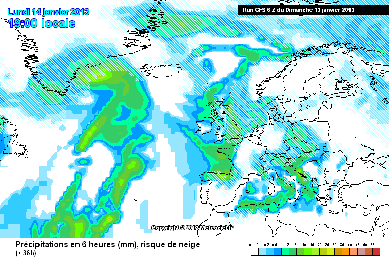
http://modeles.meteo.../gfs-2-36.png?6
back in the game

ill bank that chart right now..
-
We are still +24 hours till the band hits us (about)
That's a heck of a lot of time for change...
And this cold spell is well under way now and will be with us right up to next weekend...Then things after that may go mild..Or VERY VERY GOOD
How is this cold spell under way,wth temps around 4c, rain forcast tomorw..
-
MattHugo81
Mon snow risk restricted to Mdilands, N and E Eng and Scotland. Rain/sleet for S Eng, Wales, SW Eng, Ireland. Largest falls N Eng/S Scot.
Well that says it all,Is anyone else starting to feel really let down by this so far , we went from poss snow sat,heavy snow mon,tues and now we have rain tomorow wth a few snow showers tues, which is hit and miss at best..
The problem i see in this cold spell, which to be honest hasent really started is the tempratures are just to HIGH, which is a bit confusing wth such cold uppers around.
Maybe the uppers and due points will fall as the ppn comes down especially in heavier bursts.
Even if it does snow tomorow im pretty sure it will be wet and wont stick, so after days of telling family and friends about the oncoming freeze and snow i now need to do a u turn , does it sound familiar, aka DECEMBER....!!!!!!! sleigh is staying in the shed and cat litter under the stairs...
I do hope im wrong ,, so,so, much
-
Snow showers into south east from sunday night?, not what i've seen.........
watch the next weather bullatin on 24, she mentions and shows snow showers in kent midnight till morning {sunday} not great graphics mind...
-
again a look at nae tonights update
i see that warm front way to our west
gfs 18z tonight well out of sync with the other models
do not rule some snow flurries for us tomorrow
yea, no one on here has addressed sunday night as bbc have just shown snow showers coming into kent from midnight sunday, lasting throughout.
-
God i hope your right!!!!!!Watch the 18z downgrade that warm sector....blimey I'm starting to sound like Mr. Murr.
-
Sorry to cause a bit of a fuss with my last post :/ sorry guys lol!
You lot on the east coast you don't need to worry as much... South coast I don't really know but coast will be able to give a say on that.. Don't forget you lot in Kent also have tomorrows chances with the GFS picking up some Kent clippers
yeah ,not mch being said about that though,which makes me think it aint gonna happen.., what time are the nxt mods out do you know.??
-
12z will be interesting, but I just can't see any reason why there would be ANY rain, or even hints of sleetyness in this set-up away from the coasts. I'm going to put my neck on the line here (when I do put it on the line, I'm nearly always right, as some older veterns may remember from previous events!) and say that away from the coastal strip, it'll be snow the whole way through. Settled snow at the start will neglect any WEAK (and that is actually what it is!) warm sector.
Also precip shouldn't be an issue, given there is a develop low on the frontal system if anything it should pep up, as per the warning.
Hello, some of us live on the coast {kent coast}
-
To get snow you need uppers of -7 or less ...anything above that and you're looking at it being marginal , especially at sea level...you could probably get away with snow at -6 , but -5 doesn't quite cut it, so I'd say those areas showing -6 or less are more likely to get snow, those that are showing -3 / -4 / -5 are likely to get more of a rain-sleet-wet snow event
monday night has -10uppers right on the east coast of kent, Expalin the marginality there.
-
With those uppers anyone inland will have snow, no marginality at all. Nothing to worry about, hoever anyone near the coast even with -6 uppers looks VERY marginal with wind source. If i had to wager now my money would be rain and lots of it for my location!
why would it be marginal, by the east coast wth -9 uppers and the front in question arriving from the north west, the same thing happened last febuary and we all got a good dumping wth less cold uppers?? confused.
-
wth these sort of uppers how can darren mild bett be showing all rain across kent now for monday avo . I have just watched his forcast on 24.
Really getting anoyed now ,last night i was looking at 3 days of snow now looking like wet,wet,wet.....
-
As things stand I would expect an all snow event.......
Thanks for clearing that up,ill sleep better now,
-
question peeps,are we expecting the event monday night to be all snow in the south east or is there a possabillity of rain because of the occluded front joining from the west??
-
Here in Ramsgate 1.7c , dosent sound low but all the cars in the street have a good white coating of frost. in a few days they could have an even thicker coat of snow..
-
Just seen bbc news 24 showing sleet/ rain for east Anglian and south east!
yeah was blue not white, just our luck it will be rain..
-
Control run at 120h...
surely the southeast would be in a snow event here?
-
Steve M's slider at 120 perfectly illustrated on the UKMO run
But arent we losing the cold uppers at this point.?
-
The Monday system reminds me a bit of the Feb 2012 snow event. Cold air piling in from the east, weather system moving in from the NW giving us a lot of snow, but us staying in the cold air. May turn out to be similar.
Remember it well..A week of fun..
-
Met Office Update
UK Outlook for Wednesday 16 Jan 2013 to Friday 25 Jan 2013:
It should remain cold across many parts of the UK, with a good deal of dry and frosty weather, especially for central areas, but there will be some wintry showers and persistent rain, sleet and snow to watch out for on occasion. The detail of where the snow is most likely to be is currently uncertain at this time. At the moment, scattered snow showers look most likely to affect eastern parts of the UK with a risk of some significant snowfall here, whilst occasional periods of persistent rain and milder conditions may fringe into western areas, but turning to snow as it runs into the cold air. An ongoing risk of icy stretches overnight, and freezing fog may also be an issue during the cold and clearer nights.
Updated: 1146 on Fri 11 Jan 2013
looks to stay cold in the east for longer, good
-
Cant post charts,(on phone) but Monday nights snow event is a bit like last Februarys.
Cold block to the East and a front coming down from northwest.
Thats exacly what ive been thinking, 1 snow event that gave me 5 inches and stayed for atleast 7 days due to the cold, would settle for that right now..
-
6-7pm.
Thanks for that ,will be very important me thinks,,..
-
Does anyone in this thread know what time the ECM comes out later??
-
All 3 major weather models are showing a very cold outlook until next friday...with a good snow signal from monday onwards.....
HAVE YOU GOT THE CHARTS FOR NXT FRIDAY TO SHOW THEN??


London & South East Regional Discussion
in Regional
Posted
But will this be snow..???/