


supernova
-
Posts
317 -
Joined
-
Last visited
Content Type
Forums
Blogs
Gallery
Events
Learn About Weather and Meteorology
Community guides
Posts posted by supernova
-
-
Pretty uninspiring stuff this morning with GFS ensembles predicting a general cooling trend but nothimg to stir the soul. Not much scatter either for the next week.

-
 2
2
-
-
- Popular Post
- Popular Post
It's entirely feasible next week could turn into Slidergate The Sequel. Much colder uppers on this run from both directions (East and West). I would gladly buy a round for @TEITS and @Steve Murr if this goes their way - they've delivered great insight AND entertainment this last week with their insightful comments.
-
12
-
Dear Aunty NW. Can you help? Recently, on a boozy night out, I met a girl called Easy M. She paid for my drinks all night, took me home, showed me a side to her that left nothing to the imagination and promised me a future I hardly dared dream of. Impulsively, I asked her to marry me on the spot. Then, a week before the wedding, she ran off with my best friend Geoff. Unfortunately, GeofF'S a highly-paid American model but isn't the most reliable. So I licked my wounds, pulled myself together, and started going out with this lovely girl, a UK Model, who wasn't quite so progressive as Easy M (if you know what I'm saying) but we still had a great time and the days (and nights) passed quickly. She was happy go lucky, lived for the moment, didn't look too far ahead, and was never too frosty. Now, Easy M has become unfeasibly jealous, dumped Geoff, and wants me back so badly she's started to dress and even look just like my UK Model. I know it makes sense to stick with the partner I've come to respect and appreciate but Easy M just looks so damn good...especially when I see her in the distance. Should I get back with ECM or stay loyal? Oh, and by the way, GF'S been on the phone and says he may have been wrong after all and we should be friends again. Just don't know what to do....
-
1
-
-
And don't forget, after a nailed-on dip in temperatures this weekend there are still a number of members within GFS ensembles (and the other models) offering significant potential for the longer term. Pert 5 would be fun in Skeggy
t
-
1
-
 1
1
-
-
58 minutes ago, nick sussex said:
Not a great start to the day and it could get ugly in here !
Two issues flatter upstream and lower heights to the north stop the high from shifting nw which lessens any trough disruption.
The ECM is better than the GFS but we have to be blunt and say the latter has got more right than wrong in the current set up, it did briefly start moving towards the more amplified solutions but left the party early which means we now have to survey the wreckage and try and find some crumbs of comfort!
I think we need to put whats happened in a box and move on and just take todays outputs at face value rather than spend the whole day in some slug fest between supporters of either the ECM or the GFS.
The problem is when you've been promised a trip to Monte Carlo and then end up finding out instead your going to Skegness its a bitter pill to swallow! Apologies to anyone from that region but its early and I couldn't think of anything else at this time!
So we've swallowed the pill and need to move on.
Now this is where I go into emergency crumbs of comfort mode!
The models still want to disrupt the trough to the west and pressure still remains high to the east, still some uncertainties about what level of cold will be on offer ahead of any fronts moving in from the west as that trough disruption occurs. Its clear overnight the other models picked up on that flattening upstream. The question is whether this trend will continue tonight in which case it could get uglier or whether there was some over reaction.
Trough disruption and where the energy goes is always a difficult juggling act for the models and so I think its best to take the view of being in a holding pattern today of reducing expectations but not throwing the towel in completely.
Wait for tonight and see what happens then.
Yes Nick, it’s scraps on Skeggy seafront (in more ways than one!) rather than seabass in the south of France if GFS turns out to be nearer the mark but the op is on the milder side of its ENS throughout the period that’s caught our interest over recent days and which remains some way in FI. Besides, Skeggy’s as good a place as any to witness an Easterly if one does eventually arrive!
-
2
-
-
3 hours ago, Tim Bland said:
Hmm personally I'm not buying it. Will be very impressed with that forecast of a cold spell starting end of nxt week if it happens though...time will tell i suppose.
Our northern blocking is gone completely from the models this morning. IMO we will have to wait longer for the trop response to any SSW and MJO phase 8 - meaning blocking will not return for another couple of weeks, perhaps early march before we see the effects on our weather.
Certainly it's a bold call but I can't help but appreciate the fact @Steve Murr is often prepared to stick his neck out. Looking at the ensembles this morning it'd be quite some turnaround, and whilst shenanigans are still expected up high it'd need to produce a very quick response for such a prediction to come right. Either way, I'd rather hope Steve's right than what appears to be an early start to Spring, even if the data before us currently suggests the latter. I guess that's what makes this forum so compelling, FI is never far away!
-
2
-
-
So cross model agreement for a roaring Beasterly back end of next week. What could possibly go wrong!
Lots actually but let's enjoy the moment...if it's good enough for TEITS it's good enough for me. Now where's that runner polish....
-
5
-
-
06 GFS better alignment of Scandi high and slightly more progressive with increased energy undercutting at 96hrs. Small steps but encouraging.
-
14 minutes ago, frosty ground said:
Is that not yesterdays run?
Apologies Frosty Ground, post amended accordingly.
-
1
-
-
- Popular Post
- Popular Post
This morning's GFS similar to yesterday's Para with it all going pear shaped at about 100hrs. We simply don't get enough energy running SE under the block, as shown by the ECM and UKMO. TBH I'm just thankful we've got the chance to latch onto another shot at cold so early in Feb....when I caught up on the model thread over the weekend it was all doom and gloom with about as much action as you'd expect in a subtitled documentary about the moisture content of paint. That said, much as I love an Easterly (Lincolnshire rarely benefits memorably from anything coming from the North West), we've been down this path so many times before, it's important to remain optimistically cautious for at least another three to four days and hope that in the meantime we can find cross model agreement. At least the UKMO is on board with the ECM this time, that's a massive positive, I don't prefer any model over the other but this winter in particular the UKMO has been excellent. Remember also, however, that it was barely a fortnight ago when the GFS led us back from another ECM goose chase at about the same time frame we are currently watching with great interest. Get your sledges out the loft by all means, but for goodness sake don't polish the runners and UNDER NO CIRCUMSTANCES TELL ANYBODY! Fingers crossed. BTW, If this one goes Pete Tong I volunteer to organise next year's Netweather outing to Lapland. Northern Lights anyone?
-
13
-
21 minutes ago, chionomaniac said:
It's to do with how many planetary waves are affecting the vortex at any one time. If there is only one wave affecting the vortex then we call that wavenumber 1 and this will displace the vortex. Imagine a balloon blown up - if you put 1 finger of pressure on that balloon then you will distort it into a more banana like shape - akin to a wave 1. For wave 2, put 2 fingers of pressure on the balloon on opposite sides and you will achieve an '8' shape - with a split down the middle.
So that is what we are seeing with the strat vortex - here is the classic wave 1 displacement
And late in the run we see the pinching effects that wave 2 brings
Technically, the waves don't need to be geographically based, but in reality they tend to be Atlantic or Pacific based because of the position of land masses and mountain ranges.
Great, informative post Chiono. Based on that forecast, would be interested to know if and what blocking might prevail thereafter.
-
- Popular Post
- Popular Post
It cannot be coincidence that charts like the ECM240 are as rare as rocking horse poo....and the chances of it actually verifying are similarly unlikely. That said, it's a delight to have some colder weather incoming in the reliable, and the number of ensemble members tending colder still are increasing as an overall trend despite the usual scatter.
-
28
-
15 minutes ago, Weathervane said:
That would be a great call. One of my favourites from the archives is December 1938 when a high migrates from around Nova Zemyla to Scandinavia over a week or so. Unforeseen then and I wonder how well it would have been forecasted today?
32 minutes ago, bluearmy said:Actually, following on from the day 10 op which joined the Russian surface high with our sceuro fellow into one large feature, the control goes on to do similar and subsequently extends the Atlantic trough towards Iberia which strengthens the se flow across the uk as the Russian high extends itself nw into Scandinavia . Not often I take much note of the control but it does fit quite well with the mean/anomoly and takes on the theme of the operational.
Given the apparent upcoming standoff between the Atlantic trough and sceuro ridge, perhaps the intervention of the Russian high to bolster the ridge may tip the battle in favour of the block and force the jet into Iberia.
What an insightful contribution guys. Great knowledge and enthusiasm combined. *watches with interest*
-
2
-
-
- Popular Post
- Popular Post
20 minutes ago, fergieweather said:Whoah.....hang about. That can't be allowed to pass unchallenged.
Do you *really* think Prof Adam Scaife - and the Hadley Centre scientists - sit in their monthly Seasonal Team meeting at Exeter and stare singularly and unscientifically at UKMO output and then dismiss everything else out of some sort of 'confirmation bias'??
The Contingency Planning 3-month document (which, stress, is a *probabilistic*, not *deterministic* outlook) is based on the consensus reached at those monthly meetings and written-up shortly afterwards. At those forums, the collective output across a number of respected seasonal modelling centres is viewed comparatively with weighting applied; and detailed areas of global forcings/teleconnections discussed. This includes output made available to UKMO from ECMWF, MeteoFrance, NCEP, plus Japan/Korea/S Africa and many others. Indeed you will often see reference made in those documents to where agreement exists between GloSea5 and "other seasonal forecast agencies/models". This isn't some cursory exercise of pulling bits of CFS off the web and comparing to UKMO products: it's a rigorous piece of scientific scrutiny with a duly critical approach applied.
The fact remains that as of mid Nov, excellent agreement on broadscale pattern existed between GloSea, ECMWF Seasonal and MeteoFrance-Climate. Not dissimilar output appeared in other (less highly weighted) models such as CFS.
Note that at NO point did UKMO probabilistic forecasts lean to 'very cold' categorisation: merely a higher than average chance of colder than average. Anxious that certain media types would blow it all beyond proportion to ape 2010-11, Adam blogged in detail on the UKMO website to offer context to the last two 3-monthly outlooks that were issued.
To suggest Adam and his team "took eye off ball" out of some deference to an in-house model firstly ignores the cross-model support available to them at the time. Secondly, it's actually quite insulting for a guy who has published or co-authored so many peer-reviewed papers in the field of seasonal to decadal forecasting; SSW's; etc etc. Whatever has gone pear-shaped so far in Dec, I'd wager Adam could explain unhesitatingly.
And by the way: with cluster 1 of today's 12z ECMWF heading into building strong +ve GPH anomalies and rising MSLP above Scandinavia with a resultant easterly flow just before Christmas, it's also too early anyway to utterly dismiss what Glosea leaned to originally.
Just don't get this persistent need to bash the MetO. As gottalovethisweather's excellent post (couple of pages earlier) shows, and we see time and time again, FI got it's nickname for very good reason and anything much past days 4/5 is incredibly difficult to forecast accurately. This forum would be a starker place without Fergieweather's input and I'm amazed he remains so steadfastly generous in sharing an inside line when so often people on here (thankfully a minority) are too quick to criticise.
-
27
-
38 minutes ago, nick sussex said:
I've been digging around for a few crumbs of positivity. At this rate I'll be hitting oil soon as my search is now heading towards the earths core!
Putting my obvious irritation at the outputs aside I have managed to locate some news. Now I advise members have a stiff drink before I deliver this earth shattering info.
So here it goes, cue drum roll!
This is from the NCEP New York state forecast:
In the mid levels, a fast quasi-zonal flow Friday through the
weekend will become more amplified next week.Glad that's cleared that up Nick. Presumably we can all now look forward to significant Atlantic troughing forcing the jet way south with a resulting Greenie high that ushers in a fortnight's cold spell starting Dec 12th and resulting in a significant nor'eastlerley soon afterwards?
-
9
-
-
- Popular Post
- Popular Post
Think I just saw some tumbleweed roll across this thread. If it's cold you're after, there's little love to be found in the models tonight, and you know the job's a complete horlicks when Frosty's looking at transient cold from the south west and SM's hidden his sausage and gone looking for a pack of arctic penguins in the JMA.
The GFS trying to ramp up the PV is a right royal kick in the nuts after what looked like unprecedented weakness for the start of winter proper BUT there are still signs of northern blocking in the long range EPS, albeit more muted than before, and the Met O continue to favour this outcome according to our most recent information. Besides, if it chucked it down with snow for three days this early in winter what the hell would we argue about until March? Keep calm, there's time.
-
22
-
Interesting snippet from Dr Cohen on Twitter.
"Still working on the blog but as a teaser here is a temperature forecast in today's post- nice example of warm #Arctic / #cold continents."
-
6
-
-
- Popular Post
- Popular Post
Lack of cross-model consistency (even in the semi reliable) and, thereafter, a messy solution 144hrs onwards makes me doubt the surety of any upcoming cold shot (or any other shot) in the short term but there's one thing I know for certain, the words 'upgrade', 'potential' and 'blocking' were in very short supply at any point last year and those same words have aleady been bandied about quite a bit on this thread as we head towards winter proper. Also, there are still any number of positive synoptics (solar slumber, disorganised PV, Siberian warming, sea ice levels, advancing Eurasian snow cover) in place to make this year far less disappointing than the boring sludge we've endured over recent times. Although all models appear to have their own strengths and weaknesses, I'm as yet unconvinced by the latest ECM updates which appear to have over compensated for its propensity to exagerate Atlantic amplification (am reluctant to recall THAT notorious occasion but there have been other unforgivable teases too). What I have more confidence in, is the quality of analysis and knowledge on this forum, and I'm grateful to all those characters who share their time and expertise so generously....giving followers like me a welcome weather insight, unavailable anywhere else. Keep it up (you know who you are), we don't all have the knowledge to post on here with confidence but that doesn't mean we can't enjoy the ride.
-
20
-
- Popular Post
32 minutes ago, Vorticity0123 said:After a record-crushing warm December month, January has so far delivered much more seasonable temperatures. In the Netherlands, some parts in the northeast have experienced a rather weird winter. Days of freezing rain made it possible to go ice skating on roads. Read more about it in my previous post here. Nevertheless, the southwest of the Netherlands, and most parts of the UK as well, have seen very little in the way of winter. Yet, changes may well be on their way, as possibly northerlies are going to set up shop. How does this look like, and what about possible uncertainty? Time to read on!
Here I mention the 500 hPa level. I assume this level is located about in the middle of the troposphere. I use this level here because the 500 hPa level is less influenced by surface features (like friction) than the surface level.
Troughing into Europe - High pressure towards the Atlantic?
Let's start with the current weather pattern.
GFS 500 hPa heights (colours) and surface pressure (white contours) as of today 12Z.
The chart shows little in the way of winter for the UK as of yet. Low pressure (and 500 hPa troughing, blue) in the Atlantic to the west of the UK is causing mostly unsettled weather there. Behind this low pressure area, we can see a ridge (yellow colours edging northward) buidling near Newfoundland. The ridge is forecast to move into the Atlantic, whereas the low pressure activity is expected to move into Europe towards Scandinavia.
If the ridge near Newfoundland would be able to amplify enough (that means that it is able to extend far enough northward), it may allow for cold air to flow from the north to the UK. Will this happen? That appears to be the main question for now. It should be stressed that the situation as described above is a severe simplification from reality, as many other minor developments are bound to change the details. For simplicity and clarity reasons, I will only focus on the large scale developments, and NOT on the small-scale features.
What about the differences and uncertainty?
Here we make a jump of 6 days. In order not to get a too messed pattern, I use an ensemble map instead of the operational run. Since the GFS run did not work on my computer, below are the ECMWF ensembles.
GFS 500 hPa heights (colours) and surface pressure (white contours) as of today 12Z.
At the large scale, we see a 500 hPa trough over Scandinavia, whereas some ridging at 500 hPa is evident over the Central Atlantic. The ridge is extending northwards all the way towards Greenland (yellow and green colours extending northward, red arrow). All models roughly agree on this pattern, but once again the devil is in the detail. Though we can also extract some more large-scale differences as well. Below are the ECMWF, UKMO and GFS operational runs for the very same timeframe as given above (for 6 days out):
One clear difference in the models is the degree of amplification (northward extension) of the ridge over the Mid-Atlantic. The ECMWF and UKMO tend to amplify the ridge more than the GFS. The result of more northward-extension would be a higher likelihood of a more northerly base flow instead of northwest or west, with more chances on wintry weather.
Furthermore, we also see a myraid of solutions concerning the shape of the trough (blue colours) over Scandinavia. Nevertheless, the presence of this feature is quite certain. It is yet too early to talk about surface features, though, so to what extent a cold spell will develop or not over the UK is still in debate. A good guide for that are the ensemble forecasts as posted by Captain Shortwave.
Mid-Atlantic or Greenland ridging persisting?
In the long term, it seems that we will see a continuation of ridging over the Mid-Atlantic towards Greenland and beyond.
NOAA 500 hPa heights (green) and anomalies (red and blue) for 6 to 10 days out.
The map above shows a 'kink' in the green lines towards the north in the center of the Atlantic (also indicated by the red arrow). This 'kink' is indicative of the presence of ridging (high pressure activity). With this kind of ridging present, one could suggest that a northerly component is likely in the flow over the UK (see black arrow over the UK which runs parallel to the isobars). Therefore, I expect the temperatures during that period to be below average. This statement is in agreement with the ensemble forecast shown by Captain Shortwave. To what degree these below average temperatures will end up remains to be seen, but a somewhat more cool (fore some parts even wintry) spell appears to be quite likely in the medium-to long term.
I hope this post gives an understandable overview of the weather to expect in the coming days and also the uncertainties still present at large scales. If anything is unclear with respect to this post, just ask!
Sources:
http://www.wetterzentrale.de/topkarten/fsecmeur.html
http://www.cpc.ncep.noaa.gov/products/predictions/610day/500mb.php
Probably the post of the day for me. Informative, insightful, helpful, interesting and relevant. Thanks for taking the time to write this Vorticity, if I'm representative of the clueless enthusiasts on here, lots of us will have enjoyed reading this.
-
14
-
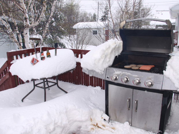
31 minutes ago, Ravelin said:
For those of you who are still unsure if next week will be BBQ weather or Snowmageddon...
Brilliant. Best of both worlds!
-
Ah yes, Winter 2010, fond memories....
If we get anything like that again it would truly be a winter of two halves (not least after the terrible showing we've had to endure ever since.....shocking, mild mush here on the East coast in recent years). Last night's charts in particular showed spectacularly similar potential to 2010 but too far away to hope for anything like that just yet, as this morning's METO update only goes to highlight. They're still saying a return to westerlies for the end of next week the most likely evolution. We'll see!
-
55 minutes ago, Steve Murr said:
Ignoring the interun detail & the fact that the GfS is now touting the -10c isotherm all the way into England
this is the critical chart -
The secondary ridge over NE US at just 120....
nearly heading into the safety zone.....
s
Steve, looks important, can anyone help a grasping lurker understand this point in more detail?
-
1
-
-
Ladies and gentlemen,
It is with great pleasure I introduce to you the GFS and it's improved cousin, the GFS Parallel.
There will also be no requirement for model watchers on this forum to show any kind of skill, experience or knowledge from this point forwards. Instead you may consider yourselves all to be a...
Still, could be worse, all models could be unanimous in their agreement for the sort of mild filth we had to ensure last year. Instead, however inconsistently, some are showing the potential for interest and at least a chance of something that feels like winter. Bugger the iPad, I know what I'm asking Santa for...
(The snow in her hands, obviously)
-
8
-
-
- Popular Post
- Popular Post
Thanks to all who've taken the time to respond to my earlier plea for assistance in understanding how we get back on track towards deeper cold following tonight's superficially disappointing UKMO output and, interestingly, an apparently positive swing in the other direction from ECM. Really, really helpful and the reason this forum is compulsive viewing for all of us despite occasional moments of madness. Sincere appreciation, as ever, to those many members on here who are so generous with their knowledge (you know who you are), without whom most of us would remain clueless.
Thought this was interesting from the JMA, continued signs of meaningful warming but much closer than GFS
Best, Supernova-
12


 Best, Supernova
Model output discussion - mid-winter
in Forecast Model Discussion
Posted
To my eye ARPEGE has snow only for higher elevations in the NW next week. Dew points and uppers certainly marginal. Hope that’s not the case.