


coldcomfort
-
Posts
1,525 -
Joined
-
Last visited
-
Days Won
10
Content Type
Forums
Blogs
Gallery
Events
Learn About Weather and Meteorology
Community guides
Posts posted by coldcomfort
-
-
The Met office have been sitting on the fence unlike you and me, we showed the doubters! Flaming June here we come.
Chickens, eggs and hatched spring to mind here....

When in the 8-9 day range Flaming June could quite easily switch to Flaming Awful, just as Ranging Beasterlies morph into Whimpering Westerlies in Winter.....steady as she goes Captain!
-
 4
4
-
-
Great to see continued signs of an improvement in the longer term outlook, but the inescapable fact is we are still 8-9 days away from said change and there looks like being plenty of indifferent weather around during the interim.
Once it's inside 144hrs I might start to get really interested, but until then I'm sticking with cautious optimism
-
2
-
-
Whilst few would deny it's interesting to look longer term, especially when there are prospects of either winter cold or summer warmth, I'm going to stick with the pattern out to 168hrs and assume (for the avoidance of further disappointment) everything thereafter still has limited chances of verifying. What I see across the next 6 or 7 days doesn't exactly fill me with the joys of spring, with things looking to become increasingly unsettled, as Atlantic lows and their associated frontal troughs cue up to bowl in.
Hopefully one of these will eventually prove to be the trigger for rising pressure as we move into June and summer proper, but there's a fair bit of weather (most of it not very inspiring), to get through first.
-
1
-
-
With any real pressure build not occurring until day 9 (and how long it stays is still not known) i remain cautious. Without a proper pattern change over the US, i see little reason as to why we will remove the N/S westerly pattern.
Very much agree SB. As in Winter it's always easy to talk up what look like positive signs, but when at least a week and more away 'cautious optimism' is as much as I'm allowing myself to enjoy. I've dusted off far too many sledges and barbecues at this range over the years
-
2
-
-
On the face of it a less dire longer term outlook this morning as we move into June, with high pressure having replaced the low pressure previously touted, but as others pointed out yesterday it's a long way off and as such should be taken with an equally large pinch of salt - despite showing what most would call the preferred option.
Shorter term we do see rather more robust ridging again, which kind of tilts the next 7 days back into the better, rather than worse than average camp, but giving the overall fickle, fragile setup I still wouldn't want to say which way things will ultimately break......classic case of more runs needed, probably lots of um!
-
The standout element here has been temps, especially overnight lows, which have consistently been in the mid single digits. Don't really give a monkeys about the numbers though, what says it all is we had the heating on for 2 nights in Oct, 7 in Nov and 18 in Dec......so far this May it's been on 14 out of 18 nights, that's what I call reliable anecdotal evidence. Just to skew it though, if the missus wasn't here it wouldn't have be on any night and I'd just be reporting on the number of jumpers needed to be worn....
-
I think this high is going to be too far west to bring any warm sunny conditions.
Only the far south west seeing anything above average whilst most areas see cool north westerly's with cloud and light showers affecting central and eastern areas at times.
Poor frosty keeps getting excited posting charts which show something close to summery conditions but we just can't get there.
Indeed, the fact that he hasn't posted anything in the MOD today probably says more about future prospects than anything else...
-
2
-
-
The Azores ridge is unable to encourage a euro height rise
we seem to be stuck in this pattern and hope that the less settled spells are the ones which are short lived.
No likelihood of late spring/early summer temps.
Of course, the old adage that stuff equals itself out could promise some very plumey summer conditions
It's disappointing enough to be stuck in this pattern, but what is more disappointing to me is the longer range GFS already appears to have picked up a strong signal of what is to follow as we enter June and to be fair it does look like the natural progression.....seen it time and time before.
As a result we may in 2-3 weeks time be reflecting on just how good the coming week was in comparison to what we now have, because if the kind of pattern being suggested by the longer range 06 GFS does set up, it could be a very long way back indeed to something even half decent.
-
All I meant by that was there is a bit of a flip between Sunday and Monday. But yes the HP will remain centred to the west.
Chart weatherbell
Agh right, apologies for the mis interpretation Knocker. It seems equally prudent for all of us to keep feet on the ground this time of year too, what look like very good ops charts one day can look distinctly ordinary the next
-
Correct me if I'm wrong sb but a positive PNA surely indicate negative heights to the NE and positive to the W and SW? In any case the ECM is just going positive by day ten.
Looking at the ECM anomaly this morning it's still playing ticketeboo with the trough next weekend before settling on the HP influence into the ext period.
If that's what it shows then so be it, but I really can't see anything other than HP remaining centred to the west, with a subsequent dominance of flow from between N and W. On a positive note however the HP looks close enough to deliver predominantly dry weather, with a pleasantly warm feel likely in the late spring sunshine, but any genuine warmth, let alone heat still appears set to elude us into June.
-
3
-
-
The scourge of winter is the scourge of late Spring, HP to WSW.
Today
and ten days time
Indeed BFTP....quite why the models often want to build pressure eastwards from this initial set up is baffling, because they all seem to do it at some stage, only to backtrack later and hold things out west. It's seems to be the equivalent of our T+144hr and beyond direct winter northerlies, which almost always get shunted ever further eastwards as time goes by - but we still fall for them too time after time
-
3
-
-
Fair point CKOF, but even the 06 GFS illustrates quite well what I was trying to say, with a fairly active set of fronts still bringing rain southeastwards across many parts of the UK on Sunday....almost a week away. Whether this then proves to be the trigger for a more robust and sustainable pressure rise into next week remains to be seen, but I will remain sceptical about that for now, with my 'most likely' option being more of the same.
Unable to post charts atm, but the overnight runs pretty much confirm my thoughts from yesterday, with the 144 and 168hr ECM in particular proving very resistant to any sustained ridging, let alone HP setting up over or to the east of us.
-
1
-
-
Fair point CKOF, but even the 06 GFS illustrates quite well what I was trying to say, with a fairly active set of fronts still bringing rain southeastwards across many parts of the UK on Sunday....almost a week away. Whether this then proves to be the trigger for a more robust and sustainable pressure rise into next week remains to be seen, but I will remain sceptical about that for now, with my 'most likely' option being more of the same.
-
1
-
-
Without question the outlook is far better than what we're currently experiencing, but given the initial position of the main high centre I'm reluctant to get too far ahead of myself regarding the outlook. All too often in the past the models have been keen to build pressure eastwards 3 or 4 days hence from this kind of set up, but as time goes by this proves increasingly difficult to do, with winds remaining N of W and weak systems continuing to move down across eastern areas in particular.
-
2
-
-
looking like a chilly but fresh second half of May
still, in the sun itll feel very pleasant, when theres no cloud the sky should be very blue (as opposed to milky) with good air quality. good for viewing noctilucent clouds?
Think it will be OK along the south coast for much of the time given the relatively good protection, but if the current GFS verifies it will be a cold 2nd half of May (relative to normal) in my opinion, with night frosts and high level snow impossible to dismiss even during the last week of the month. To my mind the charts offer up the possibility, even likelihood of just about everything, barring any warmth and/or heat of course...ergo standard UK stuff
-
He must be crazy imo.
-
Rather frustrating to see high pressure refusing to ridge in fully across the UK during the next week to 10 days, but that said it should remain close enough to produce some decent weather at times across the S and SW in particular, where it will at least feel pleasant in the sunshine and out of the breeze.
Typically we don't have to look too far south for some proper heat (just as in winter we often don't have to look too far east for proper cold), with maxima close to 100f likely tomorrow in Madrid and even 95f in parts of southwestern France.
Not too shabby for the first half of May!
-
Sub zero nights all next week is not ordinary at the end of April and early may, neither is frequent wintry showers in an Arctic airflow..did you read gibbys summary? Next week is as wintry as you can get so late in the season IMO, some surprise snow next week is on the cards with potential for snow to accumulate on hills, especially in the north..late season joy for Scottish ski resorts too!
With respect that all sounds a little 'over egged' given the lateness of the season and more importantly the synoptics being touted by the main models. Yes it looks chilly, even cold at times under ppt in particular, but any sleet and snow should be confined to high ground or the heaviest of showers at low levels. Without question though it's going to come as a significant shock to the system, especially for those in the south who have enjoyed lots of fine, warm weather since Good Friday, but even under -5c 850hpa temps I'd expect it to feel pleasant out of the wind and in any sunshine.
-
5
-
-
Fair enough but one or two people on here were talking about dry, settled and warm conditions for Easter not so long ago quoting high teens and even up to 20c so I do feel one or two have over-egged the Easter pudding (pardon the pun). 10-13c in early April is frankly unexceptional and yes, dry weather is to be welcomed but as we've had both heatwaves and snow at Easter in recent years (though not at the same time) the thrust is unremarkable.
We've also seen Friday downgraded considerably to this:
http://modeles.meteociel.fr/modeles/gfs/runs/2015040106/gfs-0-54.png?6
Nothing very dry, settled and warm on that.
http://modeles.meteociel.fr/modeles/gfs/runs/2015040106/gfs-0-78.png?6
Dry most and fine for many. Perhaps more cloud to the SE on that light NE'y but nothing too warm.
http://modeles.meteociel.fr/modeles/gfs/runs/2015040106/gfs-0-102.png?6
Sunday looking similar - again a cool breeze and perhaps more cloud to the SE.
http://modeles.meteociel.fr/modeles/gfs/runs/2015040106/gfs-0-126.png?6
Monday perhaps the best of the lot with more sunshine especially for central parts.
The active Scandi trough prevents the HP heading NE and there's too much energy in the jet to send it NW so the HP is stuck around the Brirish Isles for some time and this is a position we've seen many times before which can mean more and more cloud gets trapped within the circulation with time.
http://modeles.meteociel.fr/modeles/gfs/runs/2015040106/gfs-0-168.png?6
A half-hearted attempt at retrogression
http://modeles.meteociel.fr/modeles/gfs/runs/2015040106/gfs-0-252.png?6
This was the kind of chart I was alluding to in my previous. The trough moves out of Scandinavia and a new slow-moving Atlantic LP encourages HP development downstream so the HP sits near the British Isles so as the original HP recedes SE into Europe, a new centre can form near or just to the east drawing in a southerly feed so the possibility of a negative NAO and warmth - this is where your first 20c originates. Let's see if the OP into low-res offers more in this fashion.
Unless I'm missing something Sun-Mon look downright cold across much of central and eastern England. 850's of <-5c, a stiff breeze and lots of cloud will make for a bracing walk and an even more bracing dip in the southern North Sea..
-
1
-
-
It's early April in the UK and the most I ever expect for an early Eater is dry weather. Sporting events, walks, shopping, getting out and about are all possible. A washout looks like being off the register and that is the main theme. We would need to strike lucky to get any very mild weather and with the CET so far this year having been just above average the expectation has always been aligned with that. In the sun it could feel pleasant, not unlike today, with NW'ly winds and uppers of -4c temps still about 10c in the south. It was 13c in the Surrey area yesterday when the sun came out. During Easter there should be light winds so certainly feeling warmer than currently. The met update showing high confidence for HP till mid April with average temps for most, maybe above in the south. It could be a lot worse as Gibby says.
Indeed IDO, don't get me wrong it looks a very useable Easter, if not the Excess's hottest on record
That said I think it is continuing to look rather more disappointing the closer we get to it, especially in the east with mid single digit maxima and as I mentioned previously given the more west centric HP the first half of next week doesn't look as good as it has done recently. However, if you had offered me this as Easter weather a few weeks ago i'd have grabbed it with both hands, so as is often the case it's all relative I guess.-
1
-
-
Morning all
I'm far from convinced we've even got the detail for the coming weekend sorted. The earlier meme of a fine, warm Easter seems to have been consistently downgraded over the past few days.
This morning's GFS 00Z OP, which seems to be canned by the usual suspects on an almost daily basis, is strongly anticyclonic though for those looking for warmth, profoundly frustrating.
http://modeles.meteociel.fr/modeles/gfs/runs/2015040100/gfs-0-120.png?0?0
Not terribly warm
http://www.meteociel.fr/modeles/ecmwf/runs/2015040100/ECM1-120.GIF
Better though not really a heatwave but would be pleasant enough for all.
http://modeles.meteociel.fr/modeles/gem/runs/2015040100/gem-0-120.png?00
GEM different again - so a long way to go yet before we can be confident beyond Friday which doesn't look too promising it has to be said.
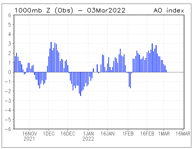
http://www.cpc.ncep.noaa.gov/products/precip/CWlink/daily_ao_index/ao.obs.gif
As of yesterday, the AO coming off its current high number
http://www.cpc.ncep.noaa.gov/products/precip/CWlink/daily_ao_index/ao.sprd2.gif
Looking ahead, a sharp fall back to neutrality as perhaps once again we try to get the set up of heights over the Pole and LP further south but huge scatter into the medium and longer term periods so lots of options on the table. EC32 apparently suggests the return of the Atlantic but that's default so I remain to be convinced. The emphasis for HLB seems to have shifted back to Scandinavia from Greenland in the last few days but that might just be indicative of no strong signal into mid-month. GFS has toyed with any number of HLB and MLB scenarios into FI so we'll see...
http://www.cpc.ncep.noaa.gov/products/precip/CWlink/pna/nao.sprd2.gif
The NAO is starting to catch my eye - it's been as positive now as it's been all winter but the signs are for at the least a return to neutrality and quite a cluster of members going negative and, apart from a brief period at Christmas, the NAO has been positive for ages.
http://modeles.meteociel.fr/modeles/gfs/archives/gfsnh-2014122500-0-6.png?0
This is the last time the NAO went negative - Christmas Day in fact. The key, I think, is the large LP in mid-Atlantic which would depress the pressure anomaly for that region. Going forward, a negative NAO in April might suggest a deep LP in mid-Atlantic throwing HP north or east ahead of it and I wonder if that's where we might be in mid-April with the Atlantic dominated by a static deep LP and strong HP over NW and NE Europe ahead of it.
Agreed....I said as much in the moans thread yesterday, there's still plenty of potential for a disappointing Easter overall, especially in the east. Unlike recent days all the main models now keep HP rather more west based too as we move towards midweek, so I will remain sceptical about any proper 'warmth', but given light winds and any cloud breaks it should at least feel quite pleasant.
-
What will spring/summer be like? I don't think it's remotely clear what Easter will be like yet, but for my money probably nothing like as good as is currently being suggested, with thicker cloud and patchy rain proving very reluctant to give way despite rising pressure.
It's no real surprise that as we go into April we are starting to see the kind of synoptics most of us craved all winter either, that's exactly what tends to happen around these parts, with almost monotonous regularity it must be said..
-
2
-
-
Dire model output at the moment, neither fish nor foul. Stripping wind and rain out of the mix, we must have some on the most boring weather on this planet, with any interesting extremes virtually non existent. End of rant!!
-
Quite startling to see models making a huge backtrack with the original high oriented outlook to now a more unsettled and rather messy outlook. Hats off to Ecm yesterday as its been a leader in this change and Gfs has followed.....
From my memory AW it was the ECM that originally and quite ridiculously blew up heights in the first place, something I alluded to in the Moans and Banter thread at the time. Where you draw the chronological line in the sand is really what dictates which model is playing catch up, but in my opinion looking back across the last week or so GFS has been far more on the money regarding the upcoming spell, having never really got sucked into some of the cold E'erly eye candy occasionally offered up by the ECM.


Model Banter, Moans and Ramps Spring/Summer 2015.
in Forecast Model Discussion
Posted · Edited by coldcomfort
Not sure you can claim to be right when any potential change is over a week away, but I'd like to think you will be - and I'm just simple hotelier, desperate for some decent summer weather to placate the guests who have moaned at me all month about how poor it's been.