


Luke Attwood
-
Posts
84 -
Joined
-
Last visited
Content Type
Forums
Blogs
Gallery
Events
Learn About Weather and Meteorology
Community guides
Posts posted by Luke Attwood
-
-
13 minutes ago, Steve Murr said:
5 or 6 you say...
unless you live in Penzance....

S
Hi Steve I was referring to the uppers that are being showed for next week.+2/4 uppers on display would it still be cold?
-
3 minutes ago, geordiekev said:
It was -6C here this morning, barely up above freezing and now back down to nearly freezing. It is cold already and snow already falling in places and that's before the entrees are even served. More than a snap I would say.
People on here know there's not always a pot of gold at the end of the rainbow, but enjoy the rainbow itself. That's how I view this special forum. It's a shame some are out there with such a bleak view.
Not being bleak about things,of course it could turn out to be a very cold spell but I always remain cautious here in the UK because its so difficult to maintain cold conditions for a long period of time.
-
2 minutes ago, winterof79 said:
Any one got a link to the learning thread?
No he has a got a point,this cold will lead to nothing special.its looking like a cold snap rather then spell,people saying next week will be cold with higher 850's but it wont be that cold,probably 5/6c nothing special is it! It seems people are to bias on here when there's signs of cold coming,always trying to ramp it up.its almost like we lie to ourselfs in suggesting that it will be a lot colder then what is showing.
-
 1
1
-
-
7 minutes ago, bluearmy said:
Ec strat also not going the split route as per GFS this morning
not the best continuity from yesterday's 12z either
at least we now have agreement in the short term that chase the cold pool could be the weekend fixture - most excitement for several years!
For several years ,you really think it will be that good!?
-
Wow even bigger cold pool heading our way,on the 18z
-
1
-
-
So when are u the ECM ensembles released
-
Well if u look at the latest ecm,you will understand the negativity. The problem is with the cold coming up its always very marginal setup's. And sad to say it I think our luck will be out again! Its frustrating I hope I'm wrong of course
-
2
-
-
3 minutes ago, warrenb said:
The ice day the other week was when uppers were well above 0
Oh thanks.so u expect it to stay cold throughout the weekend ?
-
5 minutes ago, s4lancia said:
Patience. Unlikely some Northerlies, the onset of Easterlies NEVER EVER follow a straightforward non-nerve-shredding evolution. We are at the end of the line, it has and will ALWAYS be this way.
In answer to your question, yes it will very likely be cold at the surface by then.
Very cold even with not cold uppers?
-
1 minute ago, s4lancia said:
Seriously... Is this just to get a reaction? Well, it's worked I guess.
I kind of agree with him, ii have bad feeling about this the uppers are not cold over next weekend. Would it still be cold at the surface?
-
1
-
-
4 minutes ago, Frosty. said:
Well I hope I'm right, it looks like the best spell of the winter so far nationwide according to most of the models, hopefully it can go from strength to strength..been waiting all winter for a spell like this
Yes how long u think it will last then,your opinion?
-
1 minute ago, Frosty. said:
Plenty of cold / wintry weather on the GEFS 6z
Hoping we are looking at cold weather becoming entrenched for more or less the month ahead!
Well I do hope you are right,but should remain cautious its only one run 06z which was great. Having said that I do believe we will see cold weather starting Wednesday and probably lasting until Monday or Tuesday the following week at least! During this period we likely to see temps range from about 3-6c and and as low as -3 overnight. That's just my opinion looking at the models. I really hope we can repeat it on the 12z
-
2 minutes ago, Banbury said:
I wouldn't say that , had support and on occasions some runs were colder
Ok thanks,how long would u say this cold spell will last? If starting from Wednesday,it looks cold throughout next weekend to me.and it could get even colder during the following week,that's my view on it
-
So the op was a cold outlier?
-
5 minutes ago, Summer Sun said:
ECM Op on the warmer side of the mean from the 9th to 13th
So ur basically saying the op should be showing slightly colder temps?
-
3 minutes ago, summer blizzard said:
The air is cold enough that it would probably generate clear skies and shower activity (though as i mentioned, the angle before day 9 is poor for most).
The north east and eastern Scotland are probably looking at stratocumulus murk though (pressure is too high for much instability).
U say the angle is wrong of the high,but it would still be cold right?
-
1 minute ago, snowray said:
GFS ensembles for Holland, some members going -15, -17 uppers there, and that is the air that on a direct easterly would be heading straight for us, so you never know, GEM might be onto something after all. I would be interested to see exactly how these ensembles sit as compared to the ECM suite, in fact I suspect the ECM operational to be a big mild outlier.
So what your saying is that the ECM should be showing colder uppers? As u said it being a mild outlier.?
-
2 minutes ago, Ed Stone said:
We were telling ourselves the very same during the snow-starved early-mid 1970s.
Yes it appears the coldest most severe winters were during the 80's .
-
1
-
-
One of the the problems is the low pressure in the Atlantic.we have the block In place next week,but one of the problems moving the cold air west is due to the lows pushing east and north,this is the wrong track! We really need them to dive south and then east,or just straight north and then west.until the latter happens we won't see a freeze up.just chilly conditions nothing to extreme.do people agree with me here?
-
2
-
-
1 minute ago, snowray said:
And, we end the run with a Scandi High!
I think you mean a Greenland high.
-
1
-
-
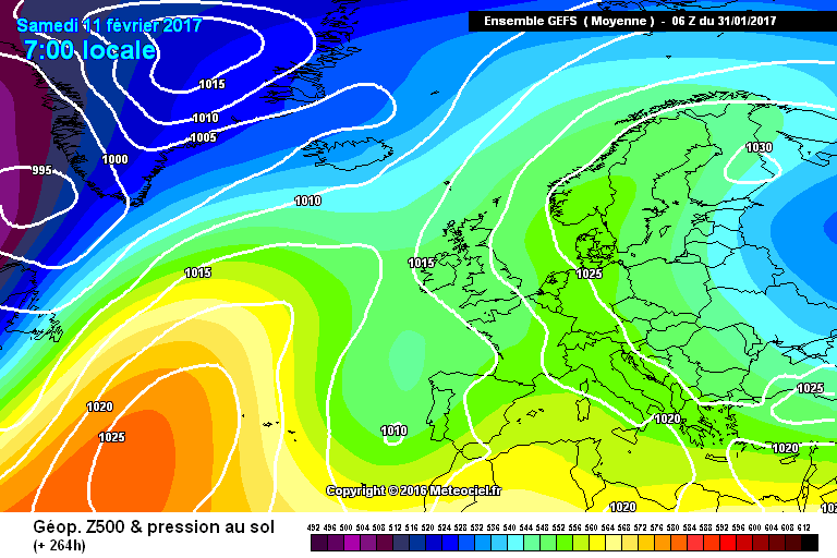
7 minutes ago, Panayiotis said:
Although yes the chart does show a southerly/south-easterly wind, you have to take into account thats it's an ensemble mean. Climatology, as stated countless times this winter, will skew any signals of easterly winds. Looking +8 days into an ensemble mean will (most of the time) have a west-east flow bias.
I suppose its not such a bad mean,could be better of course. I have a feeling that the coldest weather will remain to our east.Romania turkey being the favoured areas.I hope I am wrong though
-
4 minutes ago, Man With Beard said:
Much respect to you Ian as you completely ignore the hype and trust in your methods (very often correctly).
But I will very slightly contest the bit in bold. If you're speaking about long-range models e.g. ECM 46 - then yes, agreed.
But the shorter term models - on balance, I think many of them have actually underestimated eastern blocking in the D8-D15 range. End of December looked like a zonal-fest at first - but just a few days in, the easterly block was back. The past two weeks have been endless attempts by the models to send storms towards Scandinavia in the mid-term - it's in reality been two weeks of constant set-backs and although we're getting a few storms now, we are the very end of the line.
What I'm saying is, if the models are now going for even stronger north-eastern blocking and disrupted Atlantic lows at D8, I am very much inclined to believe them. Paticularly the GEM, which has not shown any HLB at all in FI until now - and now it's really putting the foot to the floor!
Must comment on the GEFS as they are trending, trending, trending towards the NE block winning out.
that's not bad at this stage, not bad at all.
Hmm don't really agree,no strong block to the east and the UK left in southerly to southeasterly wind.not particularly cold!
-
3 minutes ago, Dancerwithwings said:
OK thanks for that so the outlook is for cold..cold and more cold?
-
1
-
-
1 hour ago, booferking said:
Hey steve whats the Ave lag time follow a SSW to see the effects on models? Sorry edit that just seen you said 7-10 days after the ssw but maybe the possibilty to see it end of Jan. Cheers
Would you mind explaining what this means, is it a good sign for cold?


Model output discussion 25th Jan - The final third of winter beckons..
in Forecast Model Discussion
Posted
So your in hope that we will see retrogression next week, like the gfs is showing let's hope its right.as the ECM goes with southeasterly winds vearing southerly! Horrible