


thestixx
-
Posts
128 -
Joined
-
Last visited
Content Type
Forums
Blogs
Gallery
Events
Learn About Weather and Meteorology
Community guides
Posts posted by thestixx
-
-
28 minutes ago, mb018538 said:
Spain hot in summer? Who’d have thunk it! In other news, water is wet
Looks like we’re locked in to a rubbish pattern until mid month at the very earliest now. June already looking like going on the scrap heap of other very forgettable UK summer months.
Water isn't technically wet ?
-
40 minutes ago, NApplewhite said:
Mostly cloudy on Tuesday morning with some showery burst of rain affecting parts of Wales and southern England. There will be further showers in eastern Scotland and also across the far north west of Ireland. Other areas are likely to be starting today dry. However during the morning showers are going to be developing more widely and will become heavier.

This afternoon sees for the showers over parts of England and Wales. Rain in much of central Scotland and probably for Northern Ireland as well. Parts of northern England, the Midlands and southern parts of Ireland as well as the far north of Scotland and likely to be dry.
Tonight is more persistent rain three parts of Northwest England and Scotland, some of this could be quite heavy in the west. A few showers in western Ireland and some getting into western Wales and the western coast of Southwest England to. However much of Ireland, Wales, central and southern England should be dry overall.Wednesday 28/7/21
Low-pressure is expected to be centre just east of Scotland on Wednesday. This is going to be bringing an unsettled day to all areas. There will be cloud and outbreaks of rain through much of eastern, central and southern Scotland with only the far north possibly staying dry. Heavy and frequent showers, some of them thundery passing through Ireland and western parts of England as well as Wales. After a bright start the heavy showers will spread across the rest of England and Wales, these becoming thundery with the risk of hail and local torrential downpours. As is the nature of showers one or two places may escape them. Highs at 16 to 22C, warmest in the east. A moderate to fresh westerly wind in the south.
Thursday 29/7/21
A front to sinks southwards on Thursday bringing some showery outbreaks of rain into central and southern Scotland, before moving into Northern Ireland and the far north of England. Mostly fair for England and Wales wut sunny spells and a scattering of showers. More persistent showers or rain may affect the far south later. Turning brighter across central and northern parts of Scotland, although one or two showers just affecting northern coast, Orkney and Shetland. Highs at 15 in the far north, 22C in the south.Friday 30/7/21
Thundery showers and some rain may affect central and southern parts of England Wales early on Friday, although there is much uncertainty in this. Some clouds and spots of rain across Ireland and Northern Ireland. Probably brighter across central and northern parts of Scotland with some sunny spells. Highs at 15C in northern Scotland, 22C in southern England.
Saturday 31/7/21
Pressure is going to be staying rather low on Saturday. Some heavy showers developing for England and Wales, a few of them turning thundery. Scotland and Ireland should be mostly brighter, although a few showers could affect eastern Scotland and the far south of Ireland. Highs at 14C in northern Scotland, 23C in southern England.
Sunday 1/8/21
North-westerly flow is expected to affect all areas on Sunday. This brings sunny spells, but also a few showers. Most of the showers affecting windward facing coastal hills. A risk of some cloudy skies and more persistent rain affecting the far south of England. Highs at 15C in northern Scotland, 21C in southern England.
Monday 2/8/21
Showers again on Monday. These could be heavy in places, mostly the east and south. More western and northern areas are likely to be drier and brighter in the northerly flow. Highs at 14 to 22C.
Tuesday 3/8/21
High pressure tries to build back for a short time on Tuesday. Showers still affecting eastern areas, some of them thundery. To the west it should be dry and bright with sunny spells. Highs around 14C in northwest Scotland, widely 21 to 23C in England, Wales and Ireland.Greece weather - temps in the low 40s
Loving the random Greece forecast I wonder if they even have daily weather forecasts.


-
 7
7
-
-
Squally winds & rumbling from this isolated cell heading over to Yorkshire from the Pennines
-
5
-
-
5 hours ago, Frigid said:
Been a while since we've seen an ensemble graph like this.
I'm usually an optimist, but GFS & GEM are painting a miserable picture for the start of the school holidays and beyond.

-
1
-
-
- Popular Post
This monster has blocked our evening sunshine. I'm in Huddersfield so this is over the Pennines in Lancashire.
-
15
-
17 minutes ago, Ed Stone said:
And, as per usual, a quick wheech through the GFS 00Z reveals that it's nowhere near as catastrophic as some folks want to insist:
And the GEFS temperature ensembles are nae bad!
That 5th image of the Azores stretching far past Scandinavia is model porn for me. That's the classic '76 kinda chart isn't it?!
-
4
-
-
11 minutes ago, 38.7°C said:
CFS july and august 500hpa anomalies
Wow. If these were to verify is it correct to presume it could be a vintage summer ala '76 '95 etc?
-
2
-
-
Just now, Scorcher said:
Amazing how the green snot seems to be finding its way back to us next week- remarkable after such an extended warmer spell. I was sure we'd seen the last of the green 850 hPa temps with all the warmer air being pumped to our north.
It really does amaze me- other countries in Europe never seem to suffer from this in summer.
Absolutely gutted. I've taken up golf again for the first time in 8 years and heading to Belfast next Thursday. I've been following the posts on here closely and when the breakdown kept on being developed I feared the worst. Bloody typical.
I'm hoping this unsettled spell is just a blip to look after the farmers and we can get back on track asap. That low trapped between two highs really gives me the blues in Summer...
-
1
-
-
Any talk of breakdowns is definitely looking at a half empty glass IMO. It's a dream start to summer. High pressure is clearly our friend for the foreseeable and we're potentially looking at the first proper flaming June in yonks. Yeehaaa
-
5
-
 1
1
-
-
18 minutes ago, Djdazzle said:
I’d take this pattern all summer. With the occasional plume to get into the 30s. I sense it’s only a matter of time.
I was born in '76 and I'm often reminded of that summer. I remember '95 well as I was commuting over the Pennines from Bradford and witnessed Scammonden dam turn into a virtual dust bowl. 2013 was the next best for prolonged dry weather. It would be a dream for this spell to reload for weeks on end.
-
1
-
-
- Popular Post
- Popular Post
The 18Z GFS is showing an abundance of HP all over northern Europe and long may it continue. Welcome to meteorological Summer everyone
-
12
-
2
-
1 hour ago, al78 said:
I agree re pattern matching on a handful of years but was the 2003 summer really that special outside the (back then) record breaking temperature in August? I can't remember anything about that summer other than the August heatwave.
2003 was the year I really got fascinated by weather watching. High pressure was omnipresent over and around the UK for months. I remember in August it parked to the west of Ireland for the month just close enough to keep any toppling lows at bay. The summer wasn't exceptional for heat, but was very dry and settled.
-
1 hour ago, Alderc said:
I’ve not been around for a day - What happened to the high pressure? It’s almost gone / non-existent on GFS now and it looks like it’s trying to bring in a small little developing low pressure from the north east through the middle of this week...what a mess / disappointment!!
How did I know you'd see the glass half empty
In your absence the charts were looking worse than they currently are for anything settled so I'm optimistic they'll continue to improve
-
1
-
-
1 hour ago, Britneyfan said:
This is good tbh, such massive changes generally means a pattern change is occurring so all these wild swings I actually believe is a good thing
Totally with you on this. Change is good. Let's hope the dice roll favourably for summer warmth
-
3
-
-
2 hours ago, Tamara said:
Many of the worst summers have seen collapsing momentum budgets within the atmosphere coinciding with these seasonal wavelength switches. This Spring/Summer switch suggests rather more the opposite trend
This sentence is music to my ears.
Thanks once again for an enjoyable and insightful post. Hope you have a safe and enjoyable journey sunwards
-
3
-
-
31 minutes ago, Tamara said:
Boa tarde
Its a synoptically intriguing Spring-time situation with the atmospheric circulation, 'c/o tropical and extra tropical wind-flow cycles, still clearly 'remembering' the patterns of mid to late winter; at the same time as seasonal wavelengths in tandem with what *looks* like a standard fading away of the stratospheric vortex start their make their imprint over the weeks to come. However confidence in this needs to further gain traction in the weeks to come.
What is meant by 'remembering' in this context? There are known periodicity timeline recurrences with tropical and extra tropical cycles and when these both combine to produce strong wind-flow signals (high amplitude forcing) they often have a profound amplification response globally - and especially when the winter-time stratospheric feedbacks have been highly unstable as they have been over the winter of 20/21.
The feedbacks of these tropospheric and stratospheric forcing elements can produce a 'shockwave' response within the broad-scale patterns lasting through extended intra-seasonal timescales That has been very much the case in this first quarter of 2021.. Awareness of these cyclical responses can be very useful in terms of anticipating amplification potential - even though it cannot be possible, at distance, to pinpoint more geographical areas in terms of pattern/weather detail. Its very much the case of whether the significantly unstable relationship between the stratosphere and troposphere can evolve through a more seamlessly benign final warming process and then couple with the encouraging adjustment of the rossby standing wave further east within the tropics to reduce retrogressive shifts in blocking and which retain cool air advection process risks - at least for more Northern parts of Europe.
Global atmospheric angular momentum has mirrored the dynamic nature of the atmospheric response to amplitude cycles of the intra-seasonal MJO cycles. A convectively coupled kelvin wave (CCKW) within the tropics has added westerly wind-flow inertia propagation between the tropics and extra tropics c/o torque responses and the atmosphere has accordingly 'remembered' the similar passage across the Pacific Ocean that occured in February and simulated a further blocking response- (the one in the first half of February augmented through the fall-out of the January SSW effects within the troposphere and the strongest downwelling tranches of -ve zonal wind anomalies.
CCKW:
As reflected on the MJO RMM track and forecast .
= upward movement back to average levels in globally averaged AAM. Notice the much more profound effects c/o the greatest stratospheric/tropospheric instability in Feb
As the CCKW completes its tropical cycle, and the high frequency signal returns to the Indian Ocean - then this is the signal for a return of greater easterly inertia within the atmospheric circulation and angular momentum tendency easing back again accordingly. Interestingly, this forcing acts to retrogress the troublesome blocking signatures at mid and higher latitudes sitting to the NW - and in the short medium term invites a supressed jet stream across more northern parts of europe but also cuts of the ingress southward of polar originated airstreams and restrict them further north than seen for quite some time. Whether advancing low pressure systems can stall sufficiently and allow warm air advection processes as far west as the UK is debateable, at least to begin with. But it is the first step required to shift the paradigm of blocking away from cold air advection for NW and central Europe.
Further south, across many SW parts of Europe a downstream ridge response settling the weather down after recent showers and thunderstorms.
For late Spring/summer interest much depends on continued active tropical>extra tropical forcing at the same time as seasonal wavelength changes act on demise of the seasonal vortex to set a more traditional summer pattern response. If this response is non dynamic, and if tropical convection shows signs of continued trend to want to push convergence (and associated westerly wind inertia) further east across the western/central Pacific, then its conceivable a less Nina like standing wave could lead to greater downstream amplification. rather than innate Atlantic blocking (the latter being La Nina-esque)
What is key for summer prospects, mainly for Northern Europe including the UK, is that the relationship between the troposphere and stratosphere is a benign one to assure such ridging at mid latitudes (Western Europe into Scandinavia) - and not persistence of further retrogressing blocks across higher latitudes. Further south across europe into the Mediterranean ,the implications are more surrounding dryness/wetness and whether more extreme heatwaves are likely relative to usual warm/hot temperature regimes. At least as measured /compared by UK standards.
Latest indications based on tropical>extra tropical forcing adjusting to a less Nina-esque default ,suggest that a more stable mid latitude pattern can still emerge and produce the welcome warm-up that many parts of NW (inc UK) and central Europe are looking forward to with restrictions looking to ease hopefully for the summer. However (there usually is one), May is that pivotal month in the same way as November and into December is in terms of gauging propagated rossby wave extra tropical forcing from the tropics vs seasonal wavelength changes. Time will tell how quickly the atmosphere will be willing to start to evolve away from and to 'forget' the imprinted highly robust dynamics of the stratospheric/tropospheric relationship in the fist quarter of 2021. That is an answer that I expect professional analysts will not have a good answer to at this stage, let alone me or any other interested parties of laypeople
Thanks Tamara. I enjoyed reading this and for once I actually get it! Cheers
-
7
-
1
-
-
1 minute ago, icykev said:
ECM UKMO on the same page 144
What's the thinking behind this set up? Moist/mild southerlies being pulled up then clashing with frigid easterlies?
-
8 minutes ago, DEYS(Kent) said:
Model fatigue for in here for some. Or a bit of reverse psychology going on; I’m not sure..
Early February looks like the next chase for widespread snow for the UK and the background signals are showing little chinks of light in the current output.
Keeps me interested that’s for sure.
I've had a few days off watching the models and everything is still 10+ days off
-
1
-
-
Shared album - Bryan Munslow - Google Photos
PHOTOS.APP.GOO.GL
Shared album - Bryan Munslow - Google Photos
PHOTOS.APP.GOO.GL
i was lucky enough to be in Rhodes to witness this yesterday. It was amazing!
-
4
-
-
This was really close, after it died off, it reformed and wrecked the hotel next door, there was allsorts flying about.
-
2
-
-
What a day. About 10 waterspouts formed in front of my hotel in Rhodes, 3 came in land a made a right mess of next doors parasols etc. I've never seen anything like it. Insane to be so close. I filmed a few, this was after the initial spout had seemingly died off.
-
6
-
-
21 minutes ago, mb018538 said:
Warming up on the 12z ECM - back to Into the mid 20s
Hope this scenario verifies! September has consistently delivered a warm settled spell like this chart shows.
-
5
-
-
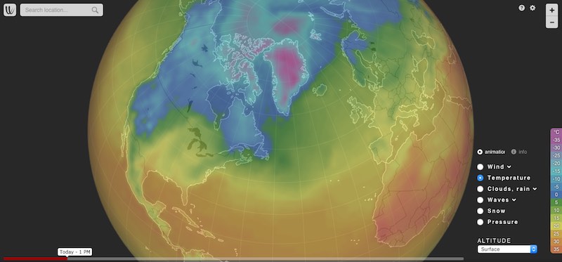
10 minutes ago, Zak M said:
Holy shizzles... just woken up to some amazing runs today!
If the 00z ECM comes off then it could potentially result in one of the most thundery periods in years.
Take a look at this - click on the 'Rain, thunder' option (make sure you choose ECM as the model) and play it from Sunday onwards. Madness!
Thankyou for sharing this site, I've never heard of it! It's ace!
-
1
-
1
-
-
Sat in the Judge lodgings in York centre, it's gone very dark, windy and it feels like I could be in luck for a storm!


.png.bed1d191b3d2b08063ee2e3075628801.png)


Model Output Discussion - Early Summer and Beyond
in Forecast Model Discussion
Posted · Edited by thestixx
Typo
I've seen a few allusions to this outcome after next week's hot spell. My heart goes out to the Glastonbury goers if this trough sets up over the UK. Where else can be It go though? Huge highs either side..