


Uncle_Barty
-
Posts
469 -
Joined
-
Last visited
Content Type
Forums
Blogs
Gallery
Events
Learn About Weather and Meteorology
Community guides
Posts posted by Uncle_Barty
-
-
Just a chart with an explanation on it to try and correct the wrong idea that the European high is causing the jet to...
It is actually the other way round

Thanks for this, John.
Did you mean 'to the right of the jet entrance' in the graphic. Positions of the circles you put in suggests right rather than left?
I've always assumed that the surface patterns are the result of the upper air ones, rather than vice versa? Which is way I usually scratch my head when I see something like "that shortwave is stopping the blocks from meeting/moving east" or whatever, whereas I always thought "the shortwave is there because the position of the blocks allows it to be there.."!
-
The trend for height rises over Spain and France continues apace this morning at least on the opps.
If this carries on for much longer the easterly options amongst the ensembles will really start to fall away. Whatever happens it looks like either a blowtorch or winter wonderland Christmas. It's not going to be boring over the next few days.
Rather than looking east we need to look to our south as its what happens here that's going to determine the end result in our part of the world. The trend has been clear though recently, which unfortunately is for ever stronger signal for high pressure just where we don't want it.
Noticed we have an uncle Barty posting. Will he be staying for Christmas and new year though?
Jason
Jason
Oh, I'm always around!!
Despite the mild outlook in the short term, I don't think we are going to see a Bartlett setup any time soon.
More worryingly, there are some signs of some heavy rain Weds/Thurs in the areas that really doesn't want it.....
-
Snow fan I am but agree with that first paragraph, well and 2nd, if its going to be mild, lets have it dry, and preferably 13C, Bartlett position I dont mind, Its cold zonality I dont like with endless rain at 4C
removed my original post as I realised I'd somehow managed to post it in two threads (don't ask...) but agree with the rain and 4c. Truly dire!
-
The 00z outputs show the Atlantic pattern wins through next week with a milder west to south west flow as the block to our east finally relents a little.
Looking at the ECM/GFS mean charts at T192hrs keeps the UK still in a similar pattern as we approach Christmas
http://www.meteociel...1-192.GIF?15-12
http://modeles.meteo...-21-1-192.png?0
The real killer is the Iberian heights easing the jet north and at a less favourable angle.
With any luck, the jet will push far enough north to allow the HP to push north, and mild temps without much in the way of rain. Not quite 1988/9, but an improvement on wind and copious rainfall.
Not very seasonal, I know, but will make it a lot more pleasant to be out and about, and more importantly allow the flood-hit areas to dry out a lot more than if it was very cold but dry.
Some of the model output is suggesting this, though the ECM, as mentioned, is a warm outlier.
Until there is a real pattern shift, the only sign of could would be from a brief northerly toppler, and again there are hints of this in some of the model output.
-
A look at the model output over the past few days tells me that things are a little messy generally. I'm not looking beyond 5 days, as even looking for trends beyond then is hard.
On the face of it, looks average/perhaps mild at times esp in south, and unsettled for the foreseeable looks to be the form horse, and those talking up any return to cold are little more than hope/wishcasting.
But... I think we are in the kind of situation where we could be faced with a change to much colder weather again at relatively short notice from nowhere, perhaps 144/168h. I dont feel this unsettled pattern setting in today is necessarily 'locked in', despite the way the Atlantic is being modelled at the moment.
-
Lets hope we see a change in the ensembles because it looks dreadful towards the end of this year.
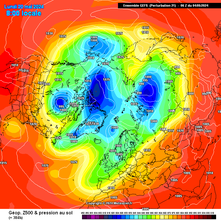
http://modeles.meteo...-21-1-384.png?6
Ensembles showing a very positive AO, NAO with the jet aligned SW-NE.
Basically the worst winter synoptics possible for the UK.
Or the best, depending on your perspective. If we ended up in a 1988/89 type of pattern I would not be disappointed, but I would be surprised if that happened this year.
With regard to the strat, I am guessing that even if a SSW happened and the vortex was annihilated, we would still need to get the right combination of ridge/trough setup in order to go into the freezer?
-
 1
1
-
-
15 years ago today, Peter Cockcroft forecasts an easterly on the way
And what followed was a brief easterly and a warm front edging in giving snow on the south coast for a time. Soon turned to rain as it became mild and very stormy at times with some notable storms around the Xmas period IIRC
-
No snow here since December 2010.
Nothing unusual about that, though.. prior to Feb 2009, we had one single instance of lying snow this century - the thundersnow of Jan 28th 2004.
-
I like your positive thinking, and I'm trying to remain as positive as I was last night.. but after that 12z....
Have to say that those saying there will be a cold spell this/next week (after midweek this week, that is) are little more than hopecasting, rather.
Models seem set on Atlantic weather after midweek and in the absence of anything different showing in the models, I have to say that looks to be the form horse.
I saw a chart on the main MO page pointing towards a belt of positive HP amomalies from Azores stretching across central/southern Europe. (METO Glosea4), don't know what it is like in the past and of course is probably little better than guesswork, but hope it comes off.
-
Well the baggies managed the great escape several years ago in the prem, why can't we see it in the models??! After all they decided to snatch this away from right under our noses without warning. Why can't it do it again? After all , what the models are hinting at this morning is more in line with the teleconnections and strat conditions, along with fitting the bill within gp's forecast.
Sums up the models at the moment - boing!! boing!!
I still remain unconvinced - of anything - right now; whatever any individual model run might suggest...
This.
Whatever happens, nothing in the models suggest anything other than turning milder in the South. Likely to be rain right from the off IMBY, just hope for the sake of those a serious flood risk that things continue to back away as they seem to have done over the past 2-3 sets of output.
-
With easterlies, not until it arrives!! Been stung in the past as close as t72 so best not get carried away BUT the difference here is this is a MEGA block and we are well within the block, in most cases we are an the real outside. The further WEST the pattern gets the better. But I never trust the models with Easterlies, been suckered in a lot by them in the past only to be bitterly let down.
This, a thousand times! Never nailed in my book, and certainly not before t+24/36
That said, very cold weather now looks more likely than not at this stage. Certainly no sign of my favourite Bartlett any time soon.
Only thing is the UKMO not being quite on board.
-
Just had 12mm in half an hour from the leading edge of this.
The main band actually slowed up when it reached Poole, to the extent that it took another half an hour to get to the east side of Bournemouth.
Reports of flooding in one or two places round here coming in.
-
Hi Jim The thing is if the vortex comes under a really sustained attack in mid December it might not just be early winter that ends up being cold.
I know. My comments were referring to the winter 2 years ago.
-
Interesting times.
Obviously I'd much rather have a strong PV over Greenland and a large slug-like Bartlett showing its hand by now, but it's very clear from all the model output that it is light years away from that scenario, so.....
I think we were rather spoiled by the events of 2010. This isn't going to match it (things are set to change later than in 2010, for starters, and it is still November....) but the general progged pattern is oozing with potential, even if the synoptics arn't specifically showing us or mainland Europe in the freezer. So it's best not to get too hung up on the specifics like are the 850s going to be low enough etc etc. Look at the general picture.
The coldies amongst us will have to wait a little longer for the goodies to show up, but they will eventually if things carry along this track.
I remember Chio/GP (cant remember which) warning us quite early on in 2010/11 that the best of the winter would be early, and like in 1981/2, the 2nd half of winter would be disappointing for coldies in comparison. I'm trying to remember on what basis (stratospheric??) that was, and how it's looking this time.
-
ECM 216 = Yuck.
Sure, Greenland High and blocked Atlantic, but its West Based, we end up in mild Southerly winds whilst cold air digs down into the Atlantic
Why "yuck?"
I hope we can get through as much of 2nd half of autumn/early winter and preferably to March as possible without freezing cold weather increasing my heating bills and risking life and limb on my longish commute to work each day. Not to mention wrecking the sporting programme!
Milder the better so far as I'm concerned. Don't assume everyone on this thread wants us in the freezer!
Anyway, enough of that!!
However, I don't get the impression I will get my wish... certainly an unusual pattern exists and I can't remember a year when the PV appears very reluctant to get going at this stage. I think any milder spell will likely be short-lived with the hints of HP over Iceland.
-
Heavy rainfall and strengthening easterly winds now pushing into southern counties with the rainfall just nudging into South Wales now. Very heavy rainfall out over the channel atm.
Huge cloud mass associated with this system Approx 993mb central pressure atm Satellite ananlysis - lightening strikes being detected Surface analysis - this looks like it hasn't been updated for a few hoursLiam, whats the link to the bottom 2 charts please?
This looks like being not so much "Child of Nadine", but her evil ginger stepchild! (with apologies to anyone with ginger hair reading this
) -
You'll be reporting a lot more than that soon when that mass out to your south heads in!
Looks like the worst might just miss us to the east at current rate/direction of movement, with Southampton eastwards copping the worst, but it will be touch and go.
-
Just read a tweet from Matt Hugo to the effect that ECM ensembles hinting at the possibility of some unseasonably deep lows as we move through August. We shall see.
Who knows what will happen after the three fine days and a thunderstorm scenario this week/weekend.
Yes the meterological summer ends 31 August and we can get plenty of fine warm weather after this time.. but this kind of weather after a poor summer is like scoring a goal from the penalty spot in the 5th minute of injury time when you're already 5-0 down, so I know where some of the comments above are coming from.
-
Right on.
What's with this (trendy?) preoccupation with the jet stream? I know it dictates what sort of weather we get AFTER it positions itself - but isn't its final position pretty random? In my relatively uninformed mind I see it originating thousands of miles away and with a tendency to act like a hose pipe snaking around on the yard when you turn it on.
Or does it carefully pick its way around high and low pressure areas in a way we can easily forecast.......
Nothing trendy about the Jet-stream...
It drives our weather as we have all found out this summer to our cost, hence it has been a topic of conversation.
Question is - has the persistent block over Greenland pushed it south, or has the jet's southerly position allowed the Greeny high to form?
Chicken and egg.....
-
Hats off to Gfs, it does get a lot of flack,but it has set the trend in recent days! No point fighting online as to which model is best! Anyway back to the models, and lots of heat and humidity for the south in the next week, then the north cental areas, plagued by that cold front...Looks as though some very thundery conditions developing later in the south by Thursday/Friday.....
Or not, good call by Shedhead.
How can we say "hats off to GFS" etc, when we are still 5 days or more from the situation even starting to verify?????
-
http://www.meteociel...2&carte=&mode=0
i know people on here are wanting a long hot spell if you look above after a few days of next week its back to normal
That chart looks very different to what we have had for much of this "summer" - looks good for the southern third of the UK at least, at any rate.
I guess it's "normal" in an average summer, certainly far from bad.
-
We've seen these tentative signs of falling Greenland heights a number of times before recently only for later model output to extinguish that flicker of hope.
I need to see inter-model agreement and it to become consistent and within the reliable timeframe before believing it has a chance of happening before the end of the summer.
Greenland blocking will be gone in Sept anyway, for its seven month holiday before it inevitably returns next April or May.
-
No doubt high pressure will arrive in late September into early October, lol.
That is akin to scoring a goal in the 4th minute of injury time at the end of the match. When you are already 5-0 down....
-
Coincidental, I'd say. Just happens to be the pattern at the moment.


 )
)


Winter Model Discussion - The Hunt For Cold -12z 14/12/12
in Spring Weather Discussion
Posted
Thanks John. Need to find a good source of reading online or a decent book on the subject. Might be able to find something in the works library, though that is aimed at aviation.