


Mr Frost
-
Posts
2,043 -
Joined
-
Last visited
-
Days Won
15
Content Type
Forums
Blogs
Gallery
Events
Learn About Weather and Meteorology
Community guides
Posts posted by Mr Frost
-
-
The highest temp in the UK today was 20.5 which equals 68.9 Fahrenheit.Reached 21 degrees in London today. If i remember correctly someone's having sock stew for tea.
There's also a chance they will be having sock and chips tomorrow.
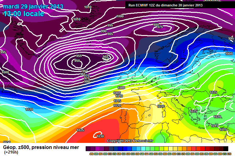
http://www.meteociel.fr/cartes_obs/comp_panel.php?mode=0&ech=18&size=2
Socks are staying in the drawer for now... :-D
Fed up of this weather IMBY, constant howling wind and showers on and off. Have not got above 14 degrees this year. Oh how I wish for a calm, sunny and warm day, tedious weather currently.
-
There are a fair few pessimists on this forum but I think you're number one at the moment SP, that's unless you're actually wishing for these 'much colder' conditions you talk about. In the reliable time frame GFS remains fairly warm for next week and until I see these cold conditions you mention in the reliable time frame I won't be making any more judgements on it. Of course it could turn colder and the pattern could become 'locked in', but I'm not going to make sweeping judgements based on one run from GFS. The ECM 12Z is hardly disastrous anyway, certainly not to the extent you make out in your post.
Is it just me or is this thread quite a depressing read at times?
Eh?
It has been depressing lately reading fantasy posts about fine weather and heatwaves on a weekly basis.
What's wrong with people who view all available data posting the truth? (Gibby, snowking and i'm dreaming of...for example who give a balanced view)
I want some heat as much as anyone on here but I like to have a balanced, realistic and non heat tinted spectacles view.
This time of the year I know there are only about 10 die hard posters on here and they are not keen on cooler weather, that's what is coming though after a decent few days next week in the South and East of England.
And CongletonHeatwe you will only be reading the views of 5 people then who have the same biased view as yourself.
No wonder this place has been deserted with the remaining 10 people shooting down anyone who gives an honest view.
-
 6
6
-
-
so you are just ignoring the warm settled weather which is shown on all the models for next week?
Frosty if anywhere in the UK gets into the 70's next week as you suggested I will eat my socks.
The only parts of the UK which will see any decent temps are the South and East of England next week. Even this weekend with plenty of fine weather about (Saturday mostly) the North is looking at 12 degrees max and the South 15 degrees max. Hardly anything to get excited about in normal circumstances. (The long run of cold months has everyone chasing a sniff of warmer weather)
The ECM has this nailed, cooler and unsettled is the way ahead.
The ens mean for the beloved GFS in here shows it.
I enjoy reading what you post but I think the orange and reds on the maps are CLOUDING your judgement.
More HIGHS and LOWS to come in this thread over the next month I feel, SUN would say we are DEW a early heatwave. But as you know it never rains but it pours when we wish for something different.
Have you read the recent Met Office outlook?
UK Outlook for Tuesday 23 Apr 2013 to Thursday 2 May 2013:
Largely unsettled with showers or longer spells of rain across the UK. Initially the rain will be heaviest and most persistent across the north and west, and showers may turn wintry at times across northwestern hills. The south and east of the country will see the best of the dry and bright weather with some spells of sunshine. At first temperatures will generally be near or just below normal across the north and west but perhaps rather warm in brighter interludes in the south and east. Later next week and into the following week, the unsettled weather in the northwest will probably spread southeast to all parts. Temperatures will become rather cold or cold in all areas with overnight frosts probably becoming more widespread.
-
Great to see a balanced and realistic post in here.see my post in the more technical thread-the 500mb charts are leaning towards more unsettled weather north and south by month end, not warm that is for sure.
The constant mention of Spanish plumes, heatwaves and the odd post of a freeze over the past 3 weeks have been grinding my gears. (We are fast approaching May and there has never been a hope in hell of either these options, bog standard Spring weather is what we have - nothing more, nothing less)
A bit of realism would not go a miss, I know everyone is pretty much craving heat but let's view all the available data and look for trends.
-
Out of this world in what way? I doubt the farmers who currently have sheep and lambs buried under the snow would agree if it's snow and cold you mean.
Scorcher if it is upsetting you so much go grab a shovel and help out. Fed up reading this nonsense in the model output discussion thread.
The cold is here to stay for another 7 days at least. (Chance of snow also)
I for one will be enjoying every minute of it.
-
Hayzus christy! I thought this was the model output discussion! Instead I have entered a whining Bill Oddie loving/Farmers club/Beechgrove garden tribute page.
If anyone here is concerned about all the above I suggest you take up another hobby.
-
The latest Met office forecast for my region...
Outlook for Tuesday to Thursday:
Very cold with further snow showers on Tuesday, prolonged at first with strong easterly winds and drifting snow. Becoming drier with some sun mid-week, winds easing, but severe frosts inland.
Issued at: 1600 on Sun 17 Mar 2013
It really is amazing to be reading this on March 17 2013! It would be more suited to mid Winter.
I look forward to some warm, dry and sunny weather in April...hopefully!
-
The ECM is very aggressive with the push of milder air from the South at T120. But as others have said it wouldn't be dry with it. This coming week might be the last cold spell until next winter so enjoy for everyone that may get snow.
Will do.
Another 5 days of fantastic wintry weather (in the middle of March) suits me. After that, who knows? Although I would much prefer dry and cold than below average/average with rain!

-
Some quite ridiculous snow totals for late March if this GFS verifies! Scotland, Northern/Central/Eastern parts of England would be in for a absolute pasting.
Truly is incredible.
If you live in these parts and enjoy cold weather get excited! You may not see the likes again for another 50 years in late March!
UKMO insane for Scotland
GFS a few days later.
-
Insane ECM from 48 hours until the end IMBY. After a day of snowfall here it seems as though I may have lots more to look forward to starting from Monday night onwards! You have to love the British climate!
Feel a bit sorry for those who prefer mild, 4 months of cold so far and no end in sight.
Surely April will deliver some warmth? (I am writing off the rest of March for any)
The sustained cold over Scandinavia is off the scale, must be hoping Gavin pops onto the weather forum over there to show the ensembles showing a warm up...next week, the week after...if you post it every day it will happen eventually. :-)
-
Reasonable grounds for thinking that the global synoptic dynamical model is moving towards a third cold pattern this winter (the waning of this present one being well advertised) and the last few GEFS ensemble means have leant support to this idea.
Tropical convection has been focussed in the western Pacific in the last 10 days. This has introduced anomalous westerly winds to the tropical Pacific which in turn has helped lift tendency in angular momentum towards an El Nino type pattern.
Latest TOA Triton data indicates anomalous ocean heat content centred just west of the Dateline and encroaching anomalous westerly winds on the back of the MJO. Trade winds are also decreasing, which is typical of MJO progression towards phase 7/8.
The GEFS MJO forecast has come to life in the last day or so, suggesting a strong amplitude wave to develop in phase 8.This seems reasonable on the basis of favourable conditions for convection due to increased heat avalability and cooling upper atmosphere (especially lower stratosphere).
These tropical developments are beginning to take effect in the sub-tropics. A strong +ve mountain torque has occured and tendency in angular momentum is already postive and likely to spike very positive in the coming days. Overall relative angular momentum similar to November.
The shrewd will recognise that the last uptick in relative angular momentum heralded our first pattern change and cold trough in December, by about 2 weeks lead time as positive (westerly) wind anomalies are fluxed poleward introducing anomalous mind and high latitude ridges and circumglobal troughs (Pacific and Atlantic).
Meantime, our first downwelling wave from a very strong polar stratospheric warming (and sustained reversal in zonal winds) has matured. Stratospheric time scales are extremely long, and we can expect further downwelling episodes lower down in the atmosphere for the next few weeks. Based on Baldwin'c composite of weak vortex events, the next episode of increased eddy activity is due around 28th January although the timing of this is not exact.
The temperature anomaly section shows a reasonable time scale for 'nodal' type propogation extending into February, perhaps more towards mid February. A typical tropospheric response to this would be very similar to an MJO phase 8 projection, so its interesting the atmosphere choreographed in this way.
So teleconnectively we have a reasoned case for anomalous heights to our north end January into February. The timing of this highly problematic as the models were to a degree blind-sided by the first downwelling wave, only latching onto it 2 days before the warming took place. Were this happen again, a sudden turnaround in modelling could well occur.
The last five GEFS mean height anomaly for the extended range has 'hit the target' on all five occasions to varying degrees, which is interesting in itself. Todays GFS super ensemble mean height anomaly....
Putting this together, expect further cold pattern, becoming stronger probability the further we go into February but I wouldn't be suprised to see it pop up from 28th January onwards. Winds from the NE and E the favoured scenario.
Copied from In depth discussion thread.
A GP special for the coldies!
AVE IT!!!
-
I totally don't see that happening (but you never know) I see a more Atlantic based pattern becoming established (briefly) towards next weekend and into the following week. But then, with the pattern shifting further east and the Polar Vortex moving out of Canada, we have the possibility of a renewed cold push from the N.E as the whole pattern moves from west to east.
Spot on Chris. I think this is what the met office are hinting at in today's update (hopefully Ian F would be kind enough to give us a fleeting thought on this? ) and also what GP and others have alluded too.
Maybe the coldest spell of Winter to come during February? We shall see.
Chin up for those who have had nothing during the current wintry spell. (I have only had a 1 cm covering which lasted 24 hours)
Plenty of Winter left for everyone to get involved!
-
What I don't understand is...when a freeze is shown at 240 on the models people urge caution and act as though everyone on this is 5 years old and are unable to think for themselves. However, when zonal is shown at 240 sheer panic sets in and folk try to push it as being the likely outcome! Very bizarre!
-
Cross-model agreement between GFS, UKMO and ECM at +120. GFS holds the low pressure off more at +144, but it would still be less cold. Confidence of a breakdown is increasing.
http://www.meteociel...M1-216.GIF?20-0
EDIT: Horrible. Horrible. Horrible. Is there anything possible we can get from these charts?
The only thing possible Tom is that the next run in the morning will show something completely different.
I would not get too upset about anything after 120+ just now.
-
The Scandinavian high is the skid mark on the underpants of weather forums throughout Europe.
Give me a Greenland high over that solution any day in Winter!
To sum up all charts for today so far...trending seasonal...slight warm up and then colder. It is as easy as that folks!
-
Some rather strange comments in here recently. Why are you complaining, looking for every worse case scenario possible and searching for the breakdown every given opportunity?
Most of the UK has not seen a single snowflake so far this Winter! The strat, ens and charts all lead us into a Wintry outlook at some point over the next few weeks! For the love of god if you don't like snow or cold please stick in into you're preferences section so I can then understand some of the posts in here.
People complaining about the GFS, it is still a cold run and just for fun it ends with a classic pattern locking in. If you love cold weather and currently can't be positive about it I suggest you take up another hobby.
-
PubliusEnigma, on 04 January 2013 - 19:30 , said:
Only a fool throws caution to the wind...
Thats a deep low feeding in albeit SSE;lys theres nothing that cold on the continent, and behind the front we are in a
S or SSW flow. So to sum up to many chickens being counted, without any of the eggs being hatched. More runs needed..
T144 and beyond is probably FI if not earlier.
If you have a passion for wintry weather and the background signals, charts and analysis from highly respected members all back up the idea of cold weather arriving from mid month then why not throw caution to the wind? However, if you prefer mild then I could see why certain members post what they do. Everyone can see and think for themselves, the whole point for me coming to this thread in Winter is to get hyped up and excited for the arrival of snow! And when the buzz is at this stage for what might happen in the 2nd half of January...I am going to ride that wave with every positive and excited bone in my body!
I don't understand the repetitive, negative tone in the posts of the same 2 or 3 people everyday. (Unless they prefer mild!)
Anyways, onwards and upwards. Things are looking extremely interesting.
-
good evening guys. How relyable is the cfs model? Frm wht i red before frm ian f's posts the our met dnt touch that model, or am i talking crap if i am then guys i stan to be corrected. Thx.
Belongs here Syed.
The CFS is usually WHEELED out in emergencies for mild or cold lovers. It has never had a HANDLE on any pattern or trend. I would keep a LID on it and just browse at you're own leisure for a bit of fun.
-
A pertinent view of it throughout the entire annual cycle ;-)
Thanks for clearing that up again Ian as per my post from a couple of days back. (See below)
Yes, I would check the CFS often in the past. It changed from week to week and I wondered how reliable it was...until Ian F gave us the information that it was never used by them.
It is about as much use as a cat flap on a submarine.
Edited by Mr Frost, 30 December 2012 - 17:27 .
It was wheeled out recently to show a flat and zonal pattern through January and February.
I would rather watch a documentary on quicksand than sit through a CFS run. (Whether it shows zonal or a snowfest)
Again, thank you for you're continued posts in here. Fantastic to hear the thoughts of the metoffice.
-
The CFS for what it's worth has a pesky piece of Vortex around Greenland and above average temperatures and rainfall for January.
Quite a lot of high pressure over the North but a pesky bit of vortex around Greenland, typical. I guess this shows what happens if we get a SSW and wet get unlucky with where the blocking positions itself.
Temperature anomalies, most of Europe is anomalously warm
It's only the CFS though so obviously a big pinch of salt.
Yes, I would check the CFS often in the past. It changed from week to week and I wondered how reliable it was...until Ian F gave us the information that it was never used by them.
It is about as much use as a cat flap on a submarine.
-
Would you perhaps like to point us towards a few of these mystery posts which suggest this? Or are you just happy to continue on a wind up...
Anyway. Bias corrected GEFS MJO forecast beginning to look a lot more reminiscent of UKMO output
GFS:
UKMO:
ECMWF: The more recent trend has been to lower the amplitude for phases 5/6, which is certainly not terrible news, and may allow external forcing to drive the pattern until we reach phase 7 (probably around mid month), though with the GWO moving into phase 4 the MJO signal may become more amplified than presently suggested.
MJO and Stratosphere still in pretty good harmony in the mean time towards mid month, I think its probably fairly fruitless looking for too much in the way of cold weather before then, though dependant on where the HP ends up settling (and this is by no means nailed on just yet) we could end up with some overnight frosts at least. Much more seasonal.
SK
Great post SK.
I have highlighted and underlined something that EVERYONE should take on board. I get the feeling certain folk are expecting blizzards within the next week going by the buzz killington posts in here.
-
I am beginning to get used to the usual " winter is over " posts on here throughout the past 10 days...
It shows no sign of dying out I see! Amazing.
Nothing to get excited about at present or for the next 10 days I imagine. I would advise a wee break from chart viewing if you are a coldie.
Hopefully the SSW delivers for our tiny island during January, I am sure most will get a wintry spell at some point during the next 10 weeks. Only a matter of time I would have thought.
Until then relax, be patient and adopt a positive attitude. It stops you from making hasty remarks.
-
Had to double take on the name of this thread, thought I had stumbled across a Stratosphere bashing one. Not much to look forward to currently from a coldies view. However, we all know how unreliable the models have been over the past couple of weeks so who knows really what is going to happen come January. Although, going by what is being posted in here most seem to know exactly what will happen. Bizarre indeed. Have a fantastic Christmas everyone! Let's hope us snow lovers have something to cheer about after New Year.
-
A fair number of IMBY posts in here so I will add mine.
After 12 days of harsh frosts and 3 separate snowfalls to start Winter I am not fussed about any mild weather! It makes a nice change to see some rain and hear wind! Also, White Christmas looks in with a shout for a number of places in the North of the UK going by the models and thoughts of the met office.
Winter will come to most parts at some stage during the next 3 months, be patient and look for trends/read the strat thread. No point constantly whining about how crap it looks currently. If you are that depressed about it book a trip to Lapland or a return flight to Scandanvia for a long weekend.
Early days for us in the UK, plenty of time for Winter wonderlands.


 ECMWF:

Model Output Discussion 12z 20/04/13
in Forecast Model Discussion
Posted
I had no idea that temps were rounded, you learn something new every day!
Heathrow hourly observations
Tabular (last six hours)Graphical (last 24 hours)
Date Time Weather Temp Wind Vis Pressure / trend
Dir Speed Gust
Tue
23
Apr 1500 18.9 °C W 11 mph 28 km 1020 hPa, Falling
1600 19.4 °C W 10 mph 26 km 1020 hPa, Falling
1700 20.2 °C W 11 mph 23 km 1020 hPa, Falling
1800 20.5 °C WSW 9 mph 25 km 1020 hPa, Falling
1900 19.8 °C W 10 mph 30 km 1020 hPa, Rising
2000 17.6 °C W 9 mph 30 km 1021 hPa, Rising
2100 16.6 °C W 7 mph 30 km 1022 hPa, Rising
Ah well... :-)