


moffatross
-
Posts
350 -
Joined
-
Last visited
-
Days Won
1
Content Type
Forums
Blogs
Gallery
Events
Learn About Weather and Meteorology
Community guides
Posts posted by moffatross
-
-
- Popular Post
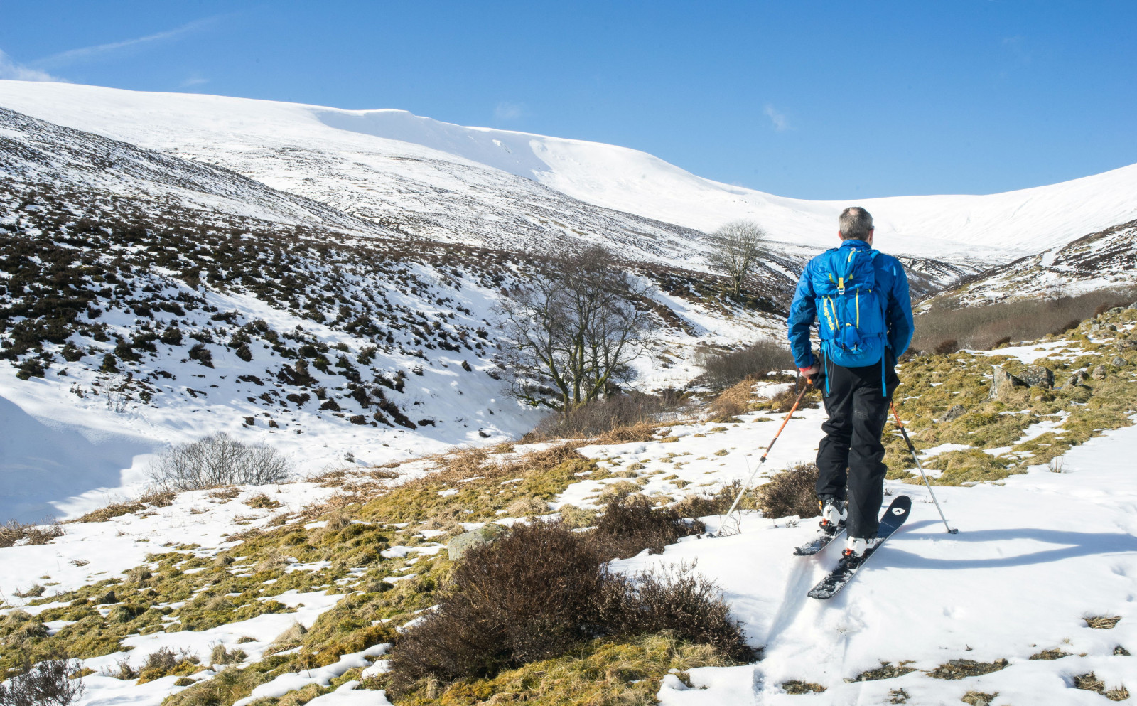
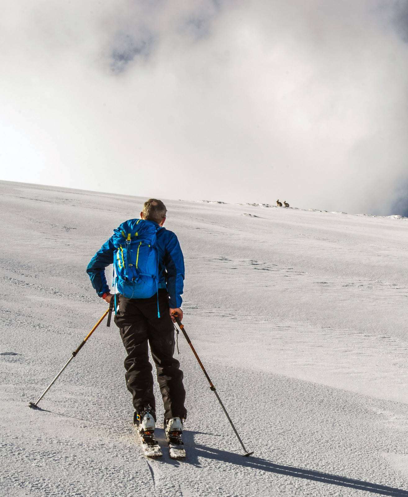
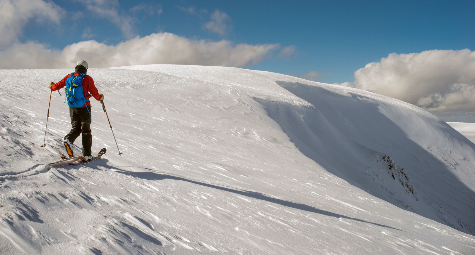
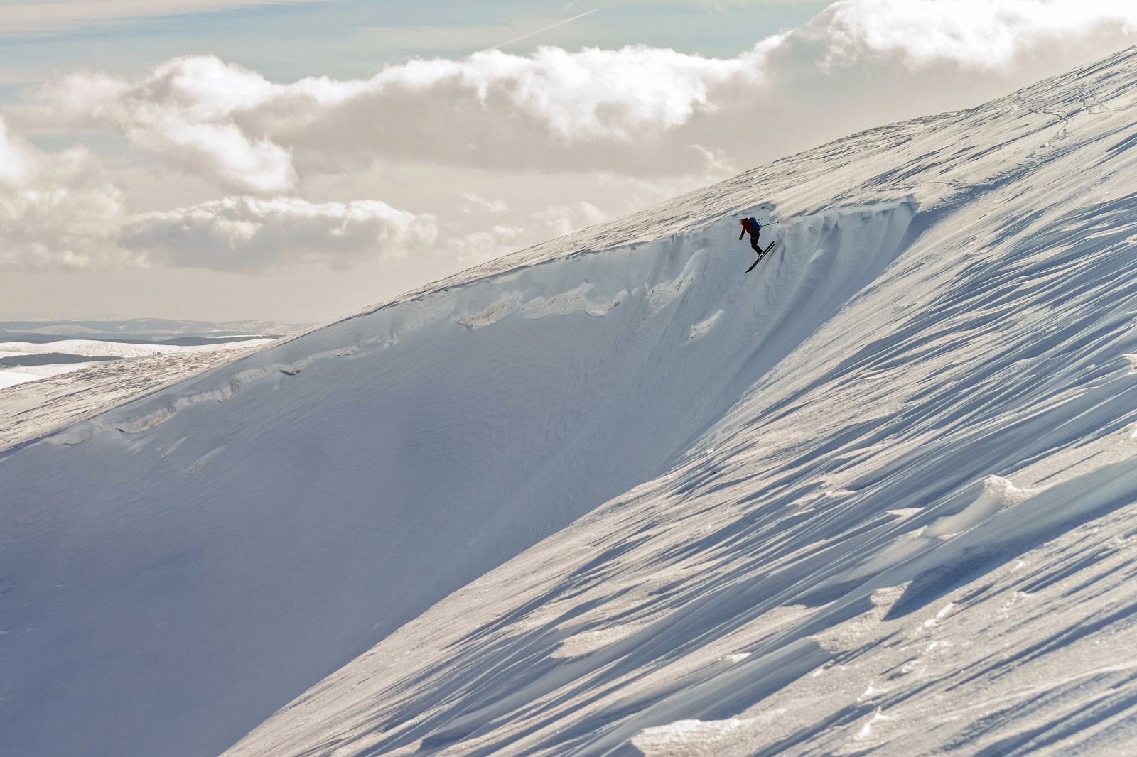
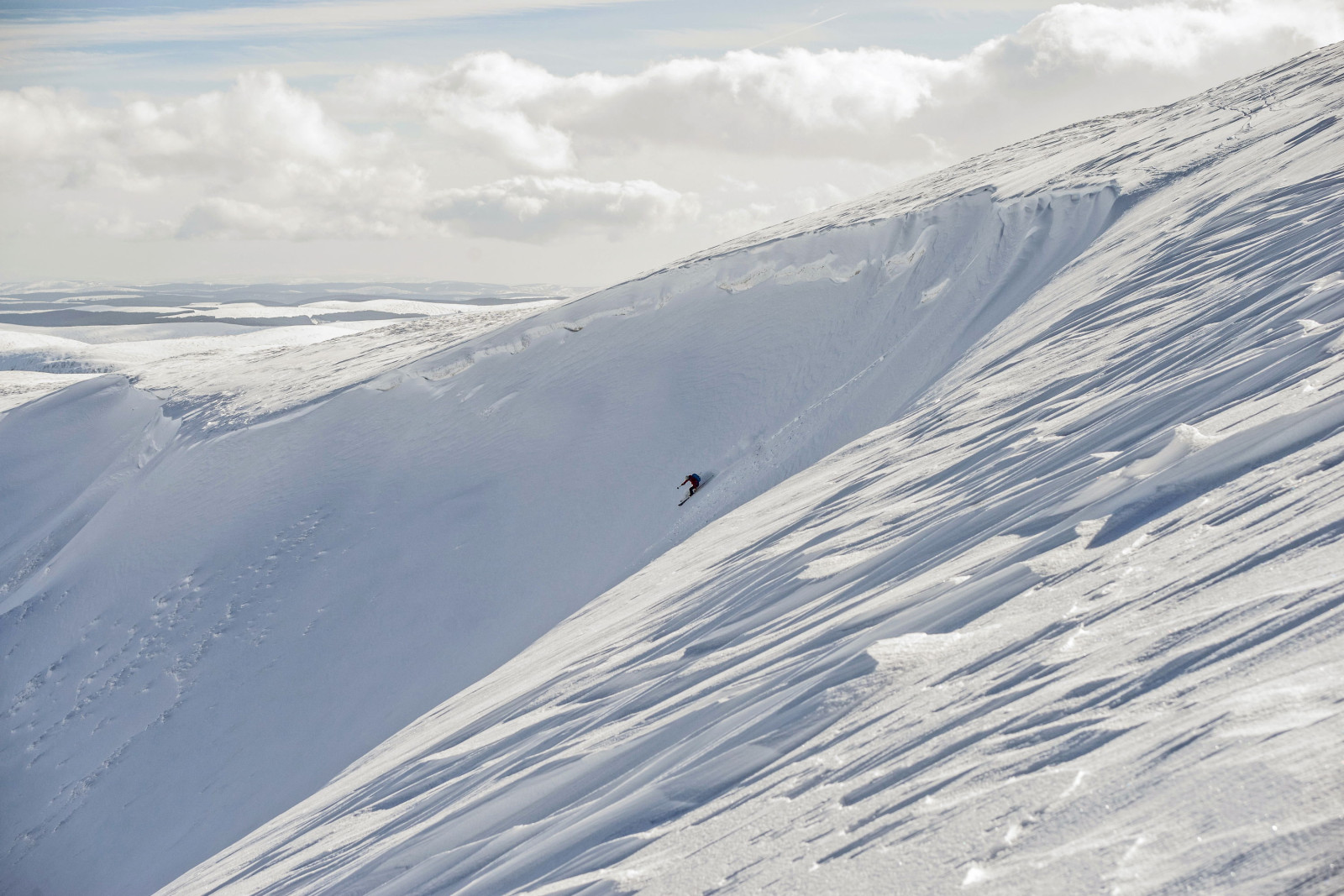
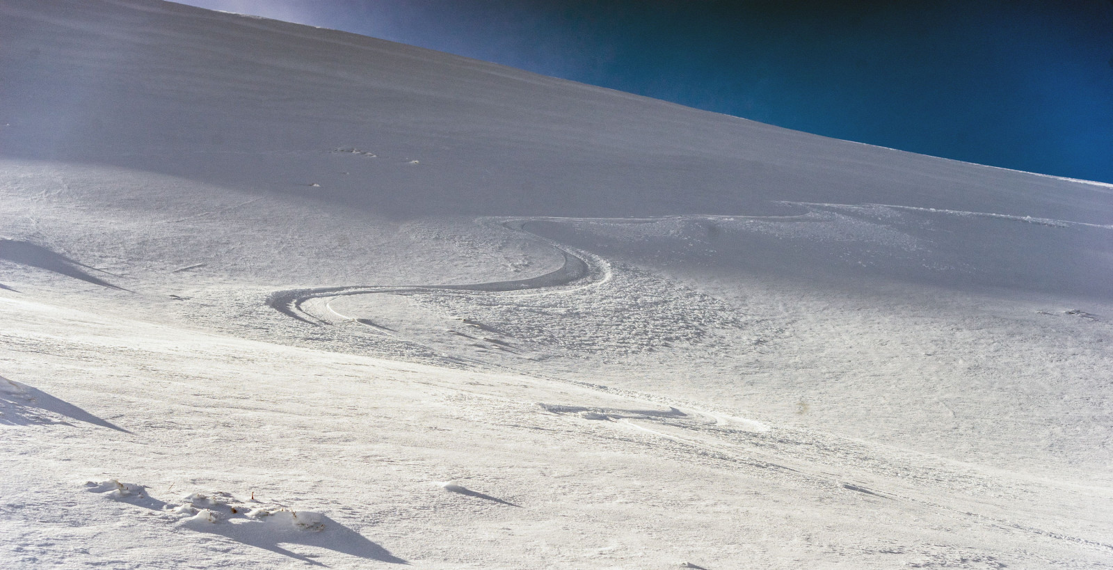
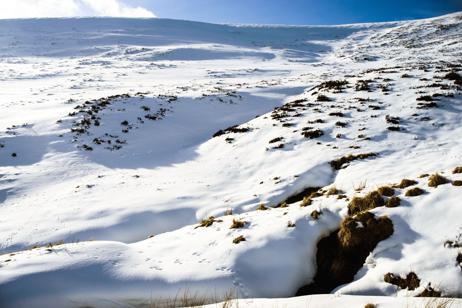
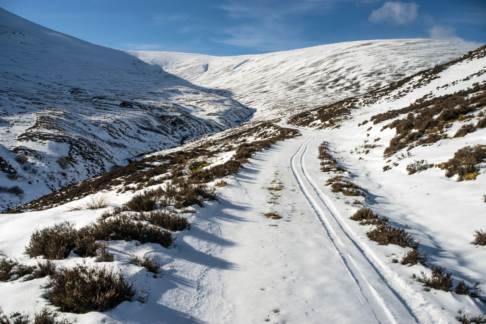
I had a wee ski in the Moffat Hills yesterday
")
Continuous snow to skin on from end to end ...
Mountain hares everywhere, bobbing upslope as we climbed ...
Crossing the brow of Cramalt Craig ...
My pal took an adventurous way in ...
And found a perfect white room ...
I'm a pussy cat and like my sunshine ...
Repeated through untouched stashes on neighbouring hills until the sun left the powdery slopes ...
Then skied all the way back to the car ...
-
 22
22
-
- Popular Post
2 hours ago, Hawesy said:Good to know I’m not the only one who is emotionally exhausted!
Definite lessons to learn. For a start here was the very crude correlation between 850s and 2m temps here on the coast during the easterly flow over the last few days:
-14c = -1c
-12c = 0c
-10c = +1c
-8c = +2c
Whole lot of other factors in play of course but a useful thing to remember. Had it been December we would have been dealing with higher sea temperatures but much less solar input so interesting to think about how that would have affected the outcome...potentially even more snowfall generated but with more marginality around coasts? Who knows!
I'm financially exhausted too. Besides the extra cost of heating, I've lost 3 days income to the snow, one from not being able to get to a site in Peebles on Friday, a stand at the cancelled motorbike show at Ingleston over the weekend, and my fallback, my regular stall at Blochairn market, was also cancelled today. On the upside, I skied some hills in Broughton yesterday that I've been eyeing up for years, but I am genuinely looking forward to spring now :-)
On your December observation though, is it wings and roundabouts i.e. would a sufficiently cold pool have even been available out of NE Europe/Asia to have provided the opportunity for those low 850 temperatures we recently experienced ?
-
16
-
14 hours ago, Hawesy said:
Still 5 hours to go until my prediction deadline....looks like a very mixed bag, on balance more miss than hit.
For a few folks I underestimated a bit, here’s looking at you @mardatha @Cheggers, among others. For a few more I don’t think I’ll be far out @snowy owl @Ruzzi but for most of the Fife, Perth and Dundee contingent I predicted way more than has fallen (barring a miracle).
Im giving myself 4/10 at this stage, certainly not up to the standard of my predictions during the January events.
Still, it’s all just fun and I certainly don’t take myself seriously. Still, I’m puzzled as to why there’s been a relative dearth of snow around north Fife, Perth and Dundee so if more knowledgeable members such as @lorenzo @LomondSnowstorm Or @CatchMyDrift can shed light on this I’d be grateful (and it might get @edo off my back)
The other thing I learned is, man, that Edinburgh contingent is demanding! I mean @101_North fair enough, I expect it, but it must be in the water!
I can't find your prediction for Moffat but I've just been for a wade around in the powder and it's truly impressive stuff from an Easterly *. It's hard to tell, what with the drifting, but there's somewhere between 15 to 20 cm of some of the most delightful powdery goodness outside the hoose, some much deeper drifts, and the snow showers are still rattling by. How's Hawesy-land looking ?
*Edit - usually, Moffat's weather is just pure cold, braw and sunny out of an Easterly, whether it's autumn, winter, spring or summer.
-
2
-
-
3 minutes ago, shuggee said:
15cm here in the western Borders. And here's the A701. No-one has driven that for a long time...
Vindicated ! I made the right decision to stay home. Even as I was driving back home to Moffat past Tweedsmuir last night, small drifts were already blowing through gates onto the white road. I can imagine there'll be some much more chunky drifts now.
-
1
-
-
It's nuking it here and Moffat Academy is closed today too. I was supposed to be working at Chesser in Edinburgh but despite winter tyres on the van, I'm giving it a miss. Bashing through snowdrifts on the way out or the way back anywhere in the 20 miles without mobile phone signal between the Beeftub and Broughton is probably not a great idea.
I'm actually really surprised by the snowfall totals here so far because the hills to our east normally suck up most of the moisture when it comes from that direction, generally leaving us with bright but braw days. Radar suggests more to come
-
5
-
-
Scotland 'on cusp' of red extreme weather warning for snow
-
12 minutes ago, Hawesy said:
Terrible film.
After all the time and effort I’ve put into securing a snowless winter in Broughty Ferry I will be raging if it’s spoiled by some misguided late season NEly. Let’s hope the models have dropped any notion of such a terrible idea by tomorrow. I’ve got my reputation to think of.
Well, your unblemished record may go unbroken, even on a full-blown Easterly that the model output thread lot have been up and down about for what seems like weeks. The 18Z GFS models mostly dry, a bit of rain, and at T384, some sleet !
-
9 minutes ago, Mr Frost said:
Has anyone climbed a Munro or Corbett in the weather conditions attached below?
I have been to the summits of Ben Nevis, Cairngorm Mountain and Ben Lomond to name a few but only in calm conditions. (mostly Summer weather, snow on the ground with light winds and clear visibility for the most part)
Today would have been the perfect day for it but I didn’t have the time - off work tomorow so thought I would give it a bash! (Fully equipped and would make for a proper wild adventure)
Think I might be biting off more than I can chew but was just curious to know if anyone has sampled walking conditions like this? (Blizzards, Storm force gusts, very poor visibility and feel like temperatures of -15?)
Yes, I've summited on touring skis in storm blizzard conditions by day and at night by headtorch. Anything over 40 mph is horrendous with the 'feels like' windchill factor being much.much more chilling than it suggests, feeling a whole lot colder than the -30's I've experienced in the Alps and North America. If you're going on foot rather than ski, it will also be much tougher than on skis. I wouldn't contemplate it.
-
3
-
 1
1
-
-
Anyone else get the thundersnow this morning ? I'm just back from working in Wanlockhead. It was hooning down this morning for a couple of hours and a fun drive up at 8 am. Mrs moffatross said thundersnow in Moffat too with multiple cracks of thunder/lightning in the heaviest snow.
-
2
-
-
15 minutes ago, Hawesy said:
Have to be honest and say I reckon you’ll need at least 200m altitude to see anything significant tomorrow. Aside from those members living the high life (altitudinally speaking) such as @Northern Strath @igloo @shuggee I think it’s rain and sleet for most, with perhaps some wet snow before it clears.
In other words, it’s nailed on.
I'm back and forth from Moffat to Wanlockhead this week on a decorating job in a house that's at 437 m ASL. I'm expecting a fun drive up there at 8 am tomorrow.
On another note, the models are throwing up all sorts of fun and games scenarios just now. This, for Friday evening, could just happen I suppose.
-
2
-
-
I think today's mild sector was undercut by the cold air a few hours earlier than expected. I've been working in the SECC in Glasgow today, and when I left @ 6.30 it was pishing down rain at 4.5C. By the time I arrived at the South Lanarks/D&G Border at 7.30 pm it was pishing down sleet at 1.5C. It's currently pishing down in Moffat @ 2.5C but I reckon the highest parts of the Southern Uplands will have already been absolutely pasted.
The Hopetoun Arms cam is showing the snow is setting in ... http://www.winterhighland.info/cams/lowtherhill/
The one up the hill will be obscured by new snow again by tomorrow morning. I must do something about that ... maybe extending the cowling around it might help but that'd also make it more prone to wind damage. We changed the Lowther Hill camera and its housing a few months ago to one similar to those used at Glencoe but it's been more susceptible to snow build-up than the one we had up there the previous winter (albeit it's also been tested a lot more by the snow this winter too
).
-
3
-
-
2 minutes ago, Hairy Celt said:
Ha. See my edit ^^
Haha !! It's like a game of sassenach vs teuchter trumps isn't it !
-
Just now, Hairy Celt said:
That's a crap map.
Tchh ! So parochial
But don't worry, I'll post photos of the snow in Moffat five ninths the way up my 'yard stick' ;-)
-
1
-
-
Just loving the 12Z ECM's fantastic prognosis for snow depths in 10 days time
https://weather.us/model-charts/euro/42-w-555-n/snow-depth-in/20180219-1200z.html
That's inches, not centimetres, folks. Pure pie in the sky I know, but nice eye candy
-
3
-
-
3 hours ago, mistyqueen said:
Tuesday looks interesting from a stormy point of view. I said to a friend last week that we haven't really had a major blast this winter, this might be it! ?
Storm damage is expensive, so praise be and all that. Thankfully, the UK Met Office aren't (yet) suggesting there'll be any notable storm for anywhere in Scotland any time over the next 6-7 days. As per usual, they've ignored the rather wilder GFS with their projection being closer to ECM, and they're suggesting peak winds in the next week or so will be overnight Saturday into Sunday
-
8 minutes ago, Stormeh said:
Great reporting from the Daily Mail again
Brilliant spot !! I'm still laughing
Residents of Saddleworth Moor had to clear snow from their windscreens. Chaos indeed
-
2 minutes ago, 101_North said:
You've done well for my location so far. First 2 predictions were pretty much spot on. Yesterday you were 100% out but in the good direction
Yep, predictions were spot on for me too. Just poked the ruler into the snow on roof of van and depth measures 5-6 cm.
-
1
-
-
10 minutes ago, mistyqueen said:
Oooooh, snowing hard now, Blawin' a bit o' a blizzard! ❄❄❄❄
Nice ! You're in line for the showers that most of the rest of us won't get today.
On the upside, I can see blue sky to the west now
-
47 minutes ago, snowblizzard said:
Yep, it's been pretty good so far for some of you guys North of the border, especially those with reasonable altitude.
Met Office analysis and outlook is for colder than average February but that doesn't mean severe cold & snowy weather for majority of UK
I think their thoughts are likely to change fairly soon!
The Met Office 30 day thoughts will change if their material evidence changes and so far they've been rather steadfast with the wording for their 2-4 week projection ...
"Through the rest of February it will remain cold but the weather may be more settled with widespread frost overnight. This looks set to last for a while with a greater chance of easterly winds, potentially bringing some very cold weather. However, into the beginning of March, it may turn more changeable at times, although any milder and wetter spells may be fairly short-lived with temperatures generally staying colder than normal."
I has barely differed for a good few days. I don't usually do too well out of an easterly but I still enjoy its prospect and surprise snowfall element anyway.
On another note, someone in this thread said that -10C @ 850 hPa or below is needed for PM showers to deliver snow even at 200m ASL in the NW English Midlands (Manchester/Oldham etc), which surprised me as we've not seen uppers that cold yet this winter. All our low level cold has been in darkness when snow has been lying, and it's surprising how air temperature can drop from freezing to -10C or below in the space of just an hour or so when the uppers are only -6 or -7.
-
2
-
-
Intensity recently pepped up from dandruff/light to moderate/Dickensian. There's absolutely nae wind, so anything sheltered is snow-free but areas with an unobstructed line down from the vertical have received a few cm.
I just dropped a post in here to add some balance to the force ...
-
7
-
-
Snow is falling and lying again this morning and it's already been a notable winter for snow and cold with temperatures routinely dropping below -5C, occasionally -10C and below. The snow on the ground day count is certainly the best out of the last 5 years and greatest snow depths here have been around 10-12 inches which is not too shabby for just 145m ASL.
To the near future, the 10 day ECM operationals are modelling hit after hit of PM frontal ppn, and the GFS ensembles for 850 height are projecting the next 16 days at 3-5 C below the long term climate average. It's an extraordinary outlook on an already unusually wintry season and the Met office analysis for nest 30 days is both fascinating and mouthwatering.
-
7
-
-
38 minutes ago, Stormeh said:
Looks like western Scotland will be the winner this winter in terms of snowfall. Plenty of PM shots on offer throughout the next couple of weeks with the possibility of decent falls of snow. As @DR(S)NO said, I can’t post this in the nut house because winter is over and my post will probably be deleted
Yep, it certainly looks like there's a fair chance of a cold zonal flow after next w/e, with opportunities for frontal rain/snow, and more interestingly, Atlantic convective WNW snow shower feeds that'd stomp all over today's snizzle.
Talking of snizzle, the Clyde wind farm is creating anomalous Doppler radar precipitation returns again today, a regular occurrence in drizzle and snizzle when the cloud base is low.
Edit ... posting a second image as it's more clearly seen on the radar without the NW ppn type feature on
-
5
-
-
The ECM sees potential for some large cumulative snowfalls over the Southern Uplands in the next 10 days. White Coomb in the Moffat Hills would see 75 cm according to the 12Z :-) ...
https://www.yr.no/place/United_Kingdom/Scotland/White_Coomb/long.html
-
3
-
-
34 minutes ago, CatchMyDrift said:
Maybe it's not going to be a snowfest but it's a beauty of a holding pattern if we can't have a snowfest.
At least it isn't mild...(if you're a cold and snow lover...sorry @ciel).
Definitely. Even if we don't get the snow, we're unlikely to get drowned, or blown away, and the snow on the hills will last rather longer into this spring and summer than it did last year too. But I think we will see some decent snow, just not the wintry Armageddon that some of the MO thread rampers are talking up.
-
1
-


 But don't worry, I'll post photos of the snow in Moffat five ninths the way up my 'yard stick' ;-)


Scotland/Alba Regional Weather Discussion - 16/01/2018 Onwards
in Regional
Posted
@Hairy Celt, yep, they're very common in the Moffat & Tweedsmuir hills, and even over to the west in the Lowther hills where the big estate owners have a reputation for killing everything but grouse, they're all over the place. I think they're amazingly resilient creatures, they're pretty bright so know when to keep their heads down, and so fast that they can almost always escape from fox and mink.