


Allseasons-Si
-
Posts
12,112 -
Joined
-
Last visited
-
Days Won
61
Content Type
Forums
Blogs
Gallery
Events
Learn About Weather and Meteorology
Community guides
Posts posted by Allseasons-Si
-
-
Evening all
@150HRS the trough out of newfoundland is some 2 to 300 miles further west on the 18z than the 12z plus more ridging up into greenland
18z
 12z
12zEDIT:at 177hrs there is i think more WAA and the trough digging further south too,looks good to me.
-
@168
we have the e/seaboard low some 200 to 300 miles NW on this run compared to the 12z + more WAA
Si
-
Hi phill
theres one thing that i have noticed over the last few days of model watching is that the lows have tended to track more of a SE shift than was progged to go barraging through the BI,the block to the east,and some hights to the north have done enough as far as i can see,and i feel there will be more of this to come,the point that OMM was stating earlier regarding that second trough out of the e'n seaboard,that's what we should be looking at as to amplify a ridge into greenland,that would open the door to the siberian flood gates
Si
sorry for confusing mods,but i was refering i.e to the low following that one @ a later timeframe at t+132 onwards,and looks a bit better on the 18z
-
Look at that low deflate and undercut out of the e/seaboard at +117
don't know if that is a good thing though.
Si
-
I seem to recall that someone(cannot remember who it was)was saying look west for our weather,now at t+90 there is more amplification off the eatern seaboard than the 12z,now i don't know if it was about this scenario but keep your eye on it
Si
-
Yes it`s more runs needed JP.
As ever a little adjustment of the whole pattern west would help -along with the undercutting of course.
Hi phill
theres one thing that i have noticed over the last few days of model watching is that the lows have tended to track more of a SE shift than was progged to go barraging through the BI,the block to the east,and some hights to the north have done enough as far as i can see,and i feel there will be more of this to come,the point that OMM was stating earlier regarding that second trough out of the e'n seaboard,that's what we should be looking at as to amplify a ridge into greenland,that would open the door to the siberian flood gates
Si
-
u thinking something like this on the right and let the trough move into the continent
YES!!!
-
ok,here is my take on the 18z gfs @+156 at face value,please feel free to correct me as i am still learning
i have circled areas of interest,we have more amplification off the eastern seaboard generating more of a ridge in the atlantic,more hights over greenland forcing the trough futher south,a more southerly flow from the east from the siberian high,and i suspect that that low will dip SE as arrowed,all speculation at this moment of cause,lets see
Si
EDIT,scrap this that i just posted,i have just run forward the frames,but it could be a good idea.
P.s fi till we get past this weekend.
-
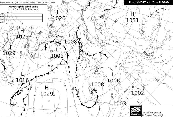
I have saved that 120hrs fax chart for investigation to see if it verifies,obviousley there will be minor changes in trothes(sos for the spelling lol),but the overall looks good.
-
120 hour fax chart http://www.meteociel...fax/fax120s.gif
All good.
That chart is a beauty,i will sleep tonight,altough i wasn't worried anyway with the background signals,goodnight peeps.
-
Is that part of the pv in siberia showing allready at 189hrs,it wasn't there on the 12z.
-
That shortwave sw of the BI looks like undercutting to me,that will draw in a stronger easterly.
-
I think the high pressure is better oriented on this run than the 12z and also there is a bigger swaithe of colder uppers NE of BI,looks good to me.
-
One day all these winters with a southerly tracking jet will come to an end and we will revert, but while it lasts, i can say that i was there and i experienced it.
true mate,we are in a lucky period that our ansestors would of witnessed many years ago and to tell us what it was like then,we NOW look like we are in a simular cluster of winters that could reflect that era,i am so happy right now,and to witness 2010/11,all be it a short snowmageddon,it was fab,this winter looks awsome at the moment
Si
-
I will be there, i will keep hoping and chasing until one day when i will either see an 87 /91 event deliver for me again or i pass.
or even 81/82
i do remember it well,there was snow drifts up to my bedroom window when i was a young teen,i could just jump out of my window into it but my dad said what r u doing,lol!
-
Can anyone spot the potential visitor....?
.the pv shifting to siberia,thats what gp,chio etc was relating to. -
Steve murr is at the global forcasting station tapping around with the mega comp and thowing in a few £££ in the process,lol,
where are u Mr.murr
-
@168 that lp is edging further towards us out of the low countries,sub snow off that maybe
-
On gfs 18z, even as early as next tuesday, snow showers in east becoming more frequent and spreading inland!
yep,
-
Those of you who watch every frame of every run are going to give yourself a heart attack before the easterly even arrives.
i take it AWD that i am one of the many lol!,it's so exciting and most of all addictive
-
Atlantic ridge further north on the 18z compared to 12z,@93hrs
12z
18z -
A bit of trouble here....low over Iceland not as ready to drop away south east as previous was.....
It's slightly further west though tt,and more of a eastley round the top or it instaed of NE.
-
I have just come out of summer hibernation recently looking at the latest models,cpc's,ensembles etc and one of them that caught my eye is this,not sure if this is the latest that has been posted in the strat thread,but it does look good
does this have the effect on what is happening next week?,i saw a post about this somewhere though that it has a knock on effect a few weeks down the line,is this true.
-
A few flurries here at the moment
off topic but i am heading for the peak district in the morning,thermals at the ready,IT WILL BE COLD!!!


 .the pv shifting to siberia,thats what gp,chio etc was relating to.


Weakening weather fronts
in Spring Weather Discussion
Posted
Hi Staffordshire
i think it's because they have a greater landmass to aid convection from and no hills and mountains to break up/weeken the systems where as we have the spine of the country with such that break up or weaken them plus we are a tiny island with not much land mass
i think that's about right but some eperienced folk could do a better job at explaining,good question though.