


TheBigFreeze
-
Posts
171 -
Joined
-
Last visited
Content Type
Forums
Blogs
Gallery
Events
Learn About Weather and Meteorology
Community guides
Posts posted by TheBigFreeze
-
-
well GFS snow maps have East Anglia covered in Snow from Monday 12:00 until 06:00 Tuesday, so happy days if it comes into fruition

-
Metcheck show 3 days of uninterrupted snow Mon,Tue, Wed for my town and a total of 23 inches of snow if the 1mm to 1cm is correct lol...wow if it happened!!
-
i'm looking forward to john Pikes fax updates to see what they hold for Norfolk...been sat here with matchsticks propping up my eyelids lol [reason being my misses will expect an immediate snow update when I pick her up from work at 6 a.m] bless her lol
-
anyone watching Look East feedback grateful
I had it on, but children distracting me a little.....along the lines of few snow showers on sunday for North Norfolk, some of which could be isolated and heavy, then Monday is where the fun is set to begin, although the exact timing of it was not confirmed yet, but expecting a few cm
-
If this comes off for Monday/Tuesday!!!! i'd by a sledge,,,,but seeing as I have no decent hills or slopes near me
lol -
http://www.netweather.tv/index.cgi?action=michaelfish;sess=
from about 3:54 is this forecast showing snow over east anglia, or is it just cloud? thanks
-
Although a bit of a downgrade on the GFS 00z longer term it appears the ECM is still all out for a snowfest!! happy days
-
after the early morning runs are we still looking at snow for the end of this weekend? I can't take a proper look on my phone?? cheers
-
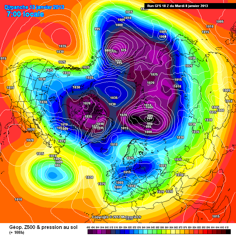
http://modeles.meteo...nh-0-108.png?18
Split flow western tip of greenland-
also slightly lower heights into the east of the UK- = more snow risk
S
so its looking good for east anglia then?? been following this thread with interest.....would like to add a thank you to all posters, i have learnt so much reading through the posts
-
so is the UKMO considered a superior model? if so I'm guessing the fact that it is moving towards the GFS output can only be viewed as a good thing??
p.s what models do tesco use as went there last night and they have put snow shovels, buckets of salt and deicer etc in the entrance lol
-
UPGRADE ALERT!!
Snow for a lot of Eng & Wales on Sat.
what are the stripy blue lines over east anglia indicating?
-
are the times the models come out GMT?? e.g are the 18z 18:00 GMT? thanks in advance
-
with lots of the models showing a potentially cold and possibly wintry weekend, why is the BBC still showing temps around 8 degrees for saturday/sunday? is it they just haven't updated their forecasts yet or that they don't think it will come to fruition, or are they just waiting for it to be nailed on?
-
-
Hi again and please feel free to delete this mods, but as a newbie, is there a post anywhere which gives a guide to the different models and all the different terminology and the way everything interacts, like heights, uppers, ensembles, anomalies etc would like to try and get my head around things a bit more..thanks in advance
-
Unfortunately it isn't half that simple, anything at the moment post say 120 hours is very unlikely to verify as currently shown by the GFS so at the moment no that wouldn't be a correct statement, look for more consistency in the future runs and hopefully falling in line with ECM or a midway point, and most importantly as a newbie if you don't understand something just read fergies posts or ask a question.
Edit: and don't take one run as a gospel!
Hi and thanks for your reply,
I'm beginning to get the idea that I should take anything past say 120h with a pinch of salt, and that to compare models and look for trends, and model alignment, however i'm still at a very novice stage, and just trying to get to grips with what the models are actually showing and doing, which is why I was asking is what I stated about that model correct in what I thought it was showing, as opposed to this is what I think will happen....sorry if that wasn't very clear
-
They are coming out as we speak
http://www.meteociel...&mode=0&carte=1
Control also brings snow to us next weekend with -10 uppers enroaching much of the UK
@ 168
Hi there,
I'm new to looking at these models, and although I know its best to ignore charts from way out, but am i right in saying that after a brief warming between 228h and 300h we get real cold attacking us from the NW??? just trying to get use to looking at the models, so please be nice lol
-
Unless that post is made by a met office forecaster ( Highly Unlikely ). Who has access to more data available and has a crystal ball to hand considering the amount of disagreement at this present time. I imagine he may be pulling your leg. Hope i am wrong though. By the way this posters name was not called yamkin was it?
That statement came from a site called uk weather tv under the heading "turning-much-colder-with-snow-for-some" [please remove if external site links are not allowed] I was quite interested in the model he is referring to ECMWF, and how you rate it as a model, and why it is differing so to many of the other models??
thanks
-
Welcome to netweather. Could you put your location into you profile, please?
yeah no problems...not a million miles from you, dereham norfolk
-
Hi there, my first time posting here, been reading and looking at the different models and trying to come to terms with the terminology, I was just reading this on another site "As the warmer air wins it will warm up for a day two before the next attack of cold air comes from the East, now the latest models show a beast from the East (the ECMWF which is a European weather model is far superior than other models due to the higher resolution of it’s forecasting which makes it much more accurate).
This particular model want’s to bring widespread snowfall and blizzard conditions across the UK with overnight temperatures down to -18c!" and was just wondering what your thoughts are on this model and the outlook it is forecasting...many thanks Simon


 lol
lol


South East & East Anglia Regional Discussion - January 12th 2013>
in Regional
Posted
its a current warning, but was made yesterday