


manutdmatt1986
-
Posts
503 -
Joined
-
Last visited
Content Type
Forums
Blogs
Gallery
Events
Learn About Weather and Meteorology
Community guides
Posts posted by manutdmatt1986
-
-
Wow, jubilation in the mod thread. Apparently in five days we have some dark blue blob over us with a deep purple blob to the left, this I believe, in my most expert opinion is very good news. So we can all look forward to 48 foot of snow in a few days after all.
Or several feet of rain when a warm sector appears out of nowhere and positions itself over us just as the precipitation arrives

-
That's just a starter wait to 144-168 lol, southern England buried
Where's the warm sector?
-
Can't wait for tomorrow's rain!!!!
-
Sunday night slight dusting
Monday could be rain now
Tuesday a few flakes in the wind
Wed snow showers for the east but that's fi now
I think you're being a bit optimistic there!
-
Could you pop your location in your profile please Matt so we can see where you are referring to?
Done
-
It seems to be passing between both of us, typical. So now we're looking towards Tuesday then, unless you like splashing around in puddles in which case tomorrow looks great!
Snow showers will no doubt miss us from Tuesday onwards too.
-
Should be snowing here according to the radar but we've got nothing.
Anyway, here's an image from the latest BBC video forecast.
-
I think thats because it all looks rather transient and marginal at this stage.
Met Office warnings suggest it will really pep up later.
-
Lesson learnt then! Best thing to say is there is a chance of snow coming, covers your back then if it all goes t*ts up
Seriously though, I'm quite excited about tomorrow and this week, loads better than what we have had so far this winter.I'm alot more cautious on my weather page and keen to highlight uncertainties. Forecasting snow is proving to be a nightmare though! :-)
-
I consider seeing any snow at all in the UK a bonus, so this week looks great. Remember 2 weeks ago when it just looked zonal and mild for weeks on end?
To be honest, I'm mainly concerned that I'm going to look silly for telling all my family and friends to expect snow tomorrow
-
lol you truly are a miserable bugger, but good entertainment none the less
At least if I do see snow I'll be pleasantly surprised
-
The shower stream coming into Kent later today and into Monday could generate 2-5 cm.... UKMO prognosis is a 30 percent probability of isolated 10 cm above 200 metres, but only if showers become aligned during this evening and tonight
Across the far South East of Kent presumably, Ian?
-
I'm expecting rain tomorrow and then to miss out on the snow showers from Tuesday onwards as they hug the coast. If I see any snow at all it will be a bonus.
-
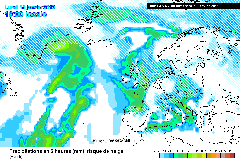
http://modeles.meteo.../gfs-2-36.png?6
back in the game
Those charts are very low res. The warm sector does still pass to the South of London but it's a lot smaller than before. It's going to be incredibly marginal tomorrow.
-
ukmo still hace us under a yellow warning for snow - as long as these remain its game on IMO
Warnings will probably be updated this morning. Wouldn't be surprised to see the warnings for areas to the south of London being removed.
It's sod's law that my home town of Harrow looks a safer bet for snow than down here in Kent when I used to watch Kent with envy at how much snow they got whilst Harrow usually missed out :-(
-
Latest NAE paints a rainy picture for most of us.
-
hi gp
hope your well
just going to update the fax charts but agree
cannot believe how much people got hung up on a small blip of warm air for monday
plenty more snow to come
I've told everyone I know to expect heavy snow on Monday. I'm going to look like a right idiot if it starts pouring with rain.
-
No it didn't
The one that was on BBC 1 did just now. Maybe a light dusting from the first frontal system but the second one was all rain for our region with the snow further north.
-
Latest BBC video forecast showed all rain for London and the South East.
-
Nothing has changed 100%
Snow
I used to live in Harrow and spent many years watching in envy as Kent got buried in snow whilst we missed out.
It would be infuriating if Harrow got buried and Kent saw nothing now that I've moved down here!
-
Kent will do well
I'll be lucky to see a single snow flake on Monday going by the most recent GFS run.
-
Going to be very marginal for the south east I fear, particulary to the south of London. However, the front could become very slow moving over our region giving a longer period of snow after the blasted warm sector has buggered off.
-
Suprised know one in the south east has mentioned the UKMO precipitation charts, looks very good for you (especially kent) monday night.
UKMO on a whole agreeing with GFS gives me extra confidence that the gfs is right.
Probably because of the marginality due to the warm sector.
An apology to the mods for my comments earlier. Was feeling somewhat disheartened with things looking more marginal for Monday.
-
Only yesterday heavy snowfall looked nailed on for here (Kent) on Monday. Serves me right for being niave!


London & South East Regional Discussion
in Regional
Posted
Steve, as one of the most knowledgable people on here, how wide spread do you think the snow showers could be from Tuesday onwards currently? (I realise it's hard to predict and details will undoubtably change).