


iceman1991
-
Posts
339 -
Joined
-
Last visited
Content Type
Forums
Blogs
Gallery
Events
Learn About Weather and Meteorology
Community guides
Posts posted by iceman1991
-
-
6 minutes ago, Chesil View said:
Ukmo keeping withs it's channel low scenario of yesterday. If anything it's better aligned to bring more snow to more of the south.
How good is this model on Accuracy for snow ?
-
35 minutes ago, MATTWOLVES said:
Exeter alert....frontal systems will approach from the SW next week bringing the possibility of SIGNIFICANT SNOW on leading edge...uncertain regarding the Northwards extent.
This could be a very exciting few days ahead folks.
Bloody brilliant young sir hopefully more upgrades over the next few days

-
 2
2
-
-
6 minutes ago, Battleground Snow said:
Blocking in all the right places for an extended cold spell.

What’s this model like for accuracy though ?
-
29 minutes ago, Captain Shortwave said:
Looks to be another change this afternoon, now a potential quick route to an easterly.
The cold trough is more elongated and still attached to the Asian vortex segment.
Easterly would be better for the south down here for more snow northlies just dry cold most of the time
-
3
-
-
2 hours ago, mountain shadow said:
Yeh. There was only about three foot of snow in my backyard.
Count yourself lucky then fella as there was nothing down here for south
-
2
-
-
Looks like March 2013 cold spell from models just dry and cold can’t see much snow from this
-
3
-
 2
2
-
-
1 minute ago, Man With Beard said:
Wednesday evening to Friday (and probably beyond) now solidly in the "snow risk" territory, with all models developing a few localised snow risks during the period. Unlikely to be snow for all, but we're now entering the stage where a very keen eye needs to be kept on where the weather features are going, because many locations could wake up to a snow forecast at very short notice.
Even for us southerners ?
-
3
-
-
9 minutes ago, Paul_1978 said:
Lots of excitement in the model thread about snow chances, but the MetO continues to state snow only on windward coasts and high ground. No mention of any widespread snow or much at lower levels.
From the weekend though there’s a chance with rain coming from the west possible snow event
-
1
-
-
10 minutes ago, Updated_Weather said:

What does this mean ??
-
16 minutes ago, Connor Bailey Degnan said:
That has to be the most underplayed forecast I've ever seen from the met. Settling snow won't be confided to Scottish hills. Little troughs can pop up at a days notice. While I do agree, the risk of snow THIS week has somewhat been watered down, I believe it will be a long term gain.
I guess postive way thinking least if it does snow end week the ground will be plenty cold enough and will stay on the ground
-
14 minutes ago, northwestsnow said:
Hmmm Exeter suggesting any lying snow confined to higher hills and N Scotland.
That's fine with me ,lots of seasonal frosty weather in the outlook inline with the 00z runs in the immediate outlook.
Referencing an attack from the SW into the following week so it looks like the low to the SW is going to be a player..
Looks interesting seems like there not to sure either what could happen with this rain coming from the west interesting they mention possibly wintry hopefully they upgrade more through the week from this

-
2
-
-
Slight upgrade for south I say for lastest mettoffice out look
-
8 minutes ago, chionomaniac said:
my memory definitely isn’t what it was. That’s for sure.

but, but, I see an opportunity for a historic cold spell despite the climate changing massively since 2010.
Reminded of that Carpenters track
Its only just begun
Wow that’s a bit of a ramp
-
7
-
-
1 hour ago, Man With Beard said:
80% of the UK under snow cover next weekend if the GFS is correct

How about us southerners ?
-
5
-
-
1 hour ago, I remember Atlantic 252 said:
definitely for Scotland, no doubt there! it's southern UK, questions remain
Recent update says rain and sleet for south typical always the case
-
10 minutes ago, Penrith Snow said:
Don’t know about that looks pants for the south they say sleet and rain
-
3
-
-
Pants mettoffice update for the south just sleet and rain hopefully will change
-
4 minutes ago, Ravelin said:
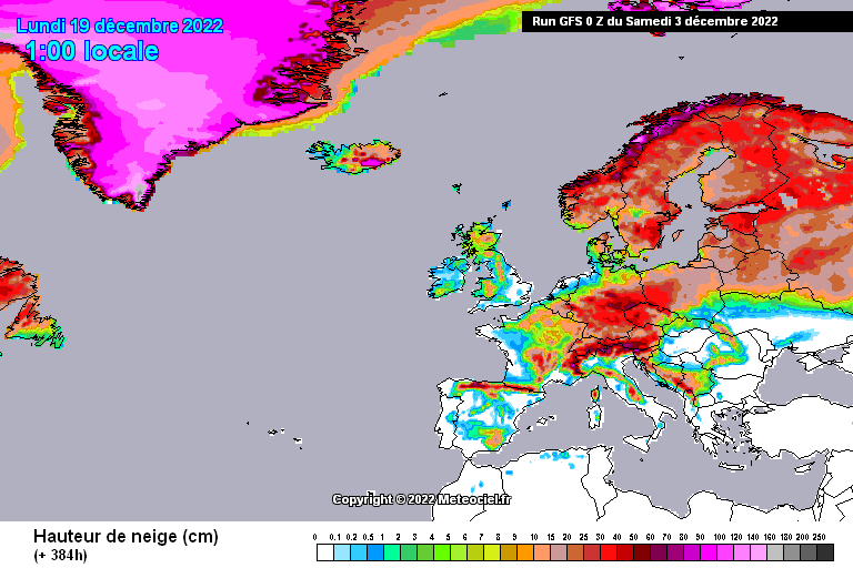
Would end with quite a snowy picture across Europe on that GFS 0z run, but obviously highly likely to change.
Hope it does Ravelin looking at that hardly anything for central southern England where I live
-
1
-
-
3 minutes ago, CreweCold said:
Final one from me before bed-
To give some context as to how cold that GFS run is, the maximum day time temperature doesn't get much above 2-3C from next Wed until the end of the run...with some harsh frosts thrown in there too, the CET for that period would probably be around freezing.
Hopefully some snow showers in the mix with that to
-
Meto update right then seems models slowly backtracking from cold just be the far north higher ground having some snow rest of us all wet oh well can’t control how we are in this abnormal world hope I really wrong though weather wise will see
-
3 minutes ago, Ed Stone said:
Oh, come on, mate: the BFTE saw Uppers of around -15C crossing a cool North Sea... There's no way (inversions excepted) we'll be seeing a daytime heavy snow at -5C with T850s of -10? Plenty cold enough for heavy snow, though!
2018 was to cold snow was dry hopefully where this one will be a touch warmer hopefully more snowier one
-
Brian gaze from weather outlook going for cold winter very interesting read say if this cold gets going in dec will highly likely carry on all through January to exiting times I highly rate him to on the ball with his forecast
-
1 minute ago, northwestsnow said:
Basically covers Dec
Whats it basically showing on this not gen up on models ?
-
29 minutes ago, Tim Bland said:
00z was actually snowier ..see below comparison
Nothing for central southern England ?
-
1
-
1
-


Model Output Discussion. 3/12/2022. How cold will it get?
in Forecast Model Discussion
Posted
Oh I see now cheers
