


Fourty Point Three Degrees
-
Posts
1,308 -
Joined
-
Last visited
Content Type
Forums
Blogs
Gallery
Events
Learn About Weather and Meteorology
Community guides
Posts posted by Fourty Point Three Degrees
-
-
6 minutes ago, markyo said:
You seem to be missing the issue totally
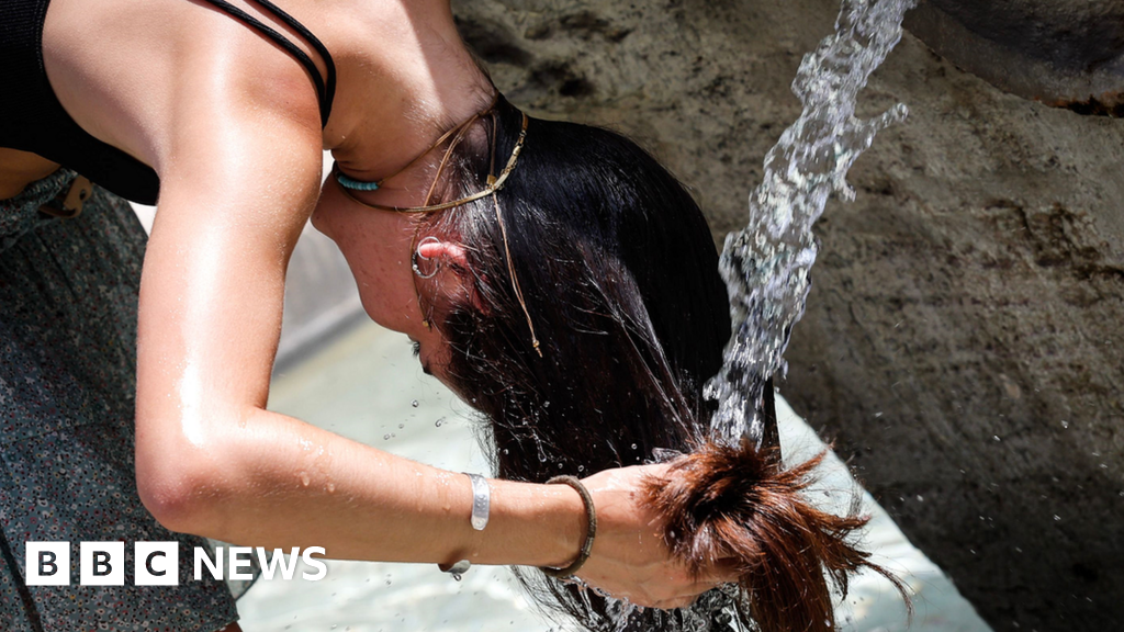
 Europe heatwave: Nearly all major Italian cities on red heat alert
WWW.BBC.CO.UKParts of Sardinia and Sicily will be the hottest in Europe with highs of 46C or 47C.
Europe heatwave: Nearly all major Italian cities on red heat alert
WWW.BBC.CO.UKParts of Sardinia and Sicily will be the hottest in Europe with highs of 46C or 47C.Isn't it always 40c plus in Southern Europe?
-
 3
3
-
-
Anyone else cancelling holidays because of the European heat or is it just the media creating panic and feeding the snowflake generation?? Quite sure there have been far hotter heatwaves down there.
-
5
-
-
Had a little chuckle when I saw this


-
2
-
-
3 minutes ago, Lee Notts said:
Wasn't 2007 and absolute shocker from around 2nd May through to August Bank Holiday? With heavy torrential rain most days including two or three serious spells of rain in June and July. I remember a dam nearly bursting in Sheffield and people being air lifted from a flooded retail park on the 25th of June. Tewkesbury cathedral was flooded in July. Can't say I've seen any of that this year nor is it being forecasted.
June 2007 was a warm month though similar to this year. Just like then, we are stuck in a rut with no hint or sign of a way forward, at least this year we've managed to avoid the floods so far.
-
1
-
-
At the end of the day (a crap fest day) we're just a tiny island off the Atlantic ocean and right now we are just being a tiny island off the Atlantic ocean. Vibes of 2006/2007 , with 2022 being the 2006 and 2023 being the 2007. Soon be September a month when the Atlantic takes a slumber and the Jet stream quietens down.
-
cherry picking
-
2
-
 1
1
-
-
I think Summer has failed to install correctly. And is stuck at a certain percentage and only way out is closing down the system and performing a fresh install from scratch, possibly reformatting all drives first. Because waiting for a failed install to complete is never going to happen...
Roll on Winter 2023....Summer is officially now written off in my book.
-
2
-
1
-
-
It is most certainly guaranteed we won't be tapping into the current heatwave in Europe anytime soon. No sign of any heat coming our way or any warmth of any kind for that matter.
-
2
-
-
Under -2 850s i'd expect snow from these
-
1
-
-
Latest GFS 0 does offer a glimmer of hope with a push of the Azores but its day 10 range so lets hope its sniffed out a pattern change and not going to be pushed back.. I can't believe just four weeks ago we were laughing at troughs at day 10 being pushed back and back saying they won't happen, just ignore and how it all looked 2018'ish. It's just amazing how quickly the pattern can suddenly flip.
-
13 minutes ago, sundog said:
?? In this day and age aren't temperatures mostly above normal as opposed to below. Just had the warmest June on record etc etc etc
Yes i forgot about June being warmest on record, where on earth did that come from? Out of nowhere... You'd expect the warmest June on record to be part of a classic hot and dry summer not one that's looking like a write off. Julys highest CET and Augusts were all part of memorable hot summer times.
-
The trend on GFS 0z is dreadful. Below average right through to the end of the run which takes us roughly to the end of the month. Never seen a GFS that is so fixated on delivering below average temps. Why can't we ever get stuck in a rut with above average temps for the foreseeable why is it always below?
-
13 minutes ago, ANYWEATHER said:
I’m afraid the model output is a little bit like this tonight….but it’s gonna get better…
We need D-REAM to come and perform a certain hit while he views latest models.
-
1 hour ago, Scorcher said:
It doesn't happen nearly as frequently elsewhere or for as long.
We are just small islands after miles and miles of Atlantic ocean and before miles and miles of European land. Troughs are born right on our doorstep.
-
3
-
-
GFS 6z is awful its just trough, low, trough, low right through to the end and its not an outlier either with almost all of its member suite following. No sign of any 30c or the usual heat spikes in this run.
-
1
-
-
1 hour ago, Wimbledon88 said:
Heathrow always quite a bit hotter due to the asphalt runways.
Are the Gardens of Kew Gardens made of asphalt? Kew Gardens can be just as warm as Heathrow and there are no runways nearby.
-
2
-
-
Just now, ANYWEATHER said:
Gfs keeps the unsettled conditions right throughout as it as done so since it’s runs predicted this big change last week …….
Its a dreadful run it must be said. That bullseye green blob just sits over us for days and goes nowhere and the op remains right below the average. A poor first half of July on the cards if this run verifies. However lets not whisper 2012 in case it triggers the usual suspects .... plenty of scatter in ensembles offering a warm up so nothing is nailed down.
-
GFS 00z has the cut off low swinging through too quickly than the others are showing that next weekend ends up being just a one day wonder. Good that its on the Saturday so pretty much a useable day.
-
2 hours ago, Alderc said:
There’s really no getting away from it both GEM and GFS are really poor in the next ten days with several deep lows at various times crossing the country. Very little in the ensembles to suggest anything else or support the warmer GFS 06Z run from earlier.
The next week or so really could bring the most disturbed period of summer weather we’ve seen at least several years, often windy, cloudy and cool. Potentially wet across the NW and even multiple spells of rain in the south. Pretty awful really.
The sad truth is its been long coming, a dreadful pattern like that has to emerge at some point to challenge 2007/12 . We can't go on forever calling those summers the worst years and we have to, at some point, call a period of summer weather the worst since 2012.
-
After days and days of 21c plus here, now stuck in mid to high teens for the foreseeable.
-
Green snot all the way on GFS 6z i think its safe to say the first 10 days of July are going to be a total write off.
-
Just watched Gavs "JMA friday" on YouTube, which shows a hot July. Also the CFS v2 four weekly charts he shows also has HP across the UK in two weeks time so probably not all as bad as it looks.
-
1
-
-
GFS 12z is a poor run with support from half its ensembles, with shockingly low 850s around 2 - 4c for 10 days.. I think summer is about to be put on hold.
-
1
-
-
26 minutes ago, MattStoke said:
GEM showing how a westerly, Atlantic driven pattern could still bring hot conditions to southern areas next week due to high pressure never being far away and increasingly hot air over southern Europe. Very hot on this run

That has to be impossible, such a massive difference of 850s in such a short distance.
-
1
-


Model Output Discussion - Mid Summer Onwards
in Forecast Model Discussion
Posted
But the GFS 00 does look like a shocker for late July. In fact you can't polish a big brown one. Why do people here always have to belittle others just for saying what a model run is showing when its unsettled? I bet you wouldn't have said anything if the poster said it was heatwave, sunny and hot next week? Fact remains, no matter the positoning of the trough its looking largely cool and unsettled at least for the next 10 days.