


Grimers
-
Posts
184 -
Joined
-
Last visited
Content Type
Forums
Blogs
Gallery
Events
Learn About Weather and Meteorology
Community guides
Posts posted by Grimers
-
-
Good morning, everyone! It's looking rather cold over the next 2 weeks according to the GFS. What we must remember is that even though the uppers aren't especially cold, there are likely to be some low temperatures both by day and night especially away from the coasts. However, snow looks unlikely due to the lack of lows, but cold and sunny conditions aren't bad especially after last year's disastrous Winter.
-
 4
4
-
-
The GFS model shows windy conditions for SW parts of the UK tomorrow.

-
1
-
-
Interesting, thanks for the link, Nick L. So, basically less moisture is needed to produce heavier falls of dry than wet snow? That would explain why the snow we had on 20 December 2010 was quite dry.
-
3 minutes ago, Paul said:
It differs. 10:1 is rare in the UK as that's about the ratio for powder snow at just below freezing as a general rule, whereas our snow is often wetter, so you could be look at 5:1 up to 10:1, perhaps even higher at even lower temperatures, but that would be rare in the UK away from mountains at least.
Thanks for the explanation, Paul. That makes sense now as the snow flakes in wetter snow are normally larger hence a lower rate.
-
* 10 mm/hr.
-
Hi there,
I've always been curious, but does snow rate equal to 10 times the rain rate? e.g. 10 cm/hr equals 100 mm/hour or can the rate differ depending on atmospheric conditions?
Thanks,
William
-
Just now, CreweCold said:
Hi Will,
My thoughts were never centred on any such thing..I think you're referring to my post the other day where I pointed out that the updated GLOSEA5 actually supported colder weather later in winter (Jan-Mar) period....
Understood, my apologies.
-
1
-
-
1 minute ago, feb1991blizzard said:
I've now watched enough output and I'm making a brave early call on this, a warm Easterly followed by a west based -NAO, slightly below average temps but no significant snow event out until second week of December, still optimism down the line for something better though.
You never know, as CreweCold posted a while back, his thoughts were centered on January and February. All hope is not lost, yet.
-
16 minutes ago, karyo said:
Why would tracking west cause a strengthening of the jet?
I would expect a track east/northeast would strenghten the jet.
That's what I thought, a high or low moving W would cause the jet stream to buckle and move W, it makes sense.
-
2 minutes ago, PerfectStorm said:
Was looking at that, keeps the 'colder' upper air temperatures on its northern flank, however it's quite hard to see what's happening when the frames are every 24 hours. Snow for the midlands?
Yes, I would agree, if the low is slightly further N than shown.
-
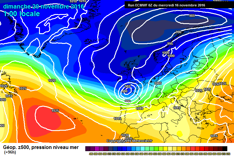
The ECMWF model shows a low to the SW of the UK bringing cold and unsettled conditions to SW parts of the UK on Sunday.
-
5
-
-
As others have mentioned, according to the GFS model a low to the SW of the UK could bring cold and unsettled conditions with snow for the higher ground of SW parts of the UK on Monday.
.
-
2
-
-
The GFS model shows cold and unsettled conditions for all parts of the UK from Thursday to Sunday!
-
3
-
-
Trying to keep up with this thread is incredibly tough, but I'm loving some of the output, especially from the GFS model! If the GFS model is correct, then this Winter could be a repeat of 2010-11!
-
4
-
-
12 minutes ago, West is Best said:
Don't forget we're on the north of the Polar Front Jet. That makes a difference ref. normal rules on upper air temperatures and dew points?
Not always, as Nick L pointed out, fronts normally bring warmer dew points hence why you sometimes need cooler uppers.
-
1
-
-
This is a big if, but if the GFS model is correct, then a blizzard is certainly not out of the question for the higher ground of Wales and N England on Sunday.
-
5
-
-
3 minutes ago, Barry95 said:
Personally I think people are getting a bit too excited. Ian's posts from last night where talking about the start of December, which is still 2 weeks away, as everyone knows a lot can change in that period of time. I've seen some very great looking charts from the GFS, but they are all in FI! and it never looks particularly cold for the UK. So, as always until these great looking charts get into the reliable timeframe I think people should temper their excitement. The background signals do look great, but that doesn't gurantee cold.
I agree, that's why I'm more interested in what the GFS model and ECMWF model are showing for Sunday and Monday rather than what could happen in FI. There's no point in getting excited for what might not happen...
-
4
-
-
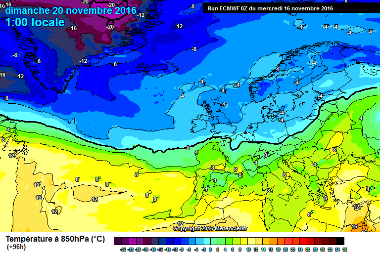
Looking at the ECMWF model, I can't see any low in the current that would bring a widespread snow events, uppers are too warm even on the northern side of the low.
OTOH, the GFS model does show a low on Monday which I think would bring a snow event to C and N parts of the UK and later to higher ground of S UK.
As shown, the ECMWF model is more realistic whereas the GFS model is getting quite excited, I love the last 2 charts shown from the GFS model, if the uppers were a little colder, the low would bring the first significant snow event to SW parts of the UK for nearly 6 years.
-
2
-
-
9 minutes ago, weirpig said:
All conjecture But the control as the first Low at t120 tracking more southerly with snow sleet rain on its northern edge maybe even the far south may see a sprinkle of the white stuff?
Yes, XC Weather uses the GFS model for it's forecasts, 10 cm is expected to fall over Postbridge on Monday.
-
I sense a lot of snow lovers in here are getting hooked on the GFS model, we should remember that the ECMWF model is better at predicting low positions at this time scale. However, the GFS model could be correct and snow instead of rain could be more of an issue.
-
7
-
-
Just now, festivalking said:
Potential for a big storm then for our neck of the woods on Sunday evening. Would be a real shock to the system if it came off after such a quiet autumn.
Yes, excited is an understatement.
-
1
-
-
12 minutes ago, Grimers said:
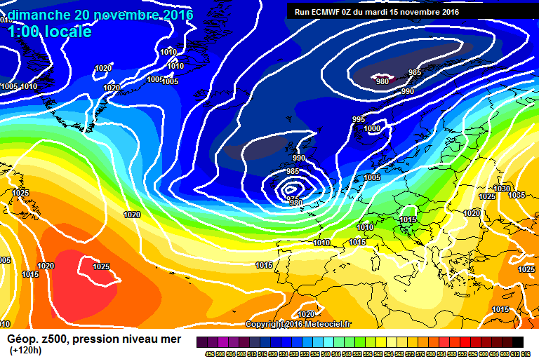
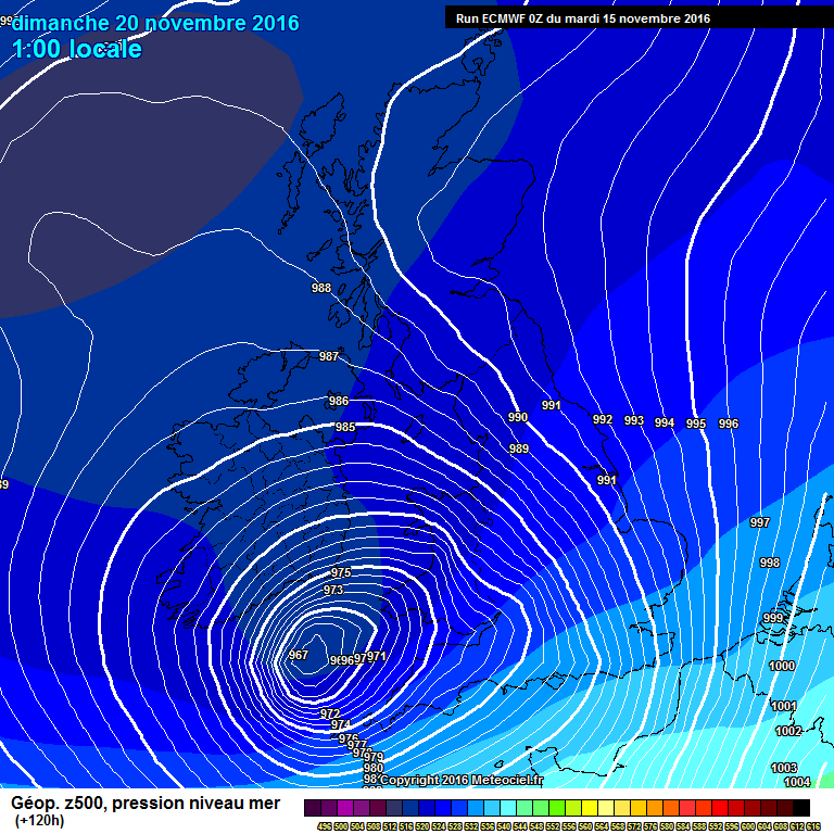
The ECMWF model shows a very deep low to the SW of Wales bringing gale force SW winds to SW parts of the UK on Sunday, this is something we haven't seen since 2014!
For some reason, I can't edit the above post, but this is what it should say...
-
1
-
-
Coming back to the more predictable future, the ECM model shows a severe storm moving into SW parts of the UK on Sunday, there's the potential of hurricane force wind gusts likely in exposure, this is something we haven't seen since 2014!
-
1
-
-
The GFS model shows cold and unsettled conditions across all parts of the UK through Friday and Saturday.


Model Output Discussions 12z 30/11/16
in Forecast Model Discussion
Posted · Edited by Grimers
It's looking pretty chilly folks!