


Yeti
-
Posts
1,277 -
Joined
-
Last visited
Content Type
Forums
Blogs
Gallery
Events
Learn About Weather and Meteorology
Community guides
Posts posted by Yeti
-
-
Craigers said on last page of locked thread.............
"GEM is my dream of a chart! which would be amazing for Yorkshire full stop! and with Europe being so cold already, it will deliver with more of a punch than of past years!!!"
Trouble is the deep cold has been shunted out of most of Europe.... http://www.uni-koeln.de/math-nat-fak/geomet/meteo/winfos/euisoTTPPWW.gif
6:00 am shows most of Europe marginal with barely a frost.
Any dry cold to help snow Tues/Wed has to come from the North or from Scandi
Len
Good point. Temperatures have risen over 20c here from -16 to 4 in just a few days - the cold spell has gone entirely from virtually all of Europe except the northern half of the UK.
This would not necessarily be a problem if, like last time, the cold air were to come from the E, as Europe cools down BEFORE the UK in such setups. However cold air is arriving from a *shallow* cold pool over Scandinavia to the N/NE of the UK and Europe should actually cool down after the UK this time:
http://www.wetterzentrale.de/pics/Rtavn962.png
http://www.wetterzentrale.de/pics/Rtavn1682.png
The only potential problem with this is if we see this kind of setup:
http://www.wetterzentrale.de/pics/Recm2401.gif
Normally this would bring widespread blizzards along the "battle ground" with a strong SE wind blowing off the continent. However as upper temps tend to be higher in these setups, ground temps need to remain favourable to prevent rain, and if the continent is not cold enough this may not happen. Of course if such a setup occurred later on, like the ECM, there would be no problem, but the UK will probably have to wait until the cold air filters S for widespread low-level snow from a setup like the above.
Here's hoping the low tracks as far S as possible - this would favour everybody!
-
http://www.wetterzentrale.de/pics/Rtavn3001.png
This must be one of the most exceptional charts the GFS has ever produced!
Iceland is freezing with snow showers, Scandanavia is frigid and a huge snowstorm sits over the UK, the Low Countries, Germany and the Alps.
We can but dream

-
Wow, you have more snow than we have here in Bonn.
Nice pics
-
Well the cold spell is drawing to a close here tomorrow after a week of consecutive sub-0 maxima. This weekend I have been out to take a few photos near home - firstly of an extinct volcano in the Rhine Valley (Saturday) and then of Ahrweiler (Sunday), a small town about 20 minutes away with a famous wine and liqueur tradition.
The weather has been exceptionally cold - a cold front on Friday brought sub-20 uppers and that translated to a maximum of just -12.1c here and -11c in Bonn on Saturday. At night temperatures dipped below -16 although other parts of Germany saw clearer skies and even colder minima with -33 reported in one area. The cold was incredible - your nose completely freezes up and more than 10 minutes outside, even with proper winter clothing, is enough to chill you to the bone.
As for snow, Friday brought light to moderate snowfall for a while but it was proper powder snow falling at those temps, so it accumulated very quickly. Yesterday brought another 2cm so overall about 8cm here which would have been a disappointment had it not been for the extreme cold which made up for it
Here is a photo of a nearby road leading to the volcano:
Inside the crater, snow covers the lava-formed rocks:
The view towards Bonn, Cologne and Düsseldorf from the top. The shining building contains the headquarters of Deutsche Post and DHL.
The Siebengebirge, our nearest range of hills, through the vineyards. The Rhine is visible at the bottom:
The Christmas markets in Ahrweiler - a Dickensian scene!
It then starts to snow:
Icicles have formed on the market stalls:
Enjoy
-
Glad to hear plenty in the N have got snow. I'm so annoyed here missing out with just a dusting!
-
Even with my cold hat on, I think the very cold spell is on borrowed time as next week progresses and the best we can hope for is to maybe buy an extra day or two at the most. It's inevitable that the arctic air will be slowly mixed out from the south, probably by the middle of next week and then the erosion of the remaining cold air further north will continue with the uk in near average temps either by boxing day or soon after.
It's such a shame - there's such a huge easterly just a few hundred miles to the N!
-
I notice some ensemble members building HP over christmas, while others keep it rather cold and slack
http://91.121.94.83/modeles/gens/run/gens-5-1-228.png?6
http://91.121.94.83/modeles/gens/run/gens-0-1-264.png?6
http://www.meteociel.fr/modeles/gefs_cartes.php?code=7&ech=240&mode=0
Surprised i haven't read more about this must be bored of the cold weather by now
Actually that's something I had noticed, quite a lot of the models are hinting at pressure and even height rises over Scandinavia later on, and whilst this might not necessarily lead to a full easterly reload it would at the least make the cold air harder to budge.
GEM: http://www.wetterzentrale.de/pics/Rgem2281.gif
UKMO: http://www.wetterzentrale.de/pics/Rukm1441.gif
ECM: http://www.wetterzentrale.de/pics/Recm2401.gif
As well as the nice GEFS members you posted
Obviously not all of those would lead to cold in the short term but seeing heights and pressure to our NE is rarely a bad thing!
On the other hand this would need to occur late enough so as not to prevent the Atlantic low moving far enough NW.
-
Hi again Phil
Well it's really a complex set up but so much relies on that low to the sw, i really hope it enters the festive spirit!
Down here is been cold all week and we're now into our second consecutive day below freezing, just shows you with 850's only near -5 what can happen with no sea modification and an easterly flow off the continent. The - 10's are expected later tomorrow so will be interesting to see what that produces, currently -1.7c here.
The cold is cruel here Nick - temps refusing to get above -3 today, with -9 maxima predicted on Saturday!
http://www.wetterzentrale.de/pics/Rmgfs574.gif
That could definitely be one of the coldest days I've ever experienced, certainly at home.
Sadly the Euros still want to send the low further W atm and so it's GFS/GEM vs ECM/UKMO. Mind you, I believe the 6z was the first GFS run to send the low at this angle? I don't remember seeing it before because a warm up looked almost guaranteed here by next week with no models showing anything more favourable e.g. 6z.
-
I'm still amazed by the sudden short-term changes on this run.
http://www.wetterzentrale.de/pics/Rtavn482.png
The -15 isotherm was expected to reach no further than East Germany yesterday. On the 6z it reaches into France and the Low Countries only 48 hours away! That's a monumental shift at this range.
-
The 6z is very similar to the GEM which I posted earlier:
http://www.wetterzentrale.de/pics/Rtavn1501.png
http://www.wetterzentrale.de/pics/Rgem1561.gif
The low heads NE into central Europe - this helps to keep the colder air over the UK as it lies on the western flank, and also it keeps northern continental Europe cooler which is a welcome surprise here!
-
http://www.wetterzentrale.de/pics/Rmgfs634.gif
That's serious cold in Germany!
The GEM is nice because one of the Atlantic lows instead swings further NE through central Europe and misses the UK, keeping it cooler for longer and if anything dragging down a bit more cold air:
http://www.wetterzentrale.de/pics/Rgem1561.gif
There are also suggestions this morning of weak pressure rises over Scandinavia in FI. Tentative, but there on ECM, UKMO and GEM to varying extents - I don't know how this fits in with the teleconnections?
For example on the UKMO we see a cold pool underneath a HP cell moving SW towards Europe:
-
Now if that isn't a snow dome over Bonn I don't know what it is!!
http://www.wetterzentrale.de/pics/Rmgfs72sum.gif
So disappointing really that despite absolutely bitter temps here, everything is so dry.
It's encouraging to see the ECM want to maintain heights to our N - the GFS has hinted at this at times as well. That would make it a lot harder for the col air to budge and would delay any breakdown until after Christmas.
Meanwhile, the UK looks like getting pasted starting Thursday night - so enjoy and let's hope some people see some really deep snow this weekend.
-
Amazing, then a "Hogmonay blizzard" to finish!
http://www.wetterzentrale.de/pics/Rtavn3721.png
Incredibly snowy run, that would be 1947 equivalent in terms of depth of snow and severity of cold!
FI
-
Personally if we're looking for detail over this weekend then to be honest at the moment its a waste of time. Very diffcult to predict what disturbances will develop within this polar flow.
As for the breakdown thats being discussed. Again personally I feel its a waste of time but I do respect members if they want to look this far. I just can't be bothered at the moment due to the potential over the next few days plus the models will really struggle beyond +120.
Looks like the cold air is winning on this run?!
http://www.wetterzentrale.de/pics/Rtavn1501.png
There is less energy in the Atlantic so the GL HP can ridge S more; there is also more energy in the northern arm of the jet helping the low to dig down S:
http://www.wetterzentrale.de/pics/Rtavn16216.png
This in turn though would probably be the death sentence for the block...
-
http://www.wetterzentrale.de/pics/Rtavn901.png
Just look at the amount of shortwaves in the flow! It's a shame it's turning out to look a bit messy.
-
Im only discussing what there showing.
but that is surely in your opinion.i'm all for respecting peoples opinions,but at times this is becomming tedious.
an ignore poster option would be very handy at times like this.
There is an ignore poster function, it's somewhere in settings.
Jed - I think all people are saying is fair enough if it's what the models are showing but if you're going to comment on them then post the relevant charts/data. Posts without given evidence are difficult to follow, look rather too like opinion and are often less convincing as a result.
-
There is look at the yellow colours, that highlights it well. But notice as soon as thats gone the atlantic starts to make inrodes through the block.
The colours represent the geopotential heights though at 500hPa so that's not WAA; the yellow would indicate very strong heights whereas the blues show troughs and lows higher in the atmosphere than can be detected at sea level. But yes as you say later on the heights crumble and move west to give a -ve NAO that sets up too far W (current pattern subject to change).
-
Mate, finding a run that shows no sign of a breakdown early next week is like trying to find a needle in a haystack..
The trend has been quickly growing over the last few days for a breakdown, but I do think most models are being a little progressive. http://www.wetterzentrale.de/pics/Rtavn1921.png This chart illistrates nicely what would go wrong.
1. WAA across greenland GONE
2. Our greeny high slipped too far north west/loosing its grip over the uk.
3.The strength of the atlantic is unleashed, with no real block in the way there is nothing to stop it bursting through. If we had heights to our north, maybe it could undercut and cause a new block to re-establish itself or pull in a n eastery.
Chances of a breakdown tue to fri Id put at about 90%, there is still a small amount of time for a change but we need to start seeing that now..
What's all this about WAA? As I understand it stands for Warm Air Advection - now that happened a few days ago up the Eastern Seaboard as the block was carved out, but for example by the time we reach 120 there's no warm air advection anywhere near GL...
-
Interesting precipitation amounts here at 144:
http://www.wetterzentrale.de/pics/Rmgfs144sum.gif
Given that most of that would fall as snow - particularly in the North - there are some pretty impressive totals there, especially in the NE.
Obviously only a very rough guide but I think it highlights roughly how the distribution of precipitation will fall.
-
144 is an amazing chart - an ice day almost everywhere with blizzard conditions in the Midlands and South and Arctic sunshine with sub-5 maxima further N:
http://www.wetterzentrale.de/pics/Rtavn14417.png
http://www.wetterzentrale.de/pics/Rtavn1442.png
-
Just recapping on this post, overnight 2nd/3rd March 2001 the temperature at Cleadon dropped to -10.2C (the only time since I began recording that it dropped below -10C, although 28/29 December 1995 came close). I certainly agree that a sharp frost helps to preserve a snow cover- without a frost there is always the chance of it thawing from underneath in marginal setups for example. That will also be a factor in the upcoming spell of weather because there are sure to be some sharp frosts. Many places that see lying snow on Friday or the weekend may well keep some snow on the ground right through until the breakdown, whenever it occurs.
I don't think Tyne & Wear/Durham are likely to see much rain or high dewpoints but from the Midlands southwards there would be a risk of that happening on the evidence of the GFS 06Z run. However, having surveyed the evidence I don't think people should worry too much about that run. It's an outlier in the truest sense of the word, and I find it hard to believe that any airflow could spawn that number of shortwaves.
It's funny you should mention melting from underneath - I'll never forget the disaster of March 10th 2006:
http://www.wetterzentrale.de/pics/archive/ra/2006/Rrea00120060310.gif
Heavy snow was forecast for the North for most of the day - however the reality was moderate snow falling all day, settling on the ground for a few minutes before the sludge beneath it engulfed the fresh whiteness. DPs remained just above 0 all day in Harrogate and humidity was high due to the Atlantic air sweeping in on top of the embedded cold. The day was an all-time disappointment and the memory of it has haunted me ever since.
Those sorts of setups can go either way...
-
Nice to see the shortwave pulling away to the SW on the 18z - it pulls in the ENE'ly feed much better afterwards than the 12z.
http://www.wetterzentrale.de/pics/Rtavn961.png
The cold air is a fair bit closer - watch the gates open...
-
GEM 120 is disappointing for the UK:
http://www.wetterzentrale.de/pics/Rgem1201.gif
The high ridges too far E and the troughing is mainly directed into central and eastern europe.
Still, 18z on its way...
-
Any sunshine would feel very Arctic I should think with high pressure, very low temps and thicknesses:
http://www.wetterzentrale.de/pics/Rtavn1743.png
This producing some scarily low maxima over Europe!
http://www.wetterzentrale.de/pics/Rtavn17417.png
Frost fair on the Rhine maybe?!


 The trend has been quickly growing over the last few days for a breakdown, but I do think most models are being a little progressive.
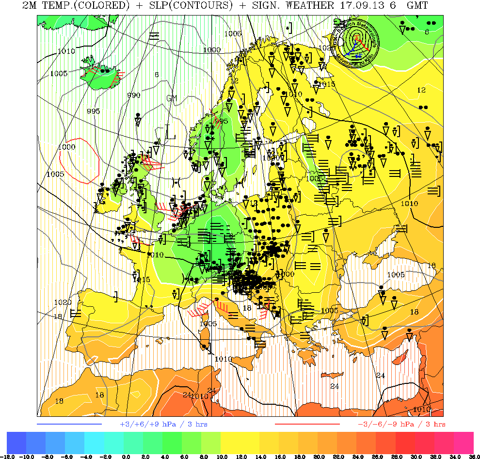
Model Output Discussion
in Forecast Model Discussion
Posted
Interestingly on weather forums in Germany (wetterzentrale forum) and Spain people tend to look at the GEM and GME a lot more than we do - I've always found the GEM a good, reliable and consistent model and it's a shame we don't look at it more often (and no that has nothing to do with today's output! )
)
Trust the Brits to favour the American and British models