


Laurence Hill
-
Posts
417 -
Joined
-
Last visited
Content Type
Forums
Blogs
Gallery
Events
Learn About Weather and Meteorology
Community guides
Posts posted by Laurence Hill
-
-
2 minutes ago, snowice said:
Confused.?
I'd go for Ali without doubt.
-
 6
6
-
 1
1
-
-
6 minutes ago, Kasim Awan said:
WOOPS I meant 15th/16th January.
Last night Scott Ingram was insistent that 15 Jan was the date for the main action.
-
2 minutes ago, LRD said:
What we're being shown is absolutely in line with what the professionals are saying for January isn't it?
Some of the takes in here this evening are utterly bizarre. If I see mild or, at least, not-cold I'll call it. I'm not seeing that at all. What I am seeing in this thread is whining one-liners, massive over-expectation and deep micro-analysis of every single frame of every single run of every single model...
Sorry to be rude but some of you need to give your heads a wobble. I reckon this is one cold spell that's going to come in relatively seamlessly. We don't know yet if it will be severe or relatively standard cold but just enjoy it being reeled in
Totally agree, if we have a centimetre of snow for everyone on my growing “Ignored List” we are laughing.
-
7
-
 1
1
-
-
Morning Carinthian
Quick question, will the forthcoming SSW event have an effect on the Austrian Alps?
-
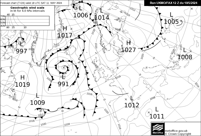
3 minutes ago, carinthian said:
Evening , going by that fax chart ,looks like Met Office will be ramping up a powerful wind potential during Thursday. 82mb difference between Southern Scandinavia and the high to the SW of British Isles centred over the Atlantic. Model all out of sync at the moment. Not only Christmas period forecast unpredictable at the moment but the

You didn’t finish Carinthian, especially as you are one of the few sane posters at the moment
-
2
-
-
16 minutes ago, Ali1977 said:
No doubt, only to drop it at crunch time

At least you have the stamina Ali!
-
2
-
-
On 03/12/2023 at 08:20, carinthian said:
Thought some of you might like these pictures of Advent Weekend on The Katschberg. Very cold and snowy yesterday.
C
These photos are the best advert I’ve seen for a winter holiday in Austria. Wish I was younger.
-
2
-
-
3 minutes ago, Ali1977 said:
However - phasing again to the NE of Greenland could either give us a freezing direct northerly or cut off the Greeny high - starting to move to FI though so lots to resolve. I still think Thursday could bring a good snow event somewhere in the U.K.
Which regional thread will you be on Ali?
-
13 minutes ago, CreweCold said:
Scandi heights are a foregone conclusion in my eyes, and I reckon it'll land some time between Christmas and New Year. I've seen this scenario play out before with the GFs like a dog with a bone in FI over Scandi height formation.
Notice that at the back end of GFS op runs we're back to seeing big amplified waves pushing WAA N right in to the Arctic...it's how this spell started and it's how the classic E'lys of the past started.
It's la la land but the last frame of the GFS op shows exactly what I mean- piercing WAA right into the Arctic with Siberian cold waiting for its chance to push westwards
Note there's support from the seasonals to transfer blocking eastwards into January...
What are the implications of a Scandi High? In layman’s terms please.
-
41 minutes ago, danm said:
Really impressed, that was a quality presentation.
-
Seems the Met Office have other problems
-
4
-
1
-
-
15 minutes ago, Kasim Awan said:
Looking more interesting now for sure
Next time tag me in the regionals so the mods don't bite our hands off lol
Hi Kasim, how do I tag you.
-
10 minutes ago, Paul Sherman said:
Streamer Incoming finally lol

For the unitiated what type of streamer is that?
-
@Surrey , nice one, you seemed to have called it right.
-
2
-
-
3 minutes ago, Tim Bland said:
It’s not , if you look back I was posting the precip for tonight fringing into Wales 2-3 days ago. It’s exactly as expected. That front is separate to the low to our south east tomorrow
Sorry!
-
3 minutes ago, Uxbridge90 said:
Think someone on the mod thread said this fax shows the weather front further west than expected. Might not be this fax, stand to be corrected.
-
11 minutes ago, Surrey said:
Well the EURO4 00Z out and its still peachy in fact.. brings forward the transition in some places and brings more people in the Western edges into the game
Still very much in line with Met office warnings
Looking forward to your updates through this period, much appreciated.
-
3
-
-
1 minute ago, Surrey said:
Soild typo on phone just got up
Great, had me worried for a moment, so looking good.
-
14 minutes ago, Surrey said:
EURO4 holding soil on the 18z run last night...
Holding soil?
-
4 minutes ago, Surrey said:
That euro 4 shows nearly 20cm of snow out east
5-10cm of snow across London and into Richmond Twickenham etc and even out to bracknell Reading..
If its what the met are going off and ignoring the other high res models then I would expect them to be looking at it very carefully..
Must note Euro4 most westerly solution this evening so far
Evening Surrey, is this for Sunday?
-
ECM 96 has the jackpot >>> London / Kent / EA / Suffolk !
BOOM
@TheSnowDreamer @ogriff79 @Meopham_WeatherFrom one SM, now I can believe it!
-
5
-
-
For the first time I have got snow on my Dark Sky app for Wednesday.
-
4 minutes ago, Snipper said:
Don’t know if anyone uses the Dark sky weather app but that so far show doesn’t show a hint of any snow. Usually pretty good their forecasts. Be interesting to see when and if they come on board.
Yeah, that will be interesting although often I find their rain forecasts are a bit iffy. Forecast for the next few hours shows just overcast then rain suddenly arrives.
-
43 minutes ago, Polaris said:
The Gritter truck has just passed my house so maybe something a foot around here.
Still feels very mild though.
Judging by the mod thread it won’t be a foot of snow
-
1
-


Midlands regional discussion - Winter 23/24
in Midlands Weather Discussion
Posted
marksp I’ve got one of those, bought in London years ago. All it’s ever been used for is clearing up leaves.