


Sainsbo
-
Posts
1,191 -
Joined
-
Last visited
Content Type
Forums
Blogs
Gallery
Events
Learn About Weather and Meteorology
Community guides
Posts posted by Sainsbo
-
-
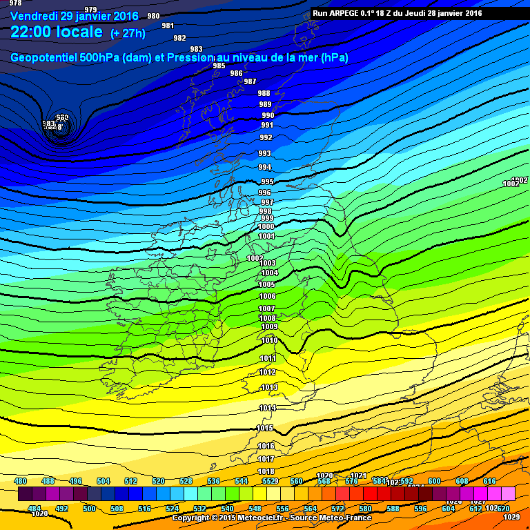
I feel like we're giving a little bit too much attention to the 850hPa temperatures for the event on Friday. The colder uppers seem to be easily pushed aside by the low, but with 4-5 days of temperatures struggling to get above freezing and harsh night time frosts the boundary layer is going to be extremely cold.
Whilst the 850hPa temps could possibly become "mild" in comparison to what we will experience this week, the warmer air associated with the low will probably be pushed aloft to an extent with the surface temperature staying around or below freezing. If not snow, counties in the far south would probably see some freezing rain.
-
 2
2
-
-
Nothing falling here in Reading just yet but I imagine anything that does will fall as snow for a while. DP still -2C here and Wet bulb temp still just below freezing. This morning the forecast was for us to reach 7C tomorrow, now only showing a max of 3C, and only 1C from midday onward. Just shows that anything can happen in situations like this, especially where the temperature gradient is so large
-
Thinking I might be a bit too far south here in Reading to get anything, even with the southward shifts in the models. Not losing all hope just yet though, hopefully the southward trend continues
-
1
-
-
It'll be interesting to see if the difference in track between the GFS and ECM is almost solely due to the different modelled strengths of the ridge or whether partly due to the stronger intensity that the GFS has the storm attaining. ECM 0z initialized Irma about 10mb weaker than it was, and the NHC expect Irma to be stronger by T48 than the ECM does by T120. 12z ECM will be interesting this evening.
-
The ECM has been showing a trend over the last few runs, with the ridge to the NE strengthening and stopping it from going back OTS. Worth keeping an eye on for sure, been showing a Major hurricane for about 5 runs now
-
77kt surface winds measured on the latest recon, we're at Cat. 1
-
1
-
-
Convection increasing, cloud tops cooling and outflow becoming better organised, wouldn't be surprised to see an eye in the microwave imagery in the next hour. Looks like Harvey will become a hurricane about a day before models and NHC anticipated - I'm sure if the 12z/18z suites are initialized at hurricane intensity they will be quite sobering. I think Wilmas max pressure drop was about 96mb in 24 hours.
-
The storm has just about passed now, dropped over 37mm in under an hour.
-
Been underneath this thunderstorm in Reading for about 45 minutes now, almost 20mm of rain in the last half an hour or so according to the Uni observatory and there's about 4 inches of water trying to make its way into my flat. Looking at the radar it looks like there's still a lot more to come!
-
1
-
-
GEFS has had a large westward shift as well it seems.
Still have no idea how Matthew has been able to maintain Category 4 intensity this whole time - It has been through a pretty sheared environment, upwelling has cooled SST's significantly under the storm given its slow movement speed, and looking at the microwave imagery, it seems that the ERC has pretty much completed. As soon as it turns more to the north, speeds up a little and goes over warmer waters again there really doesn't seem to be much to stop it from re-intensifying to a cat 5
-
Really hoping the thunderstorm is able to retain it's intensity until it's up over Swindon, looks like it's on a direct collision course currently!
-
50 minutes ago, Windblade said:
This surface heating only seems to be able to produce pulse storms, so what ingredients do we need to get a decent multi cell storm? Is it just higher cape and shear or am I missing something?
If you have a trigger and the instability is there then I think the main ingredient you need for more organized/multi-cellular storms is shear to help separate the updraft from the downdraft.
Every now and then it looks like the sun is trying to pop out here, but then it disappears again! Nothing on the radar around here as of yet, but still very early in the day. Haven't been very lucky so far this week so maybe today is the day

-
Pete was one of my lecturers this year and he was great, so I'd definitely recommend doing this!
-
Plenty of cells seem to have clipped Swindon today, with one developing rapidly just as it moves away, but so far nothing overhead. Radar looks quite promising though!
-
Looks like it got a little boost from the gulf stream, but never managed to get above 40kts. Landfall in South Carolina later on today.
A hurricane in January, a land falling tropical system before hurricane season officially starts, I wonder what else this year will bring?
-
1
-
-
Heavy rain throughout most of the night and then an hour of very heavy/torrential rain here this morning has left surface water just about everywhere. Looking at the Radar, it looks like there's more to come. Had about 30mm so far today, wouldn't be surprised if we broke 50mm if these storms hit us.
-
Can't remember seeing hailstones that large before, especially this time of year. Hailstones easily 1cm in diameter, a couple of them probably getting closer to 2!
-
It turns out that the extreme T values from CIMSS yesterday were caused by a coding glitch, which makes a bit more sense. Hopefully a large number of deaths may have been avoided as the eye wall seems to have made landfall away from a densely populated area. The band of the highest winds extended about 18km from the eye, so hopefully Suva will have missed the worst of the wind as suggested.
-
2
-
-
Looking stronger and stronger on satellite, I can't see Winston being anything less than a Cat 5 on the SS scale by this point. I'm sure JTWC will have it a lot stronger than 125kts on their next forecast.
Raw T-numbers of 8.1 are being shown now, which is off the scale
-
1
-
-
I'm not sure exactly how true it is, but lots of Meteorologists on Twitter are remarking that TC's this strong are almost unheard of in Fiji, which if true just adds to the likelihood of heavy casualties coming from this system.
Raw T-numbers are 7.7 currently, suggesting that sustained winds are much higher than what's being forecast by the JTWC, though I wouldn't rely on the T-numbers alone.
Winston's still looking good on Satellite too:
-
1
-
-
Quietly confident about seeing some snow in Swindon tomorrow night from this, but as we all know, 24 hours is plenty long enough for things to drastically change when snow is concerned, for the better or for the worse. (Hopefully the better
)
Like usual, now casting will probably be our best bet for marginal situations like this
-
-
-
27 minutes ago, Nouska said:
That feature is still on the 18Z update - I wonder if, being a mesoscale model, it is trying to develop a polar low of some sort. The model has 500mb temps as just about cold enough for development.
I think you may be right, though I didn't realise just how small they could be!
Either way, those are some seriously strong projected wind speeds.
NMM still doesn't create the feature, despite having mid level tropospheric temperatures 5 degrees or so colder, and the 18Z HIRLAM shows it, but much less severe. I guess we'll have to wait and see.
-
1
-


South West and Central Southern England Regional Weather Discussion 22/02/2018 Onwards
in Regional
Posted
Typically Reading is one of the only places outside the MetO's warning for snow today and it looks like we'll be too far east to see anything notable on Thursday/Friday Guess I'll have to be content with the odd flake blowing in the wind