


Ross Andrew Hemphill
-
Posts
971 -
Joined
-
Last visited
-
Days Won
1
Content Type
Forums
Blogs
Gallery
Events
Learn About Weather and Meteorology
Community guides
Posts posted by Ross Andrew Hemphill
-
-
18 minutes ago, cheese said:
If you were on the opposite end you would find it blood boiling as well. Don't give me that rubbish.
I second that! The contrast between Scotland and the rest of the UK this week has been incredible. 22C here today despite mostly overcast conditions, an improvement yes but more rain tomorrow.
The middle of next week is my best chance to see hot weather, but that low grazing the west seems to spoil the temps. If I get the big storms then I will not complain one bit!

-
Are we ever gonna be part of this heatwave?! It's awfully annoying seeing England sizzle while we drown
-
22C here today! The wind is very warm and it's so humid too
-
23 minutes ago, knocker said:
Not UK-wide until Glasgow reaches 80F!
Seriously though, the models show the perfect setup for heat right up to N Scotland next week but the Atlantic shoves it to the east before it has a chance to blink. Weird how the high can be so stubborn but then just disappear when it's beneficial UK-WIDE.
UK weather is a dodgy thing.
-
 1
1
-
-
2 hours ago, carinthian said:
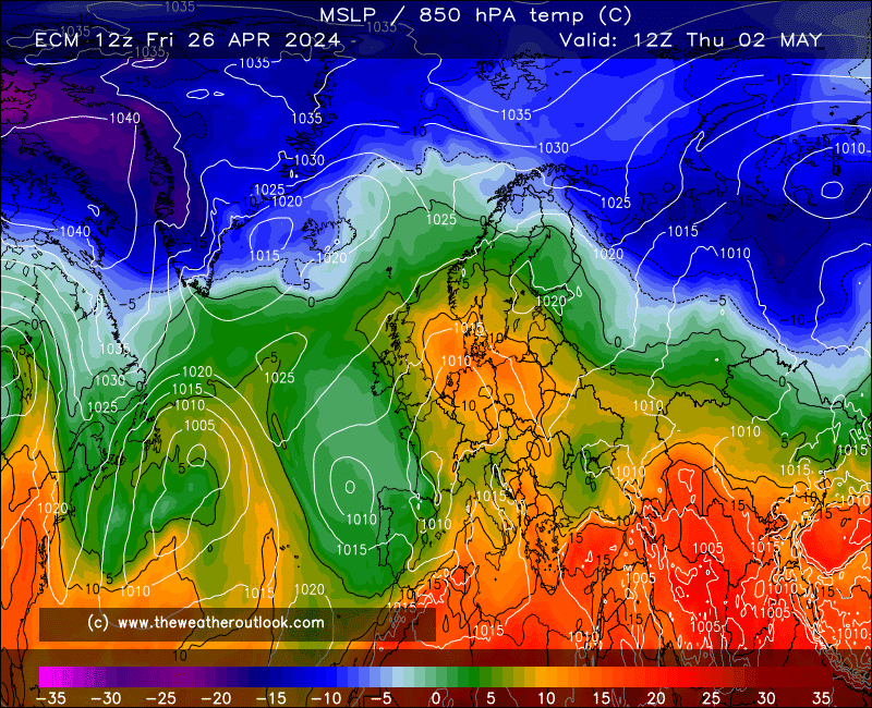
This latest chart ( below ) from ECM at 144t confirms the progress towards a second plume of hot air after this weekend. A rather unusual set up with the main plume moving out of Iberia towards the SW of British Isles. The development of a upper trough from the Azores to the West of Scotland will aid the transfer of heat in 6 to 7 days time , especially up the west side of the British Isles. Expect some real heat this time next week.
C
A heatwave that will actually include me?! This weekend looks horrific so far
-
1
-
-
17 minutes ago, cheese said:
1995 probably more appropriate - uneventful/poor June, turning hot at the end, leading to one of the best summers of our time.
Not that I expect anything like 1995 this year, but I do hope July and August are settled and warm at least.
Also including the North of the UK for once. The weather we had in May has jinxed us and the models don't like us anymore.
-
How big a part, if any, is Scotland playing in this heatwave? I really don't see anymore than 22C here in C Scotland, and I'm pretty disappointed considering it's apparently a UK-wide hot spell.
-
Beeb's latest forecast shows the possibility of 30C+ in the UK. Matt Taylor highlighting that the models are still all over the place with the position of the high and the timing of the "breakdown".
It is looking better though after Sunday for all of the UK, hopefully I get some heat up here in Scotland (higher than 25C
).
-
2
-
-
NAVGEM is scary at the end of the run, possibility of 38C in the SE.
Slight improvement with the ECM joining the GEM's ideas later in the run, but Scotland never really joins in. Still all to play for but Jesus I hope the upgrades keep coming.
-
6
-
-
UKMO has banished the hot spell, while a few other models keep the warm air and GEM brings the really good stuff. Who knows what's gonna happen, but I'm disappointed now about this summery spell we probably won't get anymore.
-
All hail GEM if you're looking for good weather!
Will be interesting to see how this develops, or disappears in the next week. Would be nice after what this week has in store.
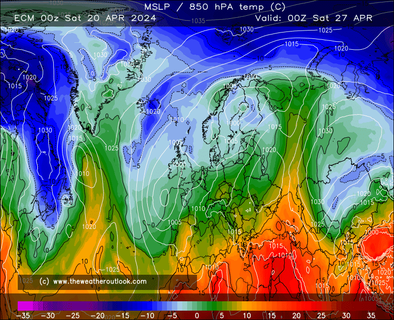
What's also nice to see is the drop in heights over the pole, comparing this Wednesday to next Wednesday:
Notice the difference this makes over Scandinavia, allowing high pressure to build giving most of Europe a lovely warm spell. This is exactly what we need for heights to stay put and deliver an overdue hot UK summer, but then the energy leaving Canada may disrupt this pattern as the lows may not be for stalling to our W/SW (generic I know, but way too many variables for me and frankly I know little about a lot of them!).
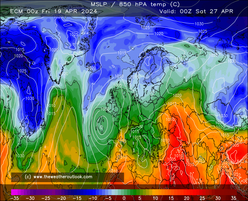
ECM also goes for this change, although the UK pattern is drastically different:
Could be heading in the same direction, but with a slower evolution which may hamper the chances of sustaining the pattern.
Of course we have to consider the fact that this is at the very end of the run, and will undoubtedly change a lot before it's nailed down. Still nice to see these charts showing up, one is just really hoping for a great summer for once!
-
8
-
-
Finally! A tropical downpour with one CG strike! Better than nothing but I want more!
-
Just now, Harsh Climate said:
Don't worry there's plenty of rain coming up for you to enjoy : ))
Rain!!
that's all it'll be
-
3
-
-
6 minutes ago, NUT said:
The skies have unleashed themselves here in the last hour it's pretty soggy outside
Aye the two big cells have merged over Glasgow, typical luck for me.
-
Still all just to the east of me, so frustrating when it looked like we were on for a good hit!
-
Fed up with these non events in Scotland! I better get something or I'll be really cheesed off
-
Cells firing now to the S/SE of me! Pleeeeeeease deliver!! Also, does anyone know why I can't upload photos here? It says error then "-200"
-
More sporadic rain developing in Scotland. Really hope this doesn't mess up our chances of a good storm
-
The front is just clearing to my north now, heading into the Scottish Highlands. Skies clear behind with the sun coming out, 22C now. Praying I get a good storm, extremely impatient after seeing that storm in SW England
-
That front moving into Southern Scotland is a joke now! After all I produced
. Typical
-
Things look great for some across the UK tomorrow, but could anyone give me a heads up for my location? Forecasts updating nearer this event seem to mention Scotland less and less...I'd be really disappointed if I missed out with all this potential around, but wouldn't really be that surprised.
-
The BBC forecast looks like nothing but a weak front moving north across NW England into Scotland, weird
-
26 Celsius today! Expecting maybe 28C tomorrow since today's high was a few degrees above the forecast
-
1
-
-
26 minutes ago, Singularity said:
I wonder why ECM has such a habit of handling plumes in different and more exciting ways to all but the (legendary/infamous) GEM?
Seems like the SE would stay toasty right out to Tuesday on this run, depending on surface details regarding cloud and showers.
I must say, as that low lifted out so far west on Sunday, I feared the Atlantic could just march right in early next week, but even this run manages to avoid that. So what are the Met Office seeing I have to wonder? Even the ensembles look less changeable-looking than 24 hours ago, although there are a fair few shallow low scenarios - yet this favours the south for rainfall which just takes us further from the Met Office guidance. Very curious indeed!
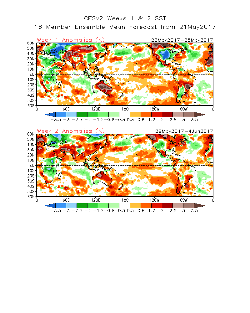
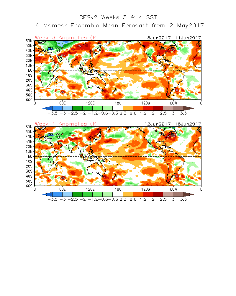
I'm now going to be naughty and leave some CFSv2 weekly ensemble mean temperature anomaly charts here
This forum probably isn't big enough to hold the size of caveat that comes with these. Except perhaps it is these days, as this model has done surprisingly well in recent months
What is this caveat you speak of?
And if those charts came off, it wouldn't only be this forum in meltdown! Lots of positive signs for really great weather in the next few weeks, everything just has to fall into place for us for once. -
1
-

 Seriously though, the models show the perfect setup for heat right up to N Scotland next week but the Atlantic shoves it to the east before it has a chance to blink. Weird how the high can be so stubborn but then just disappear when it's beneficial UK-WIDE.


 that's all it'll be
 . Typical


 And if those charts came off, it wouldn't only be this forum in meltdown! Lots of positive signs for really great weather in the next few weeks, everything just has to fall into place for us for once.
Convective / Storm Discussion Thread - 31st May 2017 onwards
in Storms & Severe Weather
Posted
My God the BBC are scared to talk about storms in Scotland. Their graphics hardly show anything for the early hours but the storm forecast on here suggests otherwise... Gonna have to wait and see but I'm not sure why they're so reluctant to mention storms