


WalsallWeather123
-
Posts
356 -
Joined
-
Last visited
Content Type
Forums
Blogs
Gallery
Events
Learn About Weather and Meteorology
Community guides
Posts posted by WalsallWeather123
-
-
Just now, northwestsnow said:
A sceuro high would actually potentially bring some very cold surface conditions in late November..
Likely not the low 850s but i would be delighted with a sceuro high personally ..
Surface cold, yes absolutely. But I'm sure most are chasing snow which we need a greenland high for this time of year
-
A sceuro high wouldn't bring in deep cold from the NE like a greenland high would. Of course thing are going to get colder but for deep cold and snow we need a greenland high for this time of the year. A sceuro high won't cut it. Lets see what this GFS run will bring
-
 1
1
-
-
Just now, booferking said:
Yes but downgrading the longevity need more heights into Greenland like the GFS earlier on like..

Yes, the end of the run is quite poor. For all the talk of the ECM being an outlier, I can see the other models coming towards it in the coming days
-
2
-
-
I think the GFS will come closer to the ECM this run
-
1
-
 1
1
-
-
ICON at T180 looks quite poor to me. Thoughts?
-
1
-
1
-
-
ICON upgrading the cold over the UK. Still looking like cold rain though
-
Just now, WalsallWeather123 said:
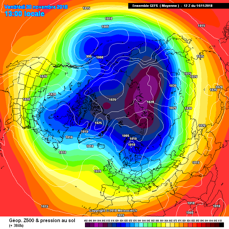
Look at the GEFS mean. The block will collapse. It's fairly evident. Give it a few more days and the model will show it. We'll get a few chilly day with a bit of surface cold, but nothing signifcant, then the block will collapse
-
1
-
-
3 minutes ago, abbie123 said:
So the ecm has this nailed at day 11 on one run I don’t think so lots more changes to come
Look at the GEFS mean. The block will collapse. It's fairly evident. Give it a few more days and the model will show it. We'll get a few chilly day with a bit of surface cold, but nothing signifcant, then the block will collapse
-
Just now, Steve Murr said:
You do realise the block isnt actually going anywhere- its just being undercut...
Of course. Doesn't show at the moment but signs are there
-
A weakening of the block and a return to Atlantic driven weather. I was blasted for saying this yesterday. Even more of a possibility today
-
Just now, mpkio2 said:
We were expecting this to happen. ECM isn't as good as GFS, but then again, that run is possibly the best outcome we could get!
ECM, as many have said, isn't a disaster at all and there is much to like - PV in shatters, high over UK and GIN corridor trying to retrogress upwards.
I'm sure if you played the run on a few extreme frames, a high would set up in GIN and we would be back in an easterly flow!
Just for a little perspective, this time last year we were looking down at the bottom of the barrel....
If a run like the ECM 12z came along, we all would have jumped on it, wishing it to fruition!
Thats a 2015 chart?
-
I didn't say its not good. I was comparing to the GFS and yesterday ECM run and everyone just jumped on me lol
-
1
-
-
3 minutes ago, markw2680 said:
Why are some so obsessed in every single run and model? They are not all going to be the same for stuff a week away or longer lol. Come on man get a grip.
the route is going colder they all say the same that’s the important part at this point
But when it shows cold its ok to be obsessed with single run? The bias is ridiculous.
-
1
-
-
You can tell the ECM isn't great just by the lack of comments on the T192 and T216 lol
-
1
-
-
WOW. Sensational T168 aswell. Real classic coming up
-
2
-
-
ECM looking better @ 144 compared to 0z run. Heights pushing further north. Updated thoughts. I think we'll get a weak easterly followed by a more potent northerly which is the one to look out for.
-
3 minutes ago, tinybill said:
going the right way!!!
That is the worse possible chart to post lol
-
1
-
-
1 minute ago, Daniel Smith said:
The soon to be new GFS model is hardly an inspiration either
Winter over lol. Genuinely can see this being a 2016. Full of hopes but nothing comes to fruition
-
1
-
1
-
-
JMA not great compared to yesterday
-
1
-
1
-
-
We have half a chance of an easterly looking at the models. The problem is there's no real cold pool to tap into. OK it'll be chilly but not cold enough for snow IMO and it will be very dry. Frosty nights- yes, snow- probably not.
-
Another seriously impressive end of GFS run for cold weather. I know it's FI and I am normally one of the biggest critics of long range charts but there is model consensus at T240 from all models and it is obvious that we are going to get a cold spell at the end of November. The building blocks are being built and you just have to put up with some mild southerlies for a while and things will cool down quick time.
-
4
-
-
1 hour ago, Mike Poole said:
Performance varies, but currently for the NH at day 5, ECM wins, UKMO 2nd, FV3 third:
At day 10 FV3 first ECM 2nd and GFS and GEM tied third:
Re the comment about snow forecast from @WalsallWeather123 you'll see a lot more charts from GFS then because precipitation and snow charts are publicly available, they aren't for ECM, UKMO. And if the snow event is actually going to happen, shorter range models like ARPEGE and HIRLAM then come into play.
GFS snow charts are ridiculous though. They also show sleet as snow and overestimate accumulation yet they still are widely used and treated as gold standard. Surely people should know this by now!
-
9 minutes ago, northwestsnow said:
I'm at a bit of a loss as to which model i trust the most if i'm honest- they all have flaws, my favourite would have to be UKMO, followed by EC and then GFS.
Thats just my opinion i guess.
Last year ICON was the best, IMO, believe it or not
-
2
-
-
19 minutes ago, blizzard81 said:
Oh! Since when did the gfs know anything?
When it predicts snow it's the only model you see on here
-
5
-


Model output discussion - The Hunt For Cold
in Forecast Model Discussion
Posted
Yes but the two lows are much closer together than the 6z. Small changes