
- Popular Post


CSC
-
Posts
158 -
Joined
-
Last visited
Content Type
Forums
Blogs
Gallery
Events
Learn About Weather and Meteorology
Community guides
Posts posted by CSC
-
-
Just now, Mapantz said:
Even before I became a mod, this North, South, East and West divide when it comes to snow really got on my goat, and it still does! I'll clamp down hard on any more posts using it as an excuse to snipe at others.
I'm not singling out anybody, this goes for everyone.
We have an exciting week coming up, and there's prospects across much of the British Isles, so why all this petiness? Let's keep it friendly and look forward to what unfolds.Thanks.
-
1 minute ago, feb1991blizzard said:
Yes that is evidence of a POSSIBLE significant snow event on the graphics for Northern Ireland, W Scotland, NW England and parts of the Midlands, plus from what i remember of the forecast, that rain could Easily edge into SE England and turn to snow, If your definition of a significant snow event is 1ft of level snow then yes you are right, to me, around 3 inches is a significant fall and that could Easily happen in any of the places i have mentioned.
Dear oh dear this is getting stupidly petty now.
Please state where I said there was no snow event possible? If you look at my posts you will see I said I think there will be one. I have studied meteorology for quite some time and this is my interpretation. I simply stated that the BBC DID NOT MENTION any possibility of widespread snow and yes, you can name every part of UK but the BBC did not mention heavy snow for ANY of these areas.
My definition of a significant snow event is anything of any significance.. i.e.snow that causes disruption. Its quite self explanatory. When the BBC don't mention heavy snow that logically suggests there won't be one in their view. Its a bit of common sense.
Over and out this is tiring me I was only trying to make a point you, along with many others are respected weather commentators but I think there was a misunderstanding.
Hope everything has been clarified and apologies again.
Onwards and upwards tomorrow!
-
 1
1
-
 1
1
-
-
Just now, johnwirral said:
You said a complete no snow event, thanks for the clarification
Apologies. I am very tired after a tough week.
I meant no snow event as in an event of significant snow. Snow showers in my opinion is a complete no snow 'event' as its not significant.
Apologies again. It is clear I need sleep!
-
2
-
-
1 minute ago, feb1991blizzard said:
For where are they backing a no snow event? - you need to be more specific.
Have you watched the 10 O'Clock news?
BBC have said 'showers in places' but nothing note of any significance. Some models seem to be going for dumping whilst others seem to go for 'showers' or some cases nothing at all. ECM puts South East in a great position whilst GFS does not.
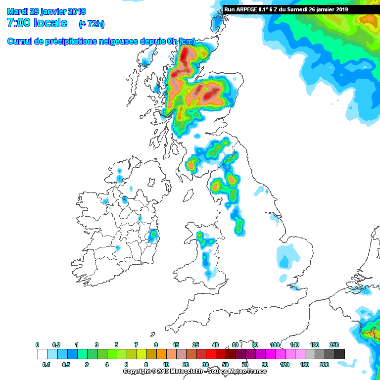
Here is the GFS

Here is there BBC. Evident to me of a non significant snow event..
Of course everything depends on the position of the Low but I was simply stating that I think the South East will be in the favourable spot this time around and that the BBC are wrong (not for the first time) about the position of the low and therefore where snow falls.
Here you can see GFS (P) is also entirely different,
Icon heavy snow too for much of Kent and Sussex.
Most know that the BBC app updates are not always in reflection to current information as they are automated much like many apps. They update at periodic intervals and sometimes, at times like these, they do not update as frequently. This means that if the app is showing snow now, it may not be currently forecasted snow for the period if it hasn't updated so a link to the website at this moment does not show their current forecast.
This what I meant for BBC not going for a significant snow event. I hope everything has clarified!
-
2
-
-
5 minutes ago, bluearmy said:
Sorry mate but you need to be a bit more specific .......precisely where over the next six days are you backing METO???
Hey dude, apologies! Very tired haha and trying to keep with this half asleep!
I mean, rather not for the extended, but for snow on Tuesday night into Wednesday.
Apologies!
-
It is a case of METO vs everyone tonight. I am still backing METO.
They have been the leaders in the past in these scenarios and will continue to be in the future.
I cannot believe that the most favourable outcome for snow for all models is the METO. Usually its GFS on a drunk one. Again, even the best models can have lapses and errors in their operational runs but I really do hope for my sanity that the METO is right and I think on this occasion it will once again prove to be.
I cannot remember a time when we are not sure what will happen in just 24 hours. There are scenarios ranging from snow in JUST 12 HOURS to 12 inches falling in Kent on Tuesday evening to no snow at all..
Astonishing. Simply astonishing stuff.
-
1
-
-
BBC are saying no snow because they are unclear as to what will happen, a conservative forecast.
Their app still shows heavy snow for the South East Uk..
-
10 minutes ago, Liima said:
No don't spoil it, I haven't watched yesterday's episode yet!
BBC are tosh..
METO app still goes heavy snow for much of SE UK, much more reliable than BBC. Even if METO vs every model I would still back METO.
I think London and South East will be the winners this time!
-
5
-
1
-
-
4 minutes ago, bluearmy said:
If everything went right we’d by living in igloos mate .........
short answer is atop the highest hills in Kent or Sussex you could see some deep snowcover by wed am ......but better to wait till Tuesday first ......
Thats true..
Kent and Sussex are sweet spots at the moment.. tomorrow maybe northern Scotland..
look outside Tuesday and see!
As some have said before, 'I will believe it when I shovel it'
-
1
-
-
What is the best scenario here for a dumping of snow SE UK?
I have read earlier that if everything goes right, somewhere in SE could get 1ft..
Is this true?
-
2
-
-
Just now, Chris. said:
Does it?
Thats the wrong update..we are talking about 12z not 6z!
-
5
-
-
45 minutes ago, northwestsnow said:
00Z runs are going to be crucial for next week, last night on shift for me so will be here for them.
Do hope UKMET continues with its cold outlook.
I do not want to end the evening on a negative but checking UKMO app its cold but goes SW for Thursday next week..
Lets hope this is a mild interval and not a progression into something warmer.
Looking cold in the near future!
Goodnight everyone
-
1
-
-
- Popular Post
- Popular Post
GFS (P) with higher resolution has gone for snow as early as this coming Monday for the south..
There is now a trend towards a snow event or multiple snow events next week for many parts of the UK!
-
10
-
On 21/01/2019 at 19:56, CSC said:
For all those pessimists saying 'winter is over', please go and get some sleep, it isnt! This is the 21st January. Last year we saw significant snow at the end of march..
I do fully understand for many snow lovers, including myself, this winter has been invariably disappointing. The promise of snow for it not to arrive or for all models to switch late on is hard to see.
This week is still looking exceptionally cold. Tuesday may well bring surprises for many. I have seen lots of comments saying that snow will not fall to lower levels. I however, think that many places will see a period of snow. It may not lay but you may well see some snow at some point, from the N W to all the way to South coast here in Brighton.
Wednesday many places will struggle to get above 1ºC or 2ºC. This thread is 'hunt for cold'. That is cold to me!
As we head into the later stages of the week, Friday up until Saturday evening there looks to be a warm up. What you may notice however is the constant reload of the jet stream each time it gets colder and colder. I personally think that after this warm up, we have our first chance of a significant snow event. I am to be proven wrong of course but this is my view on it.
With RE to ECM and GFS 'agreeing' to 240h'' it doesn't make too much difference to me. They have proved unreliable at this range in the past and will prove unreliable in the future.
I am fascinated on what is to happen next this winter.
Please everyone, it may be difficult, but remain optimistic until the end. If you don't have hope, you have nothing.
Have a good evening!
Thank you for reading
Onwards and upwards!
May I related back to this post I made on just Monday this week when many in this chat seemed to have lost hope..
Oh how the optimism in this thread has changed again
This is the exact reason why people should always hope! In the weather world things change very quickly
Bring on snow events next week!
-
1
-
2
-
-
2 minutes ago, snowbob said:
Totally agree with that but would expect that to be modelled further south nearer the time anyway not if
By experience, many posters will agree we have had many set ups that have corrected south 40 or 50 miles similar to this..
METO going for heavy snow here not far from Brighton. We are as south as you get.
Maybe just maybe the snow gods are arriving..
-
4
-
-
The pattern is there on GFS 12z but I think it will be colder come Tuesday than what it is currently showing.
The reload of the jet stream will probably happen a bit further west meaning we are colder and have more chance of snowfall.
Even at 96 the re load of jet is too close to UK
-
Just now, Dave Kightley said:
The ICON not being on board really isn't good!
ICON is tosh anyway
-
2
-
-
UKMO 144h many places will probably struggle to get much above freezing..
Looks pretty good to me!
-
2
-
1
-
-
UKMO is far colder than GFS even at 72h..
-
Through experience many know that looking for details past 120h is pointless for GFS a lot of the time. It is mainly about looking at trends at this stage and seeing where the weather looks to be heading.
For me, there is no sign of a 'trend' at this moment because the last two GFS operational runs have been so different that you cannot take one literally, or, even begin to estimate where the chance of snow may be possible.
Hence why, I advise everyone, to wait not only until the ensembles but the ECM later before getting too worried about 'no chance of snow' for the south of the UK.
There is no certainly past 120h so please people stop being so pessimistic
-
2
-
-
Just now, feb1991blizzard said:
Yes although i is a big outlier for the part of the run where its a real stonker!!
That is very true, Feb
I might start chanting 'we want snow' if this roller coaster of a winter carries on!!
-
1
-
-
That GFS 18z run, despite it being extraordinary, ITS NOT AN OUTLIER for most of the run!
Fantastic stuff that! Mean temperature beginning of February is below 1ºC all the way to the south coast!
-
In the almost unlikely chance the GFS 18z was to pull off, no one could complain about lack of snow for the following 10 winters.
Amazing stuff. Simply amazing.
Classic pub run, it really has been at the pub!
-
2
-
-
1 minute ago, mountain shadow said:
The BBC produce their forecasts from data provided by a professional meteorological company with access to data far in excess of the scraps we feed off.
It amazes me that even with the 'scraps' , the amateur forecaster on this forum produce more accurate forecasts than the BBC manage most of the time...
With all their 'progressional' data, they said that for most of the country it will be entirely dry at first for today.. then they changed it to 'rain showers, with snow at high ground'. This is despite many in the forum with the idea that it was within the realms of possibility of snow falling to lower levels.
I praise many great weather commentators in this forum who interpret the weather in my opinion, much better than the BBC are doing right now.
-
9
-


Cold hunt - models and chat
in Spring Weather Discussion
Posted
Anyone at this stage saying winter is over does need more sleep! Looks at march 2018..coldest conditions in some time an a lot of snow fell in places..
We are looking for cold in this chat, not winter pessimists.
We still don't know whats happening Tuesday never mind after!
Thank you