


ChannelThunder
-
Posts
2,060 -
Joined
-
Last visited
-
Days Won
4
Content Type
Forums
Blogs
Gallery
Events
Learn About Weather and Meteorology
Community guides
Posts posted by ChannelThunder
-
-

Look at all that cloud-growth being pulled in toward the SE; I'd be shocked if Paul's COS survives today and tonight without some form of rainfall!
-
4 minutes ago, davidpage66 said:
Taken from Gatwick area this is the cell producing the returns in Kent
Are you sure? Looks way too small and nearby to be the Kent one from there. There are newer returns on the radar that are much nearer to you which would line up with that image.
-
 2
2
-
-
1 hour ago, JON SNOW said:
Well this from the ECM 0z operational is even hotter than yesterday’s 0z if we are comparing like for like!!..and yesterday’s raw data indicated 31c 88f..I think this would now hit the low 90’s F briefly for the SE..depending on sunshine amounts of course!!!


Hopefully that would go 'bang' in the night for the storm-starved south!
-
1
-
-
34 minutes ago, Azazel said:
Tony Gilbert of UKWW actually puts me in the possible weak FC/TN box for today.
That's encouraging; i'm in it too and Tony is very knowledgeable.
It has to be our turn down here either today, overnight, or tomorrow, surely? Bored of seeing everything go up to Reading and beyond. It'd be a joke to go this entire 'thundery' period with zilch.-
1
-
-
Reading booming away with thunder to my north, sounds great under that storm!
-
1
-
-
I can hear distant booms from Wokingham, despite being under another cell!
-
3
-
-
Well, a proper downpour here at last! I can stop complaining for a while. Enjoying that fresh summer rain smell
-
2
-
-
9 minutes ago, Mitch perrott said:
can someone please explain why this cell is deciding to extend so far?...
Looking at the satellite, wind sheer is taking the anvil miles away from the centre of the cell, and some of that anvil is producing precip. With the pixelated radar (out of our range) it makes it harder to see the actual finer details.
-
3
-
-
3 minutes ago, StormLoser said:
Aha! Rumbles of thunder and a classic dark CN on our southern horizon! Sun belting down here in a humid day after this morning's shower. And it's enough to spark of a storm.
Just watching now in case it does a 90 right and avoids us...
Watching that now, satellite suggests I might have a chance of it veering toward me, but watch it go to Reading yet again!
-
Latest AROME looks tasty for south midlands tomorrow afternoon, with storms developing from Kent up to Cambs and pushing directly westwards.
Once again, it looks bone-dry south of the M4...time for my favourite smiley of late:
-
1
-
-
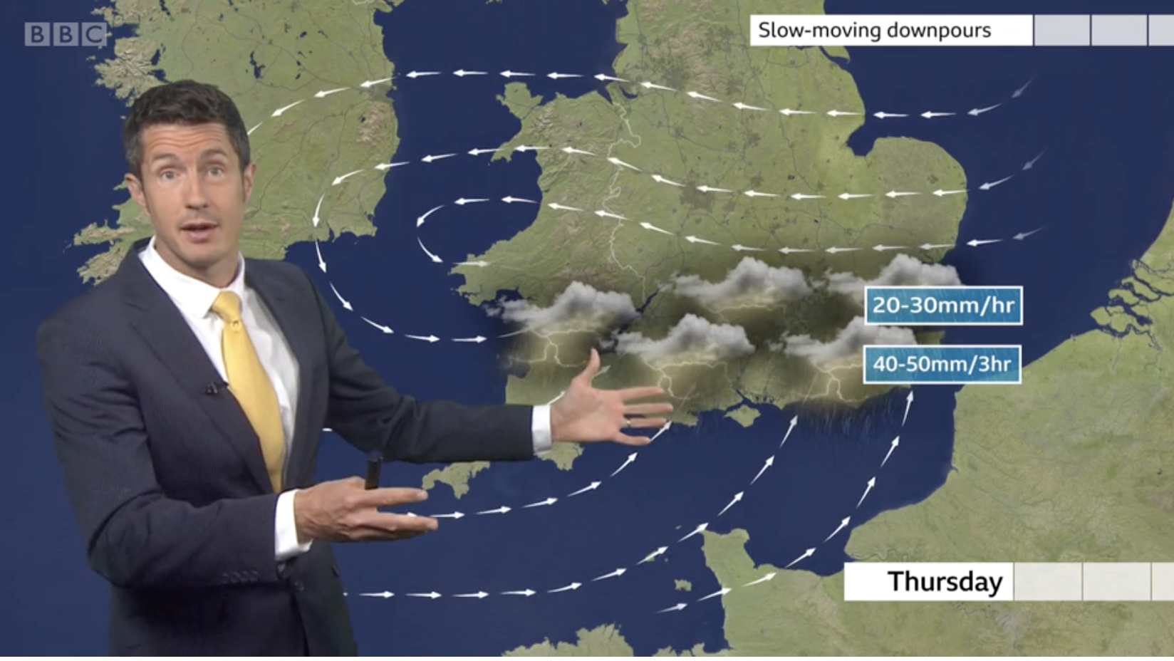
13 minutes ago, Benny123 said:
Another interesting forecast from the Beeb! Thursday.
Chris' face there is as shocked as mine will be if that comes off above my head
-
2
-
-
2 minutes ago, cheshire snow said:
@Lance M sorry not sure how I copped the photo into your post
No worries! I pressed 'submit reply' and it just appeared! I was able to remove it with an edit so it should be gone now. There are definitely some funny gremlins in the system on this forum!
-
Well, at least it looks more promising than yesterday in these parts. Sky is absolutely full of chunky CU, with some dark bases already going on.
-
1
-
-
3 minutes ago, Harry said:
Same thing happened yesterday - there’s no doubt there’s the potential for isolated, perhaps even torrential showers, even some rogue thunder, but as with yesterday I think there will just be a lack of juice over the SE. I saw some stunning looking Cb formations yesterday evening (while driving so alas no pics) but they lacked height and general oompf. I think today does look marginally better but I don’t think it’s anywhere near as promising as further west. I hope to proven wrong!
It'll probably be identical to yesterday, stuff kicking off literally just to the north of here in the M4 corridor. Spent the whole of 5 - 8pm looking at pitch black skies and towering CBs just up the A33 from me, but not a single drop of rain fell here!
-
3
-
-
4 minutes ago, Atmogenic said:
Looks like it's time to rename the Kent clipper to the Kent skipper
I'd like to introduce a brand new one that I feel is very appropriate for 2020's lack of storms here, and the fact my workplace has a statue of a Hampshire Hog outside:
The Hampshire Hog Dodger
-
2
-
-
1 minute ago, ChezWeather said:
AROME for 1800 & 2000 hrs this evening
6z run for Monday ended up being very accurate, wondering if that'll be the case today. It'll be interesting to see what changes are made when it's released.
-
3 minutes ago, Azazel said:
I think I need to sign out of this thread for a while as it does my mental health no good.
No snow in winter, no storms in summer - might actually be a contender for most boring climate on earth in my little part of England.
Sad times for us! Do you have a car? I'm willing to chase stuff within say 50 miles if anything pops up; problem is I'm working from home till 5 each day!
-
1 minute ago, Thunder and Lightning said:
Also there isn't much need to look out that far for T-Storms, as we have so many to look forward to over the next few days!
Provided we eventually join in the fun down here over the next couple of days, yeah! *Everything crossed*
-
3
-
-
47 minutes ago, jake44 said:
Looks pretty good for Saturday
Sorry to bear bad news, but BBC app can't be relied on 4-5 days out and beyond. Especially in this case, as all models show a standard Atlantic front moving in on Saturday, so a splash of frontal rainfall looks way more likely than storms
-
2
-
-
4 minutes ago, Gordon Webb said:
are there any maps that show where these convergence zones are expected to be , free of course
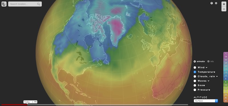
I'm sure others might have something more apt, but I would say try windy.com and go into the settings to make the wind arrows more dense/fast/bigger, you can then drag the slider at the bottom through the upcoming hours and you get a good sense of the CZs. The model you're viewing can be changed bottom right
-
Tomorrow night now looks crap again on the models; I give up!
-
3 minutes ago, Jamiee said:
Blimey
Ooo, actually just inside the green this time
-
1
-
-
4 minutes ago, Mitch perrott said:
when!? also is that the only risk map for that day or is there updates before and after that one?
Look for where it says 'valid' at the top right - so 3am Weds night/Thurs in this case. And it's not a risk map or anything like that, it's just one model's take on it. Like Paul said, some models have it way north and some have it crawling along the southern counties, so you and I need to hope for the latter
-
27 minutes ago, Zak M said:
Well hello there, EURO4... would you like to tell me what that is lurking there in Belgium on Wednesday night?
Certainly interesting and unusual origins for this one if it comes off.
Swiss plume anyone?
-
6
-


Storms and Convective discussion - 1st June 2020onwards
in Storms & Severe Weather
Posted
Ah, so it's you guys' fault everything is in a perpetual state of pivoting around CS England this week