


gottolovethisweather
-
Posts
7,850 -
Joined
-
Last visited
Content Type
Forums
Blogs
Gallery
Events
Learn About Weather and Meteorology
Community guides
Posts posted by gottolovethisweather
-
-
20 minutes ago, Sperrin said:
Huge differences on the 850s across Europe on the GFS later next week. All up in the air still.
6z on Christmas morning showing -4 uppers as far as Midlands and Wales with -6 uppers just off the coast of Co Donegal in NW Ireland. Could we see something white with a bit of altitude on the big day? Hope so!

That's some serious depth of cold out towards Greenland but will it ever leave their shores. I cannot convince myself to look past the 21st/22nd December right now, but I have a feeling the period immediately around Christmas Day and towards the close of the year will be a memorable one. Everything but the kitchen sink springs to mind, so yes I favour an active period! Snow for some too with not everyone joining in the fun and a lot of transient stuff.
-
 4
4
-
-
2 hours ago, gottolovethisweather said:
I haven't simply got the energy to even give you a short wave in response after tonight's outputs lacked potential but I agree with you about NOT looking past the reliable unless trend-spotting. I'll verify this post with the mods to see if it needs to go in the F.I'n bin next to the model fodder trough or whether it's a complete swear filter posting, before saying that winter is over, even if it never began for coldies.
I know it is bad practice to requote one's posts too often as tedium will set in for all readers, but I simply had to share this fascinating news with you all.
If you take the initial letters of my highlighted words above, whilst leaving FI aside (often best practice) you will find it spells out "ESP" v (for versus) "FW". So now, I've worked out precisely how the rest of December and the rest of winter is to pan out!
We, therefore, have two choices. Either we simply use our Extra-Sensory-Perception, or alternatively, stick with the guy whose forum name goes by the initials FW.
I knew the answer to winter 2016/17 was somewhere to be found, after all.
-
7
-
-
- Popular Post
- Popular Post
44 minutes ago, nick sussex said:Lmao! Longer range signals need to be consigned to the swear filter! The longer range models as we've seen from the weather delivered so far in December weren't upto much. It's clear so far that those longer range models have failed this winter. I'm done with them and will stick to finding signs of life within a more realistic timeframe.
1I haven't simply got the energy to even give you a short wave in response after tonight's outputs lacked potential but I agree with you about NOT looking past the reliable unless trend-spotting. I'll verify this post with the mods to see if it needs to go in the F.I'n bin next to the model fodder trough or whether it's a complete swear filter posting, before saying that winter is over, even if it never began for coldies.
-
17
-
2 minutes ago, Summer Sun said:
Good agreement now for things to turn stormy next week maybe cold enough for some snow on high ground in the north
With the ECM jumping on board from D6 or thereabouts, I think a three to four-day drier spell post-Friday, is looking a fair bet for most away from the far NW. As to next week becoming stormy or actively low pressure fixated, I'd say a 60/40 percent chance right now.
-
3 minutes ago, Steve Murr said:
ECM day 7 sees the deep vortex tightly wound up & a very strong +VE AO, very 2015 esque -
Can we get a smidge or amplification at 192 to squeeze that polar air SE
Thanks, Steve, something model related. Not that you'll get many likes for that chart and your valuable analysis, nope you've got one and it's a predictable one, lol.
-
2
-
-
Is this the banter thread or model output discussion thread? What's the ECM op up to, anyone? Will it snow on my house roof at D16? Will the GFS ever accurately forecast surface conditions which verify at D10, D12, D14 or D16? Will any model's chart be correct at such a range? Who is going to top the charts on Christmas Day? I'm Dreaming Of A Washout Christmas by the Netweather Choristers.
Happy Christmas. I need a drink.
A bit more in-depth analysis would be gratefully appreciated please. Why, where, and how you think said developments might occur and when are always helpful to full and part-time seasoned members and beginners.
-
5
-
-
24 minutes ago, Bristle boy said:
Confused.com.........again.
In space of 10 mins v conflicting views from posters.
Hopefully, my post above and my one on the previous page helps you and any newbies.
My post above requoted as follows.
"Surface cold (think inversions) but not deep cold hence some folk aren't so happy with the outputs. IMBY there should be a good deal of dry weather, hopefully, with the sunshine in abundance if our cards fall right."
IT DOES HELP IF MEMBERS WOULD POST CHART RELATED CONTENT RATHER THAN ENTERING INTO ONE LINERS ON HERE AS THE PAGE COUNT INCREASES FAR TOO FAST!
-
6
-
-
10 minutes ago, Blizzard 63 said:
High pressure over England and Wales cold crisp with frost and fog that's the way I see it
Surface cold but not deep cold hence some folk aren't so happy with the outputs. IMBY there should be a good deal of dry weather, hopefully, with sunshine in abundance if our cards fall right.
-
4
-
-
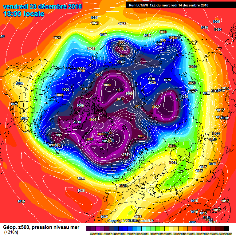
That is some odd looking D3 chart on the ECM, four to five surface lows (encircled in red) lined up along the Southern edge of the Canadian Vortex? Our friends are encircled in black, although the Euro high could be a foe if it doesn't behave as us coldies would like.
Take the above chart for Friday with a generous dosing of salt regarding the actual specific features, but more broadly, a linking up of extensive heights is incoming by the end of the working week into the weekend. Can we promote these heights further North and further North East in time, I hope we can. The following chart was predicted by the ECM 12z for this Friday, some three days ago.
A fair few differences there at the micro level but not at the global scale as such, yet this was only a t+144hours chart hence the uncertainties moving forward, other than a few days of HP influence which are nailed IMHO.
-
3
-
-
- Popular Post
- Popular Post
34 minutes ago, Timbo said:I posted this on Saturday, looks like it is shaping up nicely, with a bit of movement further north and jackpot for xmas
Indeed, I'll beat you by a day, this is my post from late Friday.
As I quoted, "However, the behaviour of Canadian vortex (trough?) incoming from the North Atlantic could yet force ever stronger heights ahead of it towards our North. This is where my prediction of more solid heights towards our NNE and NE (Scandinavia region) comes in and if we look at the D8 chart for the 13th December I threw in for a laugh on Monday's post; we can see how the ECM handled that aspect at the time."
Let's not count our chickens, but my next watch period surely has to be the days immediately prior to Christmas. Here's hoping my look due North and due East quote from the other day is also a good portent. A working week of above average Temperatures and patchy rain and drizzle in places before we get there but I am starting to feel a stronger hint of seasonality in the outputs. GAME ON!
-
11
-
1 hour ago, Carl46Wrexham said:
Reason 6 : No repeat of the horrendous flooding which impacted parts of the UK last year.
BANK. We don't make the weather but if Carlsberg did (no, I haven't been drinking) even they wouldn't produce a weather brew so foul or cruel as 2015's weather set up. Anyway, enough of my waffle. Eyes down for the bestest model run of the lot.
-
43 minutes ago, karlos1983 said:
I'm thinking the feeling of being back in the 90's is where all pessimism has come from. Especially after such promise. Understandable I think. Cold winters rarer than hens teeth lately.
We know how hard the Euro slug can be to shift once in place. Or is that uncle Bartlett
Yes, a slow pattern change? Maybe something, a certain person was banging on about some eight to ten days ago.
Trauma for those who lived through the worst of the 90s and early 2000's weather as I did but this winter feels very different to my mind. Ask yourself, if the above chart verified (which I'd say it has a 70 to 80 percent chance of doing so) which route would our weather take by Christmas week? All a long time away in Meteorology speak, but I have a sneaky feeling, the colder than average card hands are being put in the deck post 13th December. -
4
-
-
- Popular Post
- Popular Post
26 minutes ago, Ali1977 said:The sooner we get rid of the high the better , it looks like FI the PV weakens which happened in the 06z. The Alps need snow, if we can get some fronts heading W to E down that far then we may have some chance of getting some WAA far enough North to create a proper block and not a rubbishy Euro one.
Better looking NH for sure, Alps getting some snow too.
2Ali, you say "the sooner we get rid of the high the better", why? It hasn't quite arrived upon our shores, tomorrow is average temperatures darn south in my neck of the woods and wet, you can KEEP it!
I say bring it on, why?
- Reasoning one: We primarily keep the Atlantic fronts at bay.
- Reasoning two: Temperatures are likely to slowly trend downwards as the High migrates Northwards and hopefully NNE'wards if I choose to be umm choosy.
- Reasoning three: This would be a Godsend if it were to happen, for the wider environment, farming (think disease and pests) and the countryside's wildlife. It will bring some normalisation to our seasons for once too.
- Reasoning four: It might result in abundant sunshine, yes that's me straw clutching.
- Final reason: I don't need one, it's the form horse to my mind, now.
I say, look East and North, not South and West in time for the final third of December.-
17
-
- Popular Post
- Popular Post
7 minutes ago, northwestsnow said:UKMO-
Turn..that..image..upside-down..and..you..have........summer!
If there are inversion opportunities within, I'll take them with open arms. Second best conditions(dry, cold and frosty by morning) in winter if we can't have snow. As an aside, most useful snow-making synoptics arrive after Boxing Day all the way through to March, so I don't understand all the pessimism. CHINS UP GUYS N GALS!
-
13
-
15 minutes ago, Frosty. said:
I have that same hopeless feeling I had last Dec reading some of the posts today, very depressing stuff..The word underwhelming sums it up.
IDOn't if it's any help. Average Temperatures to start next week for most and then the uncertainties begin as soon as Tuesday/Wednesday. Even by then, we're only half way through December. The best of the bunch bar tomorrow's briefly cooler interlude from tonight's ECM is this chart.
This being only a D6 chart, there is potential for things to change beforehand as stated above and said evolution after that is very tough to call. A build of Scandi heights is still very much on the cards as is a Jet forecast to dive further South. No deep cold but plenty of crumbs as wise ole Phil NW has stated up thread. Too much X Factor is always bad for your health. We need the ECM UKMO Factor combination to bring us hope as we head towards Christmas and by early to mid-next week I feel it might just do that.
-
7
-
-
8 minutes ago, CreweCold said:
Snow into the W by 216 hrs
Crewe would be cold for once and perhaps snowbound.
-
3
-
-
15 minutes ago, Changing Skies said:
Train from the E is coming our way....
Indeed Daniel, the pub run appears to need rebranding as the gottolovetheweather model. Perhaps we'll rename it the GTLTW, in the hope that it sticks with the Scandi High over subsequent runs.
Baby steps tonight yes, but most important ones at that.
As per my post up thread,
"Again the D5 range chart wasn't too far off the mark, although the regions highlighted in red have shifted, the Pacific Heights cover a larger area than expected and again are aligned further Westwards towards Canada and the USA. Sadly for coldies, the heights are stronger than forecast towards our South and across towards the Azores. However, the behaviour of Canadian vortex (trough?) incoming from the North Atlantic could yet force ever stronger heights ahead of it towards our North. This is where my prediction of more solid heights towards our NNE and NE (Scandinavia region) comes in and if we look at the D8 chart for the 13th December I threw in for a laugh on Monday's post; we can see how the ECM handled that aspect at the time."
-
7
-
-
- Popular Post
- Popular Post
The expected ECM operational D4 chart as posted on my post from Monday evening.
The actual reality is shown below, for 1300hrs Friday.
Regions highlighted in red were those which I believed we had to pay particular attention to. Well it turns out at a t+96 timescale, Monday's ECM 12z wasn't far off the mark (hence the UKMO give it more credence than the GFS for example in their analyses). If anything the Upper Air patterns have backed further to the West by a few hundred miles. This might explain why the USA has been plunged into Arctic type conditions and us in the UK remain at the other extreme. The temporary extension of WAA due NNE of the UK and positive heights anomalies over in the North Pacific were also well-forecasted at such a range.
Monday's D5 chart for this Saturday, was as indicated below.
The corresponding D1 chart for t+24hrs 1300hrs tomorrow is now predicted as follows.
Again the D5 range chart wasn't too far off the mark, although the regions highlighted in red have shifted, the Pacific Heights cover a larger area than expected and again are aligned further Westwards towards Canada and the USA. Sadly for coldies, the heights are stronger than forecast towards our South and across towards the Azores. However, the behaviour of Canadian vortex (trough?) incoming from the North Atlantic could yet force ever stronger heights ahead of it towards our North. This is where my prediction of more solid heights towards our NNE and NE (Scandinavia region) comes in and if we look at the D8 chart for the 13th December I threw in for a laugh on Monday's post; we can see how the ECM handled that aspect at the time.
Right now, said chart would be D4 so clearly within the reliable, yet did it look similar to current predictions? let's take a look.
Crazy differences over in the Pacific, almost 80mb differences in Air Pressure readings, for one thing, a deep trough where there were once forecast substantial heights. The WAA currently expected by D4 in the Eastern Pacific is what holds my interest, and I think it is this that will bring about some colder solutions post the 13th December. Conversely, the Eastern Seaboard Atlantic picture and the substantial heights to our South and Southwest are holding firm. As the NWP outputs have largely struggled past D4 as proven in this analysis of simply the ECM 12zs, I would take the following D5 and D8 ECM charts with a truckload of salt. Thankfully, we can likely discount the final chart which isn't at all kind to coldies, in the hope that the D5 example has say a 70 to 80 percent chance of verifying, so could be much nearer the eventual reality. Of course, it is where we go from here that counts and the GEFS and ENS ensembles will provide more guidance in such instances.
Once the models come to some sort of agreement on developments over in the Pacific with one eye on the depth of cold in the US, we can be a bit clearer as to what Christmas week itself might bring.
All the best.
gottolovethisweather
-
25
-
33 minutes ago, Ali1977 said:
If the high towards Scandy can hold and create a proper Scady high that would be a minor miracle, is that really where we should be looking "if" we can get something colder? Let's see how many ENS can do it, if any
I'm sure we will need more runs and also as I'm not a fan of the weekend outputs given their usual divergences, we need to bide our time. I do believe there will be a quick turnaround in fortunes, though, one which takes a fair bit of interpretation. Next week will look very different to how it's currently forecasted to look. If you had to put my head on a block (no pun intended) I see a spell of Northerlies incoming and shortly after the 13th.
-
1
-
-
4 minutes ago, carinthian said:
Stop there at 168t . GFS similar to earlier extended UKMO Atlantic charts . Atlantic really struggling against the block. Surface wind flow should start to back across much of England and Wales. We need to still see heights falling over Biscay and recent runs still continue to show that. C
The voice of reason, Thanks, Carinthian. The question is, is this the new favourite in our model output race of many runners? Sometimes, it's best to get your money on a second or third favourite in such
racescircumstances. There are no certainties in any of our computer generated pieces of meteorological guesswork, it is only as good as the data fed into in the beginning. And whilst I wouldn't mind betting tomorrow's little low feature might yet curtail some of our forecaster's projections, next week is ultimately more forecastable with heights rising to the North and East of the UK and a very slow trend downwards in terms of Temperatures from their currently exceptional highs.-
1
-
-
6 minutes ago, Ali1977 said:
True, but look at that PV again, going to need a miracle to migrate the high North and disrupt it
A Scandi High isn't such a long shot though, today's UKMO is toying with that prior to the mid-range yet FI chart posted by Ravelin. Eight days away, in fact.
-
On 05/12/2016 at 19:04, gottolovethisweather said:
Bear in mind, my watch period was and still covers the period between the 10th and 13th December, which should see a relatively small yet still significant pattern change after three or four days of unseasonal warmth by day and night.
Why am I so confident in this being a crucial timeframe, well because it has been showing hints of it across all model suites (particularly the 0z and 12z suites) for a number of days now. Additionally, take a gander at the GEFS ensembles spreads which further back up my suspicions of a pattern change of sorts.
Well, the above quotes my post from Monday and in Meteorology five days is a long time. When you think of all surface developments and Upper airstream changes which can take place during 120 hours and the difference it makes to the tiny island of the UK's weather, and you'll get my point. During this past week, however, it had felt more like five entire GFS operational runs had already taken place before we got to the present date, yes we are simply five days on. We are, but only nine days into Meteorological winter and whilst there has been a lack of deep cold and snow (relatively rare UK phenomena), I have had more Air Frosts and foggy interludes than the whole of December and January 2015/16 combined. This latter fact pleases me no end, despite us being currently bathed in relative warmth. Where am I going with this? Well, please revisit the quoted text above and perhaps the whole post as most things have subsequently developed as expected, and post the 13th December I remain convinced a change is afoot. Something with a colder orientation and who knows, the word "wintry showers" might start popping up in mid-term forecasts before long.
It's no certainty I'm correct of course or even whether the experts are, with regards the mid-term, with tomorrow becoming a potential wet day down in Southern England, ask yourself how many Model Outputs had that surface feature development on their radars (at D3-D5 this Monday gone)? The weather and more appropriately Mother Nature can and does a mug of us all, time and time again.
Another word to the wise is that I am more taken in by the guys who know their "stratospheric processes" and our well-known experts at the heart of forecasting than by people attempting to make their assumptions based on one run alone. I say this as someone whose been around netweather towers for nigh on ten years now so I certainly don't lack posting experience. Please do take time before posting your thoughts, follow those few who've earned your respect. As in life itself, please live a little, listen and learn from what others have to say. I will hopefully return later tonight with my latest thoughts after having taken on board all of this afternoon's and evening's model outputs.
-
5
-
-
22 minutes ago, Jason M said:
I personally wouldn't get overly hung by the opps tonight given the differences. To further illustrate the point the GEFS that are rolling out are all over the place by day 5. By day 7 a couple are on the verge of going very cold. Seems that our old friend Shannon Entropy is back in town
Edit: By 192 Scandi high is the biggest cluster. Big changes in this suite.
Jason, I'm bumping this from earlier as you and I are clearly as one with our thoughts on this as are a number of other netweather members.
Over to the ECM to make some sense of the impending pattern change (as I'm calling it) post the 13th December, yep D5 no sooner, no later. No concerns my end just yet in my hunt for pre-Christmas cold, I think it might sneak up on us all rather quickly as did the recent extreme Temperature changes. One day 0c in parts of Scotland, next day night on 17c.
-
2
-
-
1 minute ago, Seasonality said:
For those not in the know, this refers to Shannon entropy, named after the mathematician Claude Shannon who developed the concept in information theory. Entropy can be defined as the degree of disorder or randomness in a system. In the context of the model outputs, when Shannon entropy increases this means that there will be a greater variation of outcomes, greater volatility in the output. Lower Shannon entropy means more consistent output. So higher entropy explains the swings we're seeing.
Thanks, Seasonality, I've learned something there. Not that I'm by any way sure I'm correct in using the word in circumstances such as these. I mention it as the period from around the 10th through to the 13th December when the PV initially splits has been one of great model confusion for the best part of a week now. Hence my hunch of a pattern change developing around said timescales. Whether it ends up as an HP dominated set-up or one with an increasingly active zonal flow with the Jet ever trending southwards I can't say, but something's up IMHO.
-
1
-


 Trauma for those who lived through the worst of the 90s and early 2000's weather as I did but this winter feels very different to my mind. Ask yourself, if the above chart verified (which I'd say it has a 70 to 80 percent chance of doing so) which route would our weather take by Christmas week? All a long time away in Meteorology speak, but I have a sneaky feeling, the colder than average card hands are being put in the deck post 13th December.


Model output discussion - 5th December 2016 - Into Winter we go
in Forecast Model Discussion
Posted
Yep, as in not a static "nothing happening" with the weather over Christmas type set up. I can almost see the daily newspaper headlines already.